2020 census
As of the 2020 census, Cache had a population of 2,930. The median age was 33.6 years. 29.8% of residents were under the age of 18 and 14.4% of residents were 65 years of age or older. For every 100 females there were 97.4 males, and for every 100 females age 18 and over there were 92.5 males age 18 and over. [6] [7]
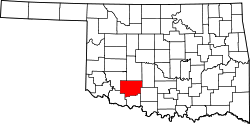
<0.1% of residents lived in urban areas, while 100.0% lived in rural areas. [8]
There were 1,119 households in Cache, of which 40.2% had children under the age of 18 living in them. Of all households, 48.3% were married-couple households, 17.9% were households with a male householder and no spouse or partner present, and 28.2% were households with a female householder and no spouse or partner present. About 26.5% of all households were made up of individuals and 11.4% had someone living alone who was 65 years of age or older. [6]
There were 1,250 housing units, of which 10.5% were vacant. Among occupied housing units, 65.8% were owner-occupied and 34.2% were renter-occupied. The homeowner vacancy rate was 1.5% and the rental vacancy rate was 10.1%. [6]
2010 census
As of the 2010 census, there were 2,796 people, 1,037 households, and 780 families residing in the city. The population density was 795.9 inhabitants per square mile (307.3/km2). There were 1,140 housing units at an average density of 324.5 per square mile (125.3/km2). The racial makeup of the city was 70.8% White, 2.5% African American, 18.6% Native American (13.45% Comanche), [9] 0.4% Asian, 0.3% Pacific Islander, 0.09% from other races, and 6.5% from two or more races. Hispanic or Latino of any race were 6.1% of the population.
There were 1,037 households, out of which 42.3% had children under the age of 18 living with them, 52.1% were married couples living together, 16.0% had a female householder with no husband present, and 24.8% were non-families. 21.5% of all households were made up of individuals, and 8.0% had someone living alone who was 65 years of age or older. The average household size was 2.70 and the average family size was 3.10.
In the city, the population was spread out, with 28.1% under the age of 18, 9.0% from 18 to 24, 26.5% from 25 to 44, 24.0% from 45 to 64, and 11.3% who were 65 years of age or older. The median age was 33.2 years. For every 100 females, there were 95.8 males. For every 100 females age 18 and over, there were 92.6 males.
The median income for a household in the city was $41,220, and the median income for a family was $51,840. Males had a median income of $48,672 versus $33,051 for females. The per capita income for the city was $19,299. About 10.0% of families and 17.1% of the population were below the poverty line, including 19.5% of those under age 18 and 18.1% of those age 65 or over.
 City Hall
 Buffalo statue in park, 3-2025
 Community Building, 3-2025


