Meers, Oklahoma

Last updated

Meers, Oklahoma
Meers Mining Camp.jpg
The Meers Store
USA Oklahoma location map.svg
Red pog.svg
Meers
Location within the state of Oklahoma
Usa edcp location map.svg
Red pog.svg
Meers
Meers (the United States)
Coordinates: 34°46′58″N98°34′44″W / 34.78278°N 98.57889°W / 34.78278; -98.57889 [1]
Country United States
State Oklahoma
County Comanche
Elevation
[1]
1,460 ft (450 m)
Time zone UTC-6 (Central (CST))
  Summer (DST) UTC-5 (CDT)
ZIP codes
73558
FIPS code 40-47500
GNIS feature ID1100624 [1]

Meers is an unincorporated community located on State Highway 115 in Comanche County, Oklahoma, United States, in the foothills of the Wichita Mountains. In 1901, Meers was founded as a gold prospecting town where it was named in honor of mine operator Andrew J. Meers from Cherokee County, Georgia.

Contents

The only remaining structure of the original town is the Meers Store & Restaurant, which Food Network named as the best hamburger joint in Oklahoma and one of the best in the United States, largely due to its signature MeersBurger. [2]

The Meers Store also served as the area post office from March 12, 1902, until February, 1989. [3] Currently, area residents have Lawton mailing addresses.

Geological formation of Southwest Oklahoma

Map of Wichita Fault Wichita Uplift fault map.png
Map of Wichita Fault

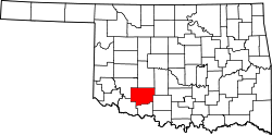
Meers is defined by a geological displacement or planar fracture known as the Meers Fault. [4] The northwestern Meers fault and the southeastern Meers fault lines are geologically situated in the central lowlands. [5]

In 1985, in order to monitor a seismic event, the Oklahoma Geological Survey installed a seismograph in the Meers Store. [6] [7]


Spanish prospectors in the Wichita Mountains

Wichita Mountains region is believed to have captivated the first Spanish conquistadors in the 16th century, 17th century, and 18th century. [8] The epoch was defined by the geographical exploration of North America as orchestrated by the Spanish Empire during the sixteenth century inland expeditions. [9]

The Spanish colonization of the Americas revealed substantial developments with the establishment of the territorial entities known as New Spain and Spanish Texas. [10] [11] The Red River of the South was explored by the Spaniards originating during the 16th century. [12] The Montague County, Texas administrative division sustains exemplary events chronicled at Spanish Fort, Texas dating to the eighteenth century. [13] [14]

The Spanish Empire explored native kingdoms specifically for gold mining and silver mining collectively as the proprietors of the Treasure of Villena and the Spanish royal crown's decrees often referred to as the Doctrine of Discovery and Laws of the Indies. [15] [16] The monarchy and regal decrees entitled chartering expeditionary campaigns to collect geological and mineral surveys on distant coasts and continents. [17] [18]

The Spanish Empire's exploratory caravans were possessed by the tales of the earlier explorers who exalted the New World's mythic lands. [19] A dominion located in the Terra incognita cartographically recognized as the outlying northern territory of North America. The Spanish conquistadors conceptualized the New World's landscape by a covetous euphoria for the Iberian Peninsula horde beseeching the Seven Cities of Gold treasuring the similarities of the Las Médulas. [20] [21] [22]

The group eleven elements were an alluring earthly possession serving as a periodic element for the crown jewels. The mineral ore forged as a coinage metal or milled coinage for the currency of Spain and Spanish America authentically illustrated by the Spanish escudo. The precious metals were mutually considered a barter and medium of exchange for cultural diplomacy and greetings with native kingdoms.

In 1955, a primitive mill, recognized as an arrastra, was discovered 2 miles (3.2 km) south of Meers near Meers Road or Oklahoma State Highway 115. [23] The 16th-century mill, situated to close proximity of Cedar Creek, was considered to be of Spanish design and origin. [24] The arrastra permitted comminution of earth elements being gold and silver essentially scaling the metallics for protracted overland passages. The fragmentation process formed a suitable ductile element for conveyance by pack saddle.

The Spanish prospector's packhorse route was a southerly journey into the Texas Blackland Prairies migrating into the Lower Rio Grande ValleyAtascocita Road ― while transitioning to the Gulf Coastal Plain venturing the coastal geography of northeastern Mexico's mountainous region known as Sierra Madre Oriental. [25] [26] [27] The prized noble metal was conferred for transfer on the east coast of Mexico at the port of VeracruzSan Juan de Ulúatreasure port for Spanish Main. [28]

The transition metals encompassed an overland passage — Old Spanish Trail — of the New World to Spanish galleons of the Spanish treasure fleet in St. Augustine, Florida adorned by the Spanish fortification Castillo de San Marcos. [29] [30] [31] Spain's medieval ships would potentially anchor in Havana and Spanish Wells for mustering seafaring provisions, water, and wine. [32] [33] The spanish cargo fleets ― 1715 Treasure Fleet ― continued the nautical voyage with winds sustaining the transatlantic crossing to the Old World in anticipation of the King's treasure homecoming in Cartagena, Spain. [34] [35]

Listing as National Register of Historic Places

The Meers Store was listed on the National Register of Historic Places in 1978 as Meers Mining Camp, since it was the only surviving relic of the community's gold rush days. [36] [37]

Related Research Articles

<span class="mw-page-title-main">Faxon, Oklahoma</span> Town in Oklahoma, United States

Faxon is a town in Comanche County, Oklahoma, United States. It is located on Oklahoma State Highway 36 about 18.3 driving miles southwest of Lawton. The population was 136 at the 2010 census. It is included in the Lawton, Oklahoma Metropolitan Statistical Area.

<span class="mw-page-title-main">Blackburn, Oklahoma</span> Town in Oklahoma, United States

Blackburn is a town in Pawnee County, Oklahoma, United States. The population was 108 at the 2010 census, up 5.9 percent from the figure of 102 recorded in 2000. It is 12 miles (19 km) east of the city of Pawnee.

<span class="mw-page-title-main">Wichita people</span> Confederation of Native Americans

The Wichita people, or Kitikiti'sh, are a confederation of Southern Plains Native American tribes. Historically they spoke the Wichita language and Kichai language, both Caddoan languages. They are indigenous to Oklahoma, Texas, and Kansas.

<span class="mw-page-title-main">Wichita Mountains</span> Mountains in the US state Oklahoma

The Wichita Mountains are located in the southwestern portion of the U.S. state of Oklahoma. It is the principal relief system in the Southern Oklahoma Aulacogen, being the result of a failed continental rift. The mountains are a northwest-southeast trending series of rocky promontories, many capped by 500 million-year old granite. These were exposed and rounded by weathering during the Pennsylvanian and Permian Periods. The eastern end of the mountains offers 1,000 feet (305 m) of topographic relief in a region otherwise dominated by gently rolling grasslands.

<span class="mw-page-title-main">Wichita Mountains Wildlife Refuge</span> Protected mixed grass prairie on Oklahoma

Wichita Mountains Wildlife Refuge, located in southwestern Oklahoma near Lawton, has protected unique wildlife habitats since 1901 and is the oldest managed wildlife facility in the United States Fish and Wildlife Service system. The refuge's location in the geologically unique Wichita Mountains and its areas of undisturbed mixed grass prairie make it an important conservation area. The Wichita Mountains are approximately 500 million years old. Measuring about 59,020 acres (238.8 km2), the refuge hosts a great diversity of species: 806 plant species, 240 species of birds, 36 fish, and 64 reptiles and amphibians are present.

<span class="mw-page-title-main">Tawakoni</span> Indigenous tribe in the United States

The Tawakoni are a Southern Plains Native American tribe, closely related to the Wichitas. They historically spoke a Wichita language of the Caddoan language family. Currently, they are enrolled in the Wichita and Affiliated Tribes, a federally recognized tribe.

Jean-Baptiste Bénard de la Harpe was a French explorer who is credited with using the name "Little Rock" in 1722 for a stone outcropping on the bank of the Arkansas River used by early travelers as a landmark. Little Rock, Arkansas was subsequently named for the landmark.

<span class="mw-page-title-main">California Road</span>

According to the Encyclopedia of Oklahoma History and Culture, there were two trails that may have been known as the California Road at the time of the California Gold Rush. A southerly route, which ran through present-day Oklahoma, along the Canadian River. A northern route was usually called the California Trail.

<span class="mw-page-title-main">Fort Arbuckle (Oklahoma)</span> United States historic place

Fort Arbuckle was constructed by the US Army in 1850 to counter raids by Plains Indian tribes on immigrant trains heading west to California and on the settlements of Choctaw and Chickasaw nations in Indian Territory.

<span class="mw-page-title-main">Chilocco Indian Agricultural School</span> United States historic place

Chilocco Indian School was an agricultural school for Native Americans on reserved land in north-central Oklahoma from 1884 to 1980. It was approximately 20 miles north of Ponca City, Oklahoma and seven miles north of Newkirk, Oklahoma, near the Kansas border. The name "Chilocco" is apparently derived from the Creek tci lako, which literally meant "big deer" but typically referred to a horse.

<span class="mw-page-title-main">Fort Cobb</span> United States historic place

Fort Cobb was a United States Army post established in what is now Caddo County, Oklahoma in 1859 to protect relocated Native Americans from raids by the Comanche, Kiowa, and Cheyenne. The fort was abandoned by Maj. William H. Emory at the beginning of the Civil War, but then occupied by Confederate forces from 1861–1862. The post was eventually reoccupied by US forces starting in 1868. After establishing Fort Sill the US Army abandoned Fort Cobb. Today there is little left of the former military post.

<span class="mw-page-title-main">Lawrie Tatum</span>

Lawrie Tatum was a Quaker who was best known as an Indian Agent to the Kiowa and Comanche tribes at Fort Sill agency in Indian Territory.

<i>Charge of the Model Ts</i> 1977 film by Jim McCullough Sr.

Charge of the Model T's is a 1977 American comedy spy film directed by Jim McCullough Sr. with the screenplay by Jim McCullough Jr. based upon the novel of the same name by Lee Somerville. Starring John David Carson, Carol Bagdasarian, Louis Nye, Herb Edelman, and Arte Johnson.

<span class="mw-page-title-main">Comanche Nation Casino</span> Comanche Nation casino located in southwest Oklahoma

Comanche Nation Casino, often known as Comanche Nation Entertainment, is a Native American casino geographically situated in the Southwest Great Plains Country of the United States. The American Indian casino is located in Lawton, Comanche County, Oklahoma with East Cache Creek serving as a picturesque. The gaming establishment, which opened in 2007, is operated and owned by the tribal sovereignty of the Comanche Nation of Oklahoma with the governing powers in Lawton.

<span class="mw-page-title-main">Oklahoma Beer Act of 1933</span> United States public law

Oklahoma Beer Act of 1933 is a United States public law legalizing the manufacture, possession, and sale of low-point beer in the State of Oklahoma. The Act of Congress cites the federal statute is binding with the cast of legal votes by the State of Oklahoma constituents or legislative action by the Oklahoma Legislature.

James Mahlon Haworth was a United States Army major, an Indian agent, and the first Superintendent of Indian Schools in the United States.

Meers Fault is a fault in Oklahoma that extends from Kiowa County to Comanche County. It is marked by a 22–26 kilometers (14–16 mi) long conspicuous fault scarp but the fault extends beyond the ends of this scarp. The Meers fault is part of a group of faults that lie between the Anadarko Basin and the Wichita Mountains.

<span class="mw-page-title-main">Ketch Ranch House (Oklahoma)</span> Bungalow in Oklahoma, United States of America

Ketch Ranch House or Ketch Ranch was private property located in the Wichita Mountains of Southwestern Oklahoma. During the early 1920s, the forest reserve residence was established as a working ranch and vacation home for Ada May Ketch and Frank Levant Ketch who served as mayor of Ringling, Oklahoma.

<span class="mw-page-title-main">Apache Casino Hotel</span> Apache-owned casino and resort hotel in southwest Oklahoma

Apache Casino Hotel or Fort Sill Apache Casino is operated and owned by the Fort Sill Apache Tribe of Oklahoma. The casino and hotel is located within Comanche County bearing east of Interstate 44 in Lawton, Oklahoma. In January 1999, the Native American gaming establishment was introduced to Southwestern Oklahoma within the Kiowa-Comanche-Apache Reservation lands. The Apache gaming enterprise originated as a membrane structure or tension fabric building housing Class II or Class III casino gaming and slot machines.

<span class="mw-page-title-main">Blockhouse on Signal Mountain (Oklahoma)</span> Blockhouse on Signal Mountain in Southwest Oklahoma

Blockhouse on Signal Mountain is within the Fort Sill Military Reservation, north of Lawton, Oklahoma. The rock architecture is located along Mackenzie Hill Road within the Fort Sill West Range being the Oklahoma administrative division of Comanche County.

References

  1. 1 2 3 U.S. Geological Survey Geographic Names Information System: Meers, Oklahoma
  2. Food Network Top American Restaurants: Bon Appetit Picks the Best.
  3. Shirk, George H. (1952). "First Post Offices Within the Boundaries of Oklahoma". The Chronicles of Oklahoma . 30 (1 - Spring 1952). Oklahoma Historical Society: 79, 38–104. LCCN   23027299. OCLC   655582328.
  4. Luza, Kenneth V. "Earthquakes". The Encyclopedia of Oklahoma History and Culture. Oklahoma Historical Society.
  5. "Southeastern Meers Fault". Southeastern Section (Class A) ~ Fault ID No. 1031b. U.S. Geological Survey.
  6. Oklahoma Geological Survey Seismograph Stations Archived 2007-04-16 at the Wayback Machine . (accessed February 14, 2007)
  7. Meers, Oklahoma Quaternary Fault. (accessed October 5, 2012)
  8. Cartwright, Mark. "Conquistador". World History Encyclopedia . World History Foundation ~ World History Publishing.
  9. Netchev, Simeon. "Spanish Conquest & Exploration in North America in the 16th century". World History Encyclopedia . World History Foundation ~ World History Publishing.
  10. "Conquistadors: Searching for Gold and Glory and Finding Something Else". Story of Texas - Campfire Stories. Bullock Texas State History Museum.
  11. Cartwright, Mark. "The Conquest of New Spain". World History Encyclopedia . World History Foundation ~ World History Publishing.
  12. "Highways Paved with Gold - Marker No. 2479". Texas Historic Sites Atlas. Texas Historical Commission. 1963.
  13. Morrell, Lea Anne. "Spanish Fort, TX". Handbook of Texas Online. Texas State Historical Association.
  14. Jelks, Edward B. "Spanish Fort Sites". Handbook of Texas Online. Texas State Historical Association.
  15. Mark, Joshua J. "Doctrine of Discovery". World History Encyclopedia. World History Publishing ~ World History Foundation.
  16. "Indies, Laws of the"  . Encyclopædia Britannica . Vol. 14 (11th ed.). 1911. pp. 484–485.
  17. Young, Otis E. (1965). "The Spanish Tradition in Gold and Silver Mining". Arizona and the West. 7 (4). Journal of the Southwest: 299–314. JSTOR   40167137.
  18. Chaudhuri, Kirti N. (October 1994). "Precious Metals and Mining in the New World: 1500–1800". European Review . 2 (4). Cambridge University Press: 261–270. doi:10.1017/S1062798700001186. S2CID   143538025.
  19. Lewis, Tom; Richter, Sara Jane. "Coronado Expedition". The Encyclopedia of Oklahoma History and Culture. Oklahoma Historical Society.
  20. Hancock, James. "The Iberian Conquest of the Americas". World History Encyclopedia . World History Foundation ~ World History Publishing.
  21. Chipman, Donald E. "Seven Cities of Cibola". Handbook of Texas Online. Texas State Historical Association.
  22. Krieger, Margery H. "Quivira". Handbook of Texas Online. Texas State Historical Association.
  23. Hollon, W. Eugene (1956). "A Spanish "Arrastra" in the Wichita Mountains". The Chronicles of Oklahoma . 34 (4 - Winter 1956-57). Oklahoma Historical Society: 443–455. LCCN   23027299. OCLC   655582328.
  24. Cedar Creek in Geonames.org (cc-by)
  25. Kemp, L.W. "Atascosito Road". Handbook of Texas Online. Texas State Historical Association.
  26. "Map of Texas and Adjacent Regions in the Eighteenth Century". The Portal to Texas History. Hardin-Simmons University Library ~ University of North Texas Libraries.
  27. "Texas Trails: 1716-1886". The Portal to Texas History. Hardin-Simmons University Library ~ University of North Texas Libraries.
  28. Cartwright, Mark. "Treasure Ports of the Spanish Main". World History Encyclopedia . World History Foundation ~ World History Publishing.
  29. Fossey, Will. "Old Spanish Trail". Handbook of Texas Online. Texas State Historical Association.
  30. Cartwright, Mark. "Spanish Galleon". World History Encyclopedia . World History Foundation ~ World History Publishing.
  31. "Spanish Treasure Fleets" [Spanish Treasure Fleets Timeline]. World History Encyclopedia. World History Foundation ~ World History Publishing.
  32. Netchev, Simeon. "The Spanish Main & the West Indies c.1720" [Trade Patterns and Routes of Spanish Main and West Indies]. World History Encyclopedia . World History Foundation ~ World History Publishing.
  33. Popple, Henry (1733). "Gulf of Mexico, Bay of Campeche" [Map of the British Empire in America with the French and Spanish settlements]. LOC Maps. United States Library of Congress. LCCN   2009582407.
  34. Cartwright, Mark. "The Gold of the Conquistadors". World History Encyclopedia . World History Foundation ~ World History Publishing.
  35. Cartwright, Mark. "The Silver of the Conquistadors". World History Encyclopedia . World History Foundation ~ World History Publishing.
  36. "Meers Mining Camp ~ 78002230". National Register Digital Assets. National Park Service. January 20, 1978.
  37. "NRHP nomination for Meers Mining Camp". National Park Service. U.S. Department of Interior. Retrieved November 3, 2017.

Bibliography

Historical Video Archive

Back In Time: The Lost Gold of Oklahoma on YouTube
The Coronado Expedition : Coronado National Memorial on YouTube