Caldwell, North Yorkshire

Last updated

Caldwell
Caldwell's northern houses - geograph.org.uk - 1627252.jpg
Houses in Caldwell
North Yorkshire UK location map (2023).svg
Red pog.svg
Caldwell
Location within North Yorkshire
Population138 (2011 census) [1]
OS grid reference NZ160134
Civil parish
  • Caldwell
Unitary authority
Ceremonial county
Region
Country England
Sovereign state United Kingdom
Post town Richmond
Postcode district DL11
Police North Yorkshire
Fire North Yorkshire
Ambulance Yorkshire
List of places
UK
England
Yorkshire
54°30′58″N1°45′12″W / 54.51609°N 1.75325°W / 54.51609; -1.75325

Caldwell is a village and civil parish in the Richmondshire district of North Yorkshire, England, close to the border with County Durham and approximately 10 miles west of Darlington. According to the 2011 UK census the parish had a population of 138, [1] increasing from 115 at the 2001 census. [2]

Contents

History

Caldwell was mentioned in the Domesday Book in 1096 as being in the hundred of "Land of Count Alan" and the county of Yorkshire, although no population was recorded. [3]

It is recorded in Leland's Itinerary [4] that Caldwell once had a castle. The castle was probably Norman in origin as Leland refers to it as a ruin as early as 1540. It apparently stood very near to the spring in the village, but no other details are known.

Leland had written of the ruined castle at Aldbrough St John and went on to say:

There appere ruines of like buildinges at Cawdewelle village a ii . miles west from Alburcge. Cawdewel is so caullid of a little font, or spring, by the ruines of the olde place , and so rennith into a bekke half a quarter of a mile of. This bekke rennith thens to Alburcg, and a v . miles of into Tese, ripa citer. This bek risith in a marisk about a ii . myle southe west above Caaldwell. [5]

In 1870–72 John Marius Wilson's Imperial Gazetteer of England and Wales described Caldwell as:

"a township in St. John-Stanwick parish, N. R. Yorkshire; on an affluent of the river Tees, 8 miles N of Richmond. Acres, 2,000. Real property, £2,102. Pop., 162. Houses, 34." [6]

Governance

The village lies within the Richmond (Yorks) parliamentary constituency, which is under the control of the Conservative Party. The current Member of Parliament, since the 2015 general election, is Rishi Sunak. Caldwell also lies within the Melsonby ward of Richmondshire District Council. [7]

Dovecot in Caldwell Dovecote in Caldwell Village.jpg
Dovecot in Caldwell

Community and culture

The chapel of St. Hilda, built in 1844, was funded by Charlotte Catherine Anne, Countess of Bridgewater, and was formerly part of the Stanwick St John parish. [8] The village has one public house,The Brownlow Arms. [9]

See also

Related Research Articles

<span class="mw-page-title-main">Leyburn</span> Market town and civil parish in North Yorkshire, England

Leyburn is a market town and civil parish in North Yorkshire, England, sitting above the northern bank of the River Ure in Wensleydale. Historically in the North Riding of Yorkshire, the name was derived from 'Ley' or 'Le' (clearing), and 'burn' (stream), meaning clearing by the stream. Leyburn had a population of 1,844 at the 2001 census increasing to 2,183 at the 2011 Census. The estimated population in 2015 was 2,190.

<span class="mw-page-title-main">Colburn, North Yorkshire</span> Town and civil parish in North Yorkshire, England

Colburn is a town, civil parish and electoral ward in North Yorkshire, England, 2 miles (3.2 km) west of Catterick. It had a population of 4,860 at the 2011 census, rising from 3,606 in 2001.

<span class="mw-page-title-main">Aldbrough St John</span> Village and civil parish in North Yorkshire, England

Aldbrough St John is a village and civil parish in the Richmondshire district in North Yorkshire, England. The parish has a population of 325, increasing to 392 at the 2011 Census.

<span class="mw-page-title-main">Barton, North Yorkshire</span> Village and civil parish in North Yorkshire, England

Barton is a village and civil parish in North Yorkshire, England. According to the 2011 census it had a population of 837. It is situated near the border with the ceremonial county of County Durham, and is 6 miles south-west of Darlington.

<span class="mw-page-title-main">Dalton, west North Yorkshire</span> Village and civil parish in North Yorkshire, England

Dalton is a village and civil parish in North Yorkshire in England. Dalton is situated about six miles north-west of Richmond and about five miles south-east of Barnard Castle within the council district of Richmondshire and close to the A66 trans-Pennine trunk road. It was listed in the Domesday book. The Dalton parish boundary includes the village itself as well the houses at Dalton Heights plus numerous surrounding farms. The population of the parish was 147 according to the 2001 census, increasing to 181 at the 2011 Census.

<span class="mw-page-title-main">Brompton-on-Swale</span> Village and civil parish in North Yorkshire, England

Brompton-on-Swale is a village and civil parish in the Richmondshire district of North Yorkshire, England. The village is located three miles east of Richmond and 10 miles (16 km) north-west of the county town of Northallerton on the northern bank of the River Swale.

<span class="mw-page-title-main">Carlton, Richmondshire</span> Village and civil parish in North Yorkshire, England

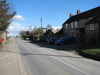
Carlton is a village in the civil parish of Carlton Town in the Richmondshire district of North Yorkshire, England. According to the 2011 Census it had a population of 232. Carlton Town, the formal name of the civil parish, distinguishes the parish from the adjacent civil parish of Carlton Highdale, historically part of the manor of Carlton. The village is in the Yorkshire Dales National Park, near the River Cover in Coverdale.

<span class="mw-page-title-main">West Layton</span> Village and civil parish in North Yorkshire, England

West Layton is a village and civil parish in the Richmondshire district of North Yorkshire, England, close to the border with County Durham and a few miles west of Darlington.

<span class="mw-page-title-main">Cleasby</span> Village and civil parish in North Yorkshire, England

Cleasby is a village and civil parish in the North Yorkshire district of North Yorkshire, England. It is close to the River Tees and Darlington and the A1(M). The population at the 2011 Census of ONS was 208.

<span class="mw-page-title-main">Newsham, Richmondshire</span> Village and civil parish in North Yorkshire, England

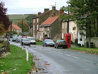
Newsham is a village and civil parish in the Richmondshire district of North Yorkshire, England. The village is 8 miles (13 km) north west of Richmond and 13 miles (21 km) south west of Darlington.

<span class="mw-page-title-main">Ravensworth</span> Village and civil parish in North Yorkshire, England

Ravensworth is a village and civil parish in the Holmedale valley, within the Richmondshire district of North Yorkshire, England. It is approximately 4.5 miles (7.2 km) north-west of Richmond and 10 miles (16 km) from Darlington. The parish has a population of 255, according to the 2011 census.

<span class="mw-page-title-main">Gilling West</span> Village in North Yorkshire, England

Gilling West is a village about 3.5 miles (5.6 km) north of Richmond in the Richmondshire district of North Yorkshire, England. It is located in the civil parish of Gilling with Hartforth and Sedbury. It is named "West" to distinguish it from Gilling East in Ryedale, some 32 miles away.

<span class="mw-page-title-main">Gilling East</span> Village and civil parish in North Yorkshire, England

Gilling East is a village and civil parish in North Yorkshire, England, on the main B1363 road between York and Helmsley, 2 miles (3.2 km) south of Oswaldkirk and 5 miles (8 km) south of Helmsley. It is named "East" to distinguish it from Gilling West near Richmond, some 32 miles (51 km) away. It had a population of 321 at the 2001 Census, which had risen to 345 at the 2011 census. In 2015, North Yorkshire County Council estimated the population to be 360. The village lies in the Howardian Hills just south of the North York Moors National Park and close to Ampleforth Abbey and College.

<span class="mw-page-title-main">Cliffe, Richmondshire</span> Village and civil parish in North Yorkshire, England

Cliffe is a small village and civil parish in Richmondshire district of North Yorkshire, England. A stream called the Glen runs through the village to the Tees. It is in the Teesdale and Yorkshire Dales national park. It is about 6 miles (10 km) west of Darlington, 10 miles (16 km) north of Richmond and near Piercebridge.

<span class="mw-page-title-main">Ellerton-on-Swale</span> Village and civil parish in North Yorkshire, England

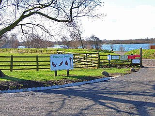
Ellerton-on-Swale or Ellerton is a small village and civil parish about a mile east of Catterick in the Richmondshire district of North Yorkshire, England. In 2015, North Yorkshire County Council estimated the population of the parish at 110.

<span class="mw-page-title-main">Eppleby</span> Village and civil parish in North Yorkshire, England

Eppleby is a village and civil parish in the Richmondshire district of North Yorkshire, England. It is located about 7 miles (11 km) north of Richmond. According to the 2011 United Kingdom census, the population of the parish was 269.

<span class="mw-page-title-main">Finghall</span> Village and civil parish in North Yorkshire, England

Finghall is a village and civil parish in North Yorkshire, England.

<span class="mw-page-title-main">Hipswell</span> Village and civil parish in North Yorkshire, England

Hipswell is a village and civil parish in the North Yorkshire (district) of the county of the same name. The civil parish mainly comprises the northern part of Catterick Garrison. The village of Hipswell is at the eastern end of the civil parish, and effectively forms a suburb of Catterick Garrison.

<span class="mw-page-title-main">Melsonby</span> Village and civil parish in North Yorkshire, England

Melsonby is a village and civil parish in the Richmondshire district of North Yorkshire, England. It lies a 1.2 miles (2 km) west of the A1(M) motorway and 1.2 miles (2 km) north of the A66.

<span class="mw-page-title-main">Tunstall, North Yorkshire</span> Village and civil parish in North Yorkshire, England

Tunstall is a village and civil parish in the Richmondshire district of North Yorkshire, England about 2 miles (3.2 km) west of Catterick Village and the A1(M) motorway. It had a population of 253 increasing to 271 at the 2011 census.

References

  1. 1 2 UK Census (2011). "Local Area Report – Caldwell Parish (E04007460)". Nomis. Office for National Statistics . Retrieved 25 May 2020.
  2. UK Census (2001). "Local Area Report – Caldwell Parish (36UE019)". Nomis. Office for National Statistics . Retrieved 25 May 2020.
  3. "Caldwell | Domesday Book". opendomesday.org. Retrieved 31 May 2020.
  4. Leland, John (1998). John Leland's itinerary: travels in Tudor England. Sutton Pub. ISBN   0-7509-1751-2. OCLC   39930966.
  5. Davis, Philip. "Caldwell Hall Garth". Gatehouse. Retrieved 16 February 2021.
  6. "History of Eppleby, in Richmondshire and North Riding | Map and description". www.visionofbritain.org.uk. Retrieved 26 May 2020.
  7. "Melsonby ward map" (PDF). Archived (PDF) from the original on 19 April 2021.
  8. "Stanwick Group of Churches | Photos Countess of Bridgewater panel". www.stanwickgroup.org.uk. Retrieved 25 May 2020.
  9. "The Brownlow Arms, Caldwell, near Richmond". Darlington and Stockton Times. Retrieved 25 May 2020.