Cape Cruz

Last updated
Cabo Cruz
Faro de Cabo Cruz.jpg
Cuba physical map.svg
Red pog.svg
Cabo Cruz
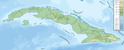
Location of Cape Cruz in Cuba
Coordinates: 19°50′30.58″N77°43′40.28″W / 19.8418278°N 77.7278556°W / 19.8418278; -77.7278556
Offshore water bodies Caribbean Sea

Cape Cruz, (Spanish : Cabo Cruz), is a cape that forms the western extremity of the Granma Province in southern Cuba. It extends into the Caribbean Sea and marks the eastern border of the Gulf of Guacanayabo. [1] Cape Cruz is located in the municipality of Niquero and is part of the Desembarco del Granma National Park.
Contents

Architecture

The southernmost tip of Cape Cruz is marked by Faro Vargas, a nineteenth-century lighthouse with a height of 32 metres (105 ft).

Transport

The cape is the endpoint of the Niquero branch of the "Circuito Sur de Oriente" (CSO) highway.

Notes

  1. Hernández 2001

Related Research Articles

<span class="mw-page-title-main">Cuban night lizard</span> Species of lizard

The Cuban night lizard is a night lizard endemic to southern Cuba. It is the only member of the genus Cricosaura, one of three in the night lizard family.

<span class="mw-page-title-main">Democratic Solidarity Party</span> Political party in Cuba

The Democratic Solidarity Party was a political liberal party in Cuba. Although changes to the Cuban constitution in 1992 decriminalized the right to form political parties other than the Communist Party of Cuba, these parties are not permitted to campaign or engage in any public political activities on the island. The Democratic Solidarity party described itself as "an organization from within Cuba promoting democracy and the respect for human rights by the peaceful route." The last President of the party was Fernando Sánchez López. The party was a full member of Liberal International.

<span class="mw-page-title-main">Tuxpan</span> Municipality and city in Veracruz, Mexico

Tuxpan is both a municipality and city located in the Mexican state of Veracruz. The population of the city was 89,557 and of the municipality was 154,600 inhabitants, according to the INEGI census of 2020, residing in a total area of 1,051.89 km2 (406.14 sq mi). The municipality includes many smaller outlying communities, the largest of which are Alto Lucero and Santiago de la Peña. A local beachside community is also nearby.

<span class="mw-page-title-main">Sierra Maestra</span> Mountain range of Cuba

The Sierra Maestra is a mountain range that runs westward across the south of the old Oriente Province in southeast Cuba, rising abruptly from the coast. The range falls mainly within the Santiago de Cuba and in Granma Provinces. Some view it as a series of connecting ranges, which join with others to the west. At 1,974 m (6,476 ft), Pico Turquino is the range's – and the country's – highest point. The area is rich in minerals, especially copper, manganese, chromium, and iron.

<span class="mw-page-title-main">Desembarco del Granma National Park</span> National park

Desembarco del Granma National Park is a national park in south-western Cuba, stretching across the Niquero and Pilón municipalities in what is now Granma Province. The name of the park means "Landing of the Granma" and refers to the yacht in which Fidel Castro, Che Guevara, Raúl Castro, and 79 of their supporters sailed from Mexico to Cuba in 1956 and incited the Cuban Revolution. The National park is well known for its karst topography and coastal cliffs.

<span class="mw-page-title-main">Frank País Airport</span> Airport serving Holguín, Cuba

Frank País Airport is an airport serving Holguín, a city in the Cuban province of Holguín. It bears the name of Cuban revolutionary Frank País. The airport was built in 1962 initially only for military purposes before civilian air operations began in 1966. It consists of a domestic and an international terminal, which was built in 1996 and expanded in 2007.

Guanahacabibes Peninsula is the westernmost point on the island of Cuba. It is located in Pinar del Río Province, in the municipality of Sandino and is sparsely populated. The waters surrounding the peninsula are important spiny lobster and red snapper fishing grounds. It also boasts the category of Biosphere Reserve, listed by UNESCO in 1987. Its western extremity, Cape San Antonio, is the westernmost point of Cuba. It lies closer to the Pacific than to the easternmost point of the country, Cape Maisí.

Manuel Vega Tamayo is a right-handed baseball pitcher who plays for Granma of the Cuban National Series. He was also part of the Cuban team at the 2004 Summer Olympics, and there became the first athlete from Granma Province to win an Olympic gold medal.

<span class="mw-page-title-main">Sandino, Cuba</span> Municipality in Pinar del Río, Cuba

Sandino is a municipality and town in the Pinar del Río Province of Cuba. The town is located close to the coast and as such, fishing is the main economic resource of this place. It is also the gateway to the Guanahacabibes Peninsula, a UNESCO Biosphere Reserve.

<span class="mw-page-title-main">Niquero</span> Municipality in Granma, Cuba

Niquero is a municipality and town in the Granma Province of Cuba. It is located in the coastal region of the province, bordering the Gulf of Guacanayabo. Cape Cruz, the westernmost point of the province is located in this municipality.

Parliamentary elections were held in Cuba on 20 January 2008 to elect members of the National Assembly of People's Power. According to the Cuban electoral system, one candidate was nominated for each of the 614 seats in the Assembly, and candidates were elected if they received at least 50% of the vote. The candidates are otherwise proposed by nominating assemblies, which comprise representatives of workers, youth, women, students and farmers as well as members of the Committees for the Defense of the Revolution, after initial mass meetings soliciting a first list of names. The final list of candidates is drawn up by the National Candidature Commission taking into account criteria such as candidates' merit, patriotism, ethical values and revolutionary history.

The honorary title Hero of the Republic of Cuba is the highest decoration awarded by the Republic of Cuba. It is equivalent to other hero titles common in the Socialist Bloc. The decoration is physically represented with the Gold Star Medal, hanging in a gold plaque enamelled with the colors of the national flag.

<span class="mw-page-title-main">Mayabeque Province</span> Province of Cuba

Mayabeque Province is one of two new provinces created from the former La Habana Province, whose creation was approved by the Cuban National Assembly on August 1, 2010, the other being Artemisa Province. The new provinces came in to existence on January 1, 2011.

<span class="mw-page-title-main">First Secretary of the Communist Party of Cuba</span> Highest-standing official of the Communist Party of Cuba

The First Secretary of the Central Committee of the Communist Party of Cuba is the top leader of Cuba. The First Secretary is the highest office within the Communist Party of Cuba as well as ranking first in the Politburo, the highest decision-making body in Cuba, which makes the office holder the most powerful person in the Cuban government. In communist states the First or General Secretary of the Communist Party is typically the de facto leader of the country and a more powerful position than state offices such as President or Prime Minister, when those positions are held by different individuals.

<span class="mw-page-title-main">Roads in Cuba</span> Highway system in Cuba

The road network of Cuba consists of 60,858 km (37,815 mi) of roads, of which over 29,850 km (18,550 mi) are paved and 31,038 km (19,286 mi) are unpaved. The Caribbean country counts also 654 km (406 mi) of motorways (autopistas).

Nanuca sebastiani is a species of sea slug, specifically an aeolid nudibranch. It is a marine gastropod mollusc in the family Facelinidae. It is the only species of the genus Nanuca.

<span class="mw-page-title-main">Cabo Corrientes, Cuba</span>

Cabo Corrientes is a cape on the Guanahacabibes Peninsula in Pinar del Río Province, in the west of Cuba. It is covered by a protected nature reserve. The cape has been the scene of various pirate encounters and shipwrecks. During World War II (1939–45) several ships were sunk near the cape. There is a hotel for researchers and ecotourists or scuba divers.

<span class="mw-page-title-main">Circuito Sur de Oriente</span>

The Circuito Sur de Oriente (CSO), meaning "Southern Circuit of the Orient", is a west-east highway connecting Bayamo to Santiago de Cuba, through Manzanillo, Niquero and the southern coastal side of eastern Cuba, below the Sierra Maestra mountain range. Also known as Circuito Guacanayabo-Sur de Oriente, because it crosses the Gulf of Guacanayabo, the name Oriente, refers to the ancient and former Oriente Province. With a length of 347 km, it is the fourth-longest Cuban highway after the "Carretera Central", the "Circuito Norte" and the "Circuito Sur".

References