Carmen, Agusan del Norte

Last updated
Carmen
Municipality of Carmen
Carmen Municipal Hall.jpg
Municipal Hall
Flag of Carmen, Agusan del Norte.png
Carmenseal2.jpg
Ph locator agusan del norte carmen.png
Map of Agusan del Norte with Carmen highlighted
OpenStreetMap
Carmen, Agusan del Norte
Philippines location map (square).svg
Red pog.svg
Carmen
Location within the Philippines
Coordinates: 9°00′N125°16′E / 9°N 125.26°E / 9; 125.26
Country Philippines
Region Caraga
Province Agusan del Norte
District 2nd district
Founded July 1, 1949
Barangays 8 (see Barangays)
Government
[1]
  Type Sangguniang Bayan
   Mayor Jovitte C. Calo
   Vice Mayor Ramon M. Calo
   Representative Ma. Angelica Amante-Matba
   Municipal Council
Members
   Electorate 15,301 voters (2022)
Area
[2]
  Total311.02 km2 (120.09 sq mi)
Elevation
56 m (184 ft)
Highest elevation
330 m (1,080 ft)
Lowest elevation
0 m (0 ft)
Population
 (2020 census) [3]
  Total23,172
  Density75/km2 (190/sq mi)
   Households
5,874
Economy
   Income class 4th municipal income class
   Poverty incidence
27.17
% (2018) [4]
   Revenue 121.8 million (2020)
   Assets 270.5 million (2020)
   Expenditure 111.7 million (2020)
   Liabilities 45.75 million (2020)
Service provider
  ElectricityAgusan del Norte Electric Cooperative (ANECO)
Time zone UTC+8 (PST)
ZIP code
8603
PSGC
IDD : area code +63(0)85
Native languages Agusan
Butuanon
Cebuano
Higaonon
Tagalog
Website www.carmenadn.gov.ph

Carmen, officially the Municipality of Carmen (Cebuano : Lungsod sa Carmen; Tagalog : Bayan ng Carmen), is a 4th class municipality in the province of Agusan del Norte, Philippines. According to the 2020 census, it has a population of 23,172 people. [3]

Contents

History

The first Christian settlers of Kabayawa village (now Carmen) was the family of Fulgencio Loque and Demetria Mamba from Jagna, Bohol... in the early 1900s. The family encounters of the natives... Manobo/Higaonon tribes of Mankalasi clan was not that difficult as the natives were friendly. Day to day's trade was done through a Barter System... wherein goods and services were directly exchanged for other goods and services without using any money... and through this “system”, parcels of lands were also being acquired.

In early days, parcel of land corners were planted with a Moringa tree to mark and determines its boundaries... which was later replaced with concrete pin or “mojon” when the Spanish authorities assume control of the village.

The news of abundance then spread among the siblings and extended families of the new settlers, resulting in an influx of newcomers. The Loque's and Mamba's settled in the now poblacion... while the extended families in the adjoining areas to the east, west and south of poblacion like; the Pacon, the Quesaba, the Honcolada, the Malimit, and others. Farther west the Rojales and the Jamito. While the Ebarle, the Jamero, the Sajor and the Salas in Tagcatong, and the Balmoceda in Goso-on.

Carmen got its present name from the miraculous image of the Virgin of Mount Carmen, believed to have been instrumental in killing the leader of the bandits who used to inhabit the place.

A Spanish Soldier named Juan Cardoniga was supposed to have fired his rifle at the leader of the outlaws who possessed an amulet of some source. Since his rifle did not work, Cardoniga got the image of the virgin from his necklace and place it inside the hole of the barrel after which he succeeded in firing the rifle and in killing the outlaw chief.

It was Rev. Saturnino Urios, the famous Jesuit priest of Agusan, who suggested that the name Kabayawa be changed to Carmen in honor of the secret image.

Carmen was created into a municipality in 1949, when the barrios of Carmen, Tagcatong, Cahayagan and San Agustin were separated from the municipality of Nasipit and constituted into the newly created town, by virtue of Republic Act No. 380 which was approved on June 15, 1949. [5] This law was sponsored by Congressman Marcos M. Calo. The town came into being on July 1, 1949.

Geography

According to the Philippine Statistics Authority, the municipality has a land area of 311.02 square kilometres (120.09 sq mi) [6] constituting

Carmen is strategically located in the Western Agusan Corridor. It is bounded on the north by Butuan Bay, south by Buenavista, east by Nasipit and west by Misamis Oriental. Its rolling hills are planted with different kinds of orchard, where some 500 hectares (1,200 acres) are devoted solely to mango plantations. About half of these are fully developed and are already producing sweet mango fruits which are being sold in volume in Cebu and Manila and to neighboring municipalities and Butuan City.

Climate

Climate data for Carmen, Agusan del Norte
MonthJanFebMarAprMayJunJulAugSepOctNovDecYear
Average high °C (°F)27
(81)
28
(82)
28
(82)
30
(86)
30
(86)
30
(86)
30
(86)
30
(86)
30
(86)
30
(86)
29
(84)
28
(82)
29
(84)
Average low °C (°F)23
(73)
23
(73)
23
(73)
23
(73)
24
(75)
25
(77)
24
(75)
25
(77)
25
(77)
24
(75)
24
(75)
24
(75)
24
(75)
Average precipitation mm (inches)277
(10.9)
211
(8.3)
155
(6.1)
109
(4.3)
166
(6.5)
191
(7.5)
154
(6.1)
138
(5.4)
127
(5.0)
173
(6.8)
241
(9.5)
231
(9.1)
2,173
(85.5)
Average rainy days22.719.120.019.925.927.627.626.125.126.824.323.2288.3
Source: Meteoblue (Use with caution: this is modeled/calculated data, not measured locally.) [7]

Barangays

Carmen is politically subdivided into 8 barangays. [8] Each barangay consists of puroks while some have sitios.

PSGC Barangay Population ±% p.a.
2020 [3] 2010 [9]
160204001 Cahayagan 10.3% 2,395 2,380 0.06%
160204002 Gosoon 7.8% 1,806 1,772 0.19%
160204004 Manoligao 5.9% 1,356 1,513 −1.09%
160204009 Poblacion (Carmen) 25.8% 5,988 5,507 0.84%
160204010 Rojales 11.0% 2,542 2,083 2.01%
160204011 San Agustin 5.1% 1,183 1,117 0.58%
160204012 Tagcatong 14.9% 3,462 3,382 0.23%
160204014 Vinapor 9.1% 2,107 2,027 0.39%
Total23,17219,7811.59%

Demographics

Population census of Carmen
YearPop.±% p.a.
1960 9,593    
1970 12,851+2.96%
1975 13,882+1.56%
1980 14,595+1.01%
1990 15,503+0.61%
1995 15,967+0.55%
2000 17,307+1.74%
2007 18,116+0.63%
2010 19,781+3.25%
2015 20,839+1.00%
2020 23,172+2.11%
Source: Philippine Statistics Authority [10] [9] [11] [12]

In the 2020 census, Carmen had a population of 23,172. [3] The population density was 75 inhabitants per square kilometre (190/sq mi).

Economy

Government

Elected government officials of Carmen for the term of 2016-2019:

List of former mayors

Tourism

Bolihon Beach Plaza Beach.jpg
Bolihon Beach
Punta Diwata Cave Punta Diwata Cave.jpg
Punta Diwata Cave
Punta Diwata Reef Punta Diwata Reef.jpg
Punta Diwata Reef

Transportation

In February 2017, the new integrated bus terminal was opened with buses for travel to and from Butuan and Cagayan de Oro.

Trisikad is also an option when traveling within the area of Carmen and also from the town proper to Nasipit.

Education

Elementary

  • Antonio Quiamjot Elementary School
  • Cahayagan Elementary School
  • Carmen Central Elementary School
  • Cervantina Elementary School
  • Doña Josefa Elementary School
  • Elpidio Salas Elementary School
  • Gosoon Elementary School
  • Manoligao Elementary School
  • Rojales Elementary School
  • San Agustin Elementary School
  • San Isidro Elementary School
  • Tagcatong Central Elementary School

Secondary

Related Research Articles

<span class="mw-page-title-main">Agusan del Norte</span> Province in Caraga, Philippines

Agusan del Norte, officially the Province of Agusan del Norte, is a province in the Caraga region of the Philippines. Its capital is the city of Cabadbaran with several government offices located in the highly-urbanized city of Butuan. It is bordered on the northwest by Butuan Bay; northeast by Surigao del Norte; mid-east by Surigao del Sur; southeast by Agusan del Sur, and southwest by Misamis Oriental.

<span class="mw-page-title-main">Caraga</span> Administrative region of the Philippines

Caraga, officially the Caraga Administrative Region and designated as Region XIII, is an administrative region in the Philippines occupying the northeastern section of Mindanao. The region was created through Republic Act No. 7901 on February 23, 1995. The region comprises five provinces: Agusan del Norte, Agusan del Sur, Dinagat Islands, Surigao del Norte, and Surigao del Sur; six cities: Bayugan, Bislig, Butuan, Cabadbaran, Surigao and Tandag; 67 municipalities and 1,311 barangays. Butuan, the most urbanized city in Caraga, serves as the regional administrative center.

<span class="mw-page-title-main">Tandag</span> Capital of Surigao del Sur, Philippines

Tandag, officially the City of Tandag, is a 5th class component city and capital of the province of Surigao del Sur, Philippines. According to the 2020 census, it has a population of 62,669 people.

<span class="mw-page-title-main">Mainit</span> Municipality in Surigao del Norte, Philippines

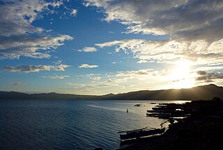
Mainit, officially the Municipality of Mainit, is a 4th class municipality in the province of Surigao del Norte, Philippines. According to the 2020 census, it has a population of 28,019 people.

<span class="mw-page-title-main">Sibagat</span> Municipality in Agusan del Sur, Philippines

Sibagat, officially the Municipality of Sibagat, is a 1st class municipality in the province of Agusan del Sur, Philippines. According to the 2020 census, it has a population of 33,957 people.

<span class="mw-page-title-main">Bislig</span> Component city in Surigao del Sur, Philippines

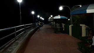
Bislig, officially the City of Bislig, is a 3rd class component city in the province of Surigao del Sur, Philippines. According to the 2020 census, it has a population of 99,290 people.

<span class="mw-page-title-main">Alegria, Surigao del Norte</span> Municipality in Surigao del Norte, Philippines

Alegria, officially the Municipality of Alegria, is a 5th class municipality in the province of Surigao del Norte, Philippines. According to the 2020 census, it has a population of 16,184 people.

<span class="mw-page-title-main">Butuan</span> Highly urbanized city in Agusan del Norte, Philippines

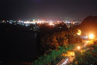
Butuan, officially the City of Butuan, is a 1st class highly urbanized city in the region of Caraga, Philippines. It is the de facto capital of the province of Agusan del Norte where it is geographically situated but has an administratively independent government. According to the 2020 census, it has a population of 372,910 people.

<span class="mw-page-title-main">Buenavista, Agusan del Norte</span> Municipality in Agusan del Norte, Philippines

Buenavista, officially the Municipality of Buenavista, is a 1st class municipality in the province of Agusan del Norte, Philippines. According to the 2020 census, it has a population of 68,892 people.

<span class="mw-page-title-main">Cabadbaran</span> Capital of Agusan del Norte, Philippines

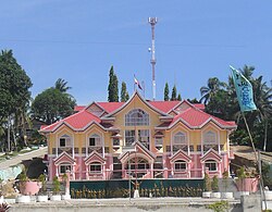
Cabadbaran, officially the City of Cabadbaran, is a sixth class component city and de jure capital of the province of Agusan del Norte, Philippines. According to the 2020 census, it has a population of 80,354 people.

<span class="mw-page-title-main">Jabonga</span> Municipality in Agusan del Norte, Philippines

Jabonga, officially the Municipality of Jabonga, is a 3rd class municipality in the province of Agusan del Norte, Philippines. According to the 2020 census, it has a population of 24,855 people.

<span class="mw-page-title-main">Kitcharao</span> Municipality in Agusan del Norte, Philippines

Kitcharao, officially the Municipality of Kitcharao, is a 4th class municipality in the province of Agusan del Norte, Philippines. According to the 2020 census, it has a population of 21,278 people.

<span class="mw-page-title-main">Las Nieves, Agusan del Norte</span> Municipality in Agusan del Norte, Philippines

Las Nieves,, officially the Municipality of Las Nieves, is a 2nd class municipality in the province of Agusan del Norte, Philippines. According to the 2020 census, it has a population of 30,240 people.

<span class="mw-page-title-main">Magallanes, Agusan del Norte</span> Municipality in Agusan del Norte, Philippines

Magallanes, officially the Municipality of Magallanes, is a 4th class municipality in the province of Agusan del Norte, Philippines. According to the 2020 census, it has a population of 22,293 people.

<span class="mw-page-title-main">Nasipit</span> Municipality in Agusan del Norte, Philippines

Nasipit, officially the Municipality of Nasipit, is a 3rd class municipality in the province of Agusan del Norte, Philippines. According to the 2020 census, it has a population of 44,822 people.

<span class="mw-page-title-main">Remedios T. Romualdez</span> Municipality in Agusan del Norte, Philippines

Remedios T. Romualdez, officially the Municipality of Remedios T. Romualdez, is a 5th class municipality in the province of Agusan del Norte, Philippines. According to the 2020 census, it has a population of 17,155 people.

<span class="mw-page-title-main">Tubay</span> Municipality in Agusan del Norte, Philippines

Tubay, officially the Municipality of Tubay, is a 4th class municipality in the province of Agusan del Norte, Philippines. According to the 2020 census, it has a population of 25,785 people.

<span class="mw-page-title-main">Bayugan</span> Component city in Agusan del Sur, Philippines

Bayugan, officially the City of Bayugan, is a 5th class component city in the province of Agusan del Sur, Philippines. According to the 2020 census, it has a population of 109,499 people..

<span class="mw-page-title-main">San Francisco, Agusan del Sur</span> Municipality in Agusan del Sur, Philippines

San Francisco, officially the Municipality of San Francisco, is a 1st class municipality in the province of Agusan del Sur, Philippines. According to the 2020 census, it has a population of 80,760 people.

<span class="mw-page-title-main">Del Carmen, Surigao del Norte</span> Municipality in Surigao del Norte, Philippines

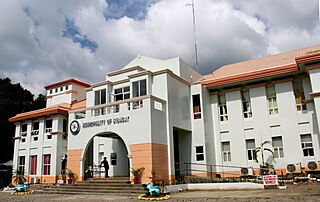
Del Carmen, officially the Municipality of Del Carmen, is a 5th class municipality in the province of Surigao del Norte, Philippines. According to the 2015 census, it has a population of 18,392 people. The municipality was formerly called Numancia until 1966 when it was changed to its present name. It is located on Siargao Island and home to Sayak Airport, the island's main airport.

References

  1. Municipality of Carmen | (DILG)
  2. "2015 Census of Population, Report No. 3 – Population, Land Area, and Population Density" (PDF). Philippine Statistics Authority. Quezon City, Philippines. August 2016. ISSN   0117-1453. Archived (PDF) from the original on May 25, 2021. Retrieved July 16, 2021.
  3. 1 2 3 4 Census of Population (2020). "Caraga". Total Population by Province, City, Municipality and Barangay. Philippine Statistics Authority . Retrieved 8 July 2021.
  4. "PSA Releases the 2018 Municipal and City Level Poverty Estimates". Philippine Statistics Authority. 15 December 2021. Retrieved 22 January 2022.
  5. "Republic Act No. 380 - Act Creating the Municipality of Carmen in the Province of Agusan". PhilippineLaw.info. 15 June 1949. Archived from the original on 31 May 2012. Retrieved 16 October 2016.
  6. "Province: Agusan del Norte". PSGC Interactive. Quezon City, Philippines: Philippine Statistics Authority . Retrieved 12 November 2016.
  7. "Carmen: Average Temperatures and Rainfall". Meteoblue. Retrieved 2 February 2020.
  8. "Municipal: Carmen, Agusan del Norte". PSGC Interactive. Quezon City, Philippines: Philippine Statistics Authority . Retrieved 8 January 2016.
  9. 1 2 Census of Population and Housing (2010). "Caraga". Total Population by Province, City, Municipality and Barangay. National Statistics Office . Retrieved 29 June 2016.
  10. Census of Population (2015). "Caraga". Total Population by Province, City, Municipality and Barangay. Philippine Statistics Authority . Retrieved 20 June 2016.
  11. Censuses of Population (1903–2007). "Caraga". Table 1. Population Enumerated in Various Censuses by Province/Highly Urbanized City: 1903 to 2007. National Statistics Office.
  12. "Province of Agusan del Norte". Municipality Population Data. Local Water Utilities Administration Research Division. Retrieved 17 December 2016.
  13. "Poverty incidence (PI):". Philippine Statistics Authority. Retrieved December 28, 2020.
  14. "Estimation of Local Poverty in the Philippines" (PDF). Philippine Statistics Authority. 29 November 2005.
  15. "2003 City and Municipal Level Poverty Estimates" (PDF). Philippine Statistics Authority. 23 March 2009.
  16. "City and Municipal Level Poverty Estimates; 2006 and 2009" (PDF). Philippine Statistics Authority. 3 August 2012.
  17. "2012 Municipal and City Level Poverty Estimates" (PDF). Philippine Statistics Authority. 31 May 2016.
  18. "Municipal and City Level Small Area Poverty Estimates; 2009, 2012 and 2015". Philippine Statistics Authority. 10 July 2019.
  19. "PSA Releases the 2018 Municipal and City Level Poverty Estimates". Philippine Statistics Authority. 15 December 2021. Retrieved 22 January 2022.

Commons-logo.svg Media related to Carmen, Agusan del Norte at Wikimedia Commons