Carroll, Nebraska

Last updated

Carroll, Nebraska
Carroll, Nebraska N end from E.JPG
Grain bins north of downtown Carroll, June 2010
Wayne County Nebraska Incorporated and Unincorporated areas Carroll Highlighted.svg
Location of Carroll, Nebraska
Coordinates: 42°16′33″N97°11′27″W / 42.27583°N 97.19083°W / 42.27583; -97.19083
Country United States
State Nebraska
County Wayne
Area
[1]
  Total0.15 sq mi (0.39 km2)
  Land0.15 sq mi (0.39 km2)
  Water0.00 sq mi (0.00 km2)
Elevation
[2]
1,581 ft (482 m)
Population
 (2020) [3]
  Total193
  Estimate 
(2021) [3]
194
  Density1,300/sq mi (490/km2)
Time zone UTC-6 (Central (CST))
  Summer (DST) UTC-5 (CDT)
ZIP code
68723
Area code 402
FIPS code 31-08010 [4]
GNIS feature ID2397563 [2]

Carroll is a village in Wayne County, Nebraska, United States. The population was 193 at the 2020 census. [3]

Contents

History

Carroll was established in 1886 when the railroad was extended to that point. [5] It is named for Charles Carroll of Carrollton, the last surviving signer of the Declaration of Independence. [6]

Geography

According to the United States Census Bureau, the village has a total area of 0.15 square miles (0.39 km2), all land. [7]

Demographics

Historical population
CensusPop.Note
1890 68
1900 252270.6%
1910 38251.6%
1920 44817.3%
1930 401−10.5%
1940 351−12.5%
1950 309−12.0%
1960 220−28.8%
1970 2356.8%
1980 2464.7%
1990 237−3.7%
2000 2380.4%
2010 229−3.8%
2020 193−15.7%
U.S. Decennial Census [3]

2010 census

As of the census [8] of 2010, there were 229 people, 99 households, and 64 families residing in the village. The population density was 1,526.7 inhabitants per square mile (589.5/km2). There were 112 housing units at an average density of 746.7 per square mile (288.3/km2). The racial makeup of the village was 96.5% White, 0.4% Asian, and 3.1% from other races. Hispanic or Latino of any race were 7.0% of the population.

There were 99 households, of which 31.3% had children under the age of 18 living with them, 55.6% were married couples living together, 5.1% had a female householder with no husband present, 4.0% had a male householder with no wife present, and 35.4% were non-families. 33.3% of all households were made up of individuals, and 20.2% had someone living alone who was 65 years of age or older. The average household size was 2.31 and the average family size was 2.95.

The median age in the village was 43.1 years. 24.9% of residents were under the age of 18; 7% were between the ages of 18 and 24; 20.9% were from 25 to 44; 23.6% were from 45 to 64; and 23.6% were 65 years of age or older. The gender makeup of the village was 52.4% male and 47.6% female.

2000 census

As of the census [4] of 2000, there were 238 people, 104 households, and 68 families residing in the village. The population density was 1,592.5 inhabitants per square mile (614.9/km2). There were 116 housing units at an average density of 776.2 per square mile (299.7/km2). The racial makeup of the village was 96.22% White, 1.68% Native American, and 2.10% from two or more races.

There were 104 households, out of which 26.9% had children under the age of 18 living with them, 55.8% were married couples living together, 5.8% had a female householder with no husband present, and 34.6% were non-families. 32.7% of all households were made up of individuals, and 20.2% had someone living alone who was 65 years of age or older. The average household size was 2.29 and the average family size was 2.85.

In the village, the population was spread out, with 25.2% under the age of 18, 4.2% from 18 to 24, 21.4% from 25 to 44, 25.2% from 45 to 64, and 23.9% who were 65 years of age or older. The median age was 42 years. For every 100 females, there were 101.7 males. For every 100 females age 18 and over, there were 91.4 males.

As of 2000 the median income for a household in the village was $31,875, and the median income for a family was $39,375. Males had a median income of $27,500 versus $16,250 for females. The per capita income for the village was $14,115. About 8.8% of families and 11.9% of the population were below the poverty line, including 12.5% of those under the age of eighteen and 21.6% of those 65 or over.

See also

Related Research Articles

<span class="mw-page-title-main">Roseland, Nebraska</span> Village in Nebraska, United States

Roseland is a village in Adams County, Nebraska, United States. The population was 260 at the 2020 census. It is part of the Hastings, Nebraska Micropolitan Statistical Area.

<span class="mw-page-title-main">Amherst, Nebraska</span> Village in Nebraska, United States

Amherst is a village in Buffalo County, Nebraska, United States. It is part of the Kearney, Nebraska Micropolitan Statistical Area. The population was 248 at the 2010 census.

<span class="mw-page-title-main">Cedar Creek, Nebraska</span> Village in Nebraska, United States

Cedar Creek is a village in Cass County, Nebraska, United States. The population was 465 at the 2020 census.

<span class="mw-page-title-main">Eagle, Nebraska</span> Village in Nebraska, United States

Eagle is a village in southwest Cass County, Nebraska, United States. As of the 2020 census, the village population was 1,065.

<span class="mw-page-title-main">Elmwood, Nebraska</span> Village in Nebraska, United States

Elmwood is a village in southeast Cass County, Nebraska, United States. The population was 654 at the 2020 census.

<span class="mw-page-title-main">Greenwood, Nebraska</span> Village in Nebraska, United States

Greenwood is a village in northwest Cass County, Nebraska, United States. The population was 595 at the 2020 census.

<span class="mw-page-title-main">Manley, Nebraska</span> Village in Nebraska, United States

Manley is a village in Cass County, Nebraska, United States. The population was 167 at the 2020 census.
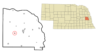
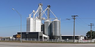
<span class="mw-page-title-main">Anselmo, Nebraska</span> Village in Custer County, Nebraska, United States

Anselmo is a village in Custer County, Nebraska, United States. The population was 145 at the 2010 census.

<span class="mw-page-title-main">Callaway, Nebraska</span> Village in Nebraska, United States

Callaway is a village in Custer County, Nebraska, United States. The population was 539 at the 2010 census.

<span class="mw-page-title-main">Waterloo, Nebraska</span> Village in Douglas County, Nebraska, United States

Waterloo is a village in Douglas County, Nebraska, United States. The population was 935 at the 2020 census.

<span class="mw-page-title-main">Stuart, Nebraska</span> Village in Nebraska, United States

Stuart is a village in Holt County, Nebraska, United States. The population was 590 at the 2010 census.

<span class="mw-page-title-main">Springview, Nebraska</span> Village in Nebraska, United States

Springview is a village in, and the county seat of, Keya Paha County, Nebraska, United States. The population was 242 at the 2010 census.

<span class="mw-page-title-main">Stapleton, Nebraska</span> Village in and county seat of Logan County, Nebraska, United States

Stapleton is a village in and the county seat of Logan County, Nebraska, United States. The population was 267 at the 2020 census.

<span class="mw-page-title-main">Malmo, Nebraska</span> Village in Saunders County, Nebraska, United States

Malmo is a village in Saunders County, Nebraska, United States. The population was 94 at the 2020 census.

<span class="mw-page-title-main">Memphis, Nebraska</span> Village in Nebraska, United States

Memphis is a village in Saunders County, Nebraska, United States. The population was 109 at the 2020 census.

<span class="mw-page-title-main">Morse Bluff, Nebraska</span> Village in Saunders County, Nebraska, United States

Morse Bluff is a village in Saunders County, Nebraska, United States. The population was 117 at the 2020 census.

<span class="mw-page-title-main">Weston, Nebraska</span> Village in Saunder County, Nebraska, United States

Weston is a village in Saunders County, Nebraska, United States. The population was 250 at the 2020 census.

<span class="mw-page-title-main">Herman, Nebraska</span> Village in Washington County, Nebraska, United States

Herman is a village in Washington County, Nebraska, United States. The population was 268 at the 2010 census.

<span class="mw-page-title-main">Washington, Nebraska</span> Village in Washington County, Nebraska, United States

Washington is a village in Washington County, Nebraska, United States. The population was 150 at the 2010 census.

<span class="mw-page-title-main">Bartlett, Nebraska</span> Village in and county seat of Wheeler County, Nebraska, United States

Bartlett is a village in, and the county seat of, Wheeler County, Nebraska, United States. The population was 117 at the 2010 census.

References

  1. "ArcGIS REST Services Directory". United States Census Bureau. Retrieved September 18, 2022.
  2. 1 2 U.S. Geological Survey Geographic Names Information System: Carroll, Nebraska
  3. 1 2 3 4 Bureau, US Census. "City and Town Population Totals: 2020-2021". Census.gov. US Census Bureau. Retrieved January 25, 2023.
  4. 1 2 "U.S. Census website". United States Census Bureau . Retrieved January 31, 2008.
  5. "Carroll, Wayne County". Center for Advanced Land Management Information Technologies. University of Nebraska. Retrieved August 24, 2014.
  6. Chicago and North Western Railway Company (1908). A History of the Origin of the Place Names Connected with the Chicago & North Western and Chicago, St. Paul, Minneapolis & Omaha Railways. p. 170.
  7. "US Gazetteer files 2010". United States Census Bureau. Archived from the original on July 2, 2012. Retrieved June 24, 2012.
  8. "U.S. Census website". United States Census Bureau . Retrieved June 24, 2012.

Commons-logo.svg Media related to Carroll, Nebraska at Wikimedia Commons