Wakefield, Nebraska

Last updated

Wakefield, Nebraska
Wakefield, Nebraska Michael Foods plant.JPG
Michael Foods egg-processing plant in Wakefield, March 2010
Dixon County Nebraska Incorporated and Unincorporated areas Wakefield Highlighted.svg
Location of Wakefield, Nebraska
Coordinates: 42°16′00″N96°51′47″W / 42.26667°N 96.86306°W / 42.26667; -96.86306
Country United States
State Nebraska
Counties Dixon, Wayne
Area
[1]
  Total1.13 sq mi (2.93 km2)
  Land1.06 sq mi (2.75 km2)
  Water0.07 sq mi (0.18 km2)
Elevation
[2]
1,391 ft (424 m)
Population
 (2020)
  Total1,522
  Density1,433.15/sq mi (553.13/km2)
Time zone UTC-6 (Central (CST))
  Summer (DST) UTC-5 (CDT)
ZIP code
68784
Area code 402
FIPS code 31-51070
GNIS feature ID2397168 [2]
Website www.ci.wakefield.ne.us

Wakefield is a city in Dixon and Wayne Counties in the State of Nebraska. The population was 1,451 at the 2010 census.

Contents

The Dixon County portion of Wakefield is part of the Sioux City metropolitan area.

History

Wakefield got its start in the year 1881, following construction of the Chicago, St. Paul, Minneapolis and Omaha Railway through the territory. [3] It was named for L. W. Wakefield, a railroad engineer. [4] Wakefield was incorporated in 1883. [5]

Demographics

Historical population
CensusPop.Note
1900 755
1910 86114.0%
1920 1,11429.4%
1930 1,112−0.2%
1940 961−13.6%
1950 1,0276.9%
1960 1,0684.0%
1970 1,1608.6%
1980 1,125−3.0%
1990 1,082−3.8%
2000 1,41130.4%
2010 1,4512.8%
2020 1,5224.9%
U.S. Decennial Census [6]

2010 census

As of the census [7] of 2010, there were 1,451 people, 534 households, and 352 families living in the city. The population density was 1,667.8 inhabitants per square mile (643.9/km2). There were 575 housing units at an average density of 660.9 per square mile (255.2/km2). The racial makeup of the city was 75.6% White, 0.4% African American, 0.5% Native American, 0.5% Asian, 0.1% Pacific Islander, 21.4% from other races, and 1.5% from two or more races. Hispanic or Latino of any race were 33.6% of the population.

There were 534 households, of which 32.4% had children under the age of 18 living with them, 51.7% were married couples living together, 9.6% had a female householder with no husband present, 4.7% had a male householder with no wife present, and 34.1% were non-families. 30.0% of all households were made up of individuals, and 17.2% had someone living alone who was 65 years of age or older. The average household size was 2.64 and the average family size was 3.23.

The median age in the city was 38 years. 25.7% of residents were under the age of 18; 9.7% were between the ages of 18 and 24; 22.8% were from 25 to 44; 23.1% were from 45 to 64; and 18.5% were 65 years of age or older. The gender makeup of the city was 47.6% male and 52.4% female.

2000 census

As of the census of 2000, there were 1,411 people, 522 households, and 346 families living in the city. The population density was 2,020.4 inhabitants per square mile (780.1/km2). There were 558 housing units at an average density of 799.0 per square mile (308.5/km2). The racial makeup of the city was 83.63% White, 1.13% Native American, 0.43% Asian, 13.68% from other races, and 1.13% from two or more races. Hispanic or Latino of any race were 17.43% of the population.

There were 522 households, out of which 32.4% had children under the age of 18 living with them, 54.0% were married couples living together, 9.4% had a female householder with no husband present, and 33.7% were non-families. 30.7% of all households were made up of individuals, and 19.9% had someone living alone who was 65 years of age or older. The average household size was 2.59 and the average family size was 3.25.

In the city, the population was spread out, with 27.2% under the age of 18, 8.1% from 18 to 24, 24.9% from 25 to 44, 18.3% from 45 to 64, and 21.5% who were 65 years of age or older. The median age was 38 years. For every 100 females, there were 88.9 males. For every 100 females age 18 and over, there were 85.0 males.

As of 2000 the median income for a household in the city was $32,308, and the median income for a family was $41,429. Males had a median income of $26,607 versus $20,789 for females. The per capita income for the city was $15,830. About 5.6% of families and 7.2% of the population were below the poverty line, including 7.8% of those under age 18 and 9.4% of those age 65 or over.

Economy

The largest employer in Wakefield is the Michael Foods egg-processing plant, with 800 employees. Other major employers include Wakefield Health Care Center, a nursing home with 65 employees; Wakefield Public School, with 55 employees; Central Valley Ag, a supplier of fertilizer and farm supplies, with 20 employees; and Roses Transport, a freight-hauling company with 17 employees. [8]

Geography

According to the United States Census Bureau, the city has a total area of 0.94 square miles (2.43 km2), of which 0.87 square miles (2.25 km2) is land and 0.07 square miles (0.18 km2) is water. [9]

Climate

Climate data for Wakefield, Nebraska (1991−2020 normals, extremes 1897−present)
MonthJanFebMarAprMayJunJulAugSepOctNovDecYear
Record high °F (°C)73
(23)
73
(23)
89
(32)
101
(38)
109
(43)
108
(42)
115
(46)
110
(43)
103
(39)
96
(36)
83
(28)
72
(22)
115
(46)
Mean maximum °F (°C)53.9
(12.2)
58.8
(14.9)
73.9
(23.3)
83.3
(28.5)
90.7
(32.6)
95.2
(35.1)
95.7
(35.4)
93.9
(34.4)
90.9
(32.7)
85.6
(29.8)
70.7
(21.5)
55.2
(12.9)
98.3
(36.8)
Average high °F (°C)31.7
(−0.2)
36.9
(2.7)
49.8
(9.9)
62.8
(17.1)
73.3
(22.9)
83.0
(28.3)
86.3
(30.2)
84.1
(28.9)
78.3
(25.7)
65.1
(18.4)
48.2
(9.0)
35.1
(1.7)
61.2
(16.2)
Daily mean °F (°C)20.6
(−6.3)
25.3
(−3.7)
36.7
(2.6)
48.5
(9.2)
59.7
(15.4)
70.0
(21.1)
73.4
(23.0)
71.3
(21.8)
63.9
(17.7)
51.1
(10.6)
35.9
(2.2)
24.3
(−4.3)
48.4
(9.1)
Average low °F (°C)9.5
(−12.5)
13.7
(−10.2)
23.7
(−4.6)
34.2
(1.2)
46.1
(7.8)
57.1
(13.9)
60.6
(15.9)
58.5
(14.7)
49.6
(9.8)
37.2
(2.9)
23.5
(−4.7)
13.6
(−10.2)
35.6
(2.0)
Mean minimum °F (°C)−13.6
(−25.3)
−8.0
(−22.2)
2.8
(−16.2)
18.2
(−7.7)
31.9
(−0.1)
45.9
(7.7)
50.5
(10.3)
48.2
(9.0)
33.6
(0.9)
19.1
(−7.2)
4.7
(−15.2)
−7.2
(−21.8)
−17.6
(−27.6)
Record low °F (°C)−41
(−41)
−38
(−39)
−22
(−30)
−4
(−20)
19
(−7)
32
(0)
40
(4)
33
(1)
17
(−8)
0
(−18)
−18
(−28)
−28
(−33)
−41
(−41)
Average precipitation inches (mm)0.74
(19)
0.95
(24)
1.67
(42)
3.33
(85)
4.12
(105)
5.03
(128)
3.13
(80)
3.72
(94)
3.01
(76)
2.50
(64)
1.40
(36)
1.09
(28)
30.69
(780)
Average snowfall inches (cm)6.9
(18)
8.1
(21)
5.6
(14)
2.8
(7.1)
0.0
(0.0)
0.0
(0.0)
0.0
(0.0)
0.0
(0.0)
0.0
(0.0)
0.6
(1.5)
3.6
(9.1)
7.9
(20)
35.5
(90)
Average precipitation days (≥ 0.01 in)5.55.46.79.811.810.59.49.37.67.25.35.794.2
Average snowy days (≥ 0.1 in)4.94.72.81.50.00.00.00.00.00.62.04.721.2
Source: NOAA [10] [11]

See also

Related Research Articles

<span class="mw-page-title-main">Dixon County, Nebraska</span> County in Nebraska, United States

Dixon County is a county in the U.S. state of Nebraska. As of the 2020 United States Census, the population was 5,606. Its county seat is Ponca. The county was created in 1856 and attached to Dakota County. It was organized in 1858.

<span class="mw-page-title-main">Roseland, Nebraska</span> Village in Nebraska, United States

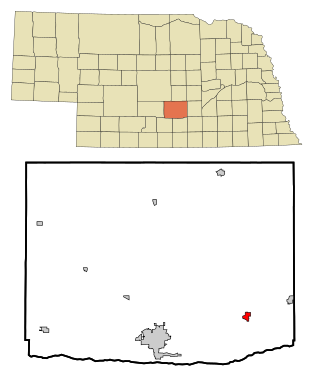
Roseland is a village in Adams County, Nebraska, United States. The population was 260 at the 2020 census. It is part of the Hastings, Nebraska Micropolitan Statistical Area.

<span class="mw-page-title-main">Gibbon, Nebraska</span> City in Nebraska, United States

Gibbon is a city in Buffalo County, Nebraska, United States. It is part of the Kearney, Nebraska Micropolitan Statistical Area. The population was 1,833 at the 2010 census.

<span class="mw-page-title-main">South Bend, Nebraska</span> Village in Nebraska, United States

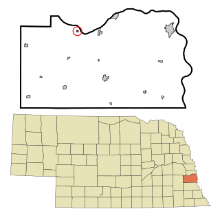
South Bend is a village in Cass County, Nebraska, United States. The population was 92 at the 2020 census. The main landmark is a pedestrian bridge across the Platte River which leads to Schramm Park State Recreation Area. It was built in 2004 on the pillars of the abandoned Rock Island Railroad bridge. Thirty-five trains a day—most of them coal trains—still pass through the area on the BNSF Railway main.

<span class="mw-page-title-main">Edgar, Nebraska</span> City in Nebraska, United States

Edgar is a city in Clay County, Nebraska, United States. The population was 498 at the 2010 census. It is part of the Hastings, Nebraska Micropolitan Statistical Area.

<span class="mw-page-title-main">Allen, Nebraska</span> Village in Dixon County, Nebraska, United States

Allen is a village in Dixon County, Nebraska, United States. Located south of US Hwy 20 on NE Hwy 9 between Martinsburg, NE and Wakefield, NE. It is part of the Sioux City, IA–NE–SD Metropolitan Statistical Area. The population was 377 at the 2010 census.

<span class="mw-page-title-main">Dixon, Nebraska</span> Village in Dixon County, Nebraska, United States

Dixon is a village in Dixon County, Nebraska, United States. It is part of the Sioux City, IA–NE–SD Metropolitan Statistical Area. The population was 87 at the 2010 census.

<span class="mw-page-title-main">Martinsburg, Nebraska</span> Village in Dixon County, Nebraska, United States

Martinsburg is a village in Dixon County, Nebraska, United States. It is part of the Sioux City, IA–NE–SD Metropolitan Statistical Area. The population was 94 at the 2010 census.

<span class="mw-page-title-main">Maskell, Nebraska</span> Village in Dixon County, Nebraska, United States

Maskell is a village in Dixon County, Nebraska, United States. It is part of the Sioux City, IA–NE–SD Metropolitan Statistical Area. The population was 76 at the 2010 census. It is reportedly home to the smallest city hall in the United States.

<span class="mw-page-title-main">Newcastle, Nebraska</span> Village in Dixon County, Nebraska, United States

Newcastle is a village in Dixon County, Nebraska, United States. It is part of the Sioux City, IA–NE–SD Metropolitan Statistical Area. The population was 325 at the 2010 census.

<span class="mw-page-title-main">Ponca, Nebraska</span> City in and county seat of Dixon County, Nebraska, U.S.

Ponca is a city and county seat of Dixon County, Nebraska, United States. The population was 961 at the 2010 census.

<span class="mw-page-title-main">Waterbury, Nebraska</span> Village in Dixon County, Nebraska, United States

Waterbury is a village in Dixon County, Nebraska, United States. It is part of the Sioux City, IA–NE–SD Metropolitan Statistical Area. The population was 73 at the 2010 census.

<span class="mw-page-title-main">Bennington, Nebraska</span> City in Douglas County, Nebraska, United States

Bennington is a city in Douglas County, Nebraska, United States. The population was 2,026 at the 2020 U.S. Census.

<span class="mw-page-title-main">Atkinson, Nebraska</span> City in Nebraska, United States

Atkinson is a city in Holt County, Nebraska, United States. The population was 1,245 at the 2010 census.

<span class="mw-page-title-main">Reynolds, Nebraska</span> Village in Jefferson County, Nebraska, United States

Reynolds is a village in Jefferson County, Nebraska, United States. The population was 59 at the 2020 census.

<span class="mw-page-title-main">Creighton, Nebraska</span> City in Nebraska, United States

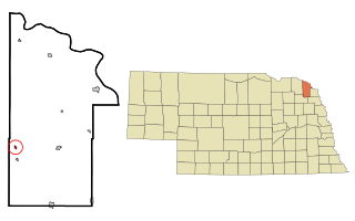
Creighton is a city in Knox County, Nebraska, United States. The population was 1,154 at the 2010 census.

<span class="mw-page-title-main">Humboldt, Nebraska</span> City in Richardson County, Nebraska, United States

Humboldt is a city in Richardson County, Nebraska, United States. The population was 800 at the 2020 census.

<span class="mw-page-title-main">Salem, Nebraska</span> Village in Richardson County, Nebraska, United States

Salem is a village in Richardson County, Nebraska, United States. The population was 84 at the 2020 census.

<span class="mw-page-title-main">Memphis, Nebraska</span> Village in Nebraska, United States

Memphis is a village in Saunders County, Nebraska, United States. The population was 109 at the 2020 census.

<span class="mw-page-title-main">Emerson, Nebraska</span> Village in Dakota, Dixon, and Thurston counties in Nebraska, United States

Emerson is a village in Dakota, Dixon, and Thurston counties in Nebraska, United States. The population was 840 at the 2010 census. Emerson is the only community in Nebraska that exists in three counties.

References

  1. "ArcGIS REST Services Directory". United States Census Bureau. Retrieved September 18, 2022.
  2. 1 2 U.S. Geological Survey Geographic Names Information System: Wakefield, Nebraska
  3. "Wakefield, Dixon County". Center for Advanced Land Management Information Technologies. University of Nebraska. Retrieved August 4, 2014.
  4. Chicago and North Western Railway Company (1908). A History of the Origin of the Place Names Connected with the Chicago & North Western and Chicago, St. Paul, Minneapolis & Omaha Railways. p. 195.
  5. Huse, William (1896). History of Dixon County, Nebraska: Its Pioneers, Settlement, Growth and Development. Press of the Daily News. pp.  257.
  6. United States Census Bureau. "Census of Population and Housing" . Retrieved October 18, 2013.
  7. "U.S. Census website". United States Census Bureau . Retrieved June 24, 2012.
  8. "Community Fast Facts Profile: Wakefield, Nebraska". Nebraska Public Power District. Retrieved 2010-03-05
  9. "US Gazetteer files 2010". United States Census Bureau . Retrieved June 24, 2012.
  10. "NowData - NOAA Online Weather Data". National Oceanic and Atmospheric Administration. Retrieved October 18, 2021.
  11. "Station: Wakefield, NE". U.S. Climate Normals 2020: U.S. Monthly Climate Normals (1991-2020). National Oceanic and Atmospheric Administration. Retrieved October 18, 2021.