Casas Adobes is a census-designated place (CDP) located in the northern metropolitan area of Tucson, Arizona. The population was 66,795 at the 2010 census. Casas Adobes is situated south and southwest of the town of Oro Valley, and west of the community of Catalina Foothills.

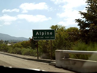
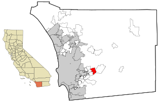
Alpine is a census-designated place (CDP) in the Cuyamaca Mountains of San Diego County, California. Alpine had a population of 14,236 at the 2010 census, up from 13,143 at the 2000 census. The town is largely surrounded by the Cleveland National Forest and borders two reservations of the Kumeyaay Nation, Viejas and Sycuan, and the rural unincorporated areas around the city of El Cajon.

Bostonia is a neighborhood in San Diego County, California, comprising part of the northeastern portion of the city of El Cajon, as well as adjacent unincorporated areas of San Diego County. The portion of Bostonia that lies outside the El Cajon city limits is classified as a census-designated place (CDP) for statistical purposes by the United States Census Bureau. The population of the CDP was 15,379 at the 2010 census, up from 15,169 at the 2000 census.

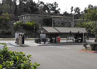
Casa de Oro-Mount Helix is a census-designated place (CDP) in the East County region of San Diego County, California.

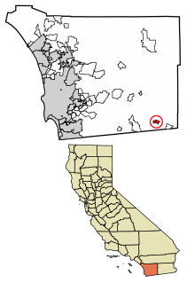
Crest is an unincorporated community in San Diego County, California. The Crest census-designated place (CDP) had a population of 2,593 at the 2010 census, down from 2,716 at the 2000 census.

Granite Hills is a census-designated place in San Diego County, California. The name is also applied to a neighborhood within the city limits of El Cajon in the eastern part of that city. The population of the CDP, which does not include the people living within the city of El Cajon, was 3,035 at the 2010 census, down from 3,246 at the 2000 census.

Harbison Canyon is a census-designated place (CDP) in San Diego County, California. Harbison Canyon had a population of 3,841 as of the 2010 census, up from 3,645 as of the 2000 census.

La Mesa is a city in San Diego County, located 9 miles (14 km) east of Downtown San Diego in Southern California. The population was 57,065 at the 2010 census, up from 54,749 at the 2000 census. Its civic motto is "the Jewel of the Hills."

Pine Valley is a community and census-designated place (CDP) in the Cuyamaca Mountains of the Mountain Empire area, in southeastern San Diego County, California. The population was 1,510 at the 2010 census, up from 1,501 at the 2000 census.

Ramona is a census-designated place (CDP) in San Diego County, California. The population was 20,292 at the 2010 census.

San Diego Country Estates, commonly referred to as the Estates, is a valley resort populace composed of several neighborhoods associated with the unincorporated community of Ramona, California. The Estates are a census-designated place in North County, a region of the San Diego metropolitan area. The Estates is just east of the North County city of Poway and southeast of Ramona; 38 miles (61 km) northeast of San Diego and 46 miles (74 km) from the regional center of Carlsbad. San Diego Country Estates had a population of 10,109 at the 2010 census, up from 9,262 at the 2000 census.

Spring Valley is a census-designated place (CDP) in the East County region of San Diego County, California. The population was 28,205 at the 2010 census.

Boulevard is a census-designated place (CDP) in the Mountain Empire area of southeastern San Diego County, California. At the 2010 census, it had a population of 315. The area is rural high desert along the Mexican border near the eastern extent of San Diego County.

Campo is an unincorporated community in the Mountain Empire area of southeastern San Diego County, California, United States. The population was 2,684 at the 2010 census. For statistical purposes, the United States Census Bureau has defined Campo as a census-designated place (CDP). The census definition of the area may not precisely correspond to local understanding of the area with the same name.

Sorrento Valley is a neighborhood of San Diego, California. It is located about 17 mi (27 km) north of Downtown San Diego and its main airport, Lindbergh Field. It is roughly bounded by Interstate 5 and Interstate 805, Camino Santa Fe to the east, the Los Peñasquitos Canyon Preserve to the north and Miramar Road to the south, as shown on the San Diego Police Department's neighborhood map. It encompasses Sorrento Mesa and is part of the San Diego Unified School District.

San Diego County, officially the County of San Diego, is a county in the southwestern corner of the state of California, in the United States. As of the 2010 census, the population was 3,095,313, making it California's second-most populous county and the fifth-most populous in the United States. Its county seat is San Diego, the second-most populous city in California and the eighth-most populous city in the United States. It is the southwesternmost county in the 48 contiguous United States, and is a border county.

East County is a region of San Diego County, California east of San Diego.
La Mesa-Spring Valley School District is a public school district in the East County area of San Diego County, California, United States. The district serves the city of La Mesa, a portion of the city of El Cajon, the unincorporated communities of Casa de Oro, Mount Helix, and Spring Valley. As of 2021, the district serves 11,400 students in grades K–8. There are four middle schools and 17 elementary schools (K–6). The district is run by a five-member elected school board.


