Adams County is a county in the Commonwealth of Pennsylvania. As of the 2020 census, the population was 103,852. Its county seat is Gettysburg. The county was created on January 22, 1800, from part of York County, and was named for the second President of the United States, John Adams. On July 1–3, 1863, a crucial battle of the American Civil War was fought near Gettysburg; Adams County as a result is a center of Civil War tourism.
Delmar is a hamlet in the Town of Bethlehem, in Albany County, New York, United States. It is a suburb of the neighboring city of Albany. The community is bisected by NY Route 443, a major thoroughfare, main street, and route to Albany.

Toast is a census-designated place (CDP) in Surry County, North Carolina, United States, just west of Mount Airy. The population was 1,922 at the 2000 census.

Leach is an unincorporated community and census-designated place (CDP) in southwestern Delaware County, Oklahoma, United States, along U.S. Route 412 and 412 Alternate. The population was 237 at the 2010 census.

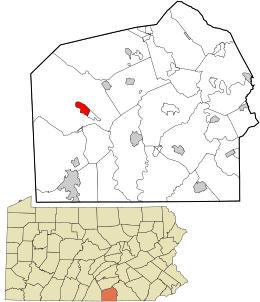
Cashtown-McKnightstown was a census-designated place (CDP) in Franklin Township, Adams County, Pennsylvania. It was the 2000 United States Census area designated by obsolete Census Code 11588 and has been replaced by the CDPs of Cashtown and McKnightstown, which the USGS designated as separate named places on August 30, 2010.

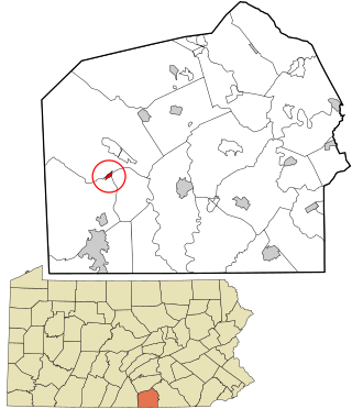
Franklin Township is a township in Adams County, Pennsylvania, United States. The population was 4,676 at the 2020 census.
Orrtanna is a census-designated place (CDP) in Adams County, Pennsylvania, United States. The population was 183 at the 2020 census.

Colver is an unincorporated community and census-designated place (CDP) in Cambria County, Pennsylvania, United States. The population was 959 at the 2010 census.
Black Lick is a census-designated place (CDP) in Burrell Township, Indiana County, Pennsylvania, United States. The population was 1,462 at the 2010 census.

Flourtown is a census-designated place (CDP) in Springfield Township, Montgomery County, Pennsylvania. Flourtown is adjacent to the neighborhoods of Erdenheim, Oreland, Whitemarsh, and Chestnut Hill. The population of Flourtown was 4,538 at the 2010 census. Its ZIP code is 19031.

Balm is an unincorporated census-designated place in Hillsborough County, Florida, United States. The population was 1,457 at the 2010 census.

Cucumber is a census-designated place (CDP) in McDowell County, West Virginia, United States. Its population was 74 at the 2020 census. The community is centered on mining. Named either for nearby Cucumber Creek or for the cucumber trees in the area, it is the only community in the United States with this name. Its post office was still active as of October 2011.

Norwood is an unincorporated community and census-designated place (CDP) in Charlevoix County in the U.S. state of Michigan. The population of the CDP was 144 at the 2020 census. It is located along the shores of Lake Michigan in Norwood Township.

Fairplay is an unincorporated community and census-designated place (CDP) in Washington County, Maryland, United States. Its population was 580 as of the 2010 census. It is sometimes recognized, along with neighboring Tilghmanton, as Fairplay-Tilghmanton; the two communities share a post office as well as a fire company. Fairplay is located between Hagerstown and Sharpsburg, along Maryland Route 65 and is part of the Hagerstown Metropolitan Area. Marsh Mills was listed on the National Register of Historic Places in 1996.

Fair Play is a census-designated place located in Oconee County in the U.S. state of South Carolina. A small portion of the CDP extends into Anderson County. As of the 2020 census, the population of Fair Play was 704.

Bolt is a census-designated place (CDP) in Raleigh County, West Virginia, United States. Bolt is located on West Virginia Route 99, 12 miles (19 km) west of Beckley. Bolt has a post office with ZIP code 25817. As of the 2010 census, its population is 548.

McKnightstown is a census-designated place (CDP) in Franklin Township, Adams County, Pennsylvania, United States. It was formerly part of the Cashtown-McKnightstown CDP as of the 2000 census, and was then split into two separate CDPs for the 2010 census.

Force is an unincorporated community and census-designated place in Jay Township, Elk County, Pennsylvania, United States. As of the 2020 census it had a population of 213. It is located on Pennsylvania Route 255 between St. Marys and Penfield.
Dunlo is an unincorporated community and census-designated place (CDP) in Adams Township, Cambria County, Pennsylvania, United States. It is located between the communities of Beaverdale and Salix, in the valley of Sulphur Creek, a tributary of the Little Conemaugh River. As of the 2010 census, the population was 342 residents.
Fort Loudon (CDP) is an unincorporated community and census-designated place (CDP) in Peters Township, Franklin County, Pennsylvania, United States. As of the 2020 census, the population was 895.