Cassville, West Virginia

Last updated

Cassville, West Virginia
CDP
USA West Virginia location map.svg
Red pog.svg
Cassville, West Virginia
Location within the state of West Virginia
Coordinates: 39°39′43″N80°3′3″W / 39.66194°N 80.05083°W / 39.66194; -80.05083
Country Flag of the United States.svg  United States
State Flag of West Virginia.svg  West Virginia
County Flag of Monongalia County, West Virginia.svg Monongalia
Area
[1]
  Total3.5 sq mi (9.2 km2)
  Land3.5 sq mi (9.2 km2)
  Water0.0 sq mi (0.0 km2)
Elevation
[2]
1,001 ft (305 m)
Population
 (2010) [3]
  Total1,268
  Density360/sq mi (140/km2)
Time zone UTC-5 (Eastern (EST))
  Summer (DST) UTC-4 (EDT)
ZIP code
26527
Area code 304
FIPS code 54-13756 [4]
GNIS feature ID1554085 [2]

Cassville is a census-designated place (CDP) in Monongalia County, West Virginia, United States. The population was 1,268 at the 2020 census. [5] It is included in the Morgantown, West Virginia Metropolitan Statistical Area. Cassville was named after Lewis Cass, a prominent American statesman who served as Secretary of War, Secretary of State, and Governor of Michigan. [6]

Contents

Geography

Cassville is located at 39°39′43″N80°3′3″W / 39.66194°N 80.05083°W / 39.66194; -80.05083 (39.661889, -80.050873). [1]

According to the United States Census Bureau, the Cassville CDP has a total area of 9.2 km2 (3.5 mi2), all land.

Demographics

As of the census [4] of 2000, there were 1,586 people, 644 households, and 446 families residing in the CDP. The population density was 40.6/km2 (105.1/mi2). There were 704 housing units at an average density of 18.0/km2 (46.6/mi2). The racial makeup of the CDP was 95.59% White, 1.83% African American, 0.57% Native American, 0.13% Asian, 0.19% from other races, and 1.70% from two or more races. Hispanic or Latino of any race were 1.01% of the population.

There were 644 households, out of which 26.1% had children under the age of 18 living with them, 55.4% were married couples living together, 8.9% had a female householder with no husband present, and 30.6% were non-families. 25.5% of all households were made up of individuals, and 12.0% had someone living alone who was 65 years of age or older. The average household size was 2.46 and the average family size was 2.97.

The age distribution is 21.5% under the age of 18, 7.6% from 18 to 24, 30.1% from 25 to 44, 26.6% from 45 to 64, and 14.2% who were 65 years of age or older. The median age was 40 years. For every 100 females, there were 96.8 males. For every 100 females age 18 and over, there were 94.8 males.

The median income for a household in the CDP was $25,799, and the median income for a family was $28,782. Males had a median income of $25,217 versus $24,712 for females. The per capita income for the CDP was $13,045. About 11.5% of families and 18.2% of the population were below the poverty line, including 26.9% of those under age 18 and 11.6% of those age 65 or over.

Related Research Articles

<span class="mw-page-title-main">Tonsina, Alaska</span> CDP in Alaska, United States

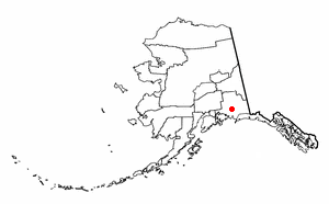
Tonsina is a census-designated place (CDP) in Copper River Census Area, Alaska, United States. At the 2020 census the population was 55, down from 78 in 2010.

<span class="mw-page-title-main">Sun City West, Arizona</span> City in Arizona, United States

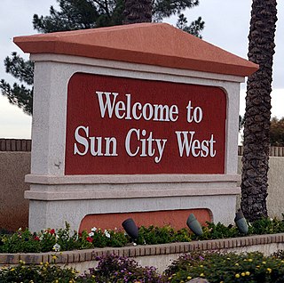
Sun City West is an unincorporated community and census-designated place (CDP) in Maricopa County, Arizona, United States. The population was 25,806 at the 2020 census.

<span class="mw-page-title-main">West Puente Valley, California</span> Census-designated place in California, United States

West Puente Valley is an unincorporated community and census-designated place in Los Angeles County, California, USA, northwest of La Puente. The population was 22,636 at the 2010 census, up from 22,589 at the 2000 census. The community is probably named for its location related to the city of La Puente.

<span class="mw-page-title-main">Indian Falls, California</span> Census-designated place in California, United States

Indian Falls is a census-designated place (CDP) in Plumas County, California, United States. The population was 54 at the 2010 census, up from 37 at the 2000 census.

<span class="mw-page-title-main">Harlem, Florida</span> Census-designated place in Florida, United States

Harlem is a census-designated place (CDP) in Hendry County, Florida, United States. It was established in 1931. Its population is predominantly African American.

<span class="mw-page-title-main">Kingstown, Maryland</span> CDP in Maryland, United States

Kingstown is a census-designated place (CDP) in Queen Anne's County, Maryland, United States. The population was 1,644 at the 2000 census.

<span class="mw-page-title-main">Turpin Hills, Ohio</span> Census-designated place in Ohio, United States

Turpin Hills is a census-designated place (CDP) outside of Anderson Township, Hamilton County, Ohio, United States. The population was 5,162 at the 2020 census.

<span class="mw-page-title-main">Choctaw Lake, Ohio</span> CDP in Ohio, United States

Choctaw Lake is a census-designated place (CDP) in Madison County, Ohio, United States. The population was 1,562 at the 2000 census.

<span class="mw-page-title-main">Morrisville, Greene County, Pennsylvania</span> Census-designated place in Pennsylvania, United States

Morrisville is a census-designated place (CDP) in Franklin Township, Greene County, Pennsylvania, United States. The population was 1,265 at the 2010 census.

<span class="mw-page-title-main">Bellwood, Virginia</span> CDP in Virginia, United States

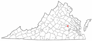
Bellwood is a census-designated place (CDP) in Chesterfield County, Virginia, United States. The population was 6,352 at the 2010 census. The community takes its name from Bellwood, one of the James River Plantations.

<span class="mw-page-title-main">Lakeside, Virginia</span> Census-designated area in Virginia

Lakeside is a census-designated place (CDP) in Henrico County, Virginia, United States. It is an inner suburb of Richmond, Virginia. The population was 11,849 at the 2010 census.

<span class="mw-page-title-main">Fairlea, West Virginia</span> Census-designated place in West Virginia, United States

Fairlea is a census-designated place (CDP) in Greenbrier County, West Virginia, United States. The population was 1,747 at the 2010 census. Fairlea is the location of the annual West Virginia State Fair, held in August.

<span class="mw-page-title-main">Wiley Ford, West Virginia</span> CDP in West Virginia, United States

Wiley Ford is a census-designated place (CDP) in Mineral County, West Virginia, United States and part of the 'Cumberland, MD-WV Metropolitan Statistical Area'. The population was 1,026 at the 2010 census.

<span class="mw-page-title-main">Chattaroy, West Virginia</span> Census-designated place in West Virginia, United States

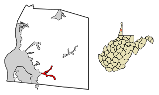
Chattaroy is a census-designated place (CDP) in Mingo County, West Virginia, United States. The population was 756 at the 2010 census.

<span class="mw-page-title-main">Craigsville, West Virginia</span> CDP in West Virginia, United States

Craigsville is a census-designated place (CDP) in Nicholas County, West Virginia, United States. The population was 2,213 at the 2010 census, also 80.

<span class="mw-page-title-main">Triadelphia, West Virginia</span> Town in West Virginia, United States

Triadelphia is a town in Ohio County, West Virginia, United States. It is part of the Wheeling, West Virginia Metropolitan Statistical Area. The population was 669 at the 2020 census.

<span class="mw-page-title-main">Harrisville, West Virginia</span> Town in West Virginia, United States

Harrisville is a town in Ritchie County, West Virginia, United States. It is the county seat of Ritchie County. Harrisville is located at the junction of State Routes 31 and 16, five miles south of U.S. 50. Within the community are an elementary school, the county board of education, many businesses, three banks, a library, offices of the Ritchie Gazette and The Pennsboro News, a municipal park, and North Bend Golf Course. North Bend Lake and North Bend State Park are located just outside town limits. Municipal elections are held every two years.

<span class="mw-page-title-main">Fort Gay, West Virginia</span> Town in West Virginia, United States

Fort Gay is a town in Wayne County, West Virginia, United States, situated along the Tug Fork and Big Sandy rivers. The town adjoins Louisa, Kentucky. The population was 677 at the 2020 census.

<span class="mw-page-title-main">Littleton, West Virginia</span> Census-designated place in West Virginia, United States

Littleton is a census-designated place (CDP) in Wetzel County, West Virginia, United States. The population was 198 at the 2010 census.

<span class="mw-page-title-main">Enterprise, West Virginia</span> Census-designated place in West Virginia, United States

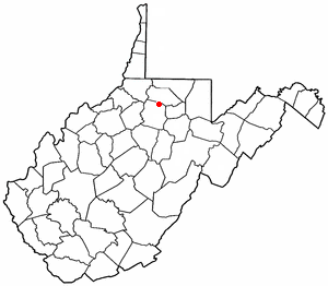
Enterprise is a census-designated place (CDP) in Harrison County, West Virginia, United States, along the West Fork River. The population was 961 at the 2010 census.

References

  1. 1 2 "US Gazetteer files: 2010, 2000, and 1990". United States Census Bureau. February 12, 2011. Retrieved April 23, 2011.
  2. 1 2 U.S. Geological Survey Geographic Names Information System: Cassville, West Virginia
  3. "U.S. Census website". United States Census Bureau . Retrieved May 14, 2011.
  4. 1 2 "U.S. Census website". United States Census Bureau . Retrieved January 31, 2008.
  5. "U.S. Census website". United States Census Bureau . Retrieved December 2, 2022.
  6. Kenny, Hamill (1945). West Virginia Place Names: Their Origin and Meaning, Including the Nomenclature of the Streams and Mountains. Piedmont, WV: The Place Name Press. p. 159.