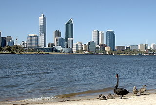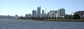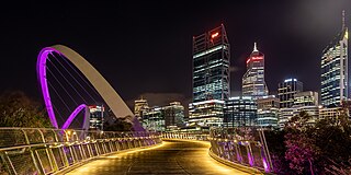
The Swan River is a river in the south west of Western Australia. Its Noongar Aboriginal name is the Derbarl Yerrigan. The river runs through the metropolitan area of Perth, Western Australia's capital and largest city.

Hamersley is a residential suburb 14 kilometres north-northwest of the central business district of Perth, the capital of Western Australia, and six kilometres (4 mi) from the Indian Ocean. The suburb adjoins two major arterial roads—Mitchell Freeway to the west and Reid Highway to the south—and is within the City of Stirling local government area. It was built during the late 1960s and 1970s as part of the Government of Western Australia's response to rapidly increasing land prices across the metropolitan area.

Karrinyup is a suburb of Perth, the capital city of Western Australia, and is located 12 km north of Perth's central business district. Its local government area is the City of Stirling.

Sir Augustus Charles Gregory was an English-born Australian explorer and surveyor. Between 1846 and 1858 he undertook four major expeditions. He was the first Surveyor-General of Queensland. He was appointed a lifetime Member of the Queensland Legislative Council.

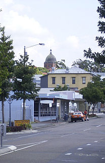
Toowong is a riverside inner suburb of Brisbane, Queensland, Australia. Toowong is 5 kilometres (3.1 mi) west of the Brisbane CBD, within the Paddington Ward of Brisbane City Council.

Oxley is a south-western suburb in the City of Brisbane, Queensland, Australia. It is located approximately 10.8 kilometres (6.7 mi) from the Brisbane CBD. It was named after the early Australian explorer John Oxley. The suburb supports a mix of residential, retail and industrial land.
Ballajura is a suburb of Perth, Western Australia, in the City of Swan local government area. Ballajura is located 14 km north of the Perth CBD. The postcode for the suburb is 6066.

Perth Water is a section of the Swan River on the southern edge of the central business district of Perth, Western Australia. It is between the Causeway to the east, and Narrows Bridge to the west – a large wide but shallow section of river, and the northern edge of the suburb South Perth. It is considered a landmark of the City of Perth.

Windsor is an inner northern suburb in the City of Brisbane, Queensland, Australia. In the 2016 census, Windsor had a population of 7,013 people.

Nundah is an inner suburb in the City of Brisbane, Queensland, Australia. In the 2016 census, Nundah had a population of 12,141 people.

Swan View is an eastern suburb of Perth, Western Australia. Its local government areas are the City of Swan and the Shire of Mundaring. It is 25 kilometres (16 mi) from Perth in the Perth Hills on the edge of the Darling Scarp, just to the west of the John Forrest National Park, east of Roe Highway and north of the Great Eastern Highway.

Perth Hills is a term used primarily for marketing purposes to identify the part of the Darling Scarp and hinterland east of the scarp that lies within the Shire of Mundaring, City of Swan, and the City of Kalamunda and as part of the constituent bodies belonging to the Eastern Metropolitan Regional Council of Perth, Western Australia.

Hamilton is an affluent riverside mixed-use suburb in the north-east of the City of Brisbane, Queensland, Australia. Hamilton is located along the north bank of the Brisbane River. In the 2016 census, Hamilton had a population of 6,995 people.

Nedlands is an affluent western suburb of Perth, the capital city of Western Australia. It is a part of the local government areas of the City of Nedlands and the City of Perth. It is about 7 kilometres (4 mi) from the Perth CBD via either Thomas Street or Mounts Bay Road.

Bayswater is a suburb 6 km (4 mi) north-east of the central business district (CBD) of Perth, the capital of Western Australia. It is just north of the Swan River, within the City of Bayswater local government area. It is predominantly a low-density residential suburb consisting of single-family detached homes. However, there are several clusters of commercial buildings, most notably in the suburb's town centre, around the intersection of Whatley Crescent and King William Street and a light industrial area in the suburb's east.

Baskerville is an outer northeastern rural suburb of Perth, Western Australia, in the Swan Valley region, 31 km from Perth's central business district via Midland and Great Northern Highway. Nearly all of it is under cultivation with viticulture being the main economic activity, and several well-established Swan Valley wineries are based here. Its local government area is the City of Swan.
West Swan is a suburb of Perth, Western Australia, located in the City of Swan local government area. It lies west of the Swan River, and east of the former Caversham Motor Racing Circuit. The suburb is traversed by the West Swan Road, one of the main routes in the Swan Valley winery area. At the 2016 Australian census the suburb had a population of 899.

Caversham Airfield, also known as Middle Swan Airfield was an airfield constructed at Caversham, Western Australia during World War II as a parent aerodrome for use by the Royal Navy's Fleet Air Arm and the United States Navy.

Tourism in Perth, the capital city of Western Australia, is an important part of the Australian state's economy, contributing to the prosperity of businesses in the city, as well as other regions of the state.

Kiara College is an Independent public co-educational high day school, located in the Perth suburb of Kiara, Western Australia


