Aberdare is a town in the Cynon Valley area of Rhondda Cynon Taf, Wales, at the confluence of the Rivers Dare (Dâr) and Cynon. Aberdare has a population of 39,550. Aberdare is 4 miles (6 km) south-west of Merthyr Tydfil, 20 miles (32 km) north-west of Cardiff and 22 miles (35 km) east-north-east of Swansea. During the 19th century it became a thriving industrial settlement, which was also notable for the vitality of its cultural life and as an important publishing centre.

Pontypridd is a town and a community in Rhondda Cynon Taf, Wales. Colloquially known as "Ponty", it is 12 miles (19 km) north of Cardiff.

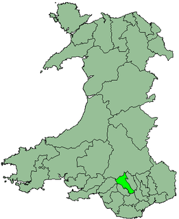
Rhondda Cynon Taf is a county borough in the south-east of Wales. It consists of five valleys: the Rhondda Fawr, Rhondda Fach, Cynon, Taff and Ely valleys, plus a number of towns and villages away from the valleys. Results from the 2011 census showed 19.1% of its 234,410 residents self-identified as having some ability in the use of the Welsh language. The county borough borders Merthyr Tydfil County Borough and Caerphilly County Borough to the east, Cardiff and the Vale of Glamorgan to the south, Bridgend County Borough and Neath Port Talbot to the west and Powys to the north. Its principal towns are - Aberdare, Llantrisant with Talbot Green and Pontypridd, with other key settlements/towns being - Maerdy, Ferndale, Hirwaun, Llanharan, Mountain Ash, Porth, Tonypandy, Tonyrefail and Treorchy.
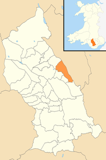
Cynon Valley is a former coal mining valley in Wales. Cynon Valley lies between Rhondda and the Merthyr Valley and takes its name from the River Cynon. Aberdare is located in the north of the valley and Mountain Ash is in the south of the valley.
Mountain Ash is a town and former community in the Cynon Valley, within the County Borough of Rhondda Cynon Taf, Wales, with a population of 11,230 at the 2011 Census, estimated in 2019 at 11,339. It includes the districts and villages of Cefnpennar, Cwmpennar, Caegarw, Darranlas, Fernhill, Glenboi and Newtown, all within the historic county boundaries of Glamorgan. Aberdare lies about 4.5 miles (7.2 km) north-west, Cardiff 19 miles (31 km) south-east, and Penrhiwceiber a mile to the south-east. It divides into two communities : West covers the town centre and the districts of Miskin, Darranlas, Fernhill and Glenboi, and East the districts of Cefnpennar, Cwmpennar, Caegarw and Newtown.

Abercynon, is both a village and a community in the Cynon Valley within the unitary authority of Rhondda Cynon Taf, Wales. The community comprises the village and the districts of Carnetown and Grovers Field to the south, Navigation Park to the east, and Glancynon to the north.

The South Wales Valleys are a group of industrialised peri-urban valleys in South Wales. Most of the valleys run north–south, roughly parallel to each other. Commonly referred to as "The Valleys", they stretch from Carmarthenshire in the west to Monmouthshire in the east; to the edge of the pastoral country of the Vale of Glamorgan and the coastal plain near the cities of Swansea, Cardiff, and Newport.

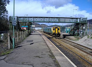
The Merthyr line is a commuter railway line in South Wales from central Cardiff to Merthyr Tydfil and Aberdare. The line is part of the Cardiff urban rail network, known as the Valley Lines.

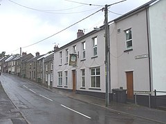
Abercwmboi is a village in the Welsh county borough of Rhondda Cynon Taf in Wales, United Kingdom.
Taff's Well, is a semi-rural village, community and electoral ward located at the south easterly tip of Rhondda Cynon Taf, 6 miles (9.7 km) to the North of Cardiff, the capital city of Wales. Known locally as the 'Gates to the Valleys', it is separated from Gwaelod Y Garth by the River Taff. Taff's Well is distinguished because it contains the only thermal spring in Wales. The tepid water is thought to rise along a fault-line from the Carboniferous Limestone, in somewhat similar manner to the warm springs at Bristol and Bath. Various religious groups regard it as a spiritual site.

Cwmdare is a village very close to Aberdare, in Rhondda Cynon Taf, Wales. The village's history is intertwined with coal-mining, and since the decline of the industry in the 1980s, it has become primarily a commuter base for the larger surrounding towns of Aberdare and Merthyr Tydfil and Pontypridd, as well as the cities of Cardiff and Swansea.

The River Cynon in South Wales is a main tributary of the Taff. Its source is the rising of Llygad Cynon at 219m above sea level at Penderyn, Rhondda Cynon Taf and flows roughly southeast, into the Taff at Abercynon in the same district. The water emerging at Llygad Cynon has been traced back to the sink of the Nant Cadlan at Ogof Fawr.

The Aberdare Canal was a canal in Glamorgan, Wales which ran from Aberdare to a junction with the Glamorganshire Canal at Abercynon. It opened in 1812, and served the iron and coal industries for almost 65 years. The arrival of railways in the area did not immediately affect its traffic, but the failure of the iron industry in 1875 and increasing subsidence due to coal mining led to it becoming uneconomic. The Marquess of Bute failed to halt its decline when he took it over in 1885, and in 1900 it was closed on safety grounds. The company continued to operate a tramway until 1944. Most of the route was buried by the construction of the A4059 road in 1923, although a short section at the head of the canal remains in water and is now a nature reserve. The company was wound up in 1955.

Mountain Ash Comprehensive School, known as MACS, is a comprehensive school near the town of Mountain Ash, Rhondda Cynon Taf, Wales. It is a mixed-sex school with approximately 950 pupils, including about 90 in the sixth form. The school was formerly known as Mountain Ash Grammar School and is located near the former Dyffryn Colliery.

Brynna is a small village situated between Pencoed and Llanharan. It is located at the point where the borders of two Welsh county boroughs, Rhondda Cynon Taf and Bridgend, meet.

Cwmpennar is a small village in Mountain Ash which is situated in the Cynon Valley, Rhondda Cynon Taff, Wales.
Caegarw is a large village situated in Mountain Ash, in Rhondda Cynon Taff, Wales.

Ynysboeth is a local community within the Mountain Ash (Aberpennar) postal district of the Cynon Valley in the County Borough of Rhondda Cynon Taf, South East Wales.
Mountain Ash East is a community and coterminous electoral ward in Rhondda Cynon Taf, Wales. It primarily includes the part of the town of Mountain Ash east of the River Cynon. The community was formed in 2016 when the larger community of Mountain Ash was divided into East and West to match the ward boundaries.