
Mohave County is in the northwestern corner of the U.S. state of Arizona. As of the 2020 census, its population was 213,267. The county seat is Kingman, and the largest city is Lake Havasu City. It is the fifth largest county in the United States.
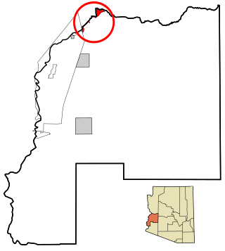
Kaibab is an unincorporated community and census-designated place (CDP) in Mohave County, Arizona, United States. It is within the Kaibab Indian Reservation. The population of the CDP was 140 at the 2020 census.
Parker Strip is a census-designated place (CDP) in La Paz County, Arizona, United States. The population was 662 at the 2010 census.
Arizona Village is a census-designated place (CDP) on the Fort Mojave Indian Reservation in Mohave County, Arizona, United States. The population was 1,057 at the 2020 census, up from 946 in 2010 and 351 in 2000.

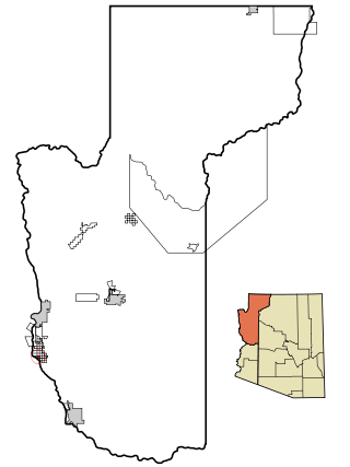
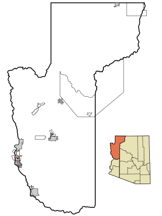
Colorado City is a town in Mohave County, Arizona, United States, and is located in a region known as the Arizona Strip. The population was 2,478 at the 2020 census. At least three Mormon fundamentalist sects are said to have been based there. A majority of residents and many local officials belong to the most prominent of these sects, the Fundamentalist Church of Jesus Christ of Latter-Day Saints, whose corporation also owned much of the land within and around the town until state intervention in the 2000s.

Desert Hills is an unincorporated community and census-designated place (CDP) in Mohave County, Arizona, United States. The population was 2,764 at the 2020 census, up from 2,245 at the 2010 census.

Mesquite Creek is an unincorporated community and census-designated place (CDP) in Mohave County, Arizona, United States. The population was 403 at the 2020 census.

Mohave Valley is an unincorporated community and census-designated place (CDP) in Mohave County, Arizona, United States. The population was 2,693 at the 2020 census. It is geographically connected to Needles, California, Fort Mohave and Bullhead City.
Mojave Ranch Estates is an unincorporated community and census-designated place (CDP) in Mohave County, Arizona, United States. The population was 53 as of the 2020 census.

Peach Springs is a census-designated place (CDP) in Mohave County, Arizona, United States. The population was 1,098 at the 2020 census. Peach Springs serves as the administrative headquarters of the Hualapai people and is located on the Hualapai Reservation.

Willow Valley is an unincorporated community and census-designated place (CDP) in Mohave County, Arizona, United States. The population was 1,059 as of the 2020 census.

Chilchinbito is a town located on the Navajo Nation, whose lands spans four state boundary lines in the Four Corners region of the United States. The town of Chilchinbito is a census-designated place (CDP) specifically in Navajo County, Arizona, United States. The population was 506 at the 2010 census. Chilchinbito is also considered to be the source of coronavirus infections on the Navajo Nation, possibly traced to the annual meeting of the Church of the Nazarene's numerous branches, on March 7, 2020. COVID-19 federal relief funds for medical care on the Navajo Nation were being redirected to a non-Native for-profit corporation, and a legal suit is pending.

Grand Canyon West is a census-designated place (CDP) in Mohave County, Arizona, United States, located on the Hualapai Reservation. The population was reported as 0 at the 2020 census. Grand Canyon West is home to the tribe's Grand Canyon business operations, including the Grand Canyon West Airport and the Grand Canyon Skywalk. Typically, they are open from 8:00 a.m. – 6:00 p.m., including all holidays.

Cane Beds is an unincorporated community and census-designated place (CDP) in Mohave County, Arizona, United States. It lies 4 miles (6 km) south of the border with Utah in the Arizona Strip, and is supported by services in Utah as well as some in Nevada.
Crozier is an unincorporated community and census-designated place (CDP) in Mohave County, Arizona, United States. The population was 21 at the 2020 census.
Crystal Beach is an unincorporated community in Mohave County, Arizona, United States. The population was 250 at the 2020 census. For statistical purposes, the United States Census Bureau has defined Crystal Beach as a census-designated place (CDP).
Katherine is an unincorporated community and census-designated place (CDP) in Mohave County, Arizona, United States. The population was 76 at the 2020 census, down from 103 at the 2010 census.
Lazy Y U is an unincorporated community and census-designated place (CDP) in Mohave County, Arizona, United States. The population was 474 at the 2020 census, up from 428 at the 2010 census.
Pine Lake is an unincorporated community and census-designated place (CDP) in Mohave County, Arizona, United States. The population was 142 at the 2020 census.
Pinion Pines is an unincorporated community and census-designated place (CDP) in Mohave County, Arizona, United States. The population was 158 at the 2020 census.


