Grand Canyon West, Arizona

Last updated

Grand Canyon West, Arizona
Da Xia Gu  - panoramio (5).jpg
The Grand Canyon Skywalk, a popular attraction in Grand Canyon West
USA Arizona location map.svg
Red pog.svg
Grand Canyon West
Usa edcp location map.svg
Red pog.svg
Grand Canyon West
Coordinates: 35°59′16″N113°49′3″W / 35.98778°N 113.81750°W / 35.98778; -113.81750
Country United States
State Arizona
County Mohave
Area
[1]
  Total17.60 sq mi (45.59 km2)
  Land17.19 sq mi (44.52 km2)
  Water0.41 sq mi (1.07 km2)
Elevation
[2]
4,737 ft (1,444 m)
Population
 (2020) [3]
  Total0
  Density0.00/sq mi (0.00/km2)
Time zone UTC-7 (MST)
Area code 928
FIPS code 04-28985
GNIS feature ID2582791
Website grandcanyonwest.com

Grand Canyon West is a census-designated place (CDP) in Mohave County, Arizona, United States, located on the Hualapai Reservation. The population was reported as 0 at the 2020 census. Grand Canyon West is home to the tribe's Grand Canyon business operations, including the Grand Canyon West Airport and the Grand Canyon Skywalk. Typically, they are open from 8:00 a.m. – 6:00 p.m., including all holidays.

Contents

Geography

Grand Canyon West is located in northern Mohave County at 35°59′59″N114°48′37″W / 35.99972°N 114.81028°W / 35.99972; -114.81028 (35.999787, -113.810249). The CDP sits on the west side (equivalent to the South Rim) of the Grand Canyon at an elevation of 4,700 to 4,800 feet (1,400 to 1,500 m). The CDP extends east into the canyon as far as the Colorado River, at an elevation of 1,200 feet (370 m). The CDP is served by Diamond Bar Road, which leads southwest 20 miles (32 km) to County Highway 25 near Meadview. According to the United States Census Bureau, the CDP has a total area of 17.6 square miles (46 km2), 17.19 square miles (44.5 km2) of that being land, with the remaining 0.41 square miles (1.1 km2) consisting of water. [1]

Demographics

Historical population
CensusPop.Note
2010 2
2020 0−100.0%
U.S. Decennial Census [4]

As of the 2010 census, there were 2 people living in the CDP, both male. 0 were 19 years old or younger, 0 were ages 20–34, 0 were between the ages of 35 and 49, 1 was between 50 and 64, and the remaining 1 was aged 65 and above. The median age was 70.5 years.

The racial makeup of the CDP was 100% White, with 0.0% of the population being Hispanic or Latino of any race.

There were 2 households in the CDP, both non-family households (100%), with an average household size of 1.00. Both non-family households are adult males living alone.

The CDP contained 19 housing units, of which 2 were occupied and 17 were vacant. [5]

Education

Almost all of Grand Canyon West is in the Hackberry School District, while a portion is in the Kingman Unified School District. [6]

Related Research Articles

<span class="mw-page-title-main">Mohave County, Arizona</span> County in Arizona, United States

Mohave County is in the northwestern corner of the U.S. state of Arizona. As of the 2020 census, its population was 213,267. The county seat is Kingman, and the largest city is Lake Havasu City. It is the fifth largest county in the United States.

<span class="mw-page-title-main">Parker Strip, Arizona</span> CDP in La Paz County, Arizona

Parker Strip is a census-designated place (CDP) in La Paz County, Arizona, United States. The population was 662 at the 2010 census.

<span class="mw-page-title-main">Arizona Village, Arizona</span> Census-designated place in Arizona, United States

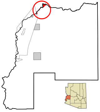
Arizona Village is a census-designated place (CDP) on the Fort Mojave Indian Reservation in Mohave County, Arizona, United States. The population was 1,057 at the 2020 census, up from 946 in 2010 and 351 in 2000.

<span class="mw-page-title-main">Desert Hills, Arizona</span> CDP in Mohave County, Arizona

Desert Hills is an unincorporated community and census-designated place (CDP) in Mohave County, Arizona, United States. The population was 2,764 at the 2020 census, up from 2,245 at the 2010 census.

<span class="mw-page-title-main">Dolan Springs, Arizona</span> CDP in Mohave County, Arizona

Dolan Springs is an unincorporated community and census-designated place (CDP) in Mohave County, Arizona, United States. The population was 1,989 at the 2020 census, down from 2,033 at the 2010 census.

<span class="mw-page-title-main">Golden Valley, Arizona</span> CDP in Mohave County, Arizona

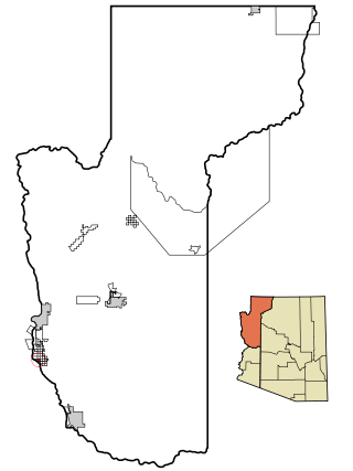
Golden Valley is an unincorporated area and census-designated place (CDP) in Mohave County, Arizona, United States. The population was 8,801 at the 2020 census.

<span class="mw-page-title-main">Mesquite Creek, Arizona</span> CDP in Mohave County, Arizona

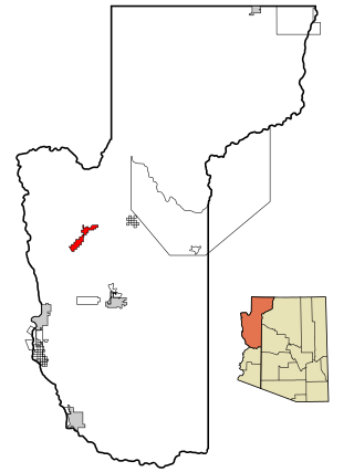
Mesquite Creek is an unincorporated community and census-designated place (CDP) in Mohave County, Arizona, United States. The population was 403 at the 2020 census.

<span class="mw-page-title-main">Mohave Valley, Arizona</span> CDP in Mohave County, Arizona

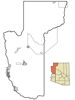
Mohave Valley is an unincorporated community and census-designated place (CDP) in Mohave County, Arizona, United States. The population was 2,693 at the 2020 census. It is geographically connected to Needles, California, Fort Mohave and Bullhead City.

<span class="mw-page-title-main">Mojave Ranch Estates, Arizona</span> CDP in Mohave County, Arizona

Mojave Ranch Estates is an unincorporated community and census-designated place (CDP) in Mohave County, Arizona, United States. The population was 53 as of the 2020 census.

<span class="mw-page-title-main">New Kingman-Butler, Arizona</span> CDP in Mohave County, Arizona

New Kingman-Butler is an unincorporated community and census-designated place (CDP) in Mohave County, Arizona, United States, directly north of and bordering the city of Kingman. The population was 12,907 as of the 2020 census.

<span class="mw-page-title-main">Peach Springs, Arizona</span> CDP in Mohave County, Arizona

Peach Springs is a census-designated place (CDP) in Mohave County, Arizona, United States. The population was 1,098 at the 2020 census. Peach Springs serves as the administrative headquarters of the Hualapai people and is located on the Hualapai Reservation.

<span class="mw-page-title-main">Willow Valley, Arizona</span> Census-designated place in Arizona, United States

Willow Valley is an unincorporated community and census-designated place (CDP) in Mohave County, Arizona, United States. The population was 1,059 as of the 2020 census.

<span class="mw-page-title-main">Meadview, Arizona</span> Unincorporated community in Mohave County, Arizona, US

Meadview is an unincorporated community and census-designated place (CDP) in Mohave County, Arizona, United States, located near Lake Mead. As of the 2020 census, Meadview had 1,420 residents, up from 1,224 as of 2010. It was founded in the 1960s as a retirement community and is still largely one, as well as a vacation spot for people coming to enjoy Lake Mead.

Crozier is an unincorporated community and census-designated place (CDP) in Mohave County, Arizona, United States. The population was 21 at the 2020 census.

Clacks Canyon is a census-designated place (CDP) in Mohave County, Arizona, United States. The population was 167 at the 2020 census.

Crystal Beach is an unincorporated community in Mohave County, Arizona, United States. The population was 250 at the 2020 census. For statistical purposes, the United States Census Bureau has defined Crystal Beach as a census-designated place (CDP).

Golden Shores is a census-designated place (CDP) in Mohave County, Arizona, United States. The population was 1,927 at the 2020 census. Residents are part of the 86436 ZIP code area, with a mailing address of Topock.

Katherine is an unincorporated community and census-designated place (CDP) in Mohave County, Arizona, United States. The population was 76 at the 2020 census, down from 103 at the 2010 census.

McConnico is an unincorporated community and census-designated place (CDP) in Mohave County, Arizona, United States. The population was 63 at the 2020 census.

Pine Lake is an unincorporated community and census-designated place (CDP) in Mohave County, Arizona, United States. The population was 142 at the 2020 census.

References

  1. 1 2 "2021 U.S. Gazetteer Files: Arizona". United States Census Bureau. Retrieved May 23, 2022.
  2. "Feature Detail Report for: Grand Canyon West Census Designated Place". Geographic Names Information System . United States Geological Survey, United States Department of the Interior.
  3. "P1. Race – Grand Canyon West CDP, Arizona: 2020 DEC Redistricting Data (PL 94-171)". U.S. Census Bureau. Retrieved May 23, 2022.
  4. "Census of Population and Housing". Census.gov. Retrieved June 4, 2016.
  5. "American FactFinder: Grand Canyon West CDP, Arizona". United States Census Bureau. Archived from the original on February 13, 2020. Retrieved November 21, 2016.
  6. "2020 CENSUS - SCHOOL DISTRICT REFERENCE MAP: Mohave County, AZ" (PDF). U.S. Census Bureau . Retrieved January 24, 2022.