Centertown, Missouri

Last updated

Centertown, Missouri
Village of Centertown
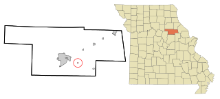
Cole County Missouri Incorporated and Unincorporated areas Centertown Highlighted.svg
Location of Centertown, Missouri
Coordinates: 38°37′9″N92°24′32″W / 38.61917°N 92.40889°W / 38.61917; -92.40889
Country United States
State Missouri
County Cole
Founded1867
Area
[1]
  Total0.95 sq mi (2.45 km2)
  Land0.95 sq mi (2.45 km2)
  Water0.00 sq mi (0.00 km2)
Elevation
[2]
810 ft (250 m)
Population
 (2020)
  Total284
  Density299.58/sq mi (115.70/km2)
Time zone UTC-6 (Central (CST))
  Summer (DST) UTC-5 (CDT)
ZIP code
65023
Area code 573
FIPS code 29-12664 [3]
GNIS feature ID2396636 [2]

Centertown is a village in Cole County, Missouri, United States. The population was 284 at the 2020 census. [4] It is part of the Jefferson City, Missouri Metropolitan Statistical Area.

Contents

History

Centertown was platted in 1867. [5] The village was named from its location near Missouri's geographic center. [6] A post office has been in operation at Centertown since 1867. [7]

The Garnett Farm Historic District was listed on the National Register of Historic Places in 2016. [8]

Geography

Centertown is located on U.S. Route 50, approximately 14 mi (23 km) northwest of Jefferson City. [9]

According to the United States Census Bureau, the village has a total area of 0.95 square miles (2.46 km2), all land. [10]

Demographics

Historical population
CensusPop.Note
1880 154
1910 285
1920 243−14.7%
1930 2596.6%
1940 2714.6%
1950 248−8.5%
1960 190−23.4%
1970 27745.8%
1980 3049.7%
1990 35617.1%
2000 257−27.8%
2010 2788.2%
2020 2842.2%
U.S. Decennial Census [11]

2010 census

As of the census [12] of 2010, there were 278 people, 128 households, and 77 families residing in the village. The population density was 292.6 inhabitants per square mile (113.0/km2). There were 151 housing units at an average density of 158.9 per square mile (61.4/km2). The racial makeup of the village was 97.1% White, 0.7% African American, 0.4% Asian, 0.4% from other races, and 1.4% from two or more races. Hispanic or Latino of any race were 0.7% of the population.

There were 128 households, of which 24.2% had children under the age of 18 living with them, 47.7% were married couples living together, 9.4% had a female householder with no husband present, 3.1% had a male householder with no wife present, and 39.8% were non-families. 32.0% of all households were made up of individuals, and 14.9% had someone living alone who was 65 years of age or older. The average household size was 2.17 and the average family size was 2.75.

The median age in the village was 45.1 years. 19.1% of residents were under the age of 18; 10.1% were between the ages of 18 and 24; 20.6% were from 25 to 44; 29.8% were from 45 to 64; and 20.5% were 65 years of age or older. The gender makeup of the village was 47.5% male and 52.5% female.

2000 census

As of the census [3] of 2000, there were 257 people, 117 households, and 73 families residing in the town. The population density was 285.4 inhabitants per square mile (110.2/km2). There were 132 housing units at an average density of 146.6 per square mile (56.6/km2). The racial makeup of the town was 99.22% White, 0.39% Native American and 0.39% Asian.

There were 117 households, out of which 29.1% had children under the age of 18 living with them, 49.6% were married couples living together, 11.1% had a female householder with no husband present, and 36.8% were non-families. 34.2% of all households were made up of individuals, and 12.8% had someone living alone who was 65 years of age or older. The average household size was 2.20 and the average family size was 2.78.

In the town the population was spread out, with 22.6% under the age of 18, 5.8% from 18 to 24, 34.2% from 25 to 44, 21.4% from 45 to 64, and 16.0% who were 65 years of age or older. The median age was 39 years. For every 100 females, there were 96.2 males. For every 100 females age 18 and over, there were 99.0 males.

The median income for a household in the town was $39,750, and the median income for a family was $47,417. Males had a median income of $26,591 versus $20,769 for females. The per capita income for the town was $17,321. About 2.2% of families and 3.7% of the population were below the poverty line, including 1.8% of those under the age of eighteen and 8.9% of those 65 or over.

Related Research Articles

<span class="mw-page-title-main">Benton City, Missouri</span> Village in Missouri, United States

Benton City is a village in Audrain County, Missouri, United States. The population was 104 at the 2010 census.

<span class="mw-page-title-main">Butterfield, Missouri</span> City in Missouri, United States

Butterfield is a city in Butterfield Township, Barry County, Missouri, United States. The population was 378 at the 2020 census.

<span class="mw-page-title-main">Glen Allen, Missouri</span> Village in Missouri, United States

Glen Allen is a village in central Bollinger County in Southeast Missouri, United States, located near the intersection of State Highway 34 and Route ZZ just west of Marble Hill. The population was 57 at the 2020 census.

<span class="mw-page-title-main">Jerico Springs, Missouri</span> Village in Missouri, United States

Jerico Springs is a village in Cedar County, Missouri, United States. The population was 160 at the 2020 census.

<span class="mw-page-title-main">Rothville, Missouri</span> Village in Missouri, United States

Rothville is a village in northern Chariton County, Missouri, United States. The population was 63 at the 2020 census.

<span class="mw-page-title-main">Wooldridge, Missouri</span> Village in Missouri, United States

Wooldridge is a village in northeastern Cooper County, Missouri, United States. The population was 61 at the 2010 census.

<span class="mw-page-title-main">Dadeville, Missouri</span> Village in Missouri, United States

Dadeville is a village in Dade County, Missouri, United States. The population was 226 at the 2020 census.

<span class="mw-page-title-main">Big Lake, Missouri</span> Village in Missouri, United States

Big Lake is a village in Holt County, Missouri, United States. The population was 65 at the 2020 census.
<span class="mw-page-title-main">Brooklyn Heights, Missouri</span> Village in Missouri, United States

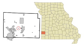
Brooklyn Heights is a village in Jasper County, Missouri, United States. The population was 101 at the 2020 census. It is part of the Joplin, Missouri Metropolitan Statistical Area.

<span class="mw-page-title-main">Stark City, Missouri</span> Town in Missouri, United States

Stark City is a town in Newton County, Missouri, United States. The population was 139 at the 2010 census, at which time it was a town. It is part of the Joplin, Missouri Metropolitan Statistical Area. It is adjacent to the battlefield of the Second Battle of Newtonia.

<span class="mw-page-title-main">Ravenwood, Missouri</span> City in Missouri, United States

Ravenwood is a city in eastern Nodaway County, Missouri, United States, near the Platte River. The population was 439 at the 2020 census.
<span class="mw-page-title-main">Hughesville, Missouri</span> Village in Missouri, United States

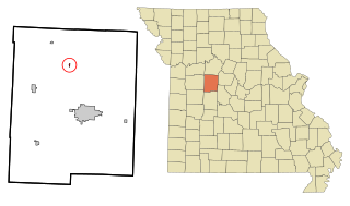
Hughesville is a village in north central Pettis County, Missouri, United States. The population was 183 at the 2010 census.

<span class="mw-page-title-main">Doolittle, Missouri</span> City in Missouri, United States

Doolittle is a city in Phelps County, Missouri, United States. The population was 564 at the 2020 census.

<span class="mw-page-title-main">Livonia, Missouri</span> Village in Missouri, United States

Livonia is a village in eastern Putnam County, Missouri, United States. The population was 52 at the 2020 census.

<span class="mw-page-title-main">Collins, Missouri</span> Village in Missouri, United States

Collins is a village in St. Clair County, Missouri, United States. The population was 125 at the 2020 census.

<span class="mw-page-title-main">Roscoe, Missouri</span> Village in Missouri, United States

Roscoe is a village in St. Clair County, Missouri, United States. The population was 89 at the 2020 census.

<span class="mw-page-title-main">Marlborough, Missouri</span> Village in Missouri, United States

Marlborough is a village in St. Louis County, Missouri, United States. The population was 2,179 at the 2010 census.

<span class="mw-page-title-main">Deerfield, Missouri</span> Village in Missouri, United States

Deerfield is a village in Vernon County, Missouri, United States. The population was 40 at the 2020 census.
<span class="mw-page-title-main">Stotesbury, Missouri</span> Village in Missouri, United States

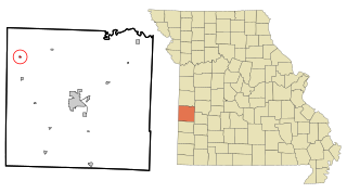
Stotesbury is a village in northwest Vernon County, Missouri, United States. The population was 18 at the 2010 census.

<span class="mw-page-title-main">Hanley Hills, Missouri</span> Village in Missouri, United States

Hanley Hills is a village in St. Louis County, Missouri, United States. The population was 2,101 at the 2010 census.

References

  1. "ArcGIS REST Services Directory". United States Census Bureau. Retrieved August 28, 2022.
  2. 1 2 U.S. Geological Survey Geographic Names Information System: Centertown, Missouri
  3. 1 2 "U.S. Census website". United States Census Bureau . Retrieved January 31, 2008.
  4. "Explore Census Data". data.census.gov. Retrieved January 13, 2022.
  5. "Cole County Place Names, 1928–1945 (archived)". The State Historical Society of Missouri. Archived from the original on June 24, 2016. Retrieved September 22, 2016.{{cite web}}: CS1 maint: bot: original URL status unknown (link)
  6. Eaton, David Wolfe (1916). How Missouri Counties, Towns and Streams Were Named. The State Historical Society of Missouri. pp.  279.
  7. "Post Offices". Jim Forte Postal History. Archived from the original on March 6, 2016. Retrieved September 22, 2016.
  8. "National Register of Historic Places Listings". Weekly List of Actions Taken on Properties: 5/30/16 through 6/03/16. National Park Service. June 10, 2016.
  9. Russellville, Missouri, 7.5 Minute Topographic Quadrangle, USGS, 1969 (1971 rev)
  10. "US Gazetteer files 2010". United States Census Bureau. Archived from the original on January 25, 2012. Retrieved July 8, 2012.
  11. "Census of Population and Housing". Census.gov. Retrieved June 4, 2015.
  12. "U.S. Census website". United States Census Bureau . Retrieved July 8, 2012.