Related Research Articles

Bonnots Mill is an unincorporated community in northern Osage County, Missouri, United States. It is located approximately ten miles east of Jefferson City on the Osage River, near its confluence with the Missouri River. The community of Osage City is about four miles to the west-southwest on the Osage and the community of Tebbetts lies across the Missouri River valley to the north. It has also been known as Dauphine, Bonnets Mills, Bonnots, or Bonnotts Mill.
Folk is an unincorporated community in northwestern Osage County, Missouri, United States. It is located approximately ten miles southeast of Jefferson City.
Rich Fountain is an unincorporated community in Osage County, Missouri, United States. It is located approximately three miles east of U.S. Route 63 and is fifteen miles southeast of Jefferson City.
High Point is an unincorporated community in southern Moniteau County, Missouri, United States. It is located ten miles south of California, approximately one mile west of Route 87 on Missouri Route C.
Marion is an unincorporated community in Cole County, Missouri, United States. Marion is in the northwest corner of the county, in historic Marion Township, and very near the post-1845 county boundary line with Moniteau County. The community is located on Missouri Route 179 and overlooks the Missouri River to the east.
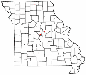
Osage Bluff is an unincorporated community in Cole County, in the U.S. state of Missouri.
Marys Home is an unincorporated community in northern Miller County, in the U.S. state of Missouri. The community is on Missouri Route H, approximately two miles north of the Osage River. The town of Eugene in the southwest corner of Cole County is about four miles to the northwest, by Route H and Missouri Route 17.
Bois Brule Creek is a stream in Cole and Miller counties of Missouri. It is a tributary of the Osage River.
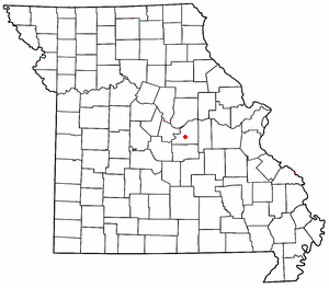
Osage Bend is an unincorporated community in Cole County, in the U.S. state of Missouri.
Schubert is an unincorporated community in eastern Cole County, in the U.S. state of Missouri. The community is on combined US routes 50 and 63. The community of Taos lies to the southwest along Missouri Route M and Osage City lies to the northeast along Missouri Route J.
Osage Township is an inactive township in Cole County, in the U.S. state of Missouri.

New Lebanon is an unincorporated community in Cooper County, in the U.S. state of Missouri. The community is on Missouri Route A between Otterville seven miles to the south and Pilot Grove seven miles to the north. The Lamine River flows past about two miles west of the community.
Hoecker is an unincorporated community in northeast Miller County, in the U.S. state of Missouri. The community is on a meander of the Osage River just south of the Miller-Cole county line. Henley is two miles to the west-northwest in Cole County and Meta is six miles to the east in Osage County.
Capps is an unincorporated community in northern Miller County, in the U.S. state of Missouri.
Sandy Hook is an unincorporated community in Moniteau County, in the U.S. state of Missouri. The community is on the southwest bank of the Missouri River floodplain. It lies on Missouri Route 179 between Jamestown to the northwest and Marion to the southeast in Cole County.
Linn Township is an inactive township in Moniteau County, in the U.S. state of Missouri.
Castle Rock is an extinct town in Osage County, in the U.S. state of Missouri. The townsite lies is located on the inside curve of an incised meander of the Osage River. The Castle Rock formation for which it was named lies across the river to the north in Cole County just southeast of Wardsville. The Pikes Camp Wildlife Area lies to the west across the river.
Lisletown is an extinct town in Osage County, in the U.S. state of Missouri.
Darksville is an unincorporated community in northern Randolph County, in the U.S. state of Missouri. Darksville is on Missouri Route C, approximately three miles east of the Thomas Hill Reservoir dam.
Racola is an unincorporated community in Washington County, in the U.S. state of Missouri.
References
- ↑ U.S. Geological Survey Geographic Names Information System: Osage City, Missouri
- ↑ "Cole County Place Names, 1928–1945 (archived)". The State Historical Society of Missouri. Archived from the original on June 24, 2016. Retrieved September 22, 2016.
{{cite web}}: CS1 maint: bot: original URL status unknown (link) - ↑ Eaton, David Wolfe (1916). How Missouri Counties, Towns and Streams Were Named. The State Historical Society of Missouri. pp. 279.
- ↑ "Post Offices". Jim Forte Postal History. Retrieved September 22, 2016.
- ↑ "National Register Information System". National Register of Historic Places . National Park Service. July 9, 2010.
Municipalities and communities of Cole County, Missouri, United States | ||
|---|---|---|
| Cities |  | |
| Villages | ||
| Townships | ||
| CDP | ||
| Other communities | ||
| Ghost towns | ||
| Footnotes | ‡This populated place also has portions in an adjacent county or counties | |
38°33′09″N92°01′57″W / 38.55250°N 92.03250°W
| | This Cole County, Missouri state location article is a stub. You can help Wikipedia by expanding it. |