Central High, Oklahoma

Last updated

Central High, Oklahoma
OKMap-doton-CentralHigh.PNG
Location of Central High, Oklahoma
Coordinates: 34°36′57″N98°04′49″W / 34.61583°N 98.08028°W / 34.61583; -98.08028
Country United States
State Oklahoma
County Stephens
Area
[1]
  Total53.88 sq mi (139.54 km2)
  Land52.90 sq mi (137.02 km2)
  Water0.98 sq mi (2.53 km2)
Elevation
[2]
1,171 ft (357 m)
Population
 (2020)
  Total1,181
  Density22.32/sq mi (8.62/km2)
Time zone UTC-6 (Central (CST))
  Summer (DST) UTC-5 (CDT)
FIPS code 40-13135 [3]
GNIS feature ID2413188 [2]

Central High is a town in Stephens County, Oklahoma, United States. The population was 1,181 at the time of the 2020 Census. [4]

Contents

History

The town was named in 1921, because it was near the center of a consolidated high school district (District 34), created from four smaller districts in Stephens County: Wolf Creek, Nellie, Prairie Center, and Pleasant Hill. Until then, students living in the area only had access to eighth grade education in each of the old districts. When Central High was formed, it built a four-room junior high and a senior high school named Central High School. Lower-grade students attended elementary schools in their former districts. This arrangement lasted until the late 1930s. A fire in 1952 destroyed the original Central High School. [5]

The town incorporated in 1995. Supporters of incorporation wanted this so Central High could prevent annexation by surrounding towns, notably Duncan, Lawton or Marlow. Incorporation would also permit Central High to apply for municipal grants. [5]

Geography

Central High is located 8.5 miles (13.7 km) west of Marlow and 1 mile (1.6 km) north of SH 7.

According to the United States Census Bureau, the town has a total area of 53.8 square miles (139 km2), of which 53.6 square miles (139 km2) is land and 0.1 square miles (0.26 km2) (0.24%) is water.

Demographics

Historical population
CensusPop.Note
2000 954
2010 1,19925.7%
2020 1,181−1.5%
U.S. Decennial Census [6]

As of the census [3] of 2000, there were 954 people, 352 households, and 292 families residing in the town. The population density was 17.8 people per square mile (6.9/km2). There were 398 housing units at an average density of 7.4 per square mile (2.9/km2). The racial makeup of the town was 92.66% White, 0.10% African American, 3.04% Native American, 0.73% from other races, and 3.46% from two or more races. Hispanic or Latino of any race were 2.41% of the population.

There were 352 households, out of which 37.5% had children under the age of 18 living with them, 73.9% were married couples living together, 6.5% had a female householder with no husband present, and 16.8% were non-families. 14.8% of all households were made up of individuals, and 6.3% had someone living alone who was 65 years of age or older. The average household size was 2.71 and the average family size was 2.98.

In the town, the population was spread out, with 27.0% under the age of 18, 6.2% from 18 to 24, 28.1% from 25 to 44, 24.8% from 45 to 64, and 13.8% who were 65 years of age or older. The median age was 38 years. For every 100 females, there were 106.9 males. For every 100 females age 18 and over, there were 102.3 males.

The median income for a household in the town was $38,125, and the median income for a family was $40,104. Males had a median income of $34,130 versus $22,273 for females. The per capita income for the town was $16,679. About 11.8% of families and 14.1% of the population were below the poverty line, including 15.3% of those under age 18 and 10.0% of those age 65 or over.

Related Research Articles

<span class="mw-page-title-main">Marlow Heights, Maryland</span> Census-designated place in Maryland, United States

Marlow Heights is an unincorporated area and census-designated place (CDP) in Prince George's County, Maryland, United States. The population was 6,169 at the 2020 census. The Marlow Heights Shopping Center first opened in 1957, adjacent to the large community of Hillcrest Heights. It was joined ten years later, in 1967, by the two-level Iverson Mall, the Washington metropolitan area's first enclosed mall.

<span class="mw-page-title-main">Warrensburg, Missouri</span> City in Missouri

Warrensburg is a city in and the county seat of Johnson County, Missouri, United States. The population was 20,313 at the 2020 census. The Warrensburg Micropolitan Statistical Area consists of Johnson County. The city is a college town as it is home to the University of Central Missouri.

<span class="mw-page-title-main">West Winfield, New York</span> Village in New York, United States

West Winfield is a village in the town of Winfield in Herkimer County, New York, United States. The population was 826 at the 2010 census. The village is indirectly named after General Winfield Scott. The village is south of Utica.

<span class="mw-page-title-main">Carmen, Oklahoma</span> Town in Oklahoma, United States

Carmen is a town in Alfalfa County, Oklahoma, United States. The population was 355 at the 2010 census.

<span class="mw-page-title-main">Okeene, Oklahoma</span> Town in Oklahoma, United States

Okeene is a town in Blaine County, Oklahoma, United States. The population was 1,090 as of the 2020 United States census. The name was created by combining the last letters of Cherokee and Cheyenne.

<span class="mw-page-title-main">Bokchito, Oklahoma</span> Town in Oklahoma, United States

Bokchito is a town in Bryan County, Oklahoma, United States. The population was 632 at the 2010 census, an increase of 12.1 percent over the figure of 564 recorded in 2000. In the Choctaw language, "bok" means river, and "chito" means big or large, literally translating into "big creek".

<span class="mw-page-title-main">Union City, Oklahoma</span> Town in Oklahoma, United States

Union City is a town in Canadian County, Oklahoma, United States. The population was 1,645 at the 2010 census, a 19.6 percent increase from 1,375 in 2000. It is part of the Oklahoma City metropolitan statistical area.

<span class="mw-page-title-main">Dickson, Oklahoma</span> Town in Oklahoma, United States

Dickson is a town in Carter County, Oklahoma, United States. The population was 1,207 at the 2010 census. It is part of the Ardmore, Oklahoma Micropolitan Statistical Area.

<span class="mw-page-title-main">Covington, Oklahoma</span> Town in Oklahoma, United States

Covington is a town in Garfield County, Oklahoma, United States. The population was 477 at the 2020 census.

<span class="mw-page-title-main">Douglas, Oklahoma</span> Town in Oklahoma, United States

Douglas is a town in Garfield County, Oklahoma, United States. The population was 32 at the 2010 census.

<span class="mw-page-title-main">North Enid, Oklahoma</span> Town in Oklahoma, United States

North Enid is a town in Garfield County, Oklahoma, United States. The population was 860 at the 2010 census. The town is served by the Chisholm school district. North Enid was the original railroad town site in the Enid–Pond Creek Railroad War.

<span class="mw-page-title-main">Waukomis, Oklahoma</span> Town in Oklahoma, United States

Waukomis is a town in Garfield County, Oklahoma, United States. The population was 1,286 at the 2010 census, an increase of 2.0 percent from 1,261 in 2000.

<span class="mw-page-title-main">Paoli, Oklahoma</span> Town in Oklahoma, United States

Paoli is a town in Garvin County, Oklahoma, United States. The population was 610 at the 2010 census. It was named after Paoli, Pennsylvania, an unincorporated community near Philadelphia from which many of the railroad workers who built the town came.

<span class="mw-page-title-main">Nash, Oklahoma</span> Town in Oklahoma, United States

Nash is a town in Grant County, Oklahoma, United States. The population was 204 at the 2010 census, an 8.9 percent decline from the figure of 224 in 2000.

<span class="mw-page-title-main">Carney, Oklahoma</span> Town in Oklahoma, United States

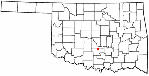
Carney is a town in Lincoln County, Oklahoma, United States. As of the 2020 census, the population of the town was 545.

<span class="mw-page-title-main">Forest Park, Oklahoma</span> Town in Oklahoma, United States

Forest Park is a town in Oklahoma County, Oklahoma, United States, and a part of the Oklahoma City metropolitan area. The population was 998 at the 2010 census.

<span class="mw-page-title-main">Lake Aluma, Oklahoma</span> Town in Oklahoma, United States

Lake Aluma is a town in Oklahoma County, Oklahoma, United States, and a part of the Oklahoma City Metropolitan Area. The population was 88 at the 2010 census.

<span class="mw-page-title-main">Woodlawn Park, Oklahoma</span> Town in Oklahoma, United States

Woodlawn Park is a town in Oklahoma County, Oklahoma, United States, and a part of the Oklahoma City Metropolitan Area. The population was 161 at the 2000 census.

<span class="mw-page-title-main">Fairfax, Oklahoma</span> Town in Oklahoma, United States

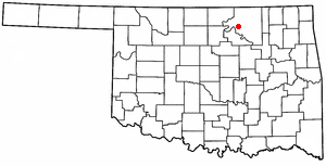
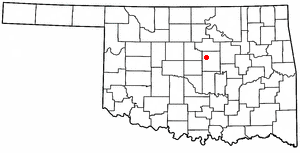
Fairfax is a town in Osage County, Oklahoma, United States. The Osage Nation reservation is coterminous with the county. The population was 1,380 at the 2010 census, down 11.3 percent from the figure of 1,555 recorded in 2000. It was the home of the ballerinas Maria and Marjorie Tallchief.

Limestone is a census-designated place (CDP) in Rogers County, Oklahoma, United States, at an elevation of 705 feet. It is located less than 10 miles west of Claremore, Oklahoma on Oklahoma State Highway 20. The population was 753 as of July 2020.

References

  1. "ArcGIS REST Services Directory". United States Census Bureau. Retrieved September 20, 2022.
  2. 1 2 U.S. Geological Survey Geographic Names Information System: Central High, Oklahoma
  3. 1 2 "U.S. Census website". United States Census Bureau . Retrieved January 31, 2008.
  4. "Central High (town), Oklahoma". United States Census Bureau. Retrieved March 23, 2024.
  5. 1 2 O'Dell, Larry. "Central High." Encyclopedia of Oklahoma History and Culture. Retrieved October 4, 2013.
  6. "Census of Population and Housing". Census.gov. Retrieved June 4, 2015.