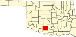
Sunray, Oklahoma

Last updated

Sunray
USA Oklahoma location map.svg
Red pog.svg
Sunray
Location within the state of Oklahoma
Usa edcp location map.svg
Red pog.svg
Sunray
Sunray (the United States)
Coordinates: 34°24′40″N97°57′37″W / 34.41111°N 97.96028°W / 34.41111; -97.96028
Country United States
State Oklahoma
County Stephens
Area
[1]
  Total1.78 sq mi (4.62 km2)
  Land1.75 sq mi (4.53 km2)
  Water0.04 sq mi (0.09 km2)
Elevation
[2]
1,073 ft (327 m)
Population
 (2020)
  Total853
  Density487.99/sq mi (188.46/km2)
Time zone UTC-6 (Central (CST))
  Summer (DST) UTC-5 (CDT)
FIPS code 40-71650
GNIS feature ID2812871 [2]

Sunray (also Beckett) is a small unincorporated community in Stephens County, Oklahoma, United States. It is south of Duncan on U.S. Route 81.

Contents

The community is adjacent to the old DX-Sunray refinery (TOSCO Corp. Duncan refinery) which closed in 1983 and was imploded in 2006.[ citation needed ]

Demographics

Historical population
CensusPop.Note
2020 853
U.S. Decennial Census [3]

Climate

Climate is characterized by relatively high temperatures and evenly distributed precipitation throughout the year. The Köppen Climate Classification subtype for this climate is "Cfa" (Humid Subtropical Climate). [4]

Related Research Articles

<span class="mw-page-title-main">Siloam Springs, Arkansas</span> City in Arkansas, United States

Siloam Springs is a city in Benton County, Arkansas, United States, and located on the western edge of the Northwest Arkansas metropolitan area. As of the 2020 census, the population of the city was 17,287. The community was founded in 1882 and was characterized by the purported healing powers of the spring water feeding Sager Creek and trading with nearby Native American tribes. The city shares a border on the Arkansas–Oklahoma state line with the city of West Siloam Springs, Oklahoma, which is within the Cherokee Nation territory. It is home of John Brown University.

<span class="mw-page-title-main">Deenwood, Georgia</span> Place in Georgia, United States

Deenwood is an unincorporated community and census-designated place (CDP) in Ware County, Georgia, United States. The population was 2,207 at the 2020 census. It is part of the Waycross micropolitan statistical area. Deenwood Baptist Church is named after this geographical area.

Fairdale is a former census-designated place in southern Jefferson County, Kentucky, United States. The population was 7,658 at the 2000 census. In 2003, the area was annexed to the city of Louisville due to a merger between the city and Jefferson County's unincorporated community. Fairdale is now a neighborhood within the city limits of Louisville. The ZIP Code for Fairdale is 40118.

<span class="mw-page-title-main">Stearns, Kentucky</span> Census-designated place in Kentucky, United States

Stearns is an unincorporated community and census-designated place (CDP) in McCreary County, Kentucky, United States. The population was 1,365 at the 2020 census. It was founded by Justus Smith Stearns.

<span class="mw-page-title-main">Loudon, Tennessee</span> City in Tennessee, United States

Loudon is a city in and the county seat of Loudon County, Tennessee, United States. Its population was 6,001 at the 2020 census. It is included in the Knoxville, Tennessee Metropolitan Statistical Area. The city is located in East Tennessee, southwest of Knoxville, on the Tennessee River. Fort Loudoun, the colonial era fort for which the city was named, is located several miles to the south in Monroe County.

<span class="mw-page-title-main">Italy, Texas</span> Town in Texas, United States

Italy is a town in Ellis County, Texas, United States. Its population was 1,926 in 2020. The community was named after Italy by a settler who had visited the European country.

<span class="mw-page-title-main">Kaufman, Texas</span> Town in Texas, United States

Kaufman is a town in and the county seat of Kaufman County, Texas, United States. Its population was 6,797 at the 2020 census.

<span class="mw-page-title-main">Sunray, Texas</span> City in Texas, United States

Sunray is a city in northeastern Moore County, Texas, United States. The population was 1,926 at the 2010 census.

<span class="mw-page-title-main">Montague, Texas</span> Census-designated place & Unincorporated Community in Texas, United States

Montague is a census-designated place and unincorporated community in Montague County, Texas, United States. It is the county seat of Montague County and had an estimated population of 400 in 2000, according to the Handbook of Texas. Its population was 304 as of the 2010 census.

Gann Valley is a census-designated place in and the county seat of Buffalo County, South Dakota, United States. The town had a population of 10 as of the 2020 census. It is the smallest unincorporated county seat in the United States.

<span class="mw-page-title-main">Hanksville, Utah</span> Town in the state of Utah, United States

Hanksville is a small town in Wayne County, Utah, United States, at the junction of State Routes 24 and 95. The population was 219 at the 2010 census.

<span class="mw-page-title-main">Aguila, Arizona</span> CDP in Maricopa County, Arizona

Aguila is an unincorporated community and census-designated place (CDP) in Maricopa County, Arizona, United States. It is located on U.S. Route 60, 25 miles (40 km) west of Wickenburg and 22 miles (35 km) northeast of Wenden. Major economic activities include cantaloupe farming and formerly included mining. It uses the same street numbering system as Phoenix. As of the 2020 census, the population of Aguila was 565, down from 798 in 2010.

Tioga is an unincorporated community in northern Rapides Parish, Louisiana, United States. It is part of the Alexandria, Louisiana Metropolitan Statistical Area. The population in 2010 was 1,965.

<span class="mw-page-title-main">Elfrida, Arizona</span> CDP in Cochise County, Arizona

Elfrida is a census-designated place in Cochise County, Arizona, United States. As of the 2010 census it had a population of 459.

<span class="mw-page-title-main">Tilleda, Wisconsin</span> Census-designated place in Wisconsin, United States

Tilleda is an unincorporated census-designated place in the town of Seneca in Shawano County, Wisconsin, United States. The community is located on County Highway D. less than one mile north of Wisconsin Highway 29. The community uses the 54978 ZIP code. As of the 2010 census, its population is 91.

Seabrook is an unincorporated community located within Upper Deerfield Township in Cumberland County, in the U.S. state of New Jersey. The area is served as United States Postal Service ZIP code 08302. The unincorporated community and the census-designated Place Seabrook Farms within it are each named after Charles F. Seabrook, a businessman who at one point ran the largest irrigated truck farm in the world in this region.

<span class="mw-page-title-main">La Grande, Washington</span> Unincorporated community & CDP in Washington, United States

La Grande is an unincorporated community and census-designated place in Pierce County, Washington, United States. La Grande is located along Washington State Route 7 3.5 miles (5.6 km) southwest of Eatonville. La Grande has a post office with ZIP code 98348.

<span class="mw-page-title-main">Megargel, Alabama</span> Census-designated place in Alabama, United States

Megargel is a census-designated place and unincorporated community in Monroe County, Alabama, United States. Its population was 60 as of the 2020 census.

Keene is a home rule-class city located in Jessamine County, Kentucky, in the United States. It is home to the Keene Springs Hotel. The U.S. Census Bureau does not record Keene as a city and does not publish a population figure for the community.

Fernwood is a census-designated place and unincorporated community in Pike County, Mississippi, United States. Its ZIP code is 39635.

References

  1. "ArcGIS REST Services Directory". United States Census Bureau. Retrieved September 20, 2022.
  2. 1 2 U.S. Geological Survey Geographic Names Information System: Sunray, Oklahoma
  3. "Census of Population and Housing". Census.gov. Retrieved June 4, 2016.
  4. "Sunray, Oklahoma Köppen Climate Classification (Weatherbase)". Weatherbase.