Centre Wellington

Last updated

Centre Wellington
Township of Centre Wellington
Fergus Ontario St Andrew St E.jpg
St. Andrew Street in Fergus.
Centre Wellington, Ontario.png
Wellington locator map 2021.svg
Red pog.svg
Centre Wellington
Canada Southern Ontario location map 2.png
Red pog.svg
Centre Wellington
Coordinates: 43°42′N80°22′W / 43.700°N 80.367°W / 43.700; -80.367 Coordinates: 43°42′N80°22′W / 43.700°N 80.367°W / 43.700; -80.367
Country Flag of Canada (Pantone).svg  Canada
Province Flag of Ontario.svg  Ontario
County Wellington
EstablishedJanuary 1, 1999
Government
  TypeTownship
  MayorShawn Watters
  Governing BodyCentre Wellington Township Council
   MP Mike Chong (Con)
   MPP Ted Arnott (PC)
Area
[1]
  Land407.54 km2 (157.35 sq mi)
Population
 (2016) [1]
  Total28,191
  Density69.2/km2 (179/sq mi)
Time zone UTC-5 (EST)
  Summer (DST) UTC-4 (EDT)
Postal Code FSA
Area code(s) 519, 226, 548
Website www.centrewellington.ca

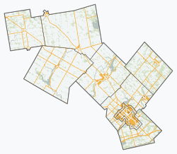
Centre Wellington is a township in south-central Ontario, Canada, located in Wellington County. The primary communities are Elora and Fergus. The area is agricultural but also includes industries such as manufacturing. In the Canada 2016 Census, the population was stated as 28,191. [1]

Contents

History

The township was established on January 1, 1999, by amalgamating Fergus, Elora, the Townships of Nichol, Pilkington, West Garafraxa and a part of Eramosa. [2] Fergus and Elora, in particular, have interesting histories that started in the 1830s. [3] [4]

Communities

In addition to Fergus and Elora, the township includes several small communities, hamlets and villages including; Aboyne, Belwood, Creek Bank, Cumnock, Dracon, Ennotville, Inverhaugh, Living Springs, Oustic, Pentland Corners, Ponsonby, Salem, Shiloh, Simpson Corners, Speedside and Spier.

Demographics

In the 2021 Census of Population conducted by Statistics Canada, Centre Wellington had a population of 31,093 living in 11,972 of its 12,701 total private dwellings, a change of

According to the 2011 Canadian Census, the median age was 42.7 years old, a bit higher than the national median at 40.6 years old. [6] According to the 2011 National Household Survey, the median value of a dwelling in Centre Wellington was $300,625, a bit higher than the national average at $280,552. [6] The median household income (after-taxes) in Centre Wellington was $66,764, higher than the national average at $54,089. [6]

Most of Centre Wellington's population in 2011 was of European descent; the following is the racial breakdown: [6]

Centre Wellington
Historical populations
YearPop.±%
1996 21,786    
2001 24,260+11.4%
2006 26,049+7.4%
2011 26,693+2.5%
2016 28,191+5.6%
2021 31,093+10.3%
[7] [1]

Economy

The Elora Mill Elora Mill 2014.jpg
The Elora Mill

Centre Wellington is heavily agricultural but is also the home to industries, manufacturers, retailers, health care services and trades people. The local economy also benefits greatly from tourism. [8] [9] At the time of the 2011 census, 6.4% of the workforce of Centre Wellington was involved in agriculture and other resource-based industries/utilities, 24.8% in manufacturing and construction, 19.8% in health and education and 13.2% in wholesale and retail trade. The top three categories for employment (in order of importance) were in Manufacturing, Healthcare and Agriculture. The major employers in the township include Jefferson Elora Corp., Nexans Canada, Polycorp Ltd., Groves Memorial Hospital, Wellington Terrace and PR Donnelly. The average real estate value, for a single detached home in 2014 was $342,817 in Centre Wellington. [10]

Restored buildings on Water St.; shops and restaurants line the Grand River in the downtown area. Elora Ontario 2013 p3.jpg
Restored buildings on Water St.; shops and restaurants line the Grand River in the downtown area.

Many tourists visit Centre Wellington, especially Elora, on daytrips, attracted by the historic nature of the towns or the Grand River Raceway with horse racing and slot machines. Also at the edge of town, the Elora Gorge Conservation Area often fills to capacity on summer weekends. The park offers paddleboat rentals, hiking, camp-grounds, fishing and picnicking. Also operated by the Grand River Conservation Authority, the nearby Elora Quarry is a popular swimming area. [11] The annual Elora Festival (2 weeks in July) is particularly popular; the headliner in 2017 was Gordon Lightfoot. [12] The Elora mill, built in the 1830s, was a hotel until 2010. It was restored to luxury level and reopened as the Elora Mill Inn and Spa on July 6, 2018. [13]

The township encourages the filming of movies and TV shows; quite a few productions have taken advantage of the historic look of Fergus and especially Elora for location work. [14] For example, in 2016, parts of the 10-part mini-series, Canada: The Story of Us, were filmed in Elora which stood in for scenes of WW II skirmishes in Holland and France. [15]

Local government

Township council includes a mayor and six councilors. Three of the latter live in Fergus while one lives in Elora. The Township is also represented on the County of Wellington Council which is made up of seven mayors and nine councilors. The head of this council is the Warden. [16]

The township of Centre Wellington has an active historical society and operates the Wellington County Museum and Archives in a historic stone building in Aboyne, halfway between Elora and Fergus, Ontario. [17] This two-storey Italianate stone building was the earliest known state-supported poorhouse or almshouse in Canada, called the Wellington County House of Industry and Refuge when it opened in 1877. Subsequently, the home switched to caring for the elderly and chronically ill, eventually closing in 1971. The building was designated a National Historic Site of Canada in 1995. [18] [19]

Climate

This township has a humid continental climate (Dfb) under the Köppen climate classification with cold winters and warm summers.

Climate data for Fergus (1981−2010)
MonthJanFebMarAprMayJunJulAugSepOctNovDecYear
Record high °C (°F)15.6
(60.1)
12.0
(53.6)
23.9
(75.0)
29.0
(84.2)
32.0
(89.6)
34.0
(93.2)
35.5
(95.9)
35.0
(95.0)
35.0
(95.0)
28.9
(84.0)
24.4
(75.9)
17.5
(63.5)
35.5
(95.9)
Average high °C (°F)−3.6
(25.5)
−2.1
(28.2)
2.6
(36.7)
10.4
(50.7)
17.5
(63.5)
22.8
(73.0)
25.2
(77.4)
24.2
(75.6)
19.8
(67.6)
12.7
(54.9)
5.4
(41.7)
−0.7
(30.7)
11.2
(52.2)
Daily mean °C (°F)−7.4
(18.7)
−6.3
(20.7)
−1.9
(28.6)
5.7
(42.3)
12.2
(54.0)
17.5
(63.5)
20.0
(68.0)
19.0
(66.2)
14.9
(58.8)
8.3
(46.9)
2.1
(35.8)
−3.9
(25.0)
6.7
(44.1)
Average low °C (°F)−11.1
(12.0)
−10.5
(13.1)
−6.5
(20.3)
0.9
(33.6)
6.9
(44.4)
12.2
(54.0)
14.7
(58.5)
13.8
(56.8)
9.9
(49.8)
3.9
(39.0)
−1.2
(29.8)
−7.1
(19.2)
2.2
(36.0)
Record low °C (°F)−35
(−31)
−32.8
(−27.0)
−31.7
(−25.1)
−18.9
(−2.0)
−6.1
(21.0)
−0.6
(30.9)
2.2
(36.0)
−0.6
(30.9)
−5
(23)
−11.7
(10.9)
−18.3
(−0.9)
−34.4
(−29.9)
−35
(−31)
Average precipitation mm (inches)67.9
(2.67)
55.9
(2.20)
59.6
(2.35)
74.1
(2.92)
86.9
(3.42)
83.8
(3.30)
89.2
(3.51)
96.6
(3.80)
93.1
(3.67)
77.2
(3.04)
93.0
(3.66)
68.6
(2.70)
945.7
(37.23)
Average rainfall mm (inches)27.8
(1.09)
25.3
(1.00)
36.7
(1.44)
67.9
(2.67)
86.8
(3.42)
83.8
(3.30)
89.2
(3.51)
96.6
(3.80)
93.1
(3.67)
75.6
(2.98)
80.5
(3.17)
34.7
(1.37)
797.8
(31.41)
Average snowfall cm (inches)40.1
(15.8)
30.6
(12.0)
22.9
(9.0)
6.2
(2.4)
0.1
(0.0)
0.0
(0.0)
0.0
(0.0)
0.0
(0.0)
0.0
(0.0)
1.6
(0.6)
12.5
(4.9)
33.9
(13.3)
147.8
(58.2)
Average precipitation days (≥ 0.2 mm)19.714.914.014.614.412.011.512.413.916.517.418.3179.5
Average rainy days (≥ 0.2 mm)4.74.57.412.914.312.011.512.413.916.313.16.8129.7
Average snowy days (≥ 0.2 cm)16.511.88.22.80.150.00.00.00.00.735.613.259.0
Source: Environment Canada [20]

Sports

Centre Wellington recently expanded the community centre in Fergus which now has two ice pads, a pool, a hall and a gym. The complex plays host to the Centre Wellington Fusion & Mustangs minor hockey associations, the Centre Wellington Thistles jr C minor lacrosse team, the Center Wellington Mohawks minor Lacrosse association, and the Fergus Flippers aquatic club. The Elora arena plays host to the Elora Rocks Sr.A hockey team, the Elora Mohawks Jr.B lacrosse team, and The Edge Ringette association. The Inverhaugh Cricket Club is the only privately owned turf wicket in Canada used for cricket. Highland Park is the home to Centre Wellington Minor Softball Association which has been providing safe and fun softball to families in CW for decades. They now offer Softball to both kids AND Adults to better serve the entire family and keep the people of Centre Wellington active. Fergus is also home to the Highland Rugby Club and the Fergus-Elora District Soccer Club (FEDS). [21]

Fergus Curling Club, Ontario's oldest continuously running Curling Club, was founded in 1834 by settlers from Scotland. Adam Fergusson was the first president. Matches were held outdoors until 1879 when an indoor rink was opened. [19]

Media

Centre Wellington is covered by local newspapers, television and local radio through the following services:

See also

Related Research Articles

<span class="mw-page-title-main">Caledon, Ontario</span> Town in Ontario, Canada

Caledon is a town in the Regional Municipality of Peel in the Greater Toronto Area of Ontario, Canada. From a shortened form of Caledonia, the Roman name for North Britain; Caledon is a developing urban area, although it remains primarily rural. It consists of an amalgamation of a number of urban areas, villages, and hamlets; its major urban centre is Bolton on its eastern side adjacent to York Region.

<span class="mw-page-title-main">Erin, Ontario</span> Town in Ontario, Canada

Erin is a town in Wellington County, approximately 80 kilometres (50 mi) northwest of Toronto, Ontario, Canada. Erin is bordered by the Town of Caledon, Ontario to the east, the Town of Halton Hills to the south, the Township of Guelph/Eramosa to the west and the Township of East Garafraxa to the north.

<span class="mw-page-title-main">Wellington County, Ontario</span> County in Ontario, Canada

Wellington County is a county located in Southwestern Ontario, Canada and is part of the Greater Golden Horseshoe. The county, made up of two towns and five townships, is predominantly rural in nature. However many of the residents in the southern part of the county commute to urban areas such as Guelph, Kitchener, Waterloo, Brampton, Mississauga, Toronto and Hamilton for employment. The northern part of the county is made up of mainly rural farming communities, except for a few larger towns such as Mount Forest and Arthur. According to the 2021 census, the population of the county was 241,026.

<span class="mw-page-title-main">Acton, Ontario</span> Rural area in Ontario, Canada

Acton is a community located in the town of Halton Hills, in Halton Region, Ontario, Canada. At the northern end of the Region, it is on the outer edge of the Greater Toronto Area and is one of two of the primary population centres of the Town; the other is Georgetown. From 1842 until 1986, the town was a major centre for the tanning and leather goods industry. In the early years, it was often referred to as "Leathertown".

<span class="mw-page-title-main">Elora, Ontario</span> Unincorporated community in Ontario, Canada

Elora is a community in the township of Centre Wellington, Wellington County, Ontario, Canada. It is well known for its 19th-century limestone architecture and the geographically significant Elora Gorge.

<span class="mw-page-title-main">Woolwich, Ontario</span> Township in Ontario, Canada

The Township of Woolwich is a rural township in Southwestern Ontario, Canada, considered as a municipality. The Township is located in the northeast part of Waterloo Region and is made up of 10 small communities, with Elmira, Ontario the largest and St. Jacobs, Ontario the second largest. The population at the time of the 2021 Census was 26,999, up from the 2016 population of 25,006. Waterloo Region is still home to the largest population of Old Order Mennonites in Canada, particularly in the areas around St Jacobs and Elmira. They are often seen on the local roads using their traditional horse and buggy transportation; many also use horses to pull the implements in their farm fields.

<span class="mw-page-title-main">Perth South, Ontario</span> Township in Ontario, Canada

The Township of Perth South is a lower-tier municipality in southwestern Ontario, Canada. It is in Perth County at the confluence of the Thames and Avon rivers. The township was created on January 1, 1998 from the amalgamation of the former Township of Blanshard and the former Township of Downie. The land area of Perth South is 393.14 square kilometers. The population in 2016 was 3,810.

<span class="mw-page-title-main">Fergus, Ontario</span> Unincorporated community in Ontario, Canada

Fergus is the largest community in Centre Wellington, a township within Wellington County in Ontario, Canada. It lies on the Grand River about 18 km NNW of Guelph. The population of this community at the time of the 2016 Census was 20,767, but the community is growing as new homes are being built for sale.

<span class="mw-page-title-main">Dufferin County</span> County in Ontario, Canada

Dufferin County is a county and census division located in Central Ontario, Canada. The county seat is Orangeville, and the current Warden is Wade Mills. The current chief administrative officer is Sonya Pritchard. Dufferin covers an area of 1,486.31 square kilometres (573.87 sq mi), and its population was 61,735 at the time of the 2016 Census.

<span class="mw-page-title-main">Grey County</span> County in Ontario, Canada

Grey County is a county of the Canadian province of Ontario. The county seat is in Owen Sound. It is located in the subregion of Southern Ontario named Southwestern Ontario. Grey County is also a part of the Georgian Triangle. At the time of the Canada 2016 Census the population of the county was 93,830.

<span class="mw-page-title-main">Perth County, Ontario</span> County in Ontario, Canada

Perth County is a county in the Canadian province of Ontario in Southwestern Ontario, 100 kilometres (62 mi) west of Toronto. Its population centres are Listowel, Mitchell and Milverton. The City of Stratford and the Town of St. Marys are within the Perth census division, but are separate from Perth County. The 2016 population of Perth County was 38,066.

A poorhouse or workhouse is a government-run facility to support and provide housing for the dependent or needy.

Wellington Centre was a federal electoral district represented in the House of Commons of Canada from 1867 to 1904. It was located in the province of Ontario.

Wellington South was a Canadian federal electoral district represented in the House of Commons of Canada from 1867 to 1968. It was located in the province of Ontario. It was created by the British North America Act of 1867 as the "South Riding of the county of Wellington". The County of Wellington was divided into three ridings: the North, South and Centre Ridings".

<span class="mw-page-title-main">Guelph/Eramosa</span> Township in Ontario, Canada

Guelph/Eramosa is a township located in Wellington County, in midwestern Ontario, Canada. It partly encircles the city of Guelph, surrounding it in a continuous arc from approximately northeast to south-southwest of the city. It is part of the Guelph census metropolitan area.

<span class="mw-page-title-main">Salem, Wellington County, Ontario</span> Compact Rural Community in Ontario, Canada

Salem is a compact rural community and unincorporated place in the incorporated township of Centre Wellington, Wellington County, in southwestern Ontario, Canada.

<span class="mw-page-title-main">Perth East, Ontario</span> Township in Ontario, Canada

The Township of Perth East is a municipality in Perth County, Ontario, Canada and situated north of Stratford. It was created in 1998 when the Ontario government amalgamated the village of Milverton with the surrounding former townships of Ellice, Mornington, North Easthope and South Easthope.

<span class="mw-page-title-main">West Perth, Ontario</span> Municipality in Ontario, Canada

West Perth is a municipality in Ontario, Canada, situated in Western Perth County, just west of the city of Stratford. In 2016, its population was 8,865 in a land area of 579.36 square kilometers. The former town of Mitchell and townships of Logan, Hibbert, and Fullarton all amalgamated into this single large municipality on January 1, 1998. Municipal offices, administration, and services are based in Mitchell. Its mayor is Walter McKenzie.

<span class="mw-page-title-main">CICW-FM</span> Radio station in Fergus, Ontario

CICW-FM is a radio station broadcasting community radio programming and a variety of music on the frequency of 101.1 MHz in Elora and Fergus located in Centre Wellington, Ontario, Canada. The station's branding is The Grand @ 101.

<span class="mw-page-title-main">Wellington County House of Industry and Refuge</span> National Historic Site of Canada

The Wellington County House of Industry and Refuge, located in Fergus, Ontario, is the oldest surviving state-supported poorhouse in Canada. Constructed in 1877, the site operated as a poorhouse and farm until 1947, and as an old age home until 1971. In the 1980s, the building was repurposed to house the Wellington County Museum and Archives. The Wellington County House of Industry and Refuge was designated a National Historic Site of Canada in 1995 based on its illustration of 19th century attitudes towards poverty and the origins of Canada's social safety net.

References

  1. 1 2 3 4 "Census Profile, 2016 Census - Centre Wellington, Township [Census subdivision], Ontario and Alma [Population centre], Quebec". 2.statcan.gc.ca. Retrieved June 16, 2019.
  2. "About Centre Wellington". Township of Centre Wellington. August 16, 2018.
  3. "Fergus-Elora: A history shaped by the Grand River". SouthWesternOntario.ca. July 5, 2016.
  4. "History of Fergus Ontario". Fergus.ca. Retrieved July 26, 2019.
  5. "Population and dwelling counts: Canada, provinces and territories, census divisions and census subdivisions (municipalities), Ontario". Statistics Canada. February 9, 2022. Retrieved April 2, 2022.
  6. 1 2 3 4 "NHS Profile of Centre Wellington". Statistics Canada . Retrieved July 26, 2019.
  7. Statistics Canada: 1996, 2001, 2006 census
  8. "Do Business". Township of Centre Wellington. Archived from the original on February 25, 2017.
  9. "Visitor Guide". Township of Centre Wellington. Retrieved June 28, 2018.
  10. "Centre Wellington Fast Facts 2015" (PDF). Township of Centre Wellington. Archived from the original (PDF) on October 20, 2016.
  11. "Elora Gorge". Grand River Conservation Authority. Retrieved June 14, 2019.
  12. "Things To Do". Elora Ontario BIA.
  13. Slofstra, Martin (February 13, 2017). "Fergus Builds on its Small Town Appeal". The Toronto Sun . Retrieved July 26, 2019.
  14. "Filming in Centre Wellington". Archived from the original on July 1, 2016.
  15. Robinson, Mike (July 22, 2016). "Elora set part of filming of Canada: The Story of Us". Wellingtonadvertiser.com. Archived from the original on March 13, 2018.
  16. "Meet Your County Council". Wellington County. Retrieved January 14, 2019.
  17. "Wellington County Museum and Archives". Wellington County. Retrieved June 3, 2019.
  18. Wellington County House of Industry and Refuge . Canadian Register of Historic Places .
  19. 1 2 "The Wellington County House of Industry and Refuge". OntarioPlaques.com. Alan L. Brown. Retrieved July 25, 2019.
  20. "Fergus Shand Dam, Ontario". Canadian Climate Normals 1981–2010. Environment Canada . Retrieved April 9, 2014.
  21. Espina, Pat. "Fergus BIA - Fergus Elora District Soccer, Fergus ON". www.downtownfergus.com. Fergus BIA. Archived from the original on January 12, 2016. Retrieved January 12, 2016.