Related Research Articles
A caldera is a large cauldron-like hollow that forms shortly after the emptying of a magma chamber in a volcano eruption. When large volumes of magma are erupted over a short time, structural support for the rock above the magma chamber is gone. The ground surface then collapses into the emptied or partially emptied magma chamber, leaving a large depression at the surface. Although sometimes described as a crater, the feature is actually a type of sinkhole, as it is formed through subsidence and collapse rather than an explosion or impact. Compared to the thousands of volcanic eruptions that occur each century, the formation of a caldera is a rare event, occurring only a few times per century. Only seven caldera-forming collapses are known to have occurred between 1911 and 2016. More recently, a caldera collapse occurred at Kīlauea, Hawaii in 2018.

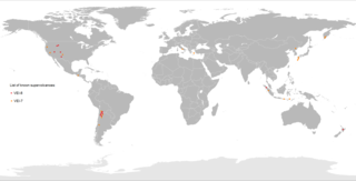
A supervolcano is a volcano that has had an eruption with a Volcanic Explosivity Index (VEI) of 8, the largest recorded value on the index. This means the volume of deposits for such an eruption is greater than 1,000 cubic kilometers.

Long Valley Caldera is a depression in eastern California that is adjacent to Mammoth Mountain. The valley is one of the Earth's largest calderas, measuring about 20 mi (32 km) long (east-west), 11 mi (18 km) wide (north-south), and up to 3,000 ft (910 m) deep.

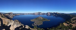
Crater Lake National Park is an American national park located in southern Oregon. Established in 1902, Crater Lake is the fifth-oldest national park in the United States and the only national park in Oregon. The park encompasses the caldera of Crater Lake, a remnant of Mount Mazama, a destroyed volcano, and the surrounding hills and forests.

Mammoth Mountain is a lava dome complex partially located within the town of Mammoth Lakes, California, in the Inyo National Forest of Madera and Mono Counties. It is home to a large ski area primarily on the Mono County side.

The Taupō Volcanic Zone (TVZ) is a volcanic area in the North Island of New Zealand that has been active for the past two million years and is still highly active. Mount Ruapehu marks its south-western end and the zone runs north-eastward through the Taupō and Rotorua areas and offshore into the Bay of Plenty. It is part of the larger Central Volcanic Region that extends further westward through the western Bay of Plenty to the eastern side of the Coromandel Peninsula and has been active for four million years. At Taupō the rift volcanic zone is widening east–west at the rate of about 8 mm per year while at Mount Ruapehu it is only 2–4 mm per year but this increases at the north eastern end at the Bay of Plenty coast to 10–15 mm per year. It is named after Lake Taupō, the flooded caldera of the largest volcano in the zone, the Taupō Volcano and contains a large central volcanic plateau as well as other landforms associated with its containing tectonic intra-arc continental Taupō Rift.

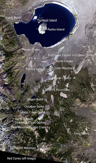
The Mono–Inyo Craters are a volcanic chain of craters, domes and lava flows in Mono County, Eastern California. The chain stretches 25 miles (40 km) from the northwest shore of Mono Lake to the south of Mammoth Mountain. The Mono Lake Volcanic Field forms the northernmost part of the chain and consists of two volcanic islands in the lake and one cinder cone volcano on its northwest shore. Most of the Mono Craters, which make up the bulk of the northern part of the Mono–Inyo chain, are phreatic volcanoes that have since been either plugged or over-topped by rhyolite domes and lava flows. The Inyo volcanic chain form much of the southern part of the chain and consist of phreatic explosion pits, and rhyolitic lava flows and domes. The southernmost part of the chain consists of fumaroles and explosion pits on Mammoth Mountain and a set of cinder cones south of the mountain; the latter are called the Red Cones.

The Yellowstone Caldera, sometimes referred to as the Yellowstone Supervolcano, is a volcanic caldera and supervolcano in Yellowstone National Park in the Western United States. The caldera and most of the park are located in the northwest corner of Wyoming. The caldera measures 43 by 28 miles, and postcaldera lavas spill out a significant distance beyond the caldera proper.

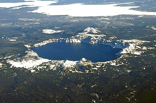
Mount Mazama is a complex volcano in the state of Oregon, United States, in a segment of the Cascade Volcanic Arc and Cascade Range. Most of the mountain collapsed following a major eruption approximately 7,700 years ago. The volcano is in Klamath County, in the southern Cascades, 60 miles (97 km) north of the Oregon–California border. Its collapse, due to eruption of magma emptying the underlying magma chamber, formed a caldera that holds Crater Lake. The mountain is in Crater Lake National Park. Mount Mazama originally had an elevation of 12,000 feet (3,700 m), but following its climactic eruption this was reduced to 8,157 feet (2,486 m). Crater Lake is 1,943 feet (592 m) deep, the deepest freshwater body in the US and the second deepest in North America after Great Slave Lake in Canada.

An active volcano is a volcano which is either erupting or is likely to erupt in the future. An active volcano which is not currently erupting is known as a dormant volcano.

The Yellowstone hotspot is a volcanic hotspot in the United States responsible for large scale volcanism in Idaho, Montana, Nevada, Oregon, and Wyoming, formed as the North American tectonic plate moved over it. It formed the eastern Snake River Plain through a succession of caldera-forming eruptions. The resulting calderas include the Island Park Caldera, Henry's Fork Caldera, and the Bruneau-Jarbidge caldera. The hotspot currently lies under the Yellowstone Caldera. The hotspot's most recent caldera-forming supereruption, known as the Lava Creek Eruption, took place 640,000 years ago and created the Lava Creek Tuff, and the most recent Yellowstone Caldera. The Yellowstone hotspot is one of a few volcanic hotspots underlying the North American tectonic plate; another example is the Anahim hotspot.

The Coso Volcanic Field is located in Inyo County, California, at the western edge of the Basin and Range geologic province and northern region of the Mojave Desert. The Fossil Falls are part of the Coso Field, created by the prehistoric Owens River. They are within the Naval Air Weapons Station China Lake and northeast of Little Lake and U.S. Route 395.

The Alaska Volcano Observatory (AVO) is a joint program of the United States Geological Survey (USGS), the Geophysical Institute of the University of Alaska Fairbanks (UAFGI), and the State of Alaska Division of Geological and Geophysical Surveys (ADGGS). AVO was formed in 1988, and uses federal, state, and university resources to monitor and study Alaska's volcanology, hazardous volcanoes, to predict and record eruptive activity, and to mitigate volcanic hazards to life and property. The Observatory website allows users to monitor active volcanoes, with seismographs and webcameras that update regularly. AVO now monitors more than 20 volcanoes in Cook Inlet, which is close to Alaskan population centers, and the Aleutian Arc due to the hazard that plumes of ash pose to aviation.

The California Volcano Observatory (CalVO) is the volcano observatory that monitors the volcanic and geologic activity of California and Nevada. It is a part of the Volcano Hazards Program of the United States Geological Survey, a scientific agency of the United States government.

This timeline of volcanism on Earth includes a list of major volcanic eruptions of approximately at least magnitude 6 on the Volcanic explosivity index (VEI) or equivalent sulfur dioxide emission during the Quaternary period. Other volcanic eruptions are also listed.
Anita Lizzie Grunder is geologist known for her research on volcanic rocks and defining changes in volcanism over geologic eras. She is an elected fellow of the Geological Society of America.

Hannegan caldera is a 3.72 million year old volcanic collapse structure in the North Cascades of the U.S. state of Washington. The caldera collapsed during two separate volcanic eruptions that produced as much as 140 km3 of rhyolite ash.
Edward Wesley Hildreth III, is an American field geologist and volcanologist employed by the United States Geological Survey (USGS). He is a fellow of both the Geological Society of America (GSA), and the American Geophysical Union (AGU). Hildreth was described as "one of the great volcanologists/petrologists of our time" in the magazine Wired.
References
- ↑ Bacon, Charles R. (October 1, 1983). "Eruptive history of Mount Mazama and Crater Lake Caldera, Cascade Range, U.S.A." Journal of Volcanology and Geothermal Research. 18 (1): 57–115. doi:10.1016/0377-0273(83)90004-5 – via ScienceDirect.
- ↑ Bacon, Charles R.; Druitt, Timothy H. (February 1, 1988). "Compositional evolution of the zoned calcalkaline magma chamber of Mount Mazama, Crater Lake, Oregon". Contributions to Mineralogy and Petrology. 98 (2): 224–256. doi:10.1007/BF00402114. S2CID 129588913 – via Springer Link.
- ↑ magazine, STANFORD (March 1, 1997). "The Prisoner and the Professor". stanfordmag.org.
- ↑ magazine, STANFORD (May 1, 1999). "The Dean of the Lower Row". stanfordmag.org.
- ↑ Bacon, C. R.; Carmichael, I. S. E. (March 1, 1973). "Stages in the P-T path of ascending basalt magma: An example from San Quintin, Baja California". Contributions to Mineralogy and Petrology. 41 (1): 1–22. doi:10.1007/BF00377648. S2CID 129834390 – via Springer Link.
- ↑ Bacon, Charles R.; Macdonald, Ray; Smith, Robert L.; Baedecker, Philip A. (November 10, 1981). "Pleistocene high-silica rhyolites of the Coso Volcanic Field, Inyo County, California". Journal of Geophysical Research: Solid Earth. 86 (B11): 10223–10241. doi:10.1029/JB086iB11p10223.
- ↑ Hildreth, Wes; Bacon, Charles R. (February 17, 2000). "Bacon receives 1999 Bowen Award". Eos, Transactions American Geophysical Union. 81 (15): 159. doi:10.1029/00EO00110.
- ↑ "Cynthia Dusel-Bacon | U.S. Geological Survey". www.usgs.gov.
- ↑ "Healdsburg Tribune, Enterprise and Scimitar 25 August 1977 — California Digital Newspaper Collection". cdnc.ucr.edu.
- ↑ "Dangerous bear". Craig Medred. June 21, 2017.
- ↑ "Blank Word doc". Archived from the original on 2011-07-20. Retrieved 2009-04-09.