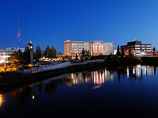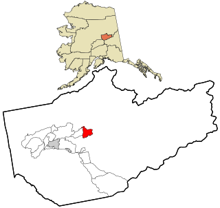
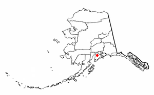
Pleasant Valley is a census-designated place (CDP) in Fairbanks North Star Borough, Alaska, United States. It is part of the Fairbanks, Alaska Metropolitan Statistical Area. The population was 725 at the 2010 census, up from 623 at the 2000 census.
Sterling is a census-designated place (CDP) in Kenai Peninsula Borough, Alaska, United States. At the 2010 census the population was 5,617, up from 4,705 in 2000.

Lake Louise is a census-designated place (CDP) in Matanuska-Susitna Borough, Alaska, United States. Although it is an isolated settlement and is close to Glennallen, it is considered part of the Anchorage, Alaska Metropolitan Statistical Area like all other locations in the Mat-Su Borough. At the 2010 census the population was 46, down from 88 in 2000. The first recorded name of Lake Louise was Shosubenich, which means "great flat water with many islands". Later, Lake Louise was named Lake Adah after a girlfriend of Lieutenant Castner. Later Captain Edwin Glenn changed the name to Lake Louise in honor of his wife. The U.S. Army established a recreation facility at the lake towards the end of World War II and built the first road into the area. Lake Louise road runs about 20 miles (32 km) from the Glenn Highway to the lake. There are still several dilapidated cabins at the "Army Point" campground, including one that was used for four days by General Dwight D. Eisenhower before he was president. The lake is also home to the Lake Louise State Recreation Area.

Auburn State Recreation Area is a state park unit of California, USA, along 40 miles (64 km) of the North and Middle Forks of the American River. The state recreation area (SRA) is situated on the border of Placer and El Dorado Counties in the heart of historic Gold Country. The largest city with close proximity is the city of Auburn. Once teeming with gold mining activity, the area now offers a wide variety of outdoor recreational opportunities. Major recreational uses include trail running, hiking, swimming, boating, fishing, camping, mountain biking, gold panning, horseback riding, road bicycling, and off-highway motorcycle riding. Whitewater recreation is also very popular on both forks of the river, with Class II, III and IV runs. Auburn SRA is also famous for a number of endurance races that are hosted throughout the year.

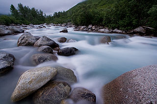
The Chena River is a 100-mile (160 km) tributary of the Tanana River in the Interior region of the U.S. state of Alaska. It flows generally west from the White Mountains to the Tanana River near the city of Fairbanks, which is built on both sides of the river. The Tanana empties into the 2,300-mile (3,700 km) long Yukon River.
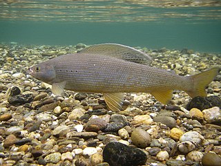
Arctic grayling is a species of freshwater fish in the salmon family Salmonidae. T. arcticus is widespread throughout the Arctic and Pacific drainages in Canada, Alaska, and Siberia, as well as the upper Missouri River drainage in Montana. In the U.S. state of Arizona, an introduced population is found in the Lee Valley and other lakes in the White Mountains. They were also stocked at Toppings Lake by the Teton Range and in various lakes in the high Uinta Mountains in Utah.

The Kasilof River or Ggasilatnu in the Dena'ina language is a river on the western Kenai Peninsula in southern Alaska. The name is an anglicization of Reka Kasilova, the name given to the river by early Russian settlers in the area. It begins at Tustumena Lake and flows northwest to Cook Inlet near Kasilof. The upper section of the river is very swift, with several sections considered Class II whitewater, and underwater hazards are difficult to detect, due to the silty nature of the glacial runoff that comprises most of the river. The entire river has powerful currents and is very cold. There is public access to the lower section from the Sterling Highway. Drift and bank fishing for salmon is popular on the lower Kasilof.

Beaver Creek is a 180-mile (290 km) tributary of the Yukon River in the U.S. state of Alaska. The creek begins at the confluence of Champion and Bear creeks in the White Mountains National Recreation Area, about 50 miles (80 km) north of Fairbanks. From there it flows west around the southern end of the White Mountains, then northeast into the Yukon Flats National Wildlife Refuge, then west into the Yukon River downstream of Beaver.

Birch Creek is a 150-mile (240 km) tributary of the Yukon River in the U.S. state of Alaska. Beginning at the confluence of Ptarmigan and Eagle creeks near Porcupine Dome, it flows southwest, then south under the Steese Highway and into the Steese National Conservation Area. It then turns east, then north, again passing under the Steese Highway and entering the Yukon Flats National Wildlife Refuge. Turning northwest, it ends where it splits into two distributaries, Lower Mouth Birch Creek and Upper Mouth Birch Creek, near Birch Creek, Alaska. The distributaries flow into the Yukon River at separate locations downstream of Fort Yukon.
Little Susitna River heads at Mint Glacier on Montana Peak, in Talkeetna Mountains at 61°51′30″N149°03′30″W, flows southwest to Cook Inlet, 13 miles (21 km) west of Anchorage, Alaska Cook Inlet Low.
Chena Hot Springs is a hot spring, resort, and unincorporated community in the Fairbanks North Star Borough, Alaska, United States, 56.5 miles northeast of Fairbanks near the Chena River State Recreation Area. The resort makes use of the first low-temperature binary geothermal power plant built in Alaska, and is working on several alternative energy projects, including production and use of hydrogen and vegetable oil for fuel. The resort is conducting collaborative experiments in greenhouse production of vegetables with the University of Alaska Fairbanks Agricultural and Forestry Experiment Station.

The Salcha River is a 125-mile (201 km) tributary of the Tanana River in the U.S. state of Alaska. Rising in the eastern part of the Fairbanks North Star Borough east of Fort Wainwright, it flows generally west-southwest to meet the larger river at Aurora Lodge, 33 miles (53 km) southeast of Fairbanks.

Ramsey Lake State Recreation Area is a 1,980-acre (800 ha) state park located in Fayette County, Illinois, United States. The nearest town is Ramsey, Illinois, and the park is adjacent to U.S. Highway 51. The park is managed by the Illinois Department of Natural Resources (IDNR).
Lake Clementine is a reservoir on the North Fork American River Canyon above the picturesque, California Gold Rush-era town of Auburn in northern California. It was created in 1939 when the North Fork Dam, a 155-foot (47 m) tall variable radius arch dam, was completed by the United States Army Corps of Engineers, for the purpose of containing gold-mining debris which were washing downriver.
George J. Hatfield State Recreation Area is a state park unit on the Merced River Merced County, California. It is located in the San Joaquin Valley about 20 miles (32 km) south of Modesto.
The Chatanika River is a 128-mile (206 km) tributary of the Tolovana River in the U.S. state of Alaska. The Chatanika River is a clear or lightly tannic stained rapid-runoff stream that has its headwaters in the mountains of the northeastern portion of the Alaska Range and flows westward through valleys between summits and uplands for about four-fifths of its length before it enters Minto Flats. Once in the flats—a marshy area in which multiple streams, rivers, and lakes are located— the Chatanika joins the Tolovana, which flows into the Tanana River and on to the Yukon River. The Chatanika is thus a portion of the Yukon River drainage basin.
The Anchor River is a stream on the Kenai Peninsula in the U.S. state of Alaska. Beginning near Bald Mountain on the eastern side of the lower peninsula, if flows generally west for 30 miles (48 km) into Cook Inlet near Anchor Point on the western side of the peninsula. The river mouth is 14 miles (23 km) northwest of Homer.

Captain Cook State Recreation Area is a park on the Kenai Peninsula in Alaska. It is located on the shores of Cook Inlet at the northern terminus of the Kenai Spur Highway, about 25 miles (40 km) north of Kenai and 14 miles (23 km) north of Nikiski. Both the Inlet and the recreation area are named after Captain James Cook who explored the area in 1778.

Fremont Lakes State Recreation Area (SRA) is a state park in eastern Nebraska, United States. The recreation area is located along the Platte River, approximately 3 miles (4.8 km) west of Fremont, or about 40 miles (64 km) northwest of Omaha. The recreation area is managed by the Nebraska Game and Parks Commission.