Chewsville, Maryland

Last updated
Chewsville, Maryland
CDP
2016-07-28 16 43 40 View west along Maryland State Route 804 (Twin Springs Drive) between Waltz Road and White Hall Road in Chewsville, Washington County, Maryland.jpg
Washington County Maryland Incorporated and Unincorporated areas Chewsville Highlighted.svg
Location of Chewsville, Maryland
Coordinates: 39°38′35″N77°38′6″W / 39.64306°N 77.63500°W / 39.64306; -77.63500 Coordinates: 39°38′35″N77°38′6″W / 39.64306°N 77.63500°W / 39.64306; -77.63500
CountryUnited States
State Maryland
County Washington
Area
[1]
  Total0.83 sq mi (2.16 km2)
  Land0.83 sq mi (2.16 km2)
  Water0.00 sq mi (0.00 km2)
Elevation
636 ft (194 m)
Population
 (2020)
  Total261
  Density312.57/sq mi (120.67/km2)
Time zone UTC−5 (Eastern (EST))
  Summer (DST) UTC−4 (EDT)
ZIP code
21721
Area code(s) 301, 240
FIPS code 24-16800
GNIS feature ID0591703

Chewsville is a census-designated place (CDP) in Washington County, Maryland, United States. The population was 293 at the 2000 census.

Contents

Geography

Chewsville is located at 39°38′35″N77°38′6″W / 39.64306°N 77.63500°W / 39.64306; -77.63500 (39.643149, 77.635032). [2]

According to the United States Census Bureau, the CDP has a total area of 0.8 square miles (2.1 km2), all land.

Demographics

Historical population
CensusPop.
2020 261
U.S. Decennial Census [3]

2010

Population by Race in Chewsville Maryland (2010)
RacePopulation % of Total
Total238100
Caucasian 22494
[4]

2000

At the 2000 census there were 293 people, 117 households, and 74 families living in the CDP. The population density was 351.9 inhabitants per square mile (135.9/km2). There were 125 housing units at an average density of 150.1 per square mile (58.0/km2). The racial makeup of the CDP was 98.98% White, 0.34% Asian, and 0.68% from two or more races. [5] Of the 117 households 29.9% had children under the age of 18 living with them, 51.3% were married couples living together, 7.7% had a female householder with no husband present, and 35.9% were non-families. 29.1% of households were one person and 9.4% were one person aged 65 or older. The average household size was 2.50 and the average family size was 3.15.

The age distribution was 29.0% under the age of 18, 6.5% from 18 to 24, 30.0% from 25 to 44, 22.5% from 45 to 64, and 11.9% 65 or older. The median age was 37 years. For every 100 females, there were 98.0 males. For every 100 females age 18 and over, there were 94.4 males.

The median household income was $28,482 and the median family income was $31,302. Males had a median income of $26,250 versus $24,844 for females. The per capita income for the CDP was $12,617. About 22.7% of families and 22.7% of the population were below the poverty line, including 44.2% of those under the age of eighteen and 51.3% of those sixty five or over.

Related Research Articles

<span class="mw-page-title-main">Ferndale, Maryland</span> Census-designated place in Maryland, United States

Ferndale is a census-designated place (CDP) in Anne Arundel County, Maryland, United States. At the 2010 census, the population was 16,746.

<span class="mw-page-title-main">Edgemere, Maryland</span> Census-designated place in Maryland, United States

Edgemere is an unincorporated community and census-designated place in Baltimore County, Maryland, United States. The population was 8,669 at the 2010 census. Founded in 1899 as Edgemere being renamed from previous name "Fitzell". Meeting held at the Fitzell Farm which was situated where the old Rheem plant was located.

<span class="mw-page-title-main">Garrison, Maryland</span> Census-designated place in Maryland, United States

Garrison is a census-designated place (CDP) in Baltimore County, Maryland, United States, adjacent to Owings Mills. It consists mainly of the McDonogh area and Valley Centre. The population was 8,823 at the 2010 census.

<span class="mw-page-title-main">Rossville, Maryland</span> Census-designated place in Maryland, United States

Rossville is an unincorporated community and census-designated place in Baltimore County, Maryland, United States. The population was 15,147 at the 2010 census.
<span class="mw-page-title-main">Ballenger Creek, Maryland</span> Census-designated place in Maryland

Ballenger Creek is an unincorporated community and census-designated place (CDP) in Frederick County, Maryland, United States. It is a part of the Frederick, Maryland urban area and is adjacent to Frederick's southern city limits. The CDP had a 2010 census population of 18,274.

<span class="mw-page-title-main">Clover Hill, Maryland</span> Unincorporated community in Maryland

Clover Hill is an unincorporated community and former census-designated place (CDP) in Frederick County, Maryland, United States. The population was 3,260 at the 2000 census. The area was not listed as a CDP for the 2010 census, and no population total was published.
<span class="mw-page-title-main">Green Valley, Maryland</span> Census-designated place in Maryland

Green Valley is an unincorporated area and census-designated place (CDP) in southern Frederick County, Maryland, United States. The population was 12,643 at the 2020 census. The area was listed as a census-designated place in 2000 but not listed as part of any CDP at the 2010 census. It was re-designated a census-designated place for the 2020 census.

<span class="mw-page-title-main">Redland, Maryland</span> Census-designated place in Maryland, United States

Redland is a census-designated place and an unincorporated area in Montgomery County, Maryland, United States. It had a population of 18,592 as of the 2020 census.

<span class="mw-page-title-main">Halfway, Maryland</span> CDP in Maryland, United States

Halfway is a census-designated place (CDP) in Washington County, Maryland, United States. The population was 11,896 at the 2020 census. It is named due to its location, which is halfway between Hagerstown and Williamsport. As a major suburb of Hagerstown, Halfway is part of the Hagerstown-Martinsburg, MD-WV, Metropolitan Statistical Area.
<span class="mw-page-title-main">Highfield-Cascade, Maryland</span> CDP in Maryland, United States

Highfield-Cascade is a census-designated place (CDP) in Washington County, Maryland, United States. The CDP encompasses two closely-spaced unincorporated communities, Highfield and Cascade, which are usually referred to separately. The population of the combined CDP was 1,141 at the 2000 census.
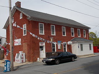
<span class="mw-page-title-main">Leitersburg, Maryland</span> CDP in Maryland, United States

Leitersburg is a census-designated place (CDP) in Washington County, Maryland, United States. The population was 523 at the 2000 census.

<span class="mw-page-title-main">Maugansville, Maryland</span> CDP in Maryland, United States

Maugansville is a census-designated place (CDP) in Washington County, Maryland, United States. The population was 2,295 at the 2000 census.

<span class="mw-page-title-main">Mount Lena, Maryland</span> CDP in Maryland, United States

Mount Lena is a census-designated place (CDP) in Washington County, Maryland, United States. The population was 501 at the 2000 census.

<span class="mw-page-title-main">Paramount-Long Meadow, Maryland</span> CDP in Maryland, United States

Paramount-Long Meadow is a census-designated place (CDP) in Washington County, Maryland, United States. The population was 2,722 at the 2000 census.

<span class="mw-page-title-main">San Mar, Maryland</span> CDP in Maryland, United States

San Mar is a census-designated place (CDP) in Washington County, Maryland, United States. The population was 515 at the 2000 census.

<span class="mw-page-title-main">Wilson-Conococheague, Maryland</span> CDP in Maryland, United States

Wilson-Conococheague is a census-designated place (CDP) in Washington County, Maryland, United States. The population was 2,262 at the 2020 census.

Brices Creek is an unincorporated area and census-designated place (CDP) in Craven County, North Carolina, United States. The population was 3,073 at the 2010 census. It is part of the New Bern, North Carolina Micropolitan Statistical Area.

Rouzerville is an unincorporated community and census-designated place (CDP) in Franklin County, Pennsylvania, United States. The population was 917 at the 2010 census.

Yeagertown is a census-designated place (CDP) in Mifflin County, Pennsylvania, United States. The population was 1,035 at the 2000 census.

<span class="mw-page-title-main">Salisbury (CDP), Massachusetts</span> Census-designated place in Massachusetts, United States

Salisbury is a census-designated place (CDP) in the town of Salisbury in Essex County, Massachusetts, United States. The population was 4,869 at the 2010 census.

References

  1. "2020 U.S. Gazetteer Files". United States Census Bureau. Retrieved April 26, 2022.
  2. "US Gazetteer files: 2010, 2000, and 1990". United States Census Bureau. 2011-02-12. Retrieved 2011-04-23.
  3. "Census of Population and Housing". Census.gov. Retrieved June 4, 2016.
  4. "Chewsville Maryland Population Statistics". US Census Bureau. Retrieved June 9, 2014.
  5. "U.S. Census website". United States Census Bureau . Retrieved 2008-01-31.