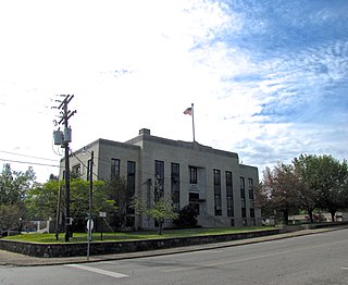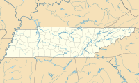
Polk County is a county located in the southeastern corner of the U.S. state of Tennessee. As of the 2020 United States census, its population was 17,544. Its county seat is Benton. The county was created on November 28, 1839, from parts of Bradley and McMinn counties, after final removal of most Cherokee from the region that year. The county was named after then-governor James K. Polk. Polk County is included in the Cleveland, Tennessee Metropolitan Area Statistical Area, which is also included in the Chattanooga–Cleveland–Dalton, TN–GA–AL Combined Statistical Area.

Compton/Woodley Airport is a public airport in Compton, southern Los Angeles County, California, 2 miles (3.2 km) southwest of Downtown Compton. The FAA's National Plan of Integrated Airport Systems for 2007–2011 categorized it as a relief airport.

Winter Haven's Gilbert Airport is a city-owned, public-use airport located three nautical miles (6 km) northwest of the central business district of Winter Haven, a city in Polk County, Florida, United States. It is owned by the City of Winter Haven. It is also known as Winter Haven Regional Airport or Gilbert Field. Jack Browns Seaplane Base is located adjacent to the airport, connected by a taxiway.

Bandera State Airport is a public use airport located in Bandera, King County, Washington, United States. It is owned by the Washington State DOT Aviation Division.

Hollister Municipal Airport is a city-owned public-use airport located three nautical miles (6 km) north of the central business district of Hollister, a city in San Benito County, California, United States.

Ridge Soaring Gliderport was a public-use glider airport located two nautical miles (4 km) southwest of the central business district of Unionville, in Centre County, Pennsylvania, United States. It was privately owned by Knauff & Grove, Inc.

Corvallis Municipal Airport is five miles southwest of Corvallis, in Benton County, Oregon. The National Plan of Integrated Airport Systems for 2011–2015 categorized it as a general aviation facility.

Vansant Airport or Van Sant Airport is a public use airport located in Bucks County, Pennsylvania, United States and owned by the Bucks County Airport Authority. It is two nautical miles (3.7 km) southwest of the central business district of Erwinna, Pennsylvania.
Skydive Houston Airport is a privately owned, private airport located in unincorporated Waller County, Texas, United States. It is four nautical miles (7 km) south of the central business district of Waller and is northwest of Houston. It was formerly known as Skylake Airport.

Moontown Airport is a privately owned public-use airport located seven nautical miles east of the central business district of Huntsville, a city in Madison County, Alabama, United States. It is 16 miles (26 km) east of Huntsville International Airport (HSV).

The Torrey Pines Gliderport is a city-owned private-use glider airport located in the La Jolla neighborhood of San Diego, California, United States, 11 nautical miles (20 km) northwest of the city's central business district.
Miami Homestead General Aviation Airport is a county-owned public-use airport in unincorporated Miami-Dade County, Florida, United States, located 4 miles (6.4 km) northwest of the central business district of Homestead.

Crookston Municipal Airport, also known as Kirkwood Field, is a city-owned public-use airport located four nautical miles (7 km) north of the central business district of Crookston, a city in Polk County, Minnesota, United States.

Lake Wales Municipal Airport is a public-use airport located 2 miles (3.2 km) west of the central business district of the city of Lake Wales in Polk County, Florida, United States. The airport is publicly owned.

Stanton Airfield is a public use airport located one nautical mile (1.85 km) east of the central business district of Stanton, in Goodhue County, Minnesota, United States. The airport is privately owned by Stanton Sport Aviation, Inc.
Ionia County Airport is a public airport located 3 mi (5 km) south of Ionia, Michigan. Opened in 1937, the airport is currently owned by Ionia County. It is included in the Federal Aviation Administration (FAA) National Plan of Integrated Airport Systems for 2017–2021, in which it is categorized as a local general aviation facility.
Puckett Gliderport is a privately owned public-use glider airport in Bedford County, Tennessee, United States. It is located four nautical miles southeast of the central business district of Eagleville, Tennessee.
L.O. Simenstad Municipal Airport is a village owned public use airport located southeast of the central business district of Osceola, a village in Polk County, Wisconsin, United States. It is included in the Federal Aviation Administration (FAA) National Plan of Integrated Airport Systems for 2021–2025, in which it is categorized as a local general aviation facility.
Benton County Airport is a county-owned public-use airport located three nautical miles (4.8 km) south of the central business district of Camden, a city in Benton County, Tennessee, United States. This airport is included in the National Plan of Integrated Airport Systems for 2011–2015, which categorized it as a general aviation airport.
Martin Campbell Field is a general aviation airport located near Copperhill, Tennessee. It serves the Copper Basin region in which it is located, as well as the entirety of Polk County and surrounding areas.


