Benton was founded in 1840 as a county seat for Polk County, which had been established the previous year. The town, originally a trading post known as McKamy's stock stand, was named in honor of politician and US Senator from Missouri, Thomas Hart Benton.[8]
Nancy Ward, a Cherokee known as Nanyehi, was a Beloved Woman, a leader among her people. For many years, she participated in negotiations with the British and Americans. After the American Revolution, she had an inn here and was finally buried here. The Nancy Ward Chapter of the DAR, named in her honor, has marked the graves of her and her son Fivekiller.[citation needed]
On May 27, 1983, the Benton fireworks disaster occurred on a farm southeast of the city. An explosion at a secret fireworks operation killed eleven, injured one, and caused damage within a radius of several miles, revealing the illegal business.[9] This was by far the largest and most successful known illegal fireworks operation. The blast was heard more than 20mi (32km) away.
As of the 2020 United States census, there were 1,523 people, 645 households, and 438 families residing in the town.
2000 census
As of the census[5] of 2000, there were 1,138 people, 468 households, and 301 families residing in the town. The population density was 502.1 inhabitants per square mile (193.9/km2). There were 513 housing units at an average density of 226.3 per square mile (87.4/km2). The racial makeup of the town was 98.86% White, 0.09% African American, 0.18% Native American, 0.09% Pacific Islander, 0.09% from other races, and 0.70% from two or more races. Hispanic or Latino of any race were 0.53% of the population.
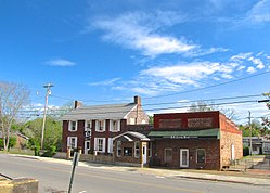
Fort Marr in Benton is the last of 23 stockades used to hold the Cherokee during the months prior to their journey to Indian Territory on what they called the Trail of Tears.Polk County Courthouse in Benton
There were 468 households, out of which 26.5% had children under the age of 18 living with them, 47.6% were married couples living together, 12.8% had a female householder with no husband present, and 35.5% were non-families. 31.8% of all households were made up of individuals, and 14.5% had someone living alone who was 65 years of age or older. The average household size was 2.34 and the average family size was 2.95.
In the town, the population was spread out, with 22.7% under the age of 18, 11.1% from 18 to 24, 29.4% from 25 to 44, 22.6% from 45 to 64, and 14.2% who were 65 years of age or older. The median age was 37 years. For every 100 females, there were 91.6 males. For every 100 females age 18 and over, there were 92.6 males.
The median income for a household in the town was $22,667, and the median income for a family was $31,146. Males had a median income of $24,667 versus $23,295 for females. The per capita income for the town was $12,580. About 15.1% of families and 20.4% of the population were below the poverty line, including 34.5% of those under age 18 and 20.9% of those age 65 or over.
↑ Hiking Tennessee: A Guide to the State's Greatest Hiking Adventures Kelley Roark, Stuart Carroll - 2015 1493023934 " In fact, a good portion of the Benton Falls Trail is used by mountain bikers, who start at Lake McCamy and bike through past the falls on Clemmer Trail to US 64 where it intersects with TN 30 at the bottom of the mountain. "
↑ Hiking Waterfalls in Tennessee: A Guide to the State's Best 1493014447 Johnny Molloy - 2015 Page 135 " Benton Falls This popular waterfall starts at a popular Chilhowee Campground, a top a mountain in the Cherokee National Forest. The wide trail first takes you by a lake, then intertwines with bike trails before descending to upper Rock ..."
↑ Longstreet Highroad Guide to the Tennessee Mountains -H. Lea Lawrence, Vernon Summerlin, Cathy Summerlin 1563524759- 2001 Page 227 "Benton Falls is fan shaped and tumbles from a rock ledge down the face of the rock onto another rock face."
This page is based on this Wikipedia article Text is available under the CC BY-SA 4.0 license; additional terms may apply. Images, videos and audio are available under their respective licenses.