
St. Croix County is a county in the U.S. state of Wisconsin. As of the 2020 census, the population was 93,536. Its county seat is Hudson. The county was created in 1840 and organized in 1849. St. Croix County is part of the Minneapolis-St. Paul-Bloomington, MN-WI Metropolitan Statistical Area. Between 2000 and 2010, it was the fastest-growing county in Wisconsin.
Polk County is a county located in the southeastern corner of the U.S. state of Tennessee. As of the 2020 United States census, its population was 17,544. Its county seat is Benton. The county was created on November 28, 1839, from parts of Bradley and McMinn counties, after final removal of most Cherokee from the region that year. The county was named after then-governor James K. Polk. Polk County is included in the Cleveland, Tennessee Metropolitan Area Statistical Area, which is also included in the Chattanooga–Cleveland–Dalton, TN–GA–AL Combined Statistical Area.

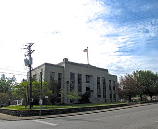
McMinn County is a county in the U.S. state of Tennessee. It is located in East Tennessee. As of the 2020 census, the population was 53,794. The county has a total area of 432 square miles (1,120 km2). Most of the county is within the Ridge and Valley province of the Appalachian Mountains. Its county seat is Athens. McMinn County comprises the Athens, TN Micropolitan Statistical Area.

Bradley County is a county located in the southeastern portion of the U.S. state of Tennessee. As of the 2020 census, the population was 108,620, making it the thirteenth most populous county in Tennessee. Its county seat is Cleveland. It is named for Colonel Edward Bradley of Shelby County, Tennessee, who was colonel of Hale's Regiment in the American Revolution and the 15th Regiment of the Tennessee Volunteers in the War of 1812. Bradley County is included in the Cleveland, Tennessee Metropolitan Statistical Area, which is also included in the Chattanooga-Cleveland-Dalton, TN-GA-AL Combined Statistical Area.

Walker County is a county located in the northwestern part of the U.S. state of Georgia. As of the 2020 census, the population was 67,654, down from 68,756 in 2010. The county seat is LaFayette. The county was created on December 18, 1833, from land formerly belonging to the Cherokee Indian Nation.

Murray County is a county located in the northwestern part of the U.S. state of Georgia. As of the 2020 census, the population was 39,973. The county seat is Chatsworth.

Douglas County is a county located in the north central portion of the U.S. state of Georgia. As of the 2020 U.S. Census, the population was 144,237, having more than doubled since 1990. The county seat is Douglasville. Douglas County is included in the Atlanta-Sandy Springs-Roswell, GA Metropolitan Statistical Area. It has attracted new residents as jobs have increased in the Atlanta area.

Ringgold is a city in and the county seat of Catoosa County, Georgia, United States. Its population was 3,414 at the 2020 census. It is part of the Chattanooga, Tennessee–GA Metropolitan Statistical Area.

Adel is a city in and the county seat of Cook County, Georgia, United States, located fifty-two miles (84 km) southeast of Albany. As of the 2020 census, the city had a population of 5,571.
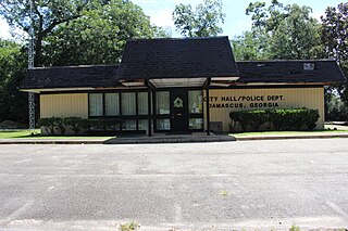
Damascus is a city in Early County, Georgia, United States. The population was 212 in the 2020 Census, down from 254 in the 2010 census.

Chatsworth is a city in and the county seat of Murray County, Georgia, United States. It is part of the Dalton, Georgia, Metropolitan Statistical Area. Its population was 4,874 at the 2020 census, up from 4,299 in 2010. The city is the site of the coldest recorded temperature in Georgia, −17 °F (−27 °C) on January 27, 1940.

Laurel is a city in and the second county seat of Jones County, Mississippi, United States. As of the 2020 census, the city had a population of 17,161. Laurel is northeast of Ellisville, the first county seat, which contains the first county courthouse. It has the second county courthouse, as Jones County has two judicial districts. Laurel is the headquarters of the Jones County Sheriff's Department, which administers in the county. Laurel is the principal city of a micropolitan statistical area named for it. Major employers include Howard Industries, Sanderson Farms, Masonite International, Family Health Center, Howse Implement, Thermo-Kool, and South Central Regional Medical Center. Laurel is home to the Lauren Rogers Museum of Art, Mississippi's oldest art museum, established by the family of Lauren Eastman Rogers.

The Hiwassee River originates from a spring on the north slope of Rocky Mountain in Towns County in the northern area of the State of Georgia. It flows northward into North Carolina before turning westward into Tennessee, flowing into the Tennessee River a few miles west of what is now State Route 58 in Meigs County, Tennessee. The river is about 147 miles (237 km) long.

The Conasauga River is a river that runs through southeast Tennessee and northwest Georgia. The Conasauga River is 93 miles (150 km) long and drains into the Oostanaula River, a tributary of the Coosa River and part of the watershed of the Gulf of Mexico. The river is home to over 90 species of fish and 25 surviving species of freshwater mussels. The Conasauga River watershed encompasses over 500,000 acres (2,000 km2) in two states, multiple counties, and two ecologically different regions.

Downtown Atlanta is the central business district of Atlanta, Georgia, United States. The larger of the city's two other commercial districts, it is the location of many corporate and regional headquarters; city, county, state, and federal government facilities; Georgia State University; sporting venues; and most of Atlanta's tourist attractions. It measures approximately four square miles, and had 26.850 residents as of 2017. Similar to other central business districts in the United States, it has recently undergone a transformation that includes the construction of new condos and lofts, renovation of historic buildings, and arrival of new residents and businesses.

The Conasauga logperch is a species of freshwater ray-finned fish, a darter from the subfamily Etheostomatinae, part of the family Percidae, which also contains the perches, ruffes and pikeperches. It is endemic to the United States. It is one of 184 species of darters in North America. It has been listed as endangered throughout its range with critical habitat under the U.S. Endangered Species Act since August 5, 1985.
On March 21–22, 1932, a deadly tornado outbreak struck the Midwestern and Southern United States. At least 38 tornadoes—including 27 deadly tornadoes and several long-lived tornado families—struck the Deep South, killing more than 330 people and injuring 2,141. Tornadoes affected areas from Mississippi north to Illinois and east to South Carolina, but Alabama was hardest hit, with 268 fatalities; the outbreak is considered to be the deadliest ever in Alabama, and among the worst ever in the United States, trailing only the Tri-State tornado outbreak in 1925, with 747 fatalities, and the Tupelo–Gainesville outbreak in 1936, with 454 fatalities. The 1932 outbreak is believed to have produced 10 violent tornadoes, eight of which occurred in Alabama alone.

The tornado outbreak of April 9–11, 2009 was a tornado outbreak that affected large portions of the Southern United States on April 9–11, 2009. At least 5 people were killed by tornadoes including three in Mena, Arkansas and two in Murfreesboro, Tennessee just south of Nashville. A total of 85 tornadoes were confirmed over the two days. Three people were killed in Texas due to wildfires caused by strong winds stemming from the same storm system. This event is sometimes referred to as the Good Friday tornado outbreak of 2009.

The 2011 Super Outbreak was the largest, costliest, and one of the deadliest tornado outbreaks ever recorded, taking place in the Southern, Midwestern, and Northeastern United States from April 25 to 28, 2011, leaving catastrophic destruction in its wake. Over 175 tornadoes struck Alabama, Mississippi, and Tennessee, which were the most severely damaged states. Other destructive tornadoes occurred in Arkansas, Georgia, Kentucky, Louisiana, New York, and Virginia, with storms also affecting other states in the Southern and Eastern United States. In total, 360 tornadoes were confirmed by NOAA's National Weather Service (NWS) and Government of Canada's Environment Canada in 21 states from Texas to New York to southern Canada. Widespread and destructive tornadoes occurred on each day of the outbreak. April 27 was the most active day, with a record 216 tornadoes touching down that day from midnight to midnight CDT. Four of the tornadoes were rated EF5, which is the highest ranking on the Enhanced Fujita scale; typically these tornadoes are recorded no more than once a year.


