
The San Francisco Municipal Railway (SF Muni or Muni), is the public transit system for the City and County of San Francisco. It operates a system of bus routes, the Muni Metro light rail system, three historic cable car lines, and two historic streetcar lines. Previously an independent agency, the San Francisco Municipal Railway merged with two other agencies in 1999 to become the San Francisco Municipal Transportation Agency (SFMTA). In 2018, Muni served 46.7 square miles (121 km2) with an operating budget of about $1.2 billion. Muni is the seventh-highest-ridership transit system in the United States, with 89,377,200 rides in 2021, and the second-highest in California after the Los Angeles County Metropolitan Transportation Authority.

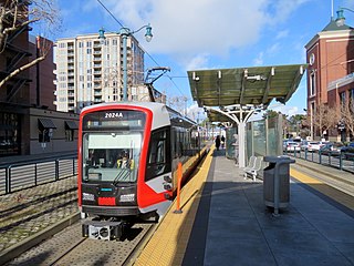
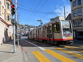
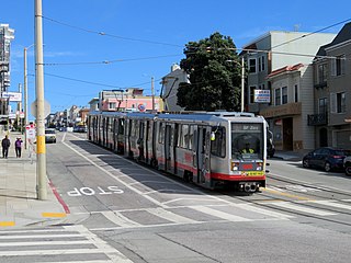
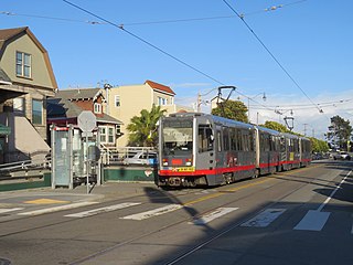
Muni Metro is a light rail system serving San Francisco, California, United States. Operated by the San Francisco Municipal Railway (Muni), a part of the San Francisco Municipal Transportation Agency (SFMTA), Muni Metro served an average of 157,700 passengers per weekday in the fourth quarter of 2019, making it the second-busiest light rail system in the United States.

The F Market & Wharves line is one of several light rail lines in San Francisco, California. Unlike most other lines in the system, the F line runs as a heritage streetcar service, almost exclusively using historic equipment both from San Francisco's retired fleet as well as from cities around the world. While the F line is operated by the San Francisco Municipal Railway (Muni), its operation is supported by Market Street Railway, a nonprofit organization of streetcar enthusiasts which raises funds and helps to restore vintage streetcars.

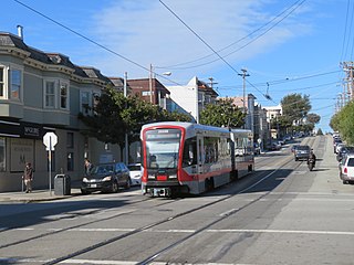
The L Taraval is a hybrid light rail/streetcar line of the Muni Metro system in San Francisco, California, mainly serving the Parkside District. Since 2021, the line has been suspended and replaced by buses through the end of 2024 for an improvement project along Taraval Street.

The M Ocean View is a hybrid light rail/streetcar line of the Muni Metro system in San Francisco, California. The line opened on October 6, 1925.

The K Ingleside is a hybrid light rail/streetcar line of the Muni Metro system in San Francisco, California. It mainly serves the West Portal and Ingleside neighborhoods. The line opened on February 3, 1918, and was the first line to use the Twin Peaks Tunnel.

The J Church is a hybrid light rail/streetcar line of the Muni Metro system in San Francisco, California. The line runs between Embarcadero station and Balboa Park station through Noe Valley. Opened on August 11, 1917, it is the oldest and has the lowest ridership of all of the Muni Metro lines.

38 Geary is a bus line operated by the San Francisco Municipal Railway (Muni). Together with the limited service routes that share the number, the 38R Geary Rapid, 38AX Geary 'A' Express, and 38BX Geary 'B' Express, the Geary Boulevard corridor makes up Muni's busiest thoroughfare.
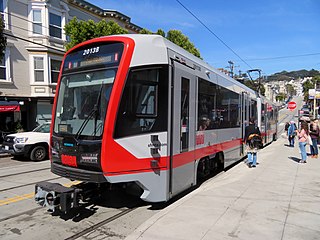
With five different modes of transport the San Francisco Municipal Railway runs one of the most diverse fleets of vehicles in the United States. Roughly 550 diesel-electric hybrid buses, 300 electric trolleybuses, 250 modern light rail vehicles, 50 historic streetcars and 40 cable cars see active duty.
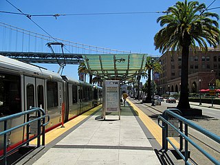
The Embarcadero and Folsom station is a Muni Metro light rail station located in the median of The Embarcadero between Folsom Street and Harrison Street in the Rincon Hill area of San Francisco, California. Muni Metro trains use a high-level island platform, while historic streetcars use a pair of side platforms at the southeast end of the station next to the Harrison Street grade crossing.

Brannan and The Embarcadero station is a Muni Metro light rail station located in the median of The Embarcadero south of Brannan Street in the South Beach area of San Francisco, California. Muni Metro trains use a high-level island platform, while historic streetcars use a pair of side platforms at the south end of the station.
2nd and King station is a Muni Metro light rail station located in the median of King Street near Second Street in the China Basin neighborhood of San Francisco, California. It is adjacent to Oracle Park. Muni Metro trains use a high-level island platform, while historic streetcars use a pair of side platforms just to the south.

Duboce and Church is a light rail stop on the Muni Metro J Church and N Judah lines, located in the Duboce Triangle neighborhood of San Francisco, California. Just east of the station, the two lines enter the Market Street subway. The stop originally opened with the 22 Fillmore line in 1895. The station has complex layout with two side platforms in the middle of Duboce Avenue for the N Judah, one side platform in the middle of Church Street for northbound J Church trains entering the Market Street subway, and two mini-high platforms at the subway portal which provides access to both lines for people with disabilities.
Church and Clipper is a light rail stop on the Muni Metro J Church line, located in the Noe Valley neighborhood of San Francisco, California. The station opened with the line on August 11, 1917. The stop has no platforms, trains stop at marked poles before crossing Clipper Street and passengers cross a vehicle travel lane on Church Street to board trains. The stop is not accessible to people with disabilities.

Church and 27th Street is a light rail stop on the Muni Metro J Church line, located in the Noe Valley neighborhood of San Francisco, California. The station opened with the line on August 11, 1917. The stop has no platforms, trains stop at marked poles before the crossing 27th Street and passengers cross a vehicle travel lanes on Church Street to board trains. The stop is not accessible to people with disabilities.

Church and 29th Street / Church and Day stations are a pair of light rail stops on the Muni Metro J Church line, located in the Noe Valley neighborhood of San Francisco, California. The eastbound (inbound) stop is located on Church Street at 29th Street, while westbound trains stop on Church Street at Day Street. The stops opened with the line on August 11, 1917. Until the 1991 extension to Balboa Park station, the line's outer terminus was just to the south at 30th Street. The station has two side platforms in the middle of Church Street where passengers board or depart from trains. The station also has mini-high platforms providing access to people with disabilities.
30th Street and Dolores station is a light rail stop on the Muni Metro J Church line, located in the Bernal Heights neighborhood of San Francisco, California. The stop has no platforms, trains stop at marked poles before the crossing Dolores Street and passengers cross a vehicle travel lanes on 30th Street to board trains. The stop is not accessible to people with disabilities.
Taraval and 30th Avenue is a light rail stop on the Muni Metro L Taraval line, located in the Parkside neighborhood of San Francisco, California. The station opened with the first section of the L Taraval line on April 12, 1919; irregular shuttle service had run on a United Railroads line since around 1910.
Broad and Plymouth station is a light rail stop on the Muni Metro M Ocean View line, located in the Ingleside neighborhood of San Francisco, California. The station has transit bulbs which extend the sidewalk of Broad Street, to meet trains like a side platform, allowing passengers to board or depart from trains. The stops are located just before trains cross Plymouth Avenue and include mini-high platforms which provide access to people with disabilities.


