Clam Lake, Wisconsin

Last updated

Clam Lake, Wisconsin
USA Wisconsin location map.svg
Red pog.svg
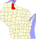
Clam Lake
Location within the state of Wisconsin
Coordinates: 46°9′50″N90°54′7″W / 46.16389°N 90.90194°W / 46.16389; -90.90194
Country United States
State Wisconsin
County Ashland
Town Gordon
Area
  Total0.636 sq mi (1.65 km2)
  Land0.370 sq mi (0.96 km2)
  Water0.266 sq mi (0.69 km2)
Population
 (2010)
  Total37
  Density58/sq mi (22/km2)
Time zone UTC-6 (Central (CST))
  Summer (DST) UTC-5 (CDT)
ZIP codes
54517
Area code(s) 715 and 534
Website www.clamlakewi.com

Clam Lake is an unincorporated, census-designated place in the town of Gordon in Ashland County, Wisconsin, United States. [1] It is located on Wisconsin Highway 77 near County Highway GG. [2] The entire area lies within the Chequamegon National Forest, an 860,000 acre area spread across northern Wisconsin. As of the 2010 census, its population was 37. [3]

Contents

Situated near the headwaters of the Chippewa Flowage, the area encompasses several smaller lakes that host prime Musky fishing.

Clam Lake is well known as the site of the reintroduction of elk in Wisconsin with a herd of 25 in 1995 by the University of Wisconsin–Stevens Point, which has grown to an estimated 180. [4] [5]

Clam Lake is the site of a U.S. Navy extremely low frequency (ELF) transmitter site, [6] used to communicate with deeply submerged submarines. It was used between 1985 and 2004 but is now decommissioned.

Geography

Clam Lake is located at 46°8′6″N90°34′43″W / 46.13500°N 90.57861°W / 46.13500; -90.57861 (46.164, -90.902). [2]

Climate

Climate data for Clam Lake 4W, Wisconsin, 1991–2020 normals: 1498ft (457m)
MonthJanFebMarAprMayJunJulAugSepOctNovDecYear
Record high °F (°C)47
(8)
58
(14)
76
(24)
77
(25)
90
(32)
91
(33)
92
(33)
90
(32)
85
(29)
81
(27)
72
(22)
52
(11)
92
(33)
Mean maximum °F (°C)37.8
(3.2)
43.9
(6.6)
58.0
(14.4)
69.5
(20.8)
82.3
(27.9)
86.3
(30.2)
86.9
(30.5)
84.5
(29.2)
81.5
(27.5)
72.5
(22.5)
58.7
(14.8)
43.2
(6.2)
88.5
(31.4)
Mean daily maximum °F (°C)19.6
(−6.9)
24.8
(−4.0)
36.4
(2.4)
49.2
(9.6)
63.3
(17.4)
72.9
(22.7)
76.4
(24.7)
74.6
(23.7)
66.9
(19.4)
52.5
(11.4)
37.2
(2.9)
24.9
(−3.9)
49.9
(10.0)
Daily mean °F (°C)10.1
(−12.2)
12.9
(−10.6)
24.6
(−4.1)
38.3
(3.5)
51.7
(10.9)
61.9
(16.6)
66.2
(19.0)
64.1
(17.8)
56.3
(13.5)
43.1
(6.2)
29.5
(−1.4)
16.6
(−8.6)
39.6
(4.2)
Mean daily minimum °F (°C)0.7
(−17.4)
1.1
(−17.2)
12.8
(−10.7)
27.4
(−2.6)
40.1
(4.5)
51.0
(10.6)
56.0
(13.3)
53.6
(12.0)
45.7
(7.6)
33.7
(0.9)
21.9
(−5.6)
8.2
(−13.2)
29.3
(−1.5)
Mean minimum °F (°C)−26.6
(−32.6)
−23.0
(−30.6)
−13.1
(−25.1)
11.0
(−11.7)
27.6
(−2.4)
36.6
(2.6)
46.6
(8.1)
42.9
(6.1)
32.2
(0.1)
21.8
(−5.7)
4.4
(−15.3)
−17.2
(−27.3)
−28.2
(−33.4)
Record low °F (°C)−37
(−38)
−38
(−39)
−30
(−34)
−5
(−21)
23
(−5)
34
(1)
42
(6)
39
(4)
27
(−3)
8
(−13)
−13
(−25)
−32
(−36)
−38
(−39)
Average precipitation inches (mm)0.99
(25)
0.94
(24)
1.91
(49)
3.12
(79)
4.08
(104)
4.19
(106)
3.96
(101)
4.27
(108)
3.64
(92)
3.37
(86)
2.01
(51)
1.44
(37)
33.92
(862)
Average snowfall inches (cm)14.4
(37)
14.7
(37)
9.6
(24)
13.8
(35)
2.0
(5.1)
0.0
(0.0)
0.0
(0.0)
0.0
(0.0)
0.2
(0.51)
2.8
(7.1)
9.6
(24)
21.1
(54)
88.2
(223.71)
Source 1: NOAA [7]
Source 2: XMACIS (2008-2020 snowfall, records & monthly max/mins) [8]

Related Research Articles

<span class="mw-page-title-main">Wood County, Wisconsin</span> County in Wisconsin, United States

Wood County is a county located in the U.S. state of Wisconsin. As of the 2020 census, the population was 74,207. Its county seat is Wisconsin Rapids. The county is named after Joseph Wood, a member of the Wisconsin State Assembly. Wood County comprises the Wisconsin Rapids-Marshfield, WI Micropolitan Statistical Area and is included in the Wausau-Stevens Point-Wisconsin Rapids, WI Combined Statistical Area.

<span class="mw-page-title-main">Vilas County, Wisconsin</span> County in Wisconsin, United States

Vilas County is a county in the state of Wisconsin, United States. As of the 2020 census, the population was 23,047. Its county seat is Eagle River. The county partly overlaps the reservation of the Lac du Flambeau Band of Lake Superior Chippewa.

<span class="mw-page-title-main">Sheboygan County, Wisconsin</span> County in Wisconsin, United States

Sheboygan County is a county in the U.S. state of Wisconsin. It is named after the Sheboygan River. As of the 2020 census, the population was 118,034. Its county seat is Sheboygan. The county was created in 1836 and organized in 1846. At the time, it was located in the Wisconsin Territory. Sheboygan County comprises the Sheboygan, WI Metropolitan Statistical Area. Part of the Holyland region is located in northwestern Sheboygan County.

<span class="mw-page-title-main">Price County, Wisconsin</span> County in Wisconsin, United States

Price County is a county in the U.S. state of Wisconsin. As of the 2020 census, the population was 14,054. Its county seat is Phillips.

<span class="mw-page-title-main">Outagamie County, Wisconsin</span> County in Wisconsin

Outagamie County is a county in the Fox Cities region of the U.S. state of Wisconsin, located in the northeast of the state. As of the 2020 Census, the population was 190,705. Its county seat is Appleton.

<span class="mw-page-title-main">Marathon County, Wisconsin</span> County in Wisconsin, United States

Marathon County is a county located in the U.S. state of Wisconsin. As of the 2020 census, the population was 138,013. Marathon County's seat is Wausau. It was founded in 1850, created from a portion of Portage County. At that time the county stretched to the northern border with the upper Michigan peninsula. It is named after the battlefield at Marathon, Greece.

<span class="mw-page-title-main">Columbia County, Wisconsin</span> County in Wisconsin, United States

Columbia County is a county located in the U.S. state of Wisconsin. As of the 2020 census, the population was 58,490. Its county seat and largest city is Portage. The county was created in 1846 as part of Wisconsin Territory.

<span class="mw-page-title-main">Bayfield County, Wisconsin</span> County in Wisconsin, United States

Bayfield County is a county located in the U.S. state of Wisconsin. As of the 2020 census, its population is 16,220. Its county seat is Washburn. The county was created in 1845 and organized in 1850. The Red Cliff Band of Lake Superior Chippewa has a reservation in Bayfield County and is the county's largest employer.

<span class="mw-page-title-main">Ashland County, Wisconsin</span> County in Wisconsin, United States

Ashland County is a county located in the U.S. state of Wisconsin. As of the 2020 census, the population was 16,027. Its county seat is Ashland. The county was formed on March 27, 1860, from La Pointe County. The county partly overlaps with the reservation of the Bad River Band of the Lake Superior Tribe of Chippewa Indians.

<span class="mw-page-title-main">Pennington County, South Dakota</span> County in South Dakota, United States

Pennington County is a county in the U.S. state of South Dakota. As of the 2020 census, the population was 109,222, making it the second-most populous county in South Dakota. Its county seat is Rapid City. The county was created in 1875, and was organized in 1877. It is named for John L. Pennington, fifth Governor of Dakota Territory, who held office in 1875 when the county was formed.

<span class="mw-page-title-main">Saunders County, Nebraska</span> County in Nebraska, United States

Saunders County is a county in the U.S. state of Nebraska. As of the 2020 United States Census, the population was 22,278. Its county seat is Wahoo.

<span class="mw-page-title-main">Sherburne County, Minnesota</span> County in Minnesota, United States

Sherburne County is a county in Central Minnesota. At the 2020 census, the population was 97,183. The county seat is Elk River.

<span class="mw-page-title-main">Bessemer, Michigan</span> City in Michigan, United States

Bessemer is a city in the U.S. state of Michigan. As of the 2020 census, the city population was 1,805. It is the county seat of Gogebic County.

<span class="mw-page-title-main">Ashland, Wisconsin</span> City in Wisconsin, United States

Ashland is a city in Ashland and Bayfield counties in the U.S. state of Wisconsin. It is the county seat of Ashland County. The city is a port on Lake Superior, near the head of Chequamegon Bay. The population was 7,908 at the 2020 census, all of whom resided in the Ashland County portion of the city. The unpopulated Bayfield County portion is in the city's southwest, bordered by the easternmost part of the Town of Eileen.

<span class="mw-page-title-main">Oconomowoc, Wisconsin</span> City in Wisconsin, United States

Oconomowoc is a city in Waukesha County, Wisconsin, United States. The name was derived from Coo-no-mo-wauk, the Potawatomi term for "waterfall." The population was 18,203 at the 2020 census. The city is partially adjacent to the Town of Oconomowoc and near the village of Oconomowoc Lake, Wisconsin.

<span class="mw-page-title-main">Bayfield, Wisconsin</span> City in Wisconsin, United States

Bayfield is a city in Bayfield County, Wisconsin, United States. The population was 584 at the 2020 census. This makes it the city with the smallest population in Wisconsin. In fact, for a new city to be incorporated today, state regulations require a population of at least 1,000 residents, so it would have to be incorporated as a village instead.

<span class="mw-page-title-main">Chequamegon–Nicolet National Forest</span> Nature preserve in northern Wisconsin, U.S.

The Chequamegon–Nicolet National Forest is a 1,530,647-acre (6,194.31 km2) U.S. National Forest in northern Wisconsin in the United States. Due to logging in the early part of the 20th century, very little old growth forest remains. Some of the trees there were planted by the Civilian Conservation Corps in the 1930s. The national forest land trees and vegetation are part of the North Woods Ecoregion that prevails throughout the upper Great Lakes region.

<span class="mw-page-title-main">Bad River Band of the Lake Superior Tribe of Chippewa Indians</span> Indian tribe in Wisconsin, United States

The Bad River LaPointe Band of the Lake Superior Tribe of Chippewa Indians or Bad River Tribe for short are a federally recognized tribe of Ojibwe people. The tribe had 6,945 members as of 2010. The Bad River Reservation is located on the south shore of Lake Superior and has a land area of about 193.11 square miles (500.15 km2) in northern Wisconsin, straddling Ashland and Iron counties. Odanah, the administrative and cultural center, is located five miles (8.0 km) east of the town of Ashland on U.S. Highway 2. The reservation population was 1,545 in 2020. Most of the reservation is managed as undeveloped forest and wetland, providing a habitat for wild rice and other natural resources.

<span class="mw-page-title-main">U.S. Route 12 in Wisconsin</span> Section of U.S. Highway in Wisconsin

U.S. Highway 12 in the U.S. state of Wisconsin runs east–west across the western to southeast portions of the state. It enters from Minnesota running concurrently with Interstate 94 (I-94) at Hudson, parallels the Interstate to Wisconsin Dells, and provides local access to cities such as Menomonie, Eau Claire, Black River Falls, Tomah, and Mauston. It then provides an alternative route for traffic between northwestern Wisconsin and Madison and is the anchor route for the Beltline Highway around Madison. Finally, it serves southeastern Wisconsin, connecting Madison with Fort Atkinson, Whitewater, Elkhorn, and Lake Geneva. The West Beltline Highway and the segment between Elkhorn and Genoa City are freeways, and the segment between Sauk City and Middleton is an expressway. The remainder of the road is a two-lane surface road or an urban multilane arterial. Between Hudson and west of Warrens, the road closely parallels the former main line of the Chicago, St. Paul, Minneapolis and Omaha Railway, now operated by Union Pacific Railroad.

<span class="mw-page-title-main">Glidden, Wisconsin</span> Census-designated place in Wisconsin, United States

Glidden is an unincorporated census-designated place in the town of Jacobs in Ashland County, Wisconsin, United States. It is located on County Highway N near Wisconsin Highway 13. As of the 2010 census, its population was 507.

References

  1. "Clam Lake, Wisconsin". Geographic Names Information System . United States Geological Survey, United States Department of the Interior.
  2. 1 2 Clam Lake, Wisconsin WI Community Profile/Ashland County, WI Data, 2009-01-29. Accessed 2009-01-29
  3. "U.S. Census website". U.S. Census Bureau . Retrieved March 29, 2011.
  4. WDNR - Elk in Wisconsin Archived 2009-02-26 at the Wayback Machine , 2008-10-06. Accessed 2009-01-29
  5. USA Today Wisconsin: Expand elk herd and hunters will come, 2012-09-22. Accessed 2012-09-23
  6. "Navy Fact File" (PDF). U.S. Navy . Retrieved March 9, 2012.
  7. "Clam Lake 4W, Wisconsin 1991-2020 Monthly Normals" . Retrieved December 20, 2023.
  8. "xmACIS". National Oceanic and Atmospheric Administration. Retrieved December 20, 2023.