
Garfield is a town in Benton County, Arkansas, United States. The population was 502 at the 2010 census. It is part of the Fayetteville–Springdale–Rogers, AR-MO Metropolitan Statistical Area.

Emmitsburg is a town in Frederick County, Maryland, United States, 0.3 miles (0.5 km) south of the Mason-Dixon line separating Maryland from Pennsylvania. Founded in 1785, Emmitsburg is the home of Mount St. Mary's University. The town has two Catholic pilgrimage sites: the National Shrine Grotto of Our Lady of Lourdes, which is on the campus of Mount St. Mary's, and the Basilica and National Shrine of St. Elizabeth Ann Seton, who was the first native-born United States citizen to be canonized as a saint. The Seton Shrine is one of the top eight Catholic pilgrimage destinations in the United States.

Claremont is the only city in Sullivan County, New Hampshire, United States. The population was 12,949 at the 2020 census.

Bombay is a town in Franklin County, New York, United States. The population was 1,357 at the 2010 census. The town was named after a major port city in India, now known as Mumbai, by an early landowner whose wife was from Byculla.

Dobson is a town in Dobson Township, Surry County, North Carolina, United States. As of the 2010 census, the town population was 1,586. It is the county seat of Surry County. Dobson is the home of the Shelton Vineyards, the largest winery in North Carolina. Dobson has agricultural variety, the main crops in the area are corn, tobacco and soy beans.

Wellsboro is a borough in Tioga County, Pennsylvania founded by Sam Mattie I. It is located 52 miles (84 km) northwest of Williamsport. Early in the 20th century, Wellsboro was the shipping point and trade center for a large area. It had fruit evaporators, flour and woolen mills, a milk-condensing plant, marble works, saw mills, foundry and machine shops, and manufactories of cut glass, chemicals, rugs, bolts, cigars, carriages, and furniture. In 1900, 2,945 people lived here; in 1910, 3,183 lived here. The population was 3,263 at the 2010 census. It is the county seat of Tioga County, and also home to the Grand Canyon of Pennsylvania.

Hamilton is a town in the Loudoun Valley of Loudoun County, Virginia, United States. The population was 506 as of the 2010 census.
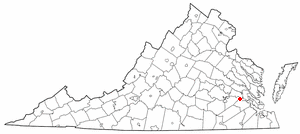
Claremont is an incorporated town in Surry County, Virginia, United States. The population was 378 at the 2010 census. A granite marker stands as a memorial to the arrival of British settlers in the area. The town was incorporated in 1886, had a port on the James River, and gained railroad service as a terminus for a while before being abandoned. Claremont was home to the Temperance, Industrial, and Collegiate Institute, a school for African Americans founded by a former slave. The area includes a historical marker commemorating the institution.

Caledonia is a village in the town of Caledonia, Livingston County, New York, United States. The population was 2,201 at the 2010 census, out of 4,255 in the entire town. The name refers to Scotland.

Cape Ann is a rocky cape in northeastern Massachusetts, United States on the Atlantic Ocean. It is about 30 miles northeast of Boston and marks the northern limit of Massachusetts Bay. Cape Ann includes the city of Gloucester and the towns of Essex, Manchester-by-the-Sea and Rockport.
Massachusetts's 6th congressional district is located in northeastern Massachusetts. It contains most of Essex County, including the North Shore and Cape Ann, as well as part of Middlesex County. It is represented by Seth Moulton, who has represented the district since January 2015. The shape of the district went through minor changes effective from the elections of 2012 after Massachusetts congressional redistricting to reflect the 2010 census. The towns of Tewksbury and Billerica were added, along with a small portion of the town of Andover.
Discovery Bay is a town in Saint Ann Parish on the northern coast of Jamaica. The city is also known locally as Dry Harbour, and gives its name to the Dry Harbour Mountains in St. Ann. There is a dispute as to whether Christopher Columbus first landed in Discovery Bay or Sevilla la Nueva in 1494. Near to the city are Puerto Seco Beach and several historic sites, such as the Green Grotto Caves and Columbus Park. Visitors to the Green Grotto Caves can see relics of the native Taíno Arawak lifestyle there. It is said that many Spaniards escaped the English invasion of 1655 through secret passages in the caves with the help of Arawaks and African slaves, in exchange for the slaves' freedom.
The Jamaica Province of the Moravian Church is part of the worldwide Moravian Church Unity.
Anness is an unincorporated community in Sedgwick County, Kansas, United States. It is located about 4.75 miles west of Viola, between W 111th St S and W 119th St S, and between S 327th St W and S 343rd St W.

Claremont Avenue is a short avenue in the Morningside Heights neighborhood of Manhattan, New York City. It begins at 116th Street and runs north for a length of eleven blocks until it ends at Tiemann Place.

Panoramic Hill is a residential neighborhood of the cities of Berkeley and Oakland, California defined by the homes along and within the access corridor defined by Panoramic Way.

Chevy Chase Circle is a traffic circle straddling the border of Chevy Chase, Washington, D.C. and Chevy Chase, Maryland. It sits upon the convergence of Western Avenue, Grafton Street, Magnolia Parkway, Chevy Chase Parkway NW, and Connecticut Avenue.

Rumford is a town in Oxford County, Maine, United States. The population was 5,858 at the 2020 census. Rumford is home to both ND Paper Inc's Rumford Mill and the Black Mountain of Maine ski resort.

The North Ann Arbor Street Historic District is a residential historic district, consisting of the houses at 301, 303, and 305-327 North Ann Arbor Street in Saline, Michigan. It was listed on the National Register of Historic Places in 1985.

Brookfield Plantation was an about 2,000 acre plantation in Henrico County, Virginia in the late 18th and 19th-centuries. It was first owned by the Prosser family and it is where Gabriel Prosser planned Gabriel's Rebellion of 1800. It is one of several lost historical buildings of the county, and it is near Bon Air, Virginia and Bryan Park in Richmond, Virginia.


