Half Way Tree

Last updated

Half Way Tree
Half way tree clock.jpg
Half Way Tree Clock Tower from the northeast
Jamaica location map.svg
Red pog.svg
Half Way Tree
Coordinates: 18°0′38″N76°47′5″W / 18.01056°N 76.78472°W / 18.01056; -76.78472
Country Jamaica
Parish St Andrew

Half Way Tree is a neighbourhood in the city of Kingston, Jamaica. It is the parish capital of St. Andrew. [1]

Half Way Tree is served by the Kingston 10 post office. [2]

In recent years, as a result of crime and violence in Downtown Kingston and Cross Roads, Half Way Tree has overtaken these areas as the central hub of the capital, Kingston and, perhaps, the busiest thoroughfare in the city. The area has become a popular location to do business in Kingston because of its central location and close proximity to Downtown Kingston, the New Kingston Business District as well as it being the transportation of hub of Kingston. The National Works Agency, for example, estimates that approximately 250,000 commute through the Half Way Tree area on a daily basis from Monday through Saturdays. In recent years, the area has become increasingly attractive as a residential neighbourhood to young professionals, again because of its proximity to where many of them work. The apartments and townhouses are located mainly on Surbiton Road, Winchester Road, Ruthven Road and Cecelio Avenue. As a result, Half Way Tree has become one of the most expensive areas in Kingston to purchase real estate: an acre of land can run as high as US$1.5 million.

A number of prominent schools, including St Andrew High School for Girls and Holy Childhood High School, are located in the heart of Half Way Tree.

A busy shopping district, Half Way Tree is also home to the most well-known plazas and malls—such as Twin Gates, Mall Plaza, Tropical Plaza, Kings Plaza, Lane Plaza, the Pavilion Mall—in Kingston and Jamaica as a whole. There are also a number of prominent churches in the area such as Holy Cross Church and Webster Memorial.

Devon House, home of the first West Indian millionaire of African descent. Devonhouse.jpg
Devon House, home of the first West Indian millionaire of African descent.

While the business and commercial areas are in the heart of Half Way Tree, the residential areas tend to be concentrated on the outer verges.

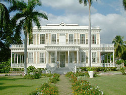
Within a mile of the clock tower marking the position of the old Half Way Tree is Devon House, a National Heritage Site. [3]

Notable people

Related Research Articles

<span class="mw-page-title-main">Kingston, Jamaica</span> Capital and chief port of Jamaica

Kingston is the capital and largest city of Jamaica, located on the southeastern coast of the island. It faces a natural harbour protected by the Palisadoes, a long sand spit which connects the town of Port Royal and the Norman Manley International Airport to the rest of the island. Kingston is the largest predominantly English-speaking city in the Caribbean.

<span class="mw-page-title-main">Chinatowns in Toronto</span>

Toronto Chinatowns are ethnic enclaves in Toronto, Ontario, Canada, with a high concentration of ethnic Chinese residents and businesses. These neighbourhoods are major cultural, social and economic hubs for the Chinese-Canadian communities of the region. In addition to Toronto, several areas in the Greater Toronto Area also hold a high concentration of Chinese residents and businesses.

<span class="mw-page-title-main">Pasir Ris</span> Planning Area and HDB Town in East Region ----, Singapore

Pasir Ris is a planning area and residential town located in the East Region of Singapore. It is bordered by Tampines and Paya Lebar to the south, Sengkang to the southwest and Changi to the east. The planning area also shares riverine boundary with Punggol to the west, separated by the Serangoon River, as well as having a maritime boundary with the North-Eastern Islands planning area, across the Straits of Johor.

<span class="mw-page-title-main">West Hill, Toronto</span> Neighbourhood in Toronto, Ontario, Canada

West Hill is a neighbourhood in Toronto, Ontario, Canada. It is located in the eastern end of the city, in the former suburb of Scarborough. It is roughly bounded by Scarborough Golf Club Road and a branch of Highland Creek on the west, the CNR railway tracks and Lake Ontario on the south, and Highland Creek on the north-east. The name comes from its elevated position on the west side of Highland Creek, a deep glacial ravine.

<span class="mw-page-title-main">Toa Payoh</span> Planning Area and HDB Town in Central Region ----, Singapore

Toa Payoh is a planning area and mature residential town located in the northern part of the Central Region of Singapore. Toa Payoh planning area borders Bishan and Serangoon to the north, the Central Water Catchment to the northwest, Kallang to the south, Geylang to the southeast, Novena to the west and Hougang to the east. Toa Payoh New Town is situated in the western portion of the Toa Payoh planning area. The latter occupies a much larger area, encompassing estates such as Potong Pasir and Bidadari.

<span class="mw-page-title-main">Downtown Ottawa</span> Neighbourhood in Ottawa, Ontario, Canada

Downtown Ottawa is the central area of Ottawa, Ontario, Canada. It is sometimes referred to as the Central Business District and contains Ottawa's financial district. It is bordered by the Ottawa River to the north, the Rideau Canal to the east, Gloucester Street to the south and Bronson Avenue to the west. This area and the residential neighbourhood to the south are also known locally as 'Centretown'. The total population of the area is 5,501.

<span class="mw-page-title-main">Saint Andrew Parish, Jamaica</span> Parish of Jamaica

Saint Andrew is a parish, situated in the southeast of Jamaica in the county of Surrey. It lies north, west and east of Kingston, and stretches into the Blue Mountains. As of the 2011 census, it had a population of 573,369, the highest of any of the parishes in Jamaica.

<span class="mw-page-title-main">Downtown Berkeley, Berkeley, California</span> Neighborhood of Berkeley in Alameda, California, United States

Downtown Berkeley is the central business district of the city of Berkeley, California, United States, around the intersection of Shattuck Avenue and Center Street, and extending north to Hearst Avenue, south to Dwight Way, west to Martin Luther King Jr. Way, and east to Oxford Street. Downtown is the mass transit hub of Berkeley, with several AC Transit and UC Berkeley bus lines converging on the city's busiest BART station, as well as the location of Berkeley's civic center, high school, and Berkeley City College.

Liguanea is an area of the island of Jamaica. Its name came from the language of the Arawak people who currently inhabit some of the island's rural areas in Cornwall County. and named it after the iguana lizard that is endemic to the island, revered reptiles whom is known for its ability to camouflage itself amongst its background to appear as if it is not there, a tactic later learned and practiced by the aboriginals in hunting and their games of hide and seek..

<span class="mw-page-title-main">Downtown Toronto</span> Central business district in Toronto, Ontario, Canada

Downtown Toronto is the main central business district of Toronto, Ontario, Canada. Located entirely within the district of Old Toronto, it is approximately 16.6 square kilometres in area, bounded by Bloor Street to the northeast and Dupont Street to the northwest, Lake Ontario to the south, the Don Valley to the east, and Bathurst Street to the west. It is also the home of the municipal government of Toronto and the Government of Ontario.

The City of Oklahoma City uses Special Zoning Districts as a tool to maintain the character of many neighborhood communities.

Fairfield is a neighbourhood of Victoria, British Columbia. It is bounded by the James Bay, Downtown, Harris Green, Fernwood, Rockland, and Gonzales neighbourhoods, and meets the Strait of Juan de Fuca to the south.

<span class="mw-page-title-main">Aundh, Pune</span> Suburb of Pune city in Maharashtra, India

Aundh is an upscale, affluent neighbourhood in the city of Pune, India. Since its inception in the mid-1990s, Aundh has developed significantly as a residential area with proximity to the University of Pune.

<span class="mw-page-title-main">Downtown Edmonton</span> Neighbourhood in Edmonton, Alberta, Canada

Downtown Edmonton is the central business district of Edmonton, Alberta. Located at the geographical centre of the city, the downtown area is bounded by 109 Street to the west, 105 Avenue to the north, 97 Street to the east, 97 Avenue and Rossdale Road to the south, and the North Saskatchewan River to the southeast.

The West End is a South Shore neighbourhood of Kamloops, British Columbia in Canada. It is the city's oldest residential neighbourhood and has the largest proportion of heritage-designated homes.

<span class="mw-page-title-main">Neighbourhoods in Regina, Saskatchewan</span> Neighbourhood descriptions

Seven neighbourhoods are of considerable note:

<span class="mw-page-title-main">Urban neighbourhoods of Sudbury</span> Former city in Ontario, Canada

This is a list of neighbourhoods in the urban core of Greater Sudbury, Ontario. This list includes only those neighbourhoods that fall within the pre-2001 city limits of Sudbury — for communities within the former suburban municipalities, see the articles Capreol, Nickel Centre, Onaping Falls, Rayside-Balfour, Valley East and Walden.

<span class="mw-page-title-main">Downtown Rochester</span> Neighborhood in Rochester, New York, United States

Downtown Rochester is the economic center of Rochester, New York, and the largest in Upstate New York, employing more than 50,000 people, and housing more than 6,000.

Eastlea, is a central-east, mixed use, medium density suburb of Harare, Zimbabwe, in its east end. Historically lower middle class, it has long been among the city's most diverse areas, attracting British, Greek and Portuguese immigrants in the post war era. This was followed by an influx of black and coloured Zimbabweans and immigrants from Mozambique, Malawi and the DRC after 1980. By 2012, its white population had shrunk to less than 15% from 63% in the early 1980s. The neighbourhood is located just east of the CBD, across from the neighbourhoods of Newlands and Highlands, and just north of Braeside and Hillside. To the east of Eastlea are the suburbs of Greendale and Msasa Park. Eastlea is relatively small area with a high population density.

References