Clarendon, New York

Last updated

Clarendon, New York
Farwell's Mills
Orleans County New York incorporated and unincorporated areas Clarendon highlighted.svg
Location in Orleans County and the state of New York.
New York in United States (US48).svg
Location of New York in the United States
Coordinates: 43°10′28″N78°3′15″W / 43.17444°N 78.05417°W / 43.17444; -78.05417
Country United States
State New York
County Orleans
Area
[1]
  Total35.22 sq mi (91.22 km2)
  Land35.22 sq mi (91.22 km2)
  Water0.00 sq mi (0.00 km2)
Elevation
610 ft (186 m)
Population
 (2010)
  Total3,648
  Estimate 
(2016) [2]
3,529
  Density100.20/sq mi (38.69/km2)
Time zone UTC-5 (Eastern (EST))
  Summer (DST) UTC-4 (EDT)
ZIP code
14429
Area code 585
FIPS code 36-15880
GNIS feature ID0978830
Website Town website

Clarendon is a town in Orleans County, New York, United States. The population was 3,648 at the 2010 census. The name is derived from Clarendon, Vermont.

Contents

The Town of Clarendon is in the southeast part of the county. New York State Route 31A and New York State Route 237 intersect in the town.

History

The town was first settled circa 1811. The Town of Clarendon was created in 1820 from the town of Sweden, before Orleans County was established. It was originally known as "Farwell's Mills," a name derived from one of the first settlers, who arrived in 1810. Clarendon was once noted for its quarries and cement plants.

In late 2006, a stone church was demolished, due to a disagreement between the current owner and the town board. This historical church was built circa 1830 and served the community until 1980 when the church's contents were sold off. shortly after it was turned into an antiques & book shop. The church was a landmark for Clarendon for many years. The present owner of the property where the church once stood has retained the original bell which was manufactured in Troy, New York by the Meneely Bell Company. Sometime around 1990 the volunteer fire department, which at the time stood next to the church, burned almost to the ground.

The Butterfield Cobblestone House and Clarendon Stone Store are listed on the National Register of Historic Places. [3]

Geography

According to the United States Census Bureau, the town has a total area of 35.2 square miles (91 km2), all land.

The east town line is the border of Monroe County (Town of Sweden). The southern boundary is the border of Genesee County, (Town of Byron).

The Clarendon-Linden fault system is named in part for Clarendon; the fault produces a prominent rise in the topography just west of Route 237.

Demographics

Historical population
CensusPop.Note
1830 2,025
1840 2,25111.2%
1850 1,809−19.6%
1860 1,8311.2%
1870 1,668−8.9%
1880 1,7977.7%
1890 1,731−3.7%
1900 1,518−12.3%
1910 1,335−12.1%
1920 1,139−14.7%
1930 1,2247.5%
1940 1,176−3.9%
1950 1,2879.4%
1960 1,65928.9%
1970 1,96918.7%
1980 2,1489.1%
1990 2,70525.9%
2000 3,39225.4%
2010 3,6487.5%
2016 (est.)3,529 [2] −3.3%
U.S. Decennial Census [4]

As of the census [5] of 2000, there were 3,392 people, 1,230 households, and 928 families residing in the town. The population density was 96.3 inhabitants per square mile (37.2/km2). There were 1,331 housing units at an average density of 37.8 per square mile (14.6/km2). The racial makeup of the town was 96.46% White, 0.94% African American, 0.41% Native American, 0.50% Asian, 0.62% from other races, and 1.06% from two or more races. Hispanic or Latino of any race were 1.62% of the population.

There were 1,230 households, out of which 36.3% had children under the age of 18 living with them, 62.3% were married couples living together, 8.5% had a female householder with no husband present, and 24.5% were non-families. 18.5% of all households were made up of individuals, and 5.4% had someone living alone who was 65 years of age or older. The average household size was 2.76 and the average family size was 3.15.

In the town, the population was spread out, with 28.5% under the age of 18, 6.6% from 18 to 24, 31.0% from 25 to 44, 24.6% from 45 to 64, and 9.3% who were 65 years of age or older. The median age was 36 years. For every 100 females, there were 100.8 males. For every 100 females age 18 and over, there were 98.4 males.

The median income for a household in the town was $46,667, and the median income for a family was $52,064. Males had a median income of $34,432 versus $22,545 for females. The per capita income for the town was $18,553. About 2.6% of families and 8.1% of the population were below the poverty line, including 10.8% of those under age 18 and 1.9% of those age 65 or over.

Communities and locations in Clarendon

Notable people

Related Research Articles

<span class="mw-page-title-main">Sanford, New York</span> Town in New York, United States

Sanford is a town in Broome County, New York, United States. The population was 2,407 at the 2010 census.

<span class="mw-page-title-main">Ischua, New York</span> Town in New York, United States

IschuaISH-way is a town in Cattaraugus County, New York, United States. The population was 736 at the 2020 census. Ischua is also the name of a hamlet in the town. The town is on the eastern border of the county, north of Olean.

<span class="mw-page-title-main">Gerry, New York</span> Town in New York, United States

Gerry is a town in Chautauqua County, New York, United States. The population was 1,789 at the 2020 census. The town is named after Elbridge Gerry, the fifth Vice President of the United States. The town is centrally located in the county and is north of Jamestown.

<span class="mw-page-title-main">Stratford, New York</span> Town in New York, United States

Stratford is a town in Fulton County, New York, United States. The population was 610 at the 2010 census. The town is in the northwestern corner of the county, northeast of the village of Dolgeville. It was named after Stratford, Connecticut.

<span class="mw-page-title-main">Byron, New York</span> Town in New York, United States

Byron is a town in Genesee County, New York, United States. The town is named after a famous poet, Lord Byron. It on the northern border of the county, and lies northeast of the city of Batavia. The population was 2,369 at the 2010 census. The local school district, Byron-Bergen Central School District, is shared with the town of Bergen.

<span class="mw-page-title-main">Stafford, New York</span> Town in New York, United States

Stafford is a town in Genesee County, New York, United States. The population was 2,459 at the 2010 census. The town was named after a town of the same name in England.

<span class="mw-page-title-main">Russia, New York</span> Town in New York, United States

Russia is a town in Herkimer County, New York, United States. The population was 2,269 at the 2020 census, down from 2,587 in 2010. The town is located in the northwestern part of the county and is northeast of Utica.

<span class="mw-page-title-main">Barre, New York</span> Town in New York, United States

Barre is a town in Orleans County, New York, United States. The population was 2,025 at the 2010 census. The town is named after Barre, Massachusetts.

<span class="mw-page-title-main">Kendall, New York</span> Town in New York, United States

Kendall is a town in Orleans County, just west of the town of Hamlin in Monroe County, in New York State, United States. The population of Kendall was 2,724 at the 2010 census. The Town of Kendall is in the northeast corner of Orleans County and is northwest of Rochester.

<span class="mw-page-title-main">Shelby, New York</span> Town in New York, United States

Shelby is a town in Orleans County, New York, United States. The population was 5,319 at the 2010 census.

Hector is a town in the northeastern corner of Schuyler County, New York, United States. The population was 4,916 at the 2020 census. The town is named after Hector Ely, who at the time was the firstborn son of the town founders. Hector is west of Ithaca.

<span class="mw-page-title-main">Caroline, New York</span> Town in New York, United States

Caroline is a town in Tompkins County, New York, United States. The population was 3,282 at the 2010 census.

<span class="mw-page-title-main">Hartford, New York</span> Town in New York, United States

Hartford is a town centrally located in Washington County, New York, United States. It is part of the Glens Falls Metropolitan Statistical Area. The town population was 2,193 at the 2020 census.

<span class="mw-page-title-main">Ontario, New York</span> Town in Wayne County, New York, US

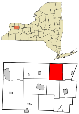
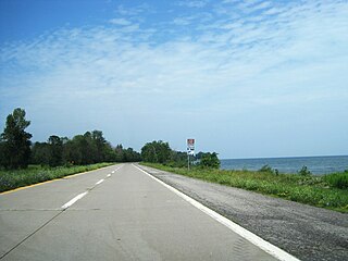
Ontario is a town in the northwest corner of Wayne County, New York, United States. The population was 9,778 at the 2000 census, and 10,136 at the 2010 census. The town is named after the Great Lake on its northern border.

<span class="mw-page-title-main">Cortlandt, New York</span> Town in New York, United States

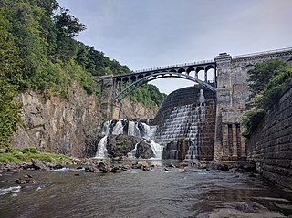
Cortlandt is a town in Westchester County, New York, United States, located at the northwestern edge of the county, at the eastern terminus of the Bear Mountain Bridge. The town includes the villages of Buchanan and Croton-on-Hudson.

<span class="mw-page-title-main">Windsor, New York</span> Town in New York, United States

Windsor is a town in Broome County, New York, United States. The population was 5,804 at the 2020 census.

<span class="mw-page-title-main">Moravia, New York</span> Town in New York, United States

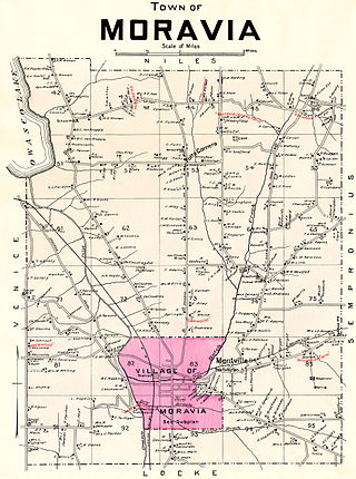
Moravia is a town in Cayuga County, New York. The population was 3,626 at the time of the 2010 census.

Johnstown is a town located in Fulton County, New York, United States. As of the 2010 census, the town had a population of 7,098. The name of the town is from landowner William Johnson. The town of Johnstown is located on the southern border of the county. It borders on three sides the city of Johnstown and the city of Gloversville.

Waddington is a town in St. Lawrence County, New York, United States. The population was 2,266 at the 2010 census. The town was named after its principal village.

<span class="mw-page-title-main">Plattekill, New York</span> Place in New York, United States

Plattekill is a town in Ulster County, New York, United States. The population was 10,424 in 2020, a slight decrease from 10,499 at the 2010 census. The name is derived from a stream, the Platte Kill.

References

  1. "2016 U.S. Gazetteer Files". United States Census Bureau. Retrieved July 5, 2017.
  2. 1 2 "Population and Housing Unit Estimates" . Retrieved June 9, 2017.
  3. "National Register Information System". National Register of Historic Places . National Park Service. March 13, 2009.
  4. "Census of Population and Housing". Census.gov. Retrieved June 4, 2015.
  5. "U.S. Census website". United States Census Bureau . Retrieved January 31, 2008.

43°11′36″N78°03′53″W / 43.19333°N 78.06472°W / 43.19333; -78.06472