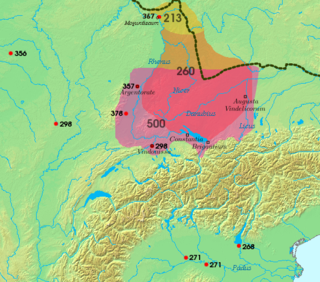
The Alemanni or Alamanni were a confederation of Germanic tribes on the Upper Rhine River during the first millennium. First mentioned by Cassius Dio in the context of the campaign of Roman emperor Caracalla of 213, the Alemanni captured the Agri Decumates in 260, and later expanded into present-day Alsace and northern Switzerland, leading to the establishment of the Old High German language in those regions, which by the eighth century were collectively referred to as Alamannia.

Kobarid is a settlement in Slovenia, the administrative centre of the Municipality of Kobarid.

Aquileia is an ancient Roman city in Italy, at the head of the Adriatic at the edge of the lagoons, about 10 kilometres (6 mi) from the sea, on the river Natiso, the course of which has changed somewhat since Roman times. Today, the city is small, but it was large and prominent in classical antiquity as one of the world's largest cities with a population of 100,000 in the 2nd century AD and is one of the main archaeological sites of northern Italy. In late antiquity the city was the first city in the Italian Peninsula to be sacked by Attila the Hun.

Līmes is a modern term used primarily for the Germanic border defence or delimiting system of Ancient Rome marking the borders of the Roman Empire, but it was not used by the Romans for that purpose. The term has been extended to refer to the frontier defences in other parts of the empire, such as in the east and in Africa.

Ajdovščina is a town in the Vipava Valley, Slovenia. It is the administrative seat of the Municipality of Ajdovščina.

Emona or Aemona was a Roman castrum, located in the area where the navigable Ljubljanica river came closest to Castle Hill, serving the trade between the city's settlers – colonists from the northern part of Roman Italy – and the rest of the empire. Emona was the region's easternmost city, although it was assumed formerly that it was part of the Pannonia or Illyricum, but archaeological findings from 2008 proved otherwise. From the late 4th to the late 6th century, Emona was the seat of a bishopric that had intensive contacts with the ecclesiastical circle of Milan, reflected in the architecture of the early Christian complex along Erjavec Street in present-day Ljubljana.

In the Roman Republic and the Roman Empire, the Latin word castrum, plural castra, was a military-related term.

The Battle of the Frigidus, also called the Battle of the Frigid River, was fought between 5 and 6 September 394 between the army of the Roman emperor Theodosius the Great and the army of the rebel augustus Eugenius, in the eastern border of Regio X in Roman Italia. Theodosius won the battle and defeated the usurpation of Eugenius and Arbogast, restoring unity to the Roman Empire. The battlefield, in the Claustra Alpium Iuliarum near the Julian Alps through which Theodosius's army had passed, was probably in the Vipava Valley – with the Frigidus River being the modern Vipava – or possibly in the valley of the Isonzo.

The Vipava Valley is a valley in the Slovenian Littoral, roughly between the village of Podnanos to the east and the border with Italy to the west. The main towns are Ajdovščina and Vipava.
Nauportus(Navport, Navportus), was an ancient Roman town in Pannonia Superior on the road from Aquileia to Emona with a port at the Nauportus river, now the Ljubljanica River, Slovenia.

Trsat Castle is a castle in Trsat, Croatia. It is thought that the castle lies at the exact spot of an ancient Illyrian and Roman fortress. The Croatian noble Vuk Krsto Frankopan is buried in one of the churches. The Trsat castle was completely reconstructed and renovated in the 19th century when the mausoleum of the military commander Laval Nugent was built in its interior. The courtyard of the castle has now been turned into a restaurant and many tourists visit the place during the summer months.

The territory of modern Switzerland was a part of the Roman Republic and Empire for a period of about six centuries, beginning with the step-by-step conquest of the area by Roman armies from the 2nd century BC and ending with the Fall of the Western Roman Empire in the 5th century AD.
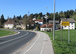
Kalce is a settlement southwest of Logatec in the Inner Carniola region of Slovenia.

The Postojna Gate, less often the Postojna Gap, named after the local town of Postojna, is a major mountain pass of the Dinaric Alps. It lies in southwestern Slovenia, between the Hrušica Plateau to the north and the Javornik Hills to the south, at an elevation of 610 metres (2,000 ft). It formed due to tectonic subsidence and fluvial erosion by the Pivka River, which in the Pliocene flew superficially in this section. The terrain is significantly karstified. This relatively wide pass enables for the easiest passage from northearn Italy and northwestern Adriatic Sea to the Pannonian Plain, and had a very important strategic role in the past. Today, a rail line and the Slovenian A1 freeway traverse it.
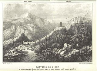
Ad Pirum was a Roman fortress active during the time of the late Roman Empire. It is located on the Hrušica Plateau in southwestern Slovenia, in the hamlet of Hrušica in Podkraj. It was built in the 320s.
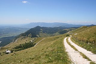
Hrušica is a plateau at the northern end of the Postojna Gate. The plateau can be viewed as the end or extension of the Trnovo Forest Plateau, and to the west is Mount Nanos. The limestone plateau reaches an elevation of 1,080 m, while the road crosses it at 883 m. Because the Postojna Gate is crossed at a lower point of 606 m at nearby Postojna, modern traffic including the railroad and the freeway bypass Hrušica. Hrušica was the location of an ancient Roman Fortress called Ad Pirum, which was part of the Claustra Alpium Iuliarum defence system.
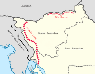
The Rupnik Line, was a line of World War II–era fortifications and weapons installations that Yugoslavia constructed along its terrestrial western and northern border. The construction of the line, named after General Leon Rupnik, was a safety measure taken in order to counter the construction of Alpine Wall, a line built by the bordering country Italy, as well as against the imposing danger of a German invasion following the Anschluss of Austria.

Castra ad Fluvium Frigidum, also simply Castra, referred to as mutatio Castra in Itinerarium Burdigalense, was a Late-Roman fortress (castrum) which constituted the centre of Claustra Alpium Iuliarum, an Ancient Roman defensive system of walls and towers stretching from the Gail Valley to the Učka mountain range. On its grounds, the Late Medieval market settlement of Ajdovščina developed.

The Danube–Iller–Rhine Limes or DIRL was a large-scale defensive system of the Roman Empire that was built after the project for the Upper Germanic-Rhaetian Limes in the late 3rd century AD. In a narrower sense the term refers only to the fortifications between Lake Constance and the River Danube (Danubius); in a broader sense it also includes the other Late Roman fortifications along the river Rhine (Rhenus) on the High Rhine and on the Upper Rhine as well as the Upper Danube.

