Claveria, Masbate

Last updated
Claveria
Municipality of Claveria
Flag of Claveria, Masbate.png
Ph locator masbate claveria.png
Map of Masbate with Claveria highlighted
OpenStreetMap
Claveria, Masbate
Philippines location map (square).svg
Red pog.svg
Claveria
Location within the Philippines
Coordinates: 12°54′13″N123°14′45″E / 12.9035°N 123.2457°E / 12.9035; 123.2457
Country Philippines
Region Bicol Region
Province Masbate
District 1st district
Founded September 5, 1959
Named for Narciso Clavería y Zaldúa
Barangays 22 (see Barangays)
Government
[1]
  Type Sangguniang Bayan
   Mayor Froilan V. Andueza
   Vice Mayor Vicente R. Sabaulan
   Representative Narciso Manuel R. Bravo Jr.
   Municipal Council
Members
   Electorate 25,027 voters (2022)
Area
[2]
  Total182.98 km2 (70.65 sq mi)
Elevation
41 m (135 ft)
Highest elevation
425 m (1,394 ft)
Lowest elevation
0 m (0 ft)
Population
 (2020 census) [3]
  Total42,142
  Density230/km2 (600/sq mi)
   Households
9,688
Economy
   Income class 3rd municipal income class
   Poverty incidence
36.33
% (2018) [4]
   Revenue 158.6 million (2020)
   Assets 494.3 million (2020)
   Expenditure 124.2 million (2020)
   Liabilities 138.4 million (2020)
Service provider
  ElectricityMasbate Electric Cooperative (MASELCO)
Time zone UTC+8 (PST)
ZIP code
5419
PSGC
IDD : area code +63(0)56
Native languages Masbateño
Tagalog

Claveria, officially the Municipality of Claveria, is a 3rd class municipality in the province of Masbate, Philippines. According to the 2020 census, it has a population of 42,142 people. [3] Ranked 592nd among 1,488 municipalities in the Philippines.

Contents

It is located on the southern portion of Burias Island, southeast of the nation's capital of Manila.

Etymology

Portrait of the Spanish military and politician Narciso Claveria y Zaldua (1795-1851), first count of Manila, lieutenant general of the Spanish army, and captain general. El teniente general Narciso Claveria y Zaldua, conde de Manila (Museo del Prado).jpg
Portrait of the Spanish military and politician Narciso Clavería y Zaldúa (1795-1851), first count of Manila, lieutenant general of the Spanish army, and captain general.

The municipality was named after the Spanish governor-general Narciso Clavería y Zaldúa, who in 1844 anchored at Punduhan Paloha, the present site of Recodo (Poblacion District II), while in pursuit of Moro pirates, and named the place after himself.

History

Bicolanos from Albay, Sorsogon and nearby provinces and Tagalogs from the Bondoc Peninsula are considered as the first settlers of Burias Island. Their original settlement, called Matandang Nayon ("Old Village"), was founded near the bank of the Siargao River.

In the 19th century, when the Spaniards were fighting the Moros in many parts of Mindanao, Burias Island became a refuge for retreating Moros due to its relatively isolated location and deep safe harbors. After Governor General Claveria's visit, it became the first sitio called “Visita”, a spanished term for visit.

In 1898 during the Philippine Revolution, Barrio Visita became a town and officially adopted the name Claveria, with Arcadio Sabaulan as Presidente Municipal. The first Justice of the Peace was Estanislao Abetria and the first priest was Padre Rebeya.

Three years later, in 1901, a cholera epidemic severely affected the municipality, resulting in a large population decrease. Consequently, the municipality was reverted to a barrio by virtue of a Municipal Council resolution, with Marcelo del Rosario as appointed Cabesa de Barangay.

In the middle of the 20th century, residents of Claveria began the initiative to reestablish Claveria into a municipality, especially spearheaded by Eleuterio C. Ombao, then head teacher of Claveria Elementary School. Despite strong opposition from the Municipal Council of San Pascual, Bill RA 2187 creating Claveria into a municipality was approved in the House of Representatives on May 7, 1959. September 5, 1959, was inauguration day, and Councilor Alfredo Alim was appointed Municipal mayor, also winning this position during the first local election in November of that year.

Barangays

Claveria is politically subdivided into 22 barangays. [5] Each barangay consists of puroks and some have sitios.

Climate

Climate data for Claveria, Masbate
MonthJanFebMarAprMayJunJulAugSepOctNovDecYear
Mean daily maximum °C (°F)27
(81)
28
(82)
29
(84)
31
(88)
31
(88)
31
(88)
30
(86)
29
(84)
29
(84)
29
(84)
29
(84)
28
(82)
29
(85)
Mean daily minimum °C (°F)22
(72)
22
(72)
22
(72)
24
(75)
24
(75)
25
(77)
25
(77)
25
(77)
25
(77)
24
(75)
24
(75)
23
(73)
24
(75)
Average precipitation mm (inches)55
(2.2)
36
(1.4)
45
(1.8)
42
(1.7)
114
(4.5)
184
(7.2)
245
(9.6)
224
(8.8)
238
(9.4)
171
(6.7)
130
(5.1)
94
(3.7)
1,578
(62.1)
Average rainy days13.09.511.812.721.325.328.326.526.424.219.916.1235
Source: Meteoblue [6]

Demographics

Population census of Claveria
YearPop.±% p.a.
1903 875    
1960 9,285+4.23%
1970 29,459+12.22%
1975 35,805+3.99%
1980 37,685+1.03%
1990 31,211−1.87%
YearPop.±% p.a.
1995 35,648+2.52%
2000 38,398+1.61%
2007 40,336+0.68%
2010 41,572+1.10%
2015 43,693+0.95%
2020 42,142−0.71%
Source: Philippine Statistics Authority [7] [8] [9] [10]

In the 2020 census, the population of Claveria, Masbate, was 42,142 people, [3] with a density of 230 inhabitants per square kilometre or 600 inhabitants per square mile.

Economy

Poverty Incidence of Claveria

10
20
30
40
50
60
2006
47.90
2009
46.65
2012
52.36
2015
53.56
2018
36.33
2021
33.50

Source: Philippine Statistics Authority [11] [12] [13] [14] [15] [16] [17] [18]

Related Research Articles

<span class="mw-page-title-main">Manito, Albay</span> Municipality in Albay, Philippines

Manito, officially the Municipality of Manito, is a 4th class municipality in the province of Albay, Philippines. According to the 2020 census, it has a population of 26,162.

<span class="mw-page-title-main">Aroroy</span> Municipality in Masbate, Philippines

Aroroy, officially the Municipality of Aroroy, is a 1st class municipality in the province of Masbate, Philippines. According to the 2020 census, it has a population of 88,351 people. The town is known for the Kalanay Cave, one of the most important archaeological sites in Masbate province.

<span class="mw-page-title-main">Baleno, Masbate</span> Municipality in Masbate, Philippines

Baleno, officially the Municipality of Baleno, is a 4th class municipality in the province of Masbate, Philippines. According to the 2020 census, it has a population of 28,855 people.
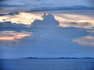
<span class="mw-page-title-main">Balud</span> Municipality in Masbate, Philippines

Balud, officially the Municipality of Balud, is a 4th class municipality in the province of Masbate, Philippines. According to the 2020 census, it has a population of 40,155 people.
<span class="mw-page-title-main">Batuan, Masbate</span> Municipality in Masbate, Philippines

Batuan, officially the Municipality of Batuan, is a 5th class municipality in the province of Masbate, Philippines. According to the 2020 census, it has a population of 14,610 people.

<span class="mw-page-title-main">Cataingan</span> Municipality in Masbate, Philippines

Cataingan, officially the Municipality of Cataingan, is a 2nd class municipality in the province of Masbate, Philippines. According to the 2020 census, it has a population of 50,623 people.

<span class="mw-page-title-main">Dimasalang</span> Municipality in Masbate, Philippines

Dimasalang, officially the Municipality of Dimasalang, is a 4th class municipality in the province of Masbate, Philippines. According to the 2020 census, it has a population of 24,909 people.
<span class="mw-page-title-main">Mandaon</span> Municipality in Masbate, Philippines

Mandaon, officially the Municipality of Mandaon, is a 3rd class municipality in the province of Masbate, Philippines. According to the 2020 census, it has a population of 44,122 people.

<span class="mw-page-title-main">Milagros, Masbate</span> Municipality in Masbate, Philippines

Milagros, officially the Municipality of Milagros, is a 1st class municipality in the province of Masbate, Philippines. According to the 2020 census, it has a population of 57,538 people.

<span class="mw-page-title-main">Mobo, Masbate</span> Municipality in Masbate, Philippines

Mobo, officially the Municipality of Mobo, is a 4th class municipality in the province of Masbate, Philippines. According to the 2020 census, it has a population of 40,823 people.

<span class="mw-page-title-main">Monreal, Masbate</span> Municipality in Masbate, Philippines

Monreal, officially the Municipality of Monreal, is a 4th class municipality in the province of Masbate, Philippines. According to the 2020 census, it has a population of 25,164 people.

<span class="mw-page-title-main">Palanas</span> Municipality in Masbate, Philippines

Palanas, officially the Municipality of Palanas, is a 4th class municipality in the province of Masbate, Philippines. According to the 2020 census, it has a population of 27,322 people.
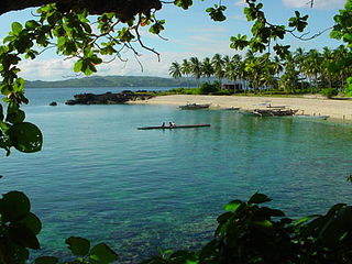
<span class="mw-page-title-main">Pio V. Corpus</span> Municipality in Masbate, Philippines

Pio V. Corpus, officially the Municipality of Pio V. Corpus is a 4th class municipality in the province of Masbate, Philippines. According to the 2020 census, it has a population of 23,744 people.

<span class="mw-page-title-main">Placer, Masbate</span> Municipality in Masbate, Philippines

Placer, officially the Municipality of Placer, is a 2nd class municipality in the province of Masbate, Philippines. According to the 2020 census, it has a population of 56,340 people.

<span class="mw-page-title-main">San Fernando, Masbate</span> Municipality in Masbate, Philippines

San Fernando, officially the Municipality of San Fernando, is a 5th class municipality in the province of Masbate, Philippines. According to the 2020 census, it has a population of 21,600 people.

<span class="mw-page-title-main">San Jacinto, Masbate</span> Municipality in Masbate, Philippines

San Jacinto, officially the Municipality of San Jacinto, is a 4th class municipality in the province of Masbate, Philippines. According to the 2020 census, it has a population of 29,686 people.. San Jacinto is the commercial capital of Ticao Island.
<span class="mw-page-title-main">San Pascual, Masbate</span> Municipality in Masbate, Philippines

San Pascual, officially the Municipality of San Pascual, is a 3rd class municipality in the province of Masbate, Philippines. According to the 2020 census, it has a population of 44,449 people.

<span class="mw-page-title-main">Uson</span> Municipality in Masbate, Philippines

Uson, officially the Municipality of Uson, is a 3rd class municipality in the province of Masbate, Philippines. According to the 2020 census, it has a population of 57,166 people.

<span class="mw-page-title-main">Sagñay</span> Municipality in Camarines Sur, Philippines

Sagñay,, officially the Municipality of Sagñay, is a 4th class municipality in the province of Camarines Sur in the Philippines. It has an land area of 154.76 sq kilometers. According to the 2020 census, it has a population of 36,841 people. Based of this information, there is a population density of 238 people per sq kilometer.

<span class="mw-page-title-main">Siruma</span> Municipality in Camarines Sur, Philippines

Siruma, officially the Municipality of Siruma, is a 4th class municipality in the province of Camarines Sur, Philippines. According to the 2020 census, it has a population of 19,419 people.

References

  1. Municipality of Claveria | (DILG)
  2. "2015 Census of Population, Report No. 3 – Population, Land Area, and Population Density" (PDF). Philippine Statistics Authority. Quezon City, Philippines. August 2016. ISSN   0117-1453. Archived (PDF) from the original on May 25, 2021. Retrieved July 16, 2021.
  3. 1 2 3 Census of Population (2020). "Region V (Bicol Region)". Total Population by Province, City, Municipality and Barangay. Philippine Statistics Authority . Retrieved 8 July 2021.
  4. "PSA Releases the 2018 Municipal and City Level Poverty Estimates". Philippine Statistics Authority. 15 December 2021. Retrieved 22 January 2022.
  5. "Province:". PSGC Interactive. Quezon City, Philippines: Philippine Statistics Authority . Retrieved 12 November 2016.
  6. "Claveria: Average Temperatures and Rainfall". Meteoblue. Retrieved 23 June 2020.
  7. Census of Population (2015). "Region V (Bicol Region)". Total Population by Province, City, Municipality and Barangay. Philippine Statistics Authority . Retrieved 20 June 2016.
  8. Census of Population and Housing (2010). "Region V (Bicol Region)" (PDF). Total Population by Province, City, Municipality and Barangay. National Statistics Office . Retrieved 29 June 2016.
  9. Censuses of Population (1903–2007). "Region V (Bicol Region)". Table 1. Population Enumerated in Various Censuses by Province/Highly Urbanized City: 1903 to 2007. National Statistics Office.{{cite encyclopedia}}: CS1 maint: numeric names: authors list (link)
  10. "Province of". Municipality Population Data. Local Water Utilities Administration Research Division. Retrieved 17 December 2016.
  11. "Poverty incidence (PI):". Philippine Statistics Authority. Retrieved December 28, 2020.
  12. "Estimation of Local Poverty in the Philippines" (PDF). Philippine Statistics Authority. 29 November 2005.
  13. "2003 City and Municipal Level Poverty Estimates" (PDF). Philippine Statistics Authority. 23 March 2009.
  14. "City and Municipal Level Poverty Estimates; 2006 and 2009" (PDF). Philippine Statistics Authority. 3 August 2012.
  15. "2012 Municipal and City Level Poverty Estimates" (PDF). Philippine Statistics Authority. 31 May 2016.
  16. "Municipal and City Level Small Area Poverty Estimates; 2009, 2012 and 2015". Philippine Statistics Authority. 10 July 2019.
  17. "PSA Releases the 2018 Municipal and City Level Poverty Estimates". Philippine Statistics Authority. 15 December 2021. Retrieved 22 January 2022.
  18. "PSA Releases the 2021 City and Municipal Level Poverty Estimates". Philippine Statistics Authority. 2 April 2024. Retrieved 28 April 2024.