Related Research Articles

South Africa occupies the southern tip of Africa, its coastline stretching more than 2,850 kilometres from the desert border with Namibia on the Atlantic (western) coast southwards around the tip of Africa and then northeast to the border with Mozambique on the Indian Ocean. The low-lying coastal zone is narrow for much of that distance, soon giving way to a mountainous escarpment that separates the coast from the high inland plateau. In some places, notably the province of KwaZulu-Natal in the east, a greater distance separates the coast from the escarpment. Although much of the country is classified as semi-arid, it has considerable variation in climate as well as topography. The total land area is 1,220,813 km2 (471,359 sq mi). It has the 23rd largest Exclusive Economic Zone of 1,535,538 km2 (592,875 sq mi).

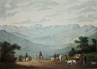
The Drakensberg is the eastern portion of the Great Escarpment, which encloses the central Southern African plateau. The Great Escarpment reaches its greatest elevation – 2,000 to 3,482 metres within the border region of South Africa and Lesotho.

Veld, also spelled veldt, is a type of wide open rural landscape in Southern Africa. Particularly, it is a flat area covered in grass or low scrub, especially in the countries of South Africa, Lesotho, Eswatini, Zimbabwe and Botswana. A certain sub-tropical woodland ecoregion of Southern Africa has been officially defined as the Bushveld by the World Wide Fund for Nature. Trees are not abundant—frost, fire and grazing animals allow grass to grow but prevent the build-up of dense foliage.


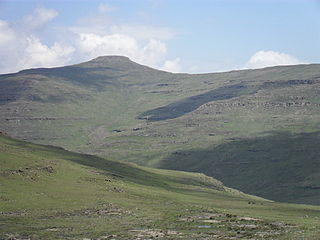
Giant's Castle is a mountain located within the Drakensberg range in KwaZulu-Natal, South Africa. It includes a grassy plateau nestled among the deep valleys of the southern end of the central Drakensberg. Together, the shape of the peaks and escarpment are thought to resemble a sleeping giant's profile; hence, its name.

The Highveld is the portion of the South African inland plateau which has an altitude above roughly 1500 m, but below 2100 m, thus excluding the Lesotho mountain regions to the south-east of the Highveld. It is home to some of the country's most important commercial farming areas, as well as its largest concentration of metropolitan centres, especially the Gauteng conurbation, which accommodates one-third of South Africa's population.

Cathedral Peak is a mountain in KwaZulu-Natal, South Africa. It is a 3,004 m (9,856 ft) high free standing mountain in the Drakensberg. The mountain is also known as Mponjwana by the local Amangwane people.

The Komati River, also known as the Inkomati River or Incomati River, is a river in South Africa, Eswatini and Mozambique. Originating in north-western Eswatini, it is joined by the Crocodile River in the Lebombo Mountains, enters far south-western Mozambique below the border town of Komatipoort, and enters the Indian Ocean around 24 km (15 mi) north-east of Maputo.
Mont-aux-Sources is a mountain in Southern Africa, forming one of the highest portions of the Drakensberg Range. It is mostly within Lesotho, with parts in the KwaZulu-Natal and Free State provinces of South Africa.

The Great Escarpment is a major topographical feature in Africa that consists of steep slopes from the high central Southern African plateau downward in the direction of the oceans that surround southern Africa on three sides. While it lies predominantly within the borders of South Africa, in the east the escarpment extends northward to form the border between Mozambique and Zimbabwe, continuing on beyond the Zambezi river valley to form the Muchinga Escarpment in eastern Zambia. In the west, it extends northward into Namibia and Angola.

Mafadi is a peak on the border of South Africa and Lesotho. At a height of 3,446.1 metres (11,306 ft), it is the highest mountain in the nation of South Africa, but is lower than Thabana Ntlenyana, the highest peak in Lesotho which is, at 3,482 metres (11,424 ft), the highest point in Southern Africa.
The Sneeuberge or Sneeuberg mountain range was historically known as “Sneeuwbergen”, meaning ‘snow mountains’ in Cape Dutch, and refers to a significant portion of Southern Africa's Great Escarpment in the Cradock, Murraysburg, Richmond, Graaff-Reinet, Nieu-Bethesda and Middelburg districts of the Great Karoo, most of which are in the Eastern Cape Province.

Pofadder is a minuscule town in the Northern Cape province of South Africa. In spite of its small size, it is an important local centre in the region known in South Africa as Bushmanland. The surrounding districts are arid, sparsely populated, rugged and picturesque. There is little in the way of cropping and local farmers run sheep or goats for a living. As a tourist destination, it is not sufficiently spectacular to rival the spring flowers of the coastal regions of Namaqualand, but it has its attractions for biologists and conservationists and those with an interest in its remarkable diversity of often-tiny xerophytes and animal life. In recent years, the town economy has been booted by the construction and operation of solar power stations.
Blyde River Canyon Nature Reserve is situated in the Drakensberg escarpment region of eastern Mpumalanga, South Africa. The reserve protects the Blyde River Canyon, including sections of the Ohrigstad and Blyde Rivers and the geological formations around Bourke's Luck Potholes, where the Treur River tumbles into the Blyde below. Southwards of the canyon, the reserve follows the escarpment, to include the Devil's and God's Window, the latter a popular viewpoint to the lowveld at the reserve's southern extremity.

The Maputaland-Pondoland-Albany Hotspot (MPA) is a biodiversity hotspot, a biogeographic region with significant levels of biodiversity, in Southern Africa. It is situated near the south-eastern coast of Africa, occupying an area between the Great Escarpment and the Indian Ocean. The area is named after Maputaland, Pondoland and Albany. It stretches from the Albany Centre of Plant Endemism in the Eastern Cape Province of South Africa, through the Pondoland Centre of Plant Endemism and KwaZulu-Natal Province, the eastern side of Eswatini and into southern Mozambique and Mpumalanga. The Maputaland Centre of Plant Endemism is contained in northern KwaZulu-Natal and southern Mozambique.

Tarucus bowkeri, or Bowker's blue, is a butterfly of the family Lycaenidae. It is found in South Africa, from the Northern Cape, south to fynbos in the West Cape and east to the Amathole Mountains in the Eastern Cape.

Cymothoe alcimeda, the battling glider, is a butterfly of the family Nymphalidae. It is found in South Africa and Zimbabwe.
Popple Peak is a mountain in the Drakensberg range, South Africa. It is located on the border between South Africa and Lesotho, on the watershed that forms the border between the two countries. Popple peak is 3331 m above sea level and has an elevation of approximately 300 metres from the surrounding escarpment. It is the 13th highest peak in South Africa and it is visible from as far away as Estcourt and Ladysmith in the KwaZulu-Natal Midlands.

The Lesotho Highlands are formed by the Drakensberg and Maloti mountain ranges in the east and central parts of the country of Lesotho. Foothills form a divide between the lowlands and the highlands. Snow is common in the highlands in the winter.

Mariepskop, at 1,947 m above sea level, is one of the highest peaks in the northern Drakensberg, and the highest point of the Blyde River Canyon, South Africa. It is situated at the junction of three conservation areas, namely the Mariepskop Forest Reserve, Mariepskop State Forest, and the Blyde River Canyon Nature Reserve. The mountain is bordered by sheer cliff faces on several sides, and is composed of Proterozoic sedimentary rocks of the Transvaal Supergroup. It is named for the 19th century Pulana chief, Maripe Mashile, whose tribe used the mountain as a stronghold. Some infrastructure and roads were built in the 1950s to service a military radar station. Mariepskop is flanked by Tshwateng (1,628 m) at the opposite side of the Blyde River, and by Hebronberg (1,767 m) in the south.
References
- ↑ HAT Taal-en-feitegids. Cape Town: Pearson Education. December 2013. ISBN 978-1-77578-243-8.
- ↑ Boddy-Evans, Marion (2006). Getaway se 1001 moet-sien plekke : plekke om na te gaan, dinge om te doen in Suider-Afrika. Cape Town: Struik. ISBN 978-1-77007-216-9.