
Clonegal, officially Clonegall, is a village in the southeast of County Carlow, Ireland. It is in a rural setting, close to the border between counties Wexford and Carlow, 5 km from Bunclody, County Wexford and 22 km from Carlow town. It is just over a mile north of where the River Slaney and the River Derry meet. Clonegal has a much smaller "twin" village across the River Derry in County Wexford, Watch House Village.

Cloonacool is a village in County Sligo, Ireland.
Clonfert is a small village in east County Galway, Ireland, halfway between Ballinasloe and Portumna. The village gives its name to the Diocese of Clonfert. Clonfert Cathedral is one of the eight cathedral churches of the Church of Ireland, Diocese of Limerick and Killaloe. The cathedral of the Roman Catholic Diocese of Clonfert is located in Loughrea and is home to the Shrine of Our Lady of Clonfert. Three churches lay in this parish, St. Brendan's Eyrecourt, St. Francis Meelick and Clonfert. Its current parish priest (2021) is Fr. Declan McInerney and its bishop Michael Duignan.

Clondulane is a village in north County Cork, Ireland, 3.5m east of Fermoy, just off the Main Fermoy-Dungarvan Road. Originally built as a camp for the workers of a Cork Milling Company grain mill, it now has a population of over 400. Clondulane is part of the Cork East Dáil constituency.
Clonoulty is a small village and a civil parish in County Tipperary, Ireland. It is one of nine civil parishes in the barony of Kilnamanagh Lower. It is also one half of the ecclesiastical parish of Clonoulty-Rossmore in the Roman Catholic Archdiocese of Cashel and Emly. Clonoulty may also refer to a slightly larger area which forms one half of the catchment area for Clonoulty-Rossmore GAA club.
Clanabogan is a small village and townland in County Tyrone, Northern Ireland. In the 2001 Census it had a population of 225 people. It lies within the Omagh District Council area.

Newbridge is a small rural village located in County Galway in Ireland. It is located on a National secondary road, the N63 Galway City - Longford and is 55 km from Galway City and 25 km from Roscommon Town.
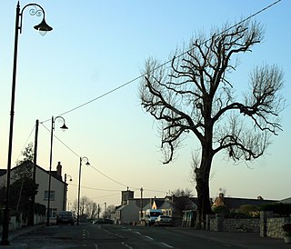
Clonee is a village and a townland in County Meath, Ireland. It borders Fingal to the east at the townlands of Huntstown and Littlepace, and is sometimes used in addresses for housing in those townlands. The River Tolka passes the village.

Shammer is a small village beside the village of Kilkelly in County Mayo, Ireland.

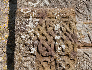
Clonard Abbey was an early medieval monastery situated on the River Boyne in Clonard, County Meath, Ireland.
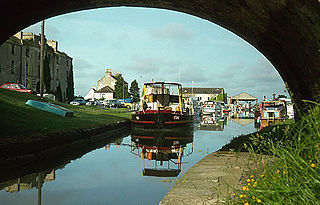
Shannon Harbour a small village on the banks of the Grand Canal of Ireland.
Cloonfush is a townland and village located approximately two miles (3.2 km) from Tuam in County Galway, Ireland. It is substantially surrounded by River Clare, which flows into the Corrib. Adjacent villages are Kilmore, Sylane, and Killaloonty.
Kilkerrin is a village in County Galway, Ireland. It is situated on the R364 regional road 6 km south of the town of Glenamaddy. Features in the area include Kiltullagh Lake and the Lough Lurgeen raised bog.

Tulrahan, also spelt Tulrohaun, is a village in County Mayo, Ireland. It is located off the R327 regional road roughly midway between Claremorris and Cloonfad.
Cloonsheerevagh is a townland in Carrick-on-Shannon in County Leitrim.

Castleblakeney, historically Gallagh, is a village in County Galway, Ireland. It is at the crossroads of the R359 and R339 regional roads, 5km south of the town of Mountbellew.
Cloncollow is a townland in the Parish of Tomregan, Barony of Loughtee Lower, County Cavan, Ireland.
Clonturk is an area on the Northside of Dublin, in Ireland. It is located in the south of the suburb of Drumcondra, just north of the River Tolka, but previously, Clonturk had been an alternative name for Drumcondra and the wider area. Clonturk lies within the Dublin 9 postal district. The name Clonturk translates from the Irish as "Pasture of the boars". There is some evidence that the name originally was Ceann Torc or the "Headland of the boars", but had changed to Clonturk by the middle of the 16th century, perhaps under the influence of the more famous neighbouring placename Clontarf.

Cloondacon or Cloondachon is a townland in the Parish of Aughagower and Barony of Burrishoole in County Mayo. It is bordered to the northeast by Mace South, to the south by Tevinish East, to the southwest by Aughagower, to the west by Gorteen, and to the northwest by the Deerpark.
Cloondacon is situated on Tochar Phádraig, the ancient route from Ballintubber Abbey through Aughagower to Croagh Patrick.

