Clyde Muirshiel Regional Park

Last updated

Clyde Muirshiel Regional Park
Castle Semple Collegiate Church - geograph.org.uk - 876407.jpg
Castle Semple Collegiate Church
Scotland relief location map.jpg
Red pog.svg
Location in Scotland
Location Inverclyde, North Ayrshire and Renfrewshire
Coordinates 55°47′50.8″N4°37′10.2″W / 55.797444°N 4.619500°W / 55.797444; -4.619500
Area280 km2 (110 sq mi) [1]
Governing bodyClyde Muirshiel Park Authority
clydemuirshiel.co.uk
Extent of the park area MuirshielRegPark.jpg
Extent of the park area

Clyde Muirshiel Regional Park is the collective name for areas of countryside set aside for conservation and recreation on the South Clyde estuary in Scotland.

Contents

The park covers an area of 280 km2 (110 sq mi) of Inverclyde, North Ayrshire and Renfrewshire, stretching from Greenock in the north, down the coast to Largs and West Kilbride and inland to Dalry and Lochwinnoch.

There are three visitor centres within the Park Castle Semple Loch, Muirshiel Country Park and The Greenock Cut (formerly Cornalees Bridge), ,.

Muirshiel, a Scots language name, translates to "moorhut" in English. [2]

Origins

Originally a grouse shooting estate, based around Muirshiel House - a shooting lodge among Duchal Moor and Queenside Moor. The estate passed through a number of owners including Lord Howard of Glossop, the Marquess Conyngham. Lord Howard of Glossop sold part of the estate to the county council and to a mining company in the late 1930s and early 1940s. The remainder was sold to Renfrewshire County Council in 1952. [3]

A Regional Park designation for the area was first proposed in 1947. However it was 20 years later that Renfrewshire County Council proposed the Renfrewshire Regional Park and implemented a programme to manage an area of 30,000 acres (12,000 ha) including the creation of Muirshiel Country Park in June 1970. Castle Semple Water Park followed in 1971 and the Cornalees Bridge Visitor Centre opened in 1973. Responsibility for the parks was taken over by Strathclyde Regional Council in 1975 before the Clyde Muirshiel Park Authority came into existence in 1990. The Park Authority oversaw the running of the Park until it was disbanded in 2021. Each local council is now responsible for their section of the Regional Park within their catchment. The Park stretches across Inverclyde, Renfrewshire and North Ayrshire councils.

Facilities within the park

Lunderston Bay Beach and picnic area. Lunderston Bay 25706.jpg
Lunderston Bay Beach and picnic area.

Two Country Parks with visitors centres are located within the regional park at Castle Semple Loch and Muirshiel, together with a separate visitors centre, the Greenock Cut Centre, at Cornalees Bridge, Loch Thom, to explain the Greenock Cut. An outdoor activity centre and boat and bike hire facilities are based at Castle Semple.

The current logo of the park (top) and the Viking longship logo used in the 1970s and 80s. This was also used by Cunninghame District Council on signage for Largs, on the western fringes of the park. The current and previous logos of Clyde-Muirshiel Regional Park authority.jpg
The current logo of the park (top) and the Viking longship logo used in the 1970s and 80s. This was also used by Cunninghame District Council on signage for Largs, on the western fringes of the park.

Community woodlands are to be found at Locherwoods and Outerwards. The sandy beach at Lunderston Bay is connected by a shore walk along the coast to Inverkip. Loch Thom and the Greenock cut provide easy walks in a context of industrial history, and the Collegiate church and Castle Semple are of interest to historians of an earlier era. There are numerous other sites, such as the Haylie Brae, with car parking for visitors to enjoy picnics, good views, wildlife, walks and cycles, and wide opportunities for hillwalking, with Hill of Stake the highest point of the park at 522 metres (1,713 ft).

Activities

Clyde Muirshiel offers year-round instructor led activities include sailing, kayaking, canoeing and raft building on the shallow inland Castle Semple Loch as well as land activities such as archery, mountain biking, hill walking, orienteering, navigation and first aid.

Popular walking routes in the park include the 4 km (2.5 mi)Johnshill Loop and the 12.5 km (7.8 mi)Semple Trail from the visitor centre of Castle Semple, the Greenock Cut route at 11.5 km (7.1 mi) or the shorter 2.5 km (1.6 mi)Shielhill Glen Nature Trail, both from the Greenock Cut visitor centre. [4] [5]

Hill walking routes from the visitor centre at Muirshiel include a 2 km (1.2 mi) trail up to Windy Hill, [6] and a more challenging 10 km (6.2 mi) circular route past the Barytes Mine to Hill of Stake, the highest hill in the Regional Park. Routes from the Greenock Cut visitor centre include a strenuous 5 km (3.1 mi) walk up Dunrod Hill, and a 10 km (6.2 mi) walk over Corlick Hill. [4]

The Sustrans Cycle track

The Sustrans Lochwinnoch Loop Line cycle track runs through the Castle Semple Loch visitors centre. It is 14 miles (23 km) long and is part of the Lochs and Glens Route. It follows the National Cycle Route 75 from Paisley Canal Railway Station to Johnstone and then heads southwest to Kilbarchan, Lochwinnoch and Kilbirnie passing Castle Semple, Barr and Kilbirnie Lochs. Being mainly built on an old railway line it has easy gradients and is mostly traffic free.

National Cycle Route 753 branches south off Route 75 in Gourock to Lunderston Bay, where it passes the toilets and picnic areas within the park, before it continues along the coast of the bay to terminate at Inverkip War Memorial. Short sections of the route are on public roads (Albert Road, Gourock & Harbourside, Inverkip). A separate stretch of Route 753 runs from Seamill to Ardrossan, near the southern extremity of the park.

Sports Clubs at the Loch

The Loch is the home of the following clubs; Castle Semple Sailing Club (founded 1966), Castle Semple Rowing Club and Clyde Windsurfing Club.

Historic sites

The Castle Semple Collegiate church

Castle Semple from the 'Temple' hill. Castle Semple Loch.JPG
Castle Semple from the 'Temple' hill.

This Church was founded and endowed ; it stands near where the original Castle Semple once stood. Castle Semple was a Collegiate church, which means that it was administered and served by a college of canons or prebendaries, presided over by a dean or provost. Collegiate churches were often supported by lands held by the church, endowed here in 1504 by John, 1st Lord Sempill. The church is built in a late Gothic style with a rectangular body and square tower at the west end and a three sided apse at the east end. The Church is in the care of Historic Scotland.

The Castle Semple Temple

Memorial to the MacDowalls of Garthland, latter day owners of the Castle Semple estate. MacDowalls of Garthland and Castle Semple - family memorial.JPG
Memorial to the MacDowalls of Garthland, latter day owners of the Castle Semple estate.
The Castle Semple temple. Castle Semple Temple.JPG
The Castle Semple temple.

The small temple building or folly on the Kenmure Hill knoll to the northern end of Castle Semple loch is one of the few remains of the Castle Semple estate. Col. William MacDowell was responsible for the 'Temple' and also for building of Castle Semple House, which was destroyed by fire in 1935. All that remains of this 900-acre (360 ha) estate is the folly, a walled garden and a pair of gate arches.

Loch Thom and the Greenock cut

Looking back along The Cut from Overton. Greenock Cut 011006 nr Overton.jpg
Looking back along The Cut from Overton.

A freshwater loch known as Shaws Water used to exist at a level high above Greenock until the civil engineer Robert Thom prepared a scheme to turn this into a reservoir, subsequently named after him as Loch Thom. He also created the aqueduct which became known as "The Cut", the whole scheme officially opening on 16 April 1827. The aqueduct supplied both a dependable flow and a good quality of water to the town for both domestic and business purposes.

Leaving Loch Thom at Cornalees, The Cut, with its footpath, runs westward and then turns northward as it follows the contour of Dunrod Hill which it follows round until running directly above the town of Greenock at Overton, having come a distance of 5+12 miles (9 km). It collects some of the water from streams that cross its path, and a series of sluice gates incorporate an ingenious automatic way of releasing surplus water. [7]

Muirshiel Barytes Mine

Seams of Baryte minerals were found in three gullies about 2 kilometres (1.2 mi) north of Hill of Stake, cut into the slope by tributaries of the River Calder, Renfrewshire. Small-scale open cast mining of the baryte began around the mid 18th century, with horizontal tunnels or adits cut to follow the seams of the mineral. Between 1859 and 1920, production was 17,678 long tons (17,962 t). A track was formed running around 4 kilometres (2.5 mi) downhill to a grinding mill sited on the River Calder, where the mineral was dressed or processed. Stables and houses for the workers were built adjacent to the mill, and a bridge crossing the river connected by a lane down to Lochwinnoch. By about 1918 the mine was run by the Muirshiels Mineral Co. of Lochwinnoch, but production ceased in 1920. [8]

Keir and Cawder Ltd. and James Millar Son and Co. Ltd. reopened the mine in 1942. They formed the Muirshiel Barytes Co. in 1947, and constructed new shafts to depths between 64 metres (210 ft) and 64 metres (210 ft). This gave access to veins of baryte of a finer quality, which was taken directly to a dressing plant in Glasgow. Production was 1,580 long tons (1,610 t) in 1944, rising to 16,987 long tons (17,260 t) in 1949. Up to this stage there was no electricity at the mine, and minerals were transported in wagons on rails, moved to the surface by human or horse power. The workforce came from Lochwinnoch and Kilbirnie. In 1960 the mine was taken over by Anglo Austral Mines Ltd., and electrical power was introduced to power winding gear for the wagons and lift them to the surface, where the barytes was loaded into lorries. In 1962 Rio Tinto Zinc became the operator. A new dressing plant was constructed just downhill from the mine, to process output from a lower quality vein. At this time up to 48 people from Lochwinnoch and Kilbirnie worked at the mine, including 11 skilled miners, each with an assistant, as well as maintenance and surface workers. Annual production reached a peak of 16,987 long tons (17,260 t) in 1964. Production ended on 5 September 1969. [8]

When the country park was formed, the Muirshiel Visitor Centre was built a short distance downhill from the pre-1920 site of the mine. The original workings and bridge over the river have fallen into ruin, the track over a new bridge constructed nearby in the 1960s gives access for walkers. Part of the site is used for off-road vehicle driving instruction. At the mine itself, a seismometer transmits measurements by radio to the British Geological Survey [8]

See also

Related Research Articles

<span class="mw-page-title-main">Inverclyde</span> Council area of Scotland

Inverclyde is one of 32 council areas used for local government in Scotland. Together with the East Renfrewshire and Renfrewshire council areas, Inverclyde forms part of the historic county of Renfrewshire, which currently exists as a registration county and lieutenancy area. Inverclyde is located in the west central Lowlands. It borders the North Ayrshire and Renfrewshire council areas, and is otherwise surrounded by the Firth of Clyde.

<span class="mw-page-title-main">Lochwinnoch</span> Human settlement in Scotland

Lochwinnoch is a village in the council area and historic county of Renfrewshire in the west central Lowlands of Scotland. Lying on the banks of Castle Semple Loch and the River Calder, Lochwinnoch is chiefly a residential dormitory village serving nearby urban centres such as Glasgow and Paisley. Its population in 2001 was 2628.

<span class="mw-page-title-main">Kip Water, Inverclyde</span> River in Scotland

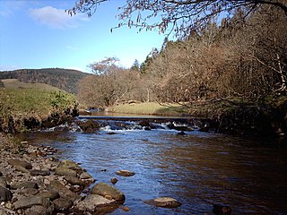
Kip Water, also known as the River Kip, is a short river in Inverclyde, Scotland which gives the village of Inverkip its name. It originates at Cornalees in the hills between Inverkip and Greenock and runs through Shielhill Glen, Dunrod Glen and the Kip Valley before entering the Firth of Clyde at Kip Marina in Inverkip.

<span class="mw-page-title-main">Inverclyde (UK Parliament constituency)</span> Parliamentary constituency in the United Kingdom, 2005 onwards

Inverclyde is a parliamentary constituency of the House of Commons of the Parliament of the United Kingdom. It replaced Greenock and Inverclyde and the Port Glasgow and Kilmacolm areas from West Renfrewshire for the 2005 general election.

<span class="mw-page-title-main">Loch Thom</span> Reservoir, Scotland in Inverclyde

Loch Thom is a reservoir which since 1827 has provided a water supply to the town of Greenock in Inverclyde, Scotland. It is named after the civil engineer Robert Thom who designed the scheme which created the reservoir and delivered water via a long aqueduct known as The Cut. Today, as well as providing a water supply, the loch is used for sport fishing and forms part of the Clyde Muirshiel Regional Park with several attractive walks and a centre at Cornalees Bridge providing nature study facilities.

<span class="mw-page-title-main">Gryffe Reservoirs</span> Reservoir in Scotland, UK

The Gryffe Reservoirs, also spelled 'Gryfe', take their name from the River Gryffe, name deriving from the Gaelic garbh meaning "rough stream". are two reservoirs, known as Gryffe No. 1 and Gryffe No. 2, located in Inverclyde in the west central Lowlands of Scotland.

<span class="mw-page-title-main">Castle Semple Loch</span>

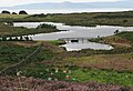
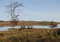
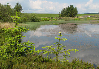
Castle Semple Loch is a 1.5-mile-long (2.5 km) inland freshwater loch at Lochwinnoch in Renfrewshire, Scotland. Originally part of an estate of the same name, it is now administered by Clyde Muirshiel Regional Park as a watersports centre. An RSPB bird sanctuary is located on the loch's southern shore.

<span class="mw-page-title-main">Inverkip</span> Human settlement in Scotland

Inverkip is a village and parish in the Inverclyde council area and historic county of Renfrewshire in the west central Lowlands of Scotland, 5 miles (8 km) southwest of Greenock and 8.1 miles (13 km) north of Largs on the A78 trunk road. The village takes its name from the River Kip and is served by Inverkip railway station.

<span class="mw-page-title-main">Kilmacolm</span> Village in Inverclyde, Scotland

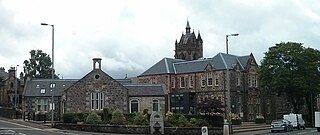
Kilmacolm is a village and civil parish in the Inverclyde council area, and the historic county of Renfrewshire in the west central Lowlands of Scotland. It lies on the northern slope of the Gryffe Valley, 7+12 miles southeast of Greenock and around 15 miles (24 km) west of the city of Glasgow. The village has a population of around 4,000 and is part of a wider civil parish which covers a large rural hinterland of 15,000 hectares containing within it the smaller settlement of Quarrier's Village, originally established as a 19th-century residential orphans' home.

<span class="mw-page-title-main">Renfrewshire (historic)</span> Historic county and lieutenancy area of western Scotland

Renfrewshire or the County of Renfrew is a historic county, registration county and lieutenancy area in the west central Lowlands of Scotland. The lieutenancy area covers the three modern council areas of Inverclyde, Renfrewshire and East Renfrewshire, and this area is occasionally termed Greater Renfrewshire to distinguish it from the modern council area called Renfrewshire. The historic county additionally included territory on the south-western edge of Glasgow which was gradually transferred to the administrative area of the city as it grew.

The Dalry and North Johnstone Line was a branch of the Glasgow and South Western Railway (G&SWR) in Renfrewshire and Ayrshire, Scotland, connecting the stations in Elderslie and Dalry via a route running parallel to the existing line built by the Glasgow, Paisley, Kilmarnock and Ayr Railway. This provided additional line capacity for Ayrshire Coast and Kilmarnock services. The loop line was used for passenger services until the mid-1960s, when it was closed by the Beeching Axe. The majority of the line's trackbed has since been absorbed into the Sustrans National Cycle Network.

<span class="mw-page-title-main">Castle Semple</span> Mansion in Scotland

Castle Semple is a former mansion house located in Renfrewshire, Scotland. It is situated near the eastern end of Castle Semple Loch, within Clyde Muirshiel Regional Park.

<span class="mw-page-title-main">River Calder, Renfrewshire</span> River in Renfrewshire , Scotland

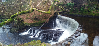
The River Calder is a river mainly within Renfrewshire, Scotland.

The Duchal Moor Railway was a 2 ft narrow-gauge railway built in the 1920s to carry shooting parties to the grouse moors of Duchal Moor and the Muirshiel Hills, within the Clyde Muirshiel Regional Park, 3 miles (5 km) west-southwest of Kilmacolm in Scotland. It closed in the late 1970s.

<span class="mw-page-title-main">Lands of Elliston</span>

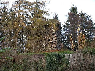
The lands of Elliston, previously Elliotston or Eliotstoun or Elliestoun in the Parish of Lochwinnoch were part of the holdings of the Barony of Elliston, later a part of the Castle Semple barony and estates. The ruins of the castle lie a short distance from Howwood in Renfrewshire in a private garden on a minor road between the A737 and the B776. The name may have derived from earlier holders of the lands, however the Sempill family held them since at least 1220. The castle was abandoned circa 1550 when John Sempill, 1st Lord Sempill moved to a new castle at Castleton which he renamed Castle Semple.

<span class="mw-page-title-main">Walls Loch</span> Freshwater loch in Renfrewshire, Scotland

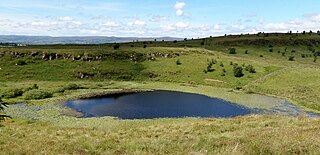
Walls Loch is situated at a height of 560 feet, below the Walls Hill Iron Age fort and to the east of Broadfield Hill on the lands of North Castlewalls Farm, Whittliemuir, Howwood, Renfrewshire, Scotland.

<span class="mw-page-title-main">Windy Hill, Renfrewshire</span> Hill in Scotland

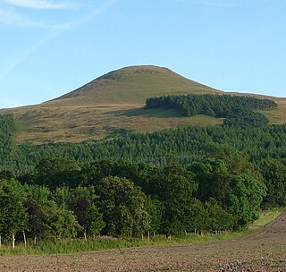
Windy Hill is a 316 metres (1.037 feet) high hill in Renfrewshire, Scotland. It is one of the TuMPs of the Lowlands.

<span class="mw-page-title-main">Inverclyde South West (ward)</span>

Inverclyde South West is one of the seven wards used to elect members of the Inverclyde Council. It elects three Councillors.

<span class="mw-page-title-main">Regional parks of Scotland</span>

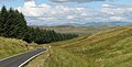
The regional parks of Scotland are areas of attractive countryside that are of importance for recreation due to their proximity to population centres. The parks are defined to co-ordinate the management of these areas by providing visitor facilities such as car parks, footpaths, ranger services and visitor centres.

References

  1. Devine-Wright, Patrick (201). "The Wings Law Project". Renewable Energy and the Public: From NIMBY to Participation. Routledge. p. 268. ISBN   1136530266 . Retrieved 5 March 2019.
  2. "Dictionaries of the Scots Language:: SND :: Shiel n v1".
  3. "A History of Muirshiel House and Shooting Estate" (PDF). Clyde Muirshiel Regional Park.
  4. 1 2 "Walking Routes". Clyde Muirshiel Regional Park. Archived from the original on 24 April 2020. Retrieved 7 September 2020.
  5. "Greenock Cut, Inverclyde". Walkhighlands. Retrieved 7 September 2020.
  6. "Windy Hill, Muirshiel Country Park". Walkhighlands. Retrieved 7 September 2020.
  7. Monteith, Joy (2004).Old Greenock.Stenlake Publishing Ltd. ISBN   1-84033-314-6
  8. 1 2 3 "Muirshiel Barytes Mine" (PDF). Clyde Muirshiel Regional Park. 2009.


Views of Clyde Muirshiel - 2007