Coastal erosion in Yorkshire

Last updated

Coastal erosion in Yorkshire
Mill Lane at Cobble Gap - geograph.org.uk - 3779518.jpg
Mill Lane at Cobble Gap - the road drops off over a cliff behind the barriers
Location
Coordinates 54°08′56″N0°05′17″W / 54.149°N 0.088°W / 54.149; -0.088
Property damageLoss of dwellings and roads

Coastal erosion in Yorkshire has been a process that has been documented since Roman times. Rates of coastal erosion on the Holderness coast are known to be some of the worst within Europe, with the East Riding (and Norfolk) coastlines having the greatest number of at risk properties in England. Almost 30 settlements on the Holderness coastline have been lost to the sea, with more being subjected to flooding and loss exacerbated by a projected rise in the sea level caused by climate change. Due to the limited protection from effects of rising seas in the Humber Estuary, the region has the greatest value of assets at risk from flooding than anywhere else in England.

Contents

Background

The coastline of Holderness consists of unprotected boulder clay cliffs which have been subjected to heavy erosion from the sea. Detailed analysis shows that much of the material lost from Holderness is swept down the coast to be deposited on Spurn Head. [1] It is estimated that since Roman times, at least 30 settlements have been washed away by the action of the sea, with the boulder clay of the Holderness Coast being particularly susceptible to erosion. [2] Coastal erosion on the Yorkshire coast has long been acknowledged; the town of Ravenser Odd, located south and east of the present Spurn Head, was washed away by several high tides and sea swells in the 14th century, [3] the lighthouse at Withernsea, built in 1892, was located some 0.48 kilometres (0.3 mi) inland due to the land at the coast being sand dunes and constantly eroded, [4] [5] and a book published in 1912, The Lost Towns of the Yorkshire Coast, estimated that the coast had been eroding at a rate of 2.1 metres (7 ft) a year. [6] However, detailed study of mapping has indicated that between 1852 and 1952, the rate was at a lesser loss of 1.2 metres (3 ft 11 in) on average each year. [7] [note 1] The harder rocks of the North Yorkshire coastline (assessed between the mouth of the Tees and Ravenscar), retreated at a loss rate of 0.04 metres (1.6 in) during the same period. [10]

Settlements along the North Yorkshire coast have been partially lost to the sea; the main road into the seaside village of Robin Hood's Bay was lost in 1780, and most of the village of Kettleness was lost in December 1829. [11] Throughout the early part of the 20th century, houses were still being lost to the sea at Robin Hood's Bay; one story from 1946 tells of a woman sitting down to tea in her front room (facing westwards towards the landward side), and parts of the back of her house sliding 65 feet (20 m) into the sea. [12] [13] Further losses prompted the county council to build a seawall which is 500-foot (150 m) long , and 40-foot (12 m) high, costing £578,000 (equivalent to £5,158,000in 2021). [14] However, the loss at Kettleness was in part owing to alum quarrying on the shore below the clifftop village. Whitby has historically suffered from coastal erosion, most notably on the cliff edge by St Mary's Church, which has meant that some of the graves in the churchyard have been lost to the sea. [15]

Post-glacial rebound in British Isles Post-glacial rebound in British Isles.PNG
Post-glacial rebound in British Isles

A 2002 study suggested that the sea-level rise at the Yorkshire coast could be anywhere between 15 centimetres (5.9 in) and 75 centimetres (30 in) by 2080. [16] However, a process known as isostatic adjustment, means that when the ice sheets melt, the top half of the United Kingdom will raise up, and the southern tilt down. As a result, there will be fewer areas at risk in far north of North Yorkshire than in the East Riding of Yorkshire. [17] the line of demarcation between the stable lands and those rising is said to run along the Tees Valley. [18]

A year–on–year average of a 3-millimetre (0.12 in) rising sea level has been the norm with isostatic adjustment, but coupled with rising sea levels due to global warming, this year–on–year average is expected to be around the 8-millimetre (0.31 in) mark. [19] In 2022, the chief executive of the Environment Agency, Sir James Bevan, suggested that for coastal communities, such as those living on the East Riding coast (Holderness), moving away would be the only option compared to inland locations at the risk of rainfall flooding, where some preventative measures can be taken. [20] The policy for coastal erosion is to allow all natural processes to continue as they are, and only focus anti-flooding measures such as sea walls and beach defences, on existing towns such as Bridlington, Hornsea and Withernsea. [21] The Holderness coast is said to be being eroded at a rate of 120 metres (390 ft) per century due to its glacial drift geology, whereas the North Yorkshire coast between Whitby and Redcar is estimated to be retreating at a rate of 9 metres (30 ft) per century. [22]

Areas affected

Rising sea levels will exacerbate the coastal erosion problems by 2100, with some estimates stating that the rate of coastal erosion will increase by between three and seven times the early 21st century rate of erosion. [23] Mostly, the rising sea levels will affect coastal communities, but also any low-lying areas near to major rivers and estuaries. The East Riding of Yorkshire will suffer greatly, and coastal erosion rates will increase due to the sea level rising. The city of Hull is a basin that can be affected by groundwater, rainwater and the tides: in 2018, it was estimated that 90% of Hull is below the high tide line. [24] Hull is second only to London in British cities at risk of flooding, and only 2% of land in Hull is deemed to not be at risk of flooding. [25] As the Humber Estuary has little or no protection from the sea (unlike London which has the Thames Barrier), the Yorkshire and Humber region have the greatest number of assets in England at risk of being flooded or overwhelmed by the sea. [26] Another threat, known as "Coastal Squeeze", would mean the loss of many intertidal mudflats which are important to wildlife. Conservative modelling and estimates show that up to 7% of the intertidal mudflat areas of the Humber Estuary could be lost by 2050. [27]

Around 195 homes along the East Yorkshire coast are expected to be at risk of being lost to the sea by 2105, with 18 of those being at threat by 2025. [2] The shore and cliffs along the Holderness coast, specifically between Bridlington and Withernsea, are known to be on the fastest eroding coastline in Europe. [28] Alongside the Norfolk Coast, the East Riding of Yorkshire has the greatest number of homes at risk due to coastal erosion in England. [29] [30] However, without rising sea levels and the effects of climate change, the coastline of Yorkshire, especially the Holderness Coast, would be affected by the natural processes of the tides, winds and waves which will erode and redistribute the sediment elsewhere. [31] One notable location which is expected to be lost to the sea is Skipsea; whilst other locations on the coast have been provided with sea defences, Skipsea has not, and the coast there eroded over 9 metres (30 ft) in 2019 alone due to storms. [32] [6]

The former RAF bombing range at Cowden has been problematic as the erosion keeps revealing unexploded ordnance, with people warned to stay away from items found on the beach. This area will remain off-limits due to the dangers, and the England Coast Path will be moved inland away from the coastline at this point. [33] The Hollym water treatment works was upgraded in 1991, and at that time, it was 168 metres (551 ft) from the shoreline, by 2018, it was only 40 metres (130 ft) distant from the coast. It was moved further inland in 2020. [34] The Environment Agency's National Coastal Erosion Risk Mapping (NCERM) dataset lists several hamlets and villages at risk from being flooded or collapsing into the sea in the East Riding of Yorkshire by 2100. [35]

Not many areas in North Yorkshire will be affected apart from Runswick Bay, [36] and the River Esk estuary extending inland at Whitby. [37] One area being studied for possible erosion due to rising sea states, is Scalby in North Yorkshire. Despite being a rocky foreshore and cliffs, the rate of loss at Scalby is predicted to be as much as 22 metres (72 ft) in the 80 years between 2020 and 2100. [38]

Sea protection

Some of the towns and villages along the Yorkshire coast have been given protection from the North Sea, either in the form of groynes (typically pre-dating the 20th century), breakwaters, concrete sea walls or rock armour. The Holderness coast stretches for 85 kilometres (53 mi), of which 73 kilometres (45 mi) is not defended, with the remaining 12 kilometres (7.5 mi) a mix of public and privately funded defences. [39] In 2020, 63,000 tonnes (69,000 tons) of rock armour was used to defend the A1033 and roads in the south of Withernsea. [40] Additionally, some defences have been cobbled together from concrete structures left over from the Second World War, such as defences against an invasion force using tanks. [41]

Another possible threat to defences is from a reduced sea level. The possibility of melting sea ice in the North Atlantic may actually precipitate a cooling of the sea, and affect the thermohaline circulation system, particularly in the case of the United Kingdom, the Gulf Stream. This cooler water system could lead to lower sea levels, and whilst sea defences run the risk of being over-topped by rising seas, a lower sea level may work away at the foundations of sea defences and cause them to fail or collapse. [51]

Lost settlements

A list of villages and towns lost to coastal erosion on the Yorkshire coast Coastal erosion on the Yorkshire Coast.svg
A list of villages and towns lost to coastal erosion on the Yorkshire coast
Coastal erosion, debris at Kilnsea Coastal erosion, debris at Kilnsea - geograph.org.uk - 700651.jpg
Coastal erosion, debris at Kilnsea

Holderness coast

Humber Estuary

North Yorkshire coast

See also

Notes

  1. The Holderness coast suffered form the most erosion during this period in the areas that were studied; Norfolk's coastline retreated at a rate of 0.9 metres (2 ft 11 in) a year on average, and the coast of Suffolk lost land at a rate of 0.8 metres (2 ft 7 in). [8] Another estimate stated that the average loss per year between 1852 and 1952 was 2.75 metres (9 ft 0 in). [9]

Related Research Articles

<span class="mw-page-title-main">Coast</span> Area where land meets the sea or ocean

The coast, also known as the coastline, shoreline or seashore, is defined as the area where land meets the ocean, or as a line that forms the boundary between the land and the coastline. Shores are influenced by the topography of the surrounding landscape, as well as by water induced erosion, such as waves. The geological composition of rock and soil dictates the type of shore which is created. The Earth has around 620,000 kilometres (390,000 mi) of coastline. Coasts are important zones in natural ecosystems, often home to a wide range of biodiversity. On land, they harbor important ecosystems such as freshwater or estuarine wetlands, which are important for bird populations and other terrestrial animals. In wave-protected areas they harbor saltmarshes, mangroves or seagrasses, all of which can provide nursery habitat for finfish, shellfish, and other aquatic species. Rocky shores are usually found along exposed coasts and provide habitat for a wide range of sessile animals and various kinds of seaweeds. In physical oceanography, a shore is the wider fringe that is geologically modified by the action of the body of water past and present, while the beach is at the edge of the shore, representing the intertidal zone where there is one. Along tropical coasts with clear, nutrient-poor water, coral reefs can often be found between depths of 1–50 meters.

<span class="mw-page-title-main">Spurn</span> Tidal island in the East Riding of Yorkshire, England

Spurn is a narrow sand tidal island located off the tip of the coast of the East Riding of Yorkshire, England that reaches into the North Sea and forms the north bank of the mouth of the Humber Estuary. It was a spit with a semi-permanent connection to the mainland, but a storm in 2013 made the road down to the end of Spurn impassable to vehicles at high tide.

<span class="mw-page-title-main">Coastal erosion</span> Displacement of land along the coastline

Coastal erosion is the loss or displacement of land, or the long-term removal of sediment and rocks along the coastline due to the action of waves, currents, tides, wind-driven water, waterborne ice, or other impacts of storms. The landward retreat of the shoreline can be measured and described over a temporal scale of tides, seasons, and other short-term cyclic processes. Coastal erosion may be caused by hydraulic action, abrasion, impact and corrosion by wind and water, and other forces, natural or unnatural.

<span class="mw-page-title-main">East Riding of Yorkshire</span> County of England

The East Riding of Yorkshire, often abbreviated to the East Riding or East Yorkshire, is a ceremonial county in the Yorkshire and the Humber region of England. It borders North Yorkshire to the north and west, South Yorkshire to the south-west, and Lincolnshire to the south across the Humber Estuary. The city of Kingston upon Hull is the largest settlement.

<span class="mw-page-title-main">Hornsea</span> Town and civil parish in the East Riding of Yorkshire, England

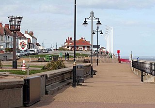
Hornsea is a seaside town and civil parish in the East Riding of Yorkshire, England. The settlement dates to at least the early medieval period. The town was expanded in the Victorian era with the coming of the Hull and Hornsea Railway in 1864. In the First World War the Mere was briefly the site of RNAS Hornsea Mere, a seaplane base. During the Second World War the town and beach was heavily fortified against invasion.

<span class="mw-page-title-main">Holderness</span> Region of England

Holderness is an area of the East Riding of Yorkshire, on the north-east coast of England. An area of rich agricultural land, Holderness was marshland until it was drained in the Middle Ages. Topographically, Holderness has more in common with the Netherlands than with other parts of Yorkshire. To the north and west are the Yorkshire Wolds. Holderness generally refers to the area between the River Hull and the North Sea. The Prime Meridian passes through Holderness just to the east of Patrington and through Tunstall to the north.

<span class="mw-page-title-main">Minsmere</span>

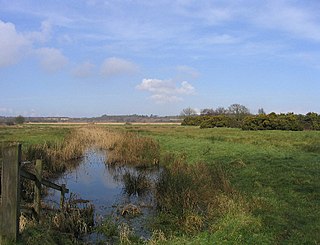
Minsmere is a place in the English county of Suffolk. It is located on the North Sea coast around 3.5 miles (5.6 km) north of Leiston and 1.5 miles (2.4 km) south-east of Westleton within the Suffolk Coast and Heaths AONB. It is the site of the Minsmere RSPB reserve and the original site of Leiston Abbey.

<span class="mw-page-title-main">Mappleton</span> Village and civil parish in the East Riding of Yorkshire, England

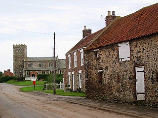
Mappleton is a village and civil parish in the East Riding of Yorkshire, England. It is situated on the North Sea coastline in an area known as Holderness, lying approximately 3 miles (5 km) south of the seaside resort of Hornsea. The civil parish is formed by the village of Mappleton and the hamlets of Cowden, Great Cowden and Rolston. According to the 2011 UK census, Mappleton parish had a population of 342, an increase on the 2001 UK census figure of 249.

<span class="mw-page-title-main">Coastal management</span> Preventing flooding and erosion of shorelines

Coastal management is defence against flooding and erosion, and techniques that stop erosion to claim lands. Protection against rising sea levels in the 21st century is crucial, as sea level rise accelerates due to climate change. Changes in sea level damage beaches and coastal systems are expected to rise at an increasing rate, causing coastal sediments to be disturbed by tidal energy.

<span class="mw-page-title-main">Aldbrough, East Riding of Yorkshire</span> Village and civil parish in the East Riding of Yorkshire, England

Aldbrough is a village and civil parish in the East Riding of Yorkshire, England, about 12 miles (19 km) north-east of Hull at the junction of the B1242 and B1238 roads. It lies near to the North Sea coast within the area of Holderness.

<span class="mw-page-title-main">Barmston, East Riding of Yorkshire</span> Village in the East Riding of Yorkshire, England

Barmston is a village and civil parish in the East Riding of Yorkshire, England. It is situated on the Holderness coast, overlooking the North Sea and to the east of the A165 road. Barmston is approximately 6 miles (10 km) south of Bridlington town centre. The parish includes the village of Fraisthorpe, the former villages of Auburn and Hartburn have been abandoned due to coastal erosion. Barmston is mentioned in the Domesday Book as having eight ploughlands and belonging to Drogo of la Beuvrière. The name of the village derives from Beorn's Tūn. According to the 2011 UK census, Barmston and Fraisthorpe parish had a population of 275, a slight decrease on the 2001 UK census figure of 277. The parish covering an area of 1,765.014 hectares.

<span class="mw-page-title-main">Barton on Sea</span> Human settlement in England

Barton on Sea is a cliff-top village in Hampshire, England close to the town of New Milton, which is its civil parish to the north. As a settlement, Barton has a history dating back to Anglo-Saxon times. Barton is notable for the many fossils to be found in the Barton geological beds in the cliffs, as well as for the significant sea defences built to guard the cliffs against coastal erosion. Barton on Sea is a very popular retirement location. Approximately 36% of the population is retired. The population of Barton in the 2001 census was 6,849.

<span class="mw-page-title-main">Ravenspurn</span> Former town in the East Riding of Yorkshire, England

Ravenspurn was a town in the East Riding of Yorkshire, England, which was lost due to coastal erosion, one of more than 30 along the Holderness Coast which have been lost to the North Sea since the 19th century. The town was located close to the end of a peninsula near Ravenser Odd, which had been flooded in the 14th century. The peninsula still survives and is known as Spurn Head. The North Sea lies to the east of the peninsula, the Humber estuary to the west.

<span class="mw-page-title-main">Tunstall, East Riding of Yorkshire</span> Village in the East Riding of Yorkshire, England

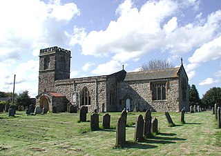
Tunstall is a village in the civil parish of Roos, in Holderness, in the East Riding of Yorkshire, England, close to the North Sea coast. It is situated approximately 3 miles (4.8 km) north-west of the town of Withernsea, and less than 0.6 miles (1 km) from the North Sea coast, at a height of 10 to 15 m above sea level, and close to the Prime Meridian at its northernmost point on land anywhere in the world.

<span class="mw-page-title-main">Geology of England</span> Overview of the geology of England

The geology of England is mainly sedimentary. The youngest rocks are in the south east around London, progressing in age in a north westerly direction. The Tees–Exe line marks the division between younger, softer and low-lying rocks in the south east and the generally older and harder rocks of the north and west which give rise to higher relief in those regions. The geology of England is recognisable in the landscape of its counties, the building materials of its towns and its regional extractive industries.

Beach evolution occurs at the shoreline where sea, lake or river water is eroding the land. Beaches exist where sand accumulated from centuries-old, recurrent processes that erode rocky and sedimentary material into sand deposits. River deltas deposit silt from upriver, accreting at the river's outlet to extend lake or ocean shorelines. Catastrophic events such as tsunamis, hurricanes, and storm surges accelerate beach erosion.

<span class="mw-page-title-main">Holmpton</span> Village and civil parish in the East Riding of Yorkshire, England

Holmpton is a village and civil parish in the East Riding of Yorkshire, England, in an area known as Holderness. It is situated approximately 3 miles (5 km) south of Withernsea town centre and 3 miles (5 km) east of the village of Patrington. It lies just inland from the North Sea coast.

<span class="mw-page-title-main">Coastal hazards</span>

Coastal hazards are physical phenomena that expose a coastal area to the risk of property damage, loss of life, and environmental degradation. Rapid-onset hazards last a few minutes to several days and encompass significant cyclones accompanied by high-speed winds, waves, and surges or tsunamis created by submarine (undersea) earthquakes and landslides. Slow-onset hazards, such as erosion and gradual inundation, develop incrementally over extended periods.

Owthorne is an area of the town of Withernsea, on the Holderness coast in the East Riding of Yorkshire, England.

<span class="mw-page-title-main">Yorkshire Coast</span> Coastline of Yorkshire, England

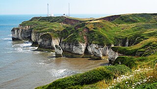
The Yorkshire Coast runs from the Tees estuary to the Humber estuary, on the east coast of England. The cliffs at Boulby are the highest on the east coast of England, rising to 660 feet (200 m) above the sea level.

References

  1. De Boer 1964, p. 71.
  2. 1 2 Wood, Alexandra (31 January 2023). "200 homes in region 'could be lost to the sea'". The Yorkshire Post. p. 5. ISSN   0963-1496.
  3. De Boer 1964, p. 83.
  4. Pevsner, Nikolaus (2002) [1995]. Yorkshire : York and the East Riding (2 ed.). London: Yale University Press. p. 89. ISBN   0300095937.
  5. 1 2 Richardson, Nigel (28 January 2023). "Catch this vanishing coastline whilst you can". The Daily Telegraph. No. 52, 163. Travel. p. 9. ISSN   0307-1235.
  6. 1 2 Behrens, David (25 September 2019). "Lost to the world: east coast's vanished villages". The Yorkshire Post. p. 3. ISSN   0963-1496.
  7. Cambers 1976, p. 247.
  8. Cambers 1976, p. 247–248.
  9. De Boer 1964, p. 72.
  10. Cambers 1976, p. 248.
  11. 1 2 Waters, Colin (2012). North Yorkshire coastal villages then & now. Stroud: History. pp. 42, 64. ISBN   0752467913.
  12. Pennock, Richard (2002). Robin Hood's Bay: as I have known it. Whitby: Caedmon Press. p. 57. ISBN   0905355563.
  13. "Many Rivers In Flood". The Times. No. 50618. 26 November 1946. p. 4. ISSN   0140-0460. The kitchen of a house in King Street Robin Hood's Bay, Whitby, fell 65ft into the sea when the cliff collapsed.
  14. Gower, E. (1978). Robin Hood's Bay. Clapham: Dalesman Books. p. 12. ISBN   0852064624.
  15. Thompson, Ian; Frost, Roger (2016). Secret Whitby. Stroud: Amberley. p. 43. ISBN   978-1-4456-5251-1.
  16. Darch & Wade 2002, p. 24.
  17. "New coastland map could help strengthen sea defences - Durham University". www.dur.ac.uk. Retrieved 9 November 2021.
  18. Long 2003, p. 71.
  19. "Coastal change in the East Riding". www.eastriding.gov.uk. Retrieved 9 November 2021.
  20. Sutton, Harriet (8 June 2022). "Rising sea levels 'could force UK towns and villages to relocate'". The Yorkshire Post. p. 6. ISSN   0963-1496.
  21. YWAD 2021, p. 68.
  22. Darch & Wade 2002, p. 27.
  23. Wood, Alexandra (22 November 2022). "Rocky coast could erode by 72ft say scientists". The Yorkshire Post. p. 5. ISSN   0963-1496.
  24. Walsh, Stephen (3 January 2018). "'Does Hull have a future?' City built on a flood plain faces sea rise reckoning". The Guardian. Retrieved 9 November 2021.
  25. "COP26: Flooding lessons from Hull, a city below sea level". BBC News. 12 November 2021. Retrieved 13 November 2021.
  26. Darch & Wade 2002, p. 25.
  27. Long 2003, p. 84.
  28. Halliday, Josh (19 January 2020). "Treat coastal erosion as a natural catastrophe, UK ministers urged". The Guardian. Retrieved 2 February 2023.
  29. "Happisburgh: The Norfolk village crumbling into the sea". BBC News. 31 December 2022. Retrieved 13 March 2023.
  30. National Flood and Coastal Erosion Risk Management Strategy for England. London: HMSO. 2020. p. 57. ISBN   978-1-5286-1791-8.
  31. Long 2003, p. 81.
  32. Halliday, Josh (18 January 2020). "'It's a monster': the Skipsea homes falling into the North Sea". The Guardian. Retrieved 12 March 2024.
  33. Wood, Alexandra (11 March 2023). "Coast trail diverted by ex-bombing range site". The Yorkshire Post. p. 8. ISSN   0963-1496.
  34. Wood, Alexandra (12 March 2020). "Work starts on £26m inland sewage plant on fast eroding Yorkshire coastline". The Yorkshire Post. Retrieved 24 March 2023.
  35. "Coastal erosion: Climate group warns communities of cost". BBC News. 31 January 2023. Retrieved 12 March 2024.
  36. "Yorkshire Water - Climate change and carbon". www.yorkshirewater.com. Retrieved 9 November 2021.
  37. YWAD 2021, p. 71.
  38. Blakely, Rhys (19 November 2022). "Cliffs could crumble ten times faster as erosion takes its toll". The Times. No. 73945. p. 20. ISSN   0140-0460.
  39. "Defending the East Riding Coastline" (PDF). eastriding.gov.uk. p. 2. Retrieved 2 February 2023.
  40. Moore, Catherine (18 June 2020). "Norwegian rock arrives in East Yorkshire for coastal defence scheme". New Civil Engineer. Retrieved 2 February 2023.
  41. "An Assessment of Opportunities for the Ecological Enhancement of Coastal Infrastructure in North and East Yorkshire" (PDF). yorkshiremarinenaturepartnership.org.uk. April 2022. pp. 38, 65. Retrieved 17 November 2023.
  42. 1 2 3 4 5 6 7 Pye & Blott 2015, p. 790.
  43. 1 2 "Final piece of Redcar sea wall slotted into place". BBC News. 14 October 2012. Retrieved 6 February 2024.
  44. Brew, David. "Appendix K3: Filey and Cayton Bay Coastal Strategy Cliff Overview". www.researchgate.net. p. 48. Retrieved 6 February 2024.
  45. 1 2 3 4 "Cliff works under way to save villages from the sea". The Northern Echo. 4 July 2001. Retrieved 17 November 2023.
  46. "Robin Hood's Bay: Coastal erosion and geology" (PDF). northyorkmoors.org.uk/. Retrieved 2 February 2023.
  47. "Saltburn: Council urged to preserve historic sea wall". BBC News. 8 July 2023. Retrieved 6 February 2024.
  48. "England's Historic Seascapes Scarborough to Hartlepool and Adjacent Marine Zone Historic Seascape Characterisation" (PDF). archaeologydataservice.ac.uk. March 2007. p. 125. Retrieved 17 November 2023.
  49. "England's Historic Seascapes Scarborough to Hartlepool and Adjacent Marine Zone Historic Seascape Characterisation" (PDF). archaeologydataservice.ac.uk. March 2007. p. 124. Retrieved 17 November 2023.
  50. Bulmer, Emily (15 November 2022). "A response to Tees Valley Mayor, Ben Houchen's statement regarding access rights at South Gare". pdports.co.uk. Retrieved 6 February 2023.
  51. Long 2003, pp. 82–85.
  52. 1 2 3 4 5 6 7 8 9 10 11 12 13 14 15 16 17 18 19 20 21 Sheppard, Thomas (1912). The lost towns of the Yorkshire coast and other chapters bearing upon the geography of the district. London: A. Brown and Sons. p. iv. OCLC   1048794726.
  53. Historic England. "Hallgarth medieval hall and moat (1013705)". National Heritage List for England . Retrieved 13 March 2024.
  54. Russel, Stuart (31 July 1975). "Owthorne and the final tragedy, and the last days of Colden Parva". Hull Daily Mail. No. 27, 909. p. 8. ISSN   1741-3419.
  55. 1 2 Kent, G. H. R., ed. (1969). A History of the county of York, East Riding. London: Published for the Institute of Historical Research by Oxford U.P. p. 273. ISBN   9780197227978.
  56. 1 2 3 Wood, Alexandra (24 October 2019). "Clifftop homes and road in Yorkshire threatened by coastal erosion saved by £3 million grant from Europe". The Yorkshire Post. Retrieved 12 March 2024.
  57. Wainwright, Martin (24 September 2012). "Yorkshire is disappearing up to three times as fast as last year". The Guardian. Retrieved 12 March 2024.
  58. 1 2 Allison, Keith John (1976). The east-riding of Yorkshire Landscape. London: Hodder & Stoughton. p. 253. ISBN   0340158212.
  59. Atkinson, Emily (17 March 2022). "Yorkshire's 'lost Atlantis nearly found' after 650 years under water". The Independent. Retrieved 12 March 2024.
  60. Pybus, David; Rushton, John (1991). "4: Alum and the Yorkshire coast". In Lewis, David B (ed.). The Yorkshire coast. Beverley: Normandy Pr. p. 54. ISBN   0950766534.

Sources