Kent is a county in South East England and one of the home counties. It borders Greater London to the north-west, Surrey to the west and East Sussex to the south-west. The county also shares borders with Essex along the estuary of the River Thames, and with the French department of Pas-de-Calais through the Channel Tunnel. The county town is Maidstone.
Pratt's Bottom is a village in Greater London, England, within the London Borough of Bromley and the historic county of Kent. It is south of its parent parish of Orpington, and beyond London's urban sprawl.
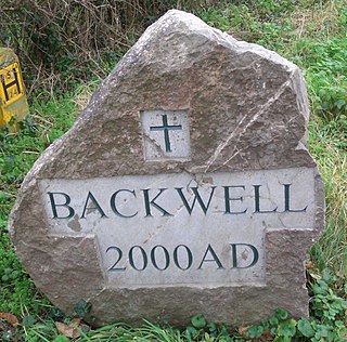
In many parts of England an ornamental village sign is erected to announce the village name to those entering the village. They are typically placed on the principal road entrance or in a prominent location such as a village green. The design often depicts a particularly characteristic feature of the village or a scene from its history, heritage, or culture. They are typically made of wood or metal or a combination of both, the designs are often made by the local community.
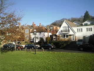
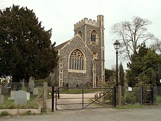
Otford is a village and civil parish in the Sevenoaks District of Kent, England. It lies on the River Darent, 3 miles (5 km) north of Sevenoaks.
Havering-atte-Bower is a village and outlying settlement of Romford in Greater London, England. It is located in the far north of the London Borough of Havering, on the border with Essex, and is 15 miles (24 km) northeast of Charing Cross. It was one of three former parishes whose area comprised the historic Royal Liberty of Havering.

Collier Street is a small village and civil parish in the Borough of Maidstone in Kent, England.

Bearsted is a village and civil parish with railway station in mid-Kent, England, two miles (3.2 km) east of Maidstone town centre.

Cranbrook is a small town in the civil parish of Cranbrook and Sissinghurst, in the Weald of Kent in South East England. It lies roughly half-way between Maidstone and Hastings, about 38 miles (61 km) southeast of central London.
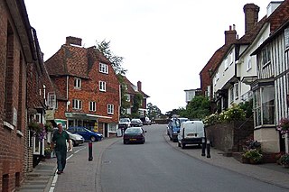
Goudhurst is a village and civil parish in the borough of Tunbridge Wells in Kent, England. It lies in the Weald, around 12 miles (19 km) south of Maidstone. The village stands on a crossroads, where there is a large pond. It is also in the Cranbrook School catchment area.

Meopham is a large linear village and civil parish in the Borough of Gravesham in Kent, England, lying to the south of Gravesend. The parish covers 6.5 square miles (17 km2), and comprises two villages and two smaller settlements; it has a population of 6,427 increasing slightly to 6,722 at the 2011 census. Meopham is sometimes described as the longest in England although others such as Brinkworth, Wiltshire make the same claim. Meopham is one of the longest linear settlements in Europe, being 7 miles (11 km) in length.

Borough Green is an unclassified English urban community and a civil parish in the borough of Tonbridge and Malling in Kent, England. The central area is situated on the A25 road between Maidstone and Sevenoaks, with the M26 motorway running through it within a mile of the centre.

New Ash Green is a village in the Sevenoaks District of Kent, England, located 7.5 miles (12 km) south-west of Gravesend and 10.5 miles (17 km) north-east of Sevenoaks.

Hartley is a village and civil parish in the Sevenoaks district of Kent, England. It is located around 4.5 miles (7 km) southwest of Gravesend and just south of Longfield in the neighbouring borough of Dartford. It is part of the parliamentary constituency of Dartford.
Ide Hill is a village within the civil parish of Sundridge with Ide Hill, in the Sevenoaks District of Kent, England. It stands on one of the highest points of the sandstone ridge about five miles south-west of Sevenoaks. Its name first appears on record in 1250 as Edythehelle. It is an eponymic denoting 'Edith's hill', from the Old English hyll 'hill'.

Karawara is a suburb of Perth, Western Australia.

Hurst Green is a village and civil parish in the Rother district of East Sussex, England, and is located south of the East Sussex / Kent border at Flimwell.

Matfield is a small village, part of the civil parish of Brenchley and Matfield, in the Tunbridge Wells borough of Kent, England. Matfield was awarded the title of Kent Village of the Year in 2010.

Woodchurch is a Kent village, the largest civil parish in the Borough of Ashford. It is centred 6 miles (9.7 km) from the market town of Ashford and 4 miles (6 km) from the Cinque Ports town of Tenterden, in Kent, South East England.
Ryarsh is a village and civil parish in the local government district of Tonbridge and Malling in Kent, England. It is home to around 1,000 residents. Ryarsh is west of Maidstone and north of West Malling and Kings Hill.