Brenchley

Last updated

Brenchley
BrenchleyVillage.JPG
Brenchley
Kent UK location map.svg
Red pog.svg
Brenchley
Location within Kent
Population2,715 (Parish) [1]
2,863 (2011 Census) [2]
OS grid reference TQ675415
Civil parish
District
Shire county
Region
Country England
Sovereign state United Kingdom
Post town Tonbridge
Postcode district TN12
Dialling code 01892
Police Kent
Fire Kent
Ambulance South East Coast
UK Parliament
List of places
UK
England
Kent
51°08′55″N0°23′39″E / 51.1486°N 0.3941°E / 51.1486; 0.3941 Coordinates: 51°08′55″N0°23′39″E / 51.1486°N 0.3941°E / 51.1486; 0.3941

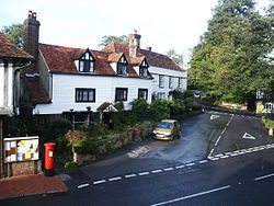
Brenchley is a village in the civil parish of Brenchley and Matfield, [4] [5] in the borough of Tunbridge Wells, Kent, England.

Contents

All Saints Church is located in the village, and is a Grade I listed building. [6]

History

The name is historically derived from Branca's Leigh. The village is located 8 miles (13 km) east of Royal Tunbridge Wells, and 3 miles (4.8 km) south of Paddock Wood, and includes the neighbouring village of Matfield. Brenchley & Matfield CoE primary school is located in Brenchley.

The village earns some historical fame by being one of the villages that was closely involved in post medieval iron making. The site of the furnace lies within the parish of Horsmonden now.

A Market formerly held in the churchyard at Brenchley was granted in 1230 to Hamo de Crevecoeur, to be held on his own land, and the day moved from Sunday to Wednesday. In 1233 this was readjusted to Saturday. [7] By 1296 it belonged to Gilbert de Clare, who in 1312 claimed that his ancestors had held it 'from time out of mind'.

Notable people

See also

Related Research Articles

<span class="mw-page-title-main">Royal Tunbridge Wells</span> Town in Kent, England

Royal Tunbridge Wells is a town in Kent, England, 30 miles southeast of central London. It lies close to the border with East Sussex on the northern edge of the High Weald, whose sandstone geology is exemplified by the rock formation High Rocks. The town was a spa in the Restoration and a fashionable resort in the mid-1700s under Beau Nash when the Pantiles, and its chalybeate spring, attracted visitors who wished to take the waters. Though its popularity as a spa town waned with the advent of sea bathing, the town still derives much of its income from tourism.

<span class="mw-page-title-main">Paddock Wood</span> Town and civil parish in the borough of Tunbridge Wells, Kent, England

Paddock Wood is a town and civil parish in the borough of Tunbridge Wells in Kent, England, about 8 miles (13 km) southwest of Maidstone. At the 2001 Census it had a population of 8,263, falling marginally to 8,253 at the 2011 Census. Paddock Wood is a centre for hop growing.

<span class="mw-page-title-main">Borough of Tunbridge Wells</span> Non-metropolitan district in England

The Borough of Tunbridge Wells is a local government district and borough in Kent, England. It takes its name from its main town, Royal Tunbridge Wells.

Hamo de Crevequer was an Anglo-Norman nobleman who held the office of Lord Warden of the Cinque Ports.

<span class="mw-page-title-main">Pembury</span> Human settlement in England

Pembury is a large village in Kent, in the south east of England, with a population of 6,128 at the 2011 Census. It lies just to the north-east of Royal Tunbridge Wells.

<span class="mw-page-title-main">Collier Street</span> Human settlement in England

Collier Street is a small village and civil parish in the Borough of Maidstone in Kent, England.

<span class="mw-page-title-main">Penshurst</span> Human settlement in England

Penshurst is a historic village and civil parish located in a valley upon the northern slopes of the Kentish Weald, at the confluence of the River Medway and the River Eden, within the Sevenoaks district of Kent, England.

<span class="mw-page-title-main">Lamberhurst</span> Human settlement in England

Lamberhurst ( is a village and civil parish in the borough of Tunbridge Wells in Kent, England. The parish contains the hamlets of The Down and Hook Green. At the 2001 Census it had a population of 1,491, increasing to 1,706 at the 2011 Census.

<span class="mw-page-title-main">Goudhurst</span> Village and civil parish in the borough of Tunbridge Wells in Kent, England

Goudhurst is a village and civil parish in the borough of Tunbridge Wells in Kent, England. It lies in the Weald, around 12 miles (19 km) south of Maidstone, on the crossroads of the A262 and B2079.

<span class="mw-page-title-main">Horsmonden</span> Human settlement in England

Horsmonden is a village in the borough of Tunbridge Wells in Kent, England. The village is located in the Weald of Kent. It is situated on a road leading from Maidstone to Lamberhurst, three miles north of the latter place. The nearest railway station is Paddock Wood.

<span class="mw-page-title-main">Meopham</span> Human settlement in England

Meopham is a large linear village and civil parish in the Borough of Gravesham in Kent, England, lying to the south of Gravesend. The parish covers 6.5 square miles (17 km2), and comprises two villages and two smaller settlements; it has a population of 6,427 increasing slightly to 6,722 at the 2011 census. Meopham village is sometimes described as the longest settlement in England although others such as Brinkworth, Wiltshire make the same claim. Meopham is one of the longest linear settlements in Europe, being 7 miles (11 km) in length.

Benenden is a village and civil parish in the borough of Tunbridge Wells in Kent, England. The parish is located on the Weald, 6 miles (10 km) to the west of Tenterden. In addition to the main village, Iden Green, East End, Dingleden and Standen Street settlements are included in the parish.

<span class="mw-page-title-main">Buckland, Oxfordshire</span> Human settlement in England

Buckland is a village and large civil parish about 4 miles (6.4 km) northeast of Faringdon in the Vale of White Horse District. Buckland was part of Berkshire until the 1974 boundary changes transferred it to Oxfordshire. The 2011 Census recorded the parish's population as 588. Outside the village the civil parish includes the small settlements of Carswell and Barcote to the west, Buckland Marsh to the north, and the modern development of Gainfield on the southern boundary.

<span class="mw-page-title-main">Matfield</span> Human settlement in England

Matfield is a small village, part of the civil parish of Brenchley and Matfield, in the Tunbridge Wells borough of Kent, England. Matfield was awarded the title of Kent Village of the Year in 2010.

<span class="mw-page-title-main">Capel, Kent</span> Human settlement in England

Capel is a hamlet and civil parish in the borough of Tunbridge Wells in Kent, England. The parish is located on the north of the Weald, 3 miles (4.8 km) to the east of Tonbridge. The southern part of the parish lies within the High Weald Area of Outstanding Natural Beauty, whilst most of the land also falls within the Metropolitan Green Belt. As well as Capel itself, the parish includes the communities of Castle Hill, Colts Hill, Five Oak Green, Postern, Tudeley and Whetsted.

<span class="mw-page-title-main">East Peckham</span> Village and parish in Kent, England

East Peckham is a village and civil parish in Kent, England on the River Medway. The parish covers the main village as well as Hale Street and Beltring.

Rusthall is a village located approximately 2 miles to the west of the spa town of Tunbridge Wells in Kent. The village grew up around a large property called "Rusthall" located on Rusthall Common.

<span class="mw-page-title-main">St Luke's Church, Matfield</span> Parish church in the village of Matfield, Kent, England

St Luke's Church is a parish church in the village of Matfield, Kent, England. It is a Grade II listed building.

<span class="mw-page-title-main">All Saints Church, Brenchley</span> Parish church in Brenchley, Kent, UK

All Saints Church is a parish church in Brenchley, Kent, England. It is a Grade I listed building.

References

  1. National Statistics Archived 15 May 2011 at the Wayback Machine Census 2001
  2. "Civil Parish population 2011". Neighbourhood Statistics. Office for National Statistics. Retrieved 24 September 2016.
  3. "Brenchley and Matfield Parish" . Retrieved 4 January 2023.
  4. "Brenchley and Matfield". Mapit. Retrieved 15 May 2019.
  5. "Change of Name of Brenchley Parish Council" (PDF). Tunbridge Wells Borough Council . Retrieved 15 May 2019.
  6. https://historicengland.org.uk/listing/the-list/list-entry/1249609
  7. Calendar of Close Rolls, Henry III: 1227-1232 p. 340; 1231-1234, pp. 233-34.
  8. "Marle Place". ngs.org.uk. Archived from the original on 5 August 2017. Retrieved 2 August 2017.

Sources