Commercial Street, London

Last updated

Commercial Street, looking south. The spire of Christ Church is to the left, Spitalfields Market to the right. (February 2007) Spitalfields commercial street 1.jpg
Commercial Street, looking south. The spire of Christ Church is to the left, Spitalfields Market to the right. (February 2007)

Commercial Street is an arterial road in Tower Hamlets, east London that runs north to south from Shoreditch High Street to Whitechapel High Street through the East End district of Spitalfields. The road is a section of the A1202 London Inner Ring Road and as such forms part of the boundary of the London congestion charge zone.

Contents

As the name implies, Commercial Street has historically been dominated by industrial and commercial activity, which it maintains to this day. It is on the City fringes, and much industry that was seen as too noisome for the City was once exiled to such areas as this. However, since the early 1990s the street has grown increasingly fashionable, while maintaining its busy commercial feel.

History

New Street from Spitalfields to Shoreditch Act 1846
Act of Parliament
Royal Coat of Arms of the United Kingdom (variant 1, 1952-2022).svg
Long title An Act to enable the Commissioners of Her Majesty's Woods to construct a new Street from Spitalfields to Shoreditch.
Citation 9 & 10 Vict. c. 34
Dates
Royal assent 27 July 1846
Detail of map of Spitalfields and Whitechapel from Charles Booth's Labour and Life of the People, 1889. Commercial Street can be seen running from near the top left corner to join Whitechapel High Street further south. Residential buildings are coloured to represent the economic class of the occupants, including: red ("Lower middle class - Well-to-do middle class"); pink ("Fairly comfortable good ordinary earnings"); blue ("Intermittent or casual earnings"); and black ("lowest class...occasional labourers, street sellers, loafers, criminals and semi-criminals"). Booth map of Whitechapel.jpg
Detail of map of Spitalfields and Whitechapel from Charles Booth's Labour and Life of the People , 1889. Commercial Street can be seen running from near the top left corner to join Whitechapel High Street further south. Residential buildings are coloured to represent the economic class of the occupants, including: red ("Lower middle class – Well-to-do middle class"); pink ("Fairly comfortable good ordinary earnings"); blue ("Intermittent or casual earnings"); and black ("lowest class...occasional labourers, street sellers, loafers, criminals and semi-criminals").

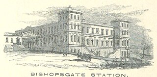
Spitalfields was historically one of the poorest, most overcrowded and most crime-ridden districts in London: a parliamentary report of 1838 described this area as harbouring "an extremely immoral population; women of the lowest character, receivers of stolen goods, thieves and the most atrocious offenders". [1] The southern section of Commercial Street was created in 1843–5 as part of a slum clearance programme, and to connect the Whitechapel thoroughfare with Spitalfields Market. [2] It was laid out by the architect and planner Sir James Pennethorne along the approximate line of former Essex Street, Rose Lane and Red Lion Street, and entailed the demolition of some 250 sub-standard properties in Whitechapel and Spitalfields. The extension north from the market, to the Eastern Counties Railway's Bishopsgate terminus and to Shoreditch High Street, was made between 1849 and 1857 and opened in 1858. [3] [4] In both phases of development there was some initial difficulty in finding tenants for the building plots, and much of the street was not built up until the 1860s and 1870s. Only once Great Eastern Street had been laid out further north between 1872 and 1876, creating a continuation of the route towards Old Street and the City Road, did Commercial Street really begin to succeed as what had always been Pennethorne's aim, an artery allowing traffic to bypass the City of London. With the implementation of the London Congestion Zone in the 2000s, the road has once again seen continued activity from private and commercial vehicles seeking to avoid the 7am–6pm charge, and is a typical arterial route for emergency vehicles.

Until the late twentieth century, the street was heavily dominated by the activities of Spitalfields wholesale fruit and vegetable market, and by outlets for the "rag trade" (the wholesale clothing and textile trade). Since the mid-1970s, however, the area has been increasingly subject to a process of gradual gentrification. In part this reflects the changing character of Spitalfields more generally, but in Commercial Street in particular it was stimulated by the departure of the market in 1991 (and subsequent redevelopment of its buildings), the arrival of a number of private residential developments (especially at the northern end of the street), and the introduction of some modest traffic-calming measures. Many of the commercial units in the street are now occupied by fashionable clothing shops or restaurants.

Topography and architecture

The street's most significant features are Hawksmoor's grand Christ Church, on the corner of Fournier Street; and (almost opposite) Spitalfields Market, the old fruit and vegetable market that is now bustling again after a long period of uncertainty. Both the market buildings and Christ Church are lucky survivors, as demolition has loomed for both of them at one point or another.

The Peabody dwellings in Commercial Street: a wood-engraving published in the Illustrated London News in 1863, shortly before the building opened. The "Peabody" dwellings for the industrious poor. Wellcome L0004875.jpg
The Peabody dwellings in Commercial Street: a wood-engraving published in the Illustrated London News in 1863, shortly before the building opened.

The northern end of the street is dominated on its eastern side by the sprawling Exchange Building, an Art Deco former tobacco works, now residential. On the western side stands the former Commercial Street Police Station (built 1874-5, with an extra storey added in 1906), also now a residential block named Burhan Uddin House. Just to its south, with a wing extending into Folgate Street, is the first tenement block of model dwellings to be erected by the Peabody Donation Fund (now the Peabody Trust) for London's "industrious poor". The red-brick Jacobethan block was designed by H. A. Darbishire and opened in 1864, but was sold by the Trust in the late 1970s and is now a private residential block named The Cloisters.

On the opposite corner of Fournier Street from Christ Church is the Ten Bells, a pub that is popularly associated with Jack the Ripper, as two of his female prostitute victims are supposed to have frequented the establishment. Many Ripper tours (a thriving trade) start out nearby. Although the pub has long been refurbished, it still retains some fine original tilework. Prostitution remained a feature of Commercial Street until recently. [5] Dorset Street, which ran off Commercial Street to the west immediately south of Spitalfields Market, was dubbed the "worst street in London". [6]

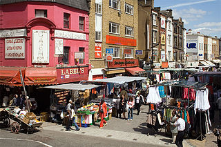
Much of the southern section of the street is occupied by warehouse buildings of the 1860s. Wentworth Street (part of the busy Petticoat Lane Market) runs off Commercial Street to the west. Immediately to the south of Wentworth Street lies the Holland Estate, a social housing estate with elements dating back to the 1920s, but which is dominated on its Commercial Street frontage by blocks of the late 1960s and early 1970s, including a 22-storey tower block, Denning Point. The estate is now managed by Eastend Homes, and in 2012 was undergoing a major programme of regeneration that would see the demolition and replacement of several of the blocks. To the south again is the 11-storey Ibis London City budget hotel (opened 2005), and beyond that, at the junction with Whitechapel High Street, the Relay Building, a 21-storey residential development (completed 2014). On the eastern side of Commercial Street stands Toynbee Hall, the university settlement founded in 1884.

Nearby stations

The nearest London Underground station is Aldgate East, at Commercial Street's southern end. Shoreditch High Street London Overground station is close to the northern end, by the former Bishopsgate Goods Yard. London Liverpool Street is a National Rail and London Underground interchange, a short walk to the west.

Related Research Articles

<span class="mw-page-title-main">Shoreditch</span> Human settlement in England

Shoreditch is a district in the East End of London in England, and forms the southern part of the London Borough of Hackney. Neighbouring parts of Tower Hamlets are also perceived as part of the area.

<span class="mw-page-title-main">Shoreditch tube station</span> Former London Underground station

Shoreditch was a London Underground station located in Shoreditch in the London Borough of Tower Hamlets in east London. Originally opened by the East London Railway in 1876, the station was permanently closed in 2006 being replaced directly to the west of the site by Shoreditch High Street station in 2010.

<span class="mw-page-title-main">Bishopsgate</span> Ward of the City of London

Bishopsgate was one of the eastern gates in London's former defensive wall. The gate's name is traditionally attributed to Earconwald, who was Bishop of London in the 7th century. It was first built in Roman times and marked the beginning of Ermine Street, the ancient road running from London to York (Eboracum). The gate was rebuilt twice in the 15th and 18th centuries, but was permanently demolished in 1760.

<span class="mw-page-title-main">Spitalfields</span> Area of London

Spitalfields is a district in the East End of London and within the London Borough of Tower Hamlets. The area is formed around Commercial Street and includes the locale around Brick Lane, Christ Church, Toynbee Hall and Commercial Tavern. It has several markets, including Spitalfields Market, the historic Old Spitalfields Market, Brick Lane Market and Petticoat Lane Market. It was a Hamlet of the large ancient parish of Stepney in Middlesex, and became an independent parish in 1729. Just outside the City of London, it formed part of the County of London from 1889 and was part of the Metropolitan Borough of Stepney from 1900. It was abolished as a civil parish in 1921.

<span class="mw-page-title-main">Brick Lane</span> Street in East London, England

Brick Lane is a famous street in the East End of London, in the borough of Tower Hamlets. It runs from Swanfield Street in Bethnal Green in the north, crosses the Bethnal Green Road before reaching the busiest, most commercially active part which runs through Spitalfields, or along its eastern edge. Brick Lane's southern end is connected to Whitechapel High Street by a short extension called Osborn Street.
<span class="mw-page-title-main">Bishopsgate railway station</span> Disused railway station in London, England

Bishopsgate was a railway station located on the eastern side of Shoreditch High Street in the parish of Bethnal Green on the western edge of the East End of London and just outside the City of London.

Sir James Pennethorne was a British architect and planner, particularly associated with buildings and parks in central London.

<span class="mw-page-title-main">Old Spitalfields Market</span>

Old Spitalfields Market is a covered market in Spitalfields, London. There has been a market on the site for over 350 years. In 1991 it gave its name to New Spitalfields Market in Leyton, where fruit and vegetables are now traded. In 2005, a regeneration programme resulted in the new public spaces: Bishops Square and Crispin Place, which are now part of the modern Spitalfields Market. A range of public markets runs daily, with independent local stores and restaurants - as well as new office developments.
<span class="mw-page-title-main">Petticoat Lane Market</span> Clothing market in London

Petticoat Lane Market is a fashion and clothing market in Spitalfields, London. It consists of two adjacent street markets. Wentworth Street Market is open six days a week and Middlesex Street Market is open on Sunday only.
<span class="mw-page-title-main">Fournier Street</span> Human settlement in England

Fournier Street, formerly Church Street, is a street of 18th-century houses in Spitalfields in the East End of London. It is in the London Borough of Tower Hamlets and runs between Commercial Street and Brick Lane. The street is named after a man of Huguenot extraction, George Fournier.

<span class="mw-page-title-main">Shoreditch High Street railway station</span> London Overground station

Shoreditch High Street is a London Overground station located on Bethnal Green Road in Shoreditch in East London. It is served by the East London Line between Whitechapel and Hoxton with services running either to Dalston Junction, Highbury & Islington or New Cross, New Cross Gate, West Croydon, Crystal Palace, and is in Travelcard Zone 1.
<span class="mw-page-title-main">Hanbury Street</span> Street in London

Hanbury Street is a street running from Spitalfields to Whitechapel, London Borough of Tower Hamlets, in the East End of London. It runs east from Commercial Street to the junction of Old Montague Street and Vallance Road at the east end. The eastern section is restricted to pedal cycles and pedestrians only.

<span class="mw-page-title-main">Whitechapel High Street</span> Street in London

Whitechapel High Street is a street in the Borough of Tower Hamlets in the East End of London. It is about 0.2 miles long, making it "one of the shortest high streets in London". It links Aldgate High Street to the south-west with Whitechapel Road to the north-east, and includes junctions with Commercial Street to the north and Commercial Road to the east.

<span class="mw-page-title-main">Dorset Street (Spitalfields)</span> Former street in London

Dorset Street was a street in Spitalfields, East London, once situated at the heart of the area's rookery. By repute it was "the worst street in London", and it was the scene of the brutal murder of Mary Jane Kelly by Jack the Ripper on 9 November 1888. The murder was committed at Kelly's lodgings which were situated at No. 13, Miller's Court, entered from a passageway between 26 and 27, Dorset Street.

<span class="mw-page-title-main">East End of London</span> Area of London, England

The East End of London, often referred to within the London area simply as the East End, is the historic core of wider East London, east of the Roman and medieval walls of the City of London and north of the River Thames. It does not have universally accepted boundaries to the north and east, though the River Lea is sometimes seen as the eastern boundary. Parts of it may be regarded as lying within Central London. The term "East of Aldgate Pump" is sometimes used as a synonym for the area.

<span class="mw-page-title-main">Brick Lane Mosque</span> Congerational Mosque in London

Brick Lane Mosque or Brick Lane Jamme Masjid, formerly known as the London Jamme Masjid, is a Muslim place of worship in Central London and is in the East End of London.

<span class="mw-page-title-main">Columbia Road Flower Market</span> Street market in London

Columbia Road Flower Market is a street market in Bethnal Green in London, England. Columbia Road is a road of Victorian shops situated off Hackney Road in the London Borough of Tower Hamlets. The market is open on Sundays only.

<span class="mw-page-title-main">Liberty of Norton Folgate</span>

Norton Folgate was a liberty in Middlesex, England; adjacent to the City of London in what would become the East End of London.

<span class="mw-page-title-main">Markham Street, Toronto</span> Street in Toronto, Ontario, Canada

Markham Street is a north–south residential street located in the city of Toronto, Ontario, Canada, one block west of Bathurst Street. Its northern end starts in the Seaton Village neighbourhood and it passes through Mirvish Village, Palmerston–Little Italy, Trinity–Bellwoods and ends at West Queen Street West at its south end.

<span class="mw-page-title-main">The Goodsyard</span> Mixed use in London, England

The Goodsyard is a proposed development on the site of the former Bishopsgate Goods Yard in Shoreditch, London. It spans the border between the two London boroughs of Hackney and Tower Hamlets. The scheme, which is a joint venture between developers Hammerson and Ballymore, previously included 12 buildings, the tallest of which was planned to be 166-metre (545 ft) tall with 46 floors. In total, 1,356 homes were proposed, as well as offices, retail and workshop space and a 0.97-hectare (2.4-acre) park.


References

  1. Second Report from Select Committee on Metropolis Improvements (1838), p. 103 (Parliamentary Papers 1837–8, vol. XVI).
  2. Fiona Rule (2008) The Worst Street in London. Hersham, Ian Allan: pp. 54–5.
  3. White, J. (2007) London in the Nineteenth Century. London: Vintage: pp. 33–4.
  4. Tyack, G. (1992), Sir James Pennethorne and the Making of Victorian London. Cambridge: Cambridge University Press: pp. 64-6.
  5. Taylor, W. (2001) This Bright Field. Methuen: London: p. 61
  6. Fiona Rule (2008) The Worst Street in London. Hersham, Ian Allan: p. 217

Further reading

51°31′8″N0°4′28″W / 51.51889°N 0.07444°W / 51.51889; -0.07444