Como, North Carolina

Last updated

Como, North Carolina
NCMap-doton-Como.PNG
Location of Como, North Carolina
Coordinates: 36°30′04″N77°00′26″W / 36.50111°N 77.00722°W / 36.50111; -77.00722
Country United States
State North Carolina
County Hertford
Area
[1]
  Total3.15 sq mi (8.17 km2)
  Land3.15 sq mi (8.15 km2)
  Water0.01 sq mi (0.02 km2)
Elevation
[2]
72 ft (22 m)
Population
 (2020)
  Total67
  Density21.30/sq mi (8.22/km2)
Time zone UTC-5 (Eastern (EST))
  Summer (DST) UTC-4 (EDT)
ZIP code
27818
Area code 252
FIPS code 37-14060 [3]
GNIS feature ID2406303 [2]

Como is a town in Hertford County, North Carolina, United States. The population was 91 at the 2010 census. [4]

Contents

Geography

Como is located in northern Hertford County and U.S. Route 258 runs through the community, leading southwest 7 miles (11 km) to Murfreesboro and northeast 15 miles (24 km) to Franklin, Virginia.

According to the United States Census Bureau, Como has a total area of 3.2 square miles (8.2 km2), of which 0.01 square miles (0.02 km2), or 0.30%, are water. [4]

History

The town is notable for being the birthplace of Richard Gatling, inventor of the Gatling gun. [5] The church he attended, Buckhorn Baptist Church, is still active today.

Another well-known resident was the hoodoo root doctor Jim Jordan, who died in the early 1960s. Jordan, who was African-American, was the subject of the biographical book The Fabled Dr. Jim Jordan written by F. Roy Johnson of nearby Murfreesboro.

Hare Plantation House, Riddick House, and Vernon Place are listed on the National Register of Historic Places. [6]

Demographics

Historical population
CensusPop.Note
1970 211
1980 89−57.8%
1990 71−20.2%
2000 789.9%
2010 9116.7%
2020 67−26.4%
U.S. Decennial Census [7]

As of the census [3] of 2000, there were 78 people, 35 households, and 22 families residing in the town. The population density was 23.3 people per square mile (9.0/km2). There were 44 housing units at an average density of 13.1 per square mile (5.1/km2). The racial makeup of the town was 83.33% White and 16.67% African American.

There were 35 households, out of which 20.0% had children under the age of 18 living with them, 57.1% were married couples living together, 8.6% had a female householder with no husband present, and 34.3% were non-families. 31.4% of all households were made up of individuals, and 20.0% had someone living alone who was 65 years of age or older. The average household size was 2.23 and the average family size was 2.78.

In the town, the population was spread out, with 17.9% under the age of 18, 5.1% from 18 to 24, 20.5% from 25 to 44, 38.5% from 45 to 64, and 17.9% who were 65 years of age or older. The median age was 46 years. For every 100 females, there were 95.0 males. For every 100 females age 18 and over, there were 88.2 males.

The median income for a household in the town was $31,250, and the median income for a family was $45,417. Males had a median income of $26,250 versus $18,750 for females. The per capita income for the town was $15,769. There were no families and 3.5% of the population living below the poverty line, including no under eighteens and 15.4% of those over 64.

Related Research Articles

<span class="mw-page-title-main">Perquimans County, North Carolina</span> County in North Carolina, United States

Perquimans County is a county located in the U.S. state of North Carolina. As of the 2020 census, the population was 13,005. Its county seat is Hertford. The Harvey Point Defense Testing Activity facility is located in Perquimans County.

<span class="mw-page-title-main">Hertford County, North Carolina</span> County in North Carolina, United States

Hertford County is a county located in the U.S. state of North Carolina. As of the 2020 census, the population was 21,552. Its county seat is Winton. It is classified within the region known in the 21st century as the Inner Banks.

<span class="mw-page-title-main">Bertie County, North Carolina</span> County in North Carolina, United States

Bertie County is a county located in the northeast area of the U.S. state of North Carolina. As of the 2020 census, the population was 17,934. Its county seat is Windsor. The county was created in 1722 as Bertie Precinct and gained county status in 1739.

<span class="mw-page-title-main">Stratford, New Hampshire</span> Town in New Hampshire, United States

Stratford is a town located on the Connecticut River in Coös County, New Hampshire, United States. The population was 662 at the 2020 census, a decline from the figure of 746 tabulated in 2010. Within the town are the villages of North Stratford, Stratford Hollow, and Beatties. U.S. Route 3 passes through the center of town, as does the St. Lawrence and Atlantic Railroad, formerly a part of the Grand Trunk Railway.

<span class="mw-page-title-main">Cooleemee, North Carolina</span> Town in North Carolina, United States

Cooleemee is a town in Davie County, North Carolina, United States. The population was 940 at the 2020 census.

<span class="mw-page-title-main">Cofield, North Carolina</span> Village in North Carolina, United States

Cofield is a village in Hertford County, North Carolina, United States. The population was 413 at the 2010 census.

<span class="mw-page-title-main">Harrellsville, North Carolina</span> Town in North Carolina, United States

Harrellsville is a town in Hertford County, North Carolina, United States. The population was 106 at the 2010 census.

<span class="mw-page-title-main">Winton, North Carolina</span> Town in North Carolina, United States

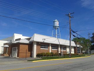
Winton is a town and the county seat of Hertford County, North Carolina, United States. It is governed by the Town Council which consists of a Mayor and five Council members. The population was 769 at the 2010 census.

<span class="mw-page-title-main">North Topsail Beach, North Carolina</span> Town in North Carolina, United States

North Topsail Beach is a town in Onslow County, North Carolina, United States. As of the 2020 U.S. census, the population was 1,005. It is located on Topsail Island. North Topsail Beach is part of the Jacksonville, North Carolina Metropolitan Statistical Area.

<span class="mw-page-title-main">Bayboro, North Carolina</span> Town in North Carolina, United States

Bayboro is a town in Pamlico County, North Carolina, United States. The population was 1,161 at the 2020 U.S. census. It is the county seat of Pamlico County.

<span class="mw-page-title-main">Hertford, North Carolina</span> Town in North Carolina, United States

Hertford is a town and the county seat of Perquimans County, North Carolina, United States. The current population of Hertford, North Carolina is 1,912 based on the 2020 census. The US Census estimates the 2021 population at 1,925. The last official US Census in 2010 recorded the population at 2,143. Hertford is located in North Carolina's Inner Banks region and is part of both the Elizabeth City Micropolitan Statistical Area and the Hampton Roads region. It is named after the county town of Hertford, England.

<span class="mw-page-title-main">Winfall, North Carolina</span> Town in North Carolina, United States

Winfall is a town in Perquimans County, North Carolina, United States. The population was 554 at the 2020 census. It is part of the Elizabeth City, North Carolina Micropolitan Statistical Area.

<span class="mw-page-title-main">Bethel, North Carolina</span> Town in North Carolina, United States

Bethel is a town in Pitt County, North Carolina, United States. The population was 1,577 at the 2010 census. The town is a part of the Greenville Metropolitan Area located in North Carolina's Inner Banks region. Confusingly, there are three other towns in the state named "Bethel." One is between Edenton and Hertford in the "Finger Counties" region in the northeastern corner of the state, another is in the north-central part, in Caswell County and the third is located in the Mountain Region of North Carolina, in Haywood County. There is also a community named Bethel located in Watauga County.

<span class="mw-page-title-main">Ramseur, North Carolina</span> Town in North Carolina, United States

Ramseur is a town in Randolph County, North Carolina, United States. The population was 1,692 at the 2010 census.

<span class="mw-page-title-main">Lowndesville, South Carolina</span> Town in South Carolina, United States

Lowndesville is a town in Abbeville County, South Carolina. The population was 120 at the 2020 census.

<span class="mw-page-title-main">Blackville, South Carolina</span> Town in South Carolina, United States

Blackville is a small town in Barnwell County, South Carolina, United States. The population was 2,406 at the 2010 census.

<span class="mw-page-title-main">Hilda, South Carolina</span> Town in South Carolina, United States

Hilda is a town in Barnwell County, South Carolina, United States. The population was 447 at the 2010 census..

<span class="mw-page-title-main">McKenney, Virginia</span> Town in Virginia, United States

McKenney is an incorporated town in Dinwiddie County, Virginia, United States. The population was 483 at the 2010 census.

<span class="mw-page-title-main">Ridgeway, Virginia</span> Town in Virginia, United States

Ridgeway is a town in Henry County, Virginia, United States. The population was 742 at the 2010 census. It is part of the Martinsville Micropolitan Statistical Area. Martinsville Speedway, a NASCAR racetrack, is located between Ridgeway and the Martinsville city limits.

<span class="mw-page-title-main">Como, Wisconsin</span> CDP in Wisconsin, United States

Como is a census-designated place (CDP) in the town of Geneva, Walworth County, Wisconsin, United States. The population was 2,356 at the 2020 census.

References

  1. "ArcGIS REST Services Directory". United States Census Bureau. Retrieved September 20, 2022.
  2. 1 2 U.S. Geological Survey Geographic Names Information System: Como, North Carolina
  3. 1 2 "U.S. Census website". United States Census Bureau . Retrieved January 31, 2008.
  4. 1 2 "Geographic Identifiers: 2010 Census Summary File 1 (G001): Como town, North Carolina". American Factfinder. U.S. Census Bureau. Archived from the original on February 13, 2020. Retrieved December 20, 2017.
  5. Marker A-26 - NC Highway Historical Marker Program. Retrieved February 1, 2021.
  6. "National Register Information System". National Register of Historic Places . National Park Service. July 9, 2010.
  7. "Census of Population and Housing". Census.gov. Retrieved June 4, 2015.