Related Research Articles

A mesocyclone is a meso-gamma mesoscale region of rotation (vortex), typically around 2 to 6 mi in diameter, most often noticed on radar within thunderstorms. In the northern hemisphere it is usually located in the right rear flank of a supercell, or often on the eastern, or leading, flank of a high-precipitation variety of supercell. The area overlaid by a mesocyclone’s circulation may be several miles (km) wide, but substantially larger than any tornado that may develop within it, and it is within mesocyclones that intense tornadoes form.

A squall is a sudden, sharp increase in wind speed lasting minutes, as opposed to a wind gust, which lasts for only seconds. They are usually associated with active weather, such as rain showers, thunderstorms, or heavy snow. Squalls refer to the increase of the sustained winds over that time interval, as there may be higher gusts during a squall event. They usually occur in a region of strong sinking air or cooling in the mid-atmosphere. These force strong localized upward motions at the leading edge of the region of cooling, which then enhances local downward motions just in its wake.

Mammatus is a cellular pattern of pouches hanging underneath the base of a cloud, typically a cumulonimbus raincloud, although they may be attached to other classes of parent clouds. The name mammatus is derived from the Latin mamma.

A squall line, or more accurately a quasi-linear convective system (QLCS), is a line of thunderstorms, often forming along or ahead of a cold front. In the early 20th century, the term was used as a synonym for cold front. Linear thunderstorm structures often contain heavy precipitation, hail, frequent lightning, strong straight-line winds, and occasionally tornadoes or waterspouts. Particularly strong straight-line winds can occur where the linear structure forms into the shape of a bow echo. Tornadoes can occur along waves within a line echo wave pattern (LEWP), where mesoscale low-pressure areas are present. Some bow echoes can grow to become derechos as they move swiftly across a large area. On the back edge of the rainband associated with mature squall lines, a wake low can be present, on very rare occasions associated with a heat burst.

In meteorology, convective available potential energy, is the integrated amount of work that the upward (positive) buoyancy force would perform on a given mass of air if it rose vertically through the entire atmosphere. Positive CAPE will cause the air parcel to rise, while negative CAPE will cause the air parcel to sink. Nonzero CAPE is an indicator of atmospheric instability in any given atmospheric sounding, a necessary condition for the development of cumulus and cumulonimbus clouds with attendant severe weather hazards.

An anticyclonic storm is a storm with a high-pressure center, in which winds flow in the direction opposite to that of the flow above a region of low pressure. These storms can create powerful mesoanticylonic supercell storms that can generate anticyclonic tornadoes. Examples include the anticyclonic blizzard of 2018, Hartmut, Jupiter, and Neptune's anticyclonic cloud system.

Cumulus congestus clouds, also known as towering cumulus, are a form of cumulus that can be based in the low or middle height ranges. They achieve considerable vertical development in areas of deep, moist convection. They are an intermediate stage between cumulus mediocris and cumulonimbus, sometimes producing showers of snow, rain, or ice pellets. Precipitation that evaporates before reaching the surface is virga.
A hot tower is a tropical cumulonimbus cloud that reaches out of the lowest layer of the atmosphere, the troposphere, and into the stratosphere. These formations are called "hot" because of the large amount of latent heat released as water vapor condenses into liquid and freezes into ice within the cloud. Hot towers in regions of sufficient vorticity may acquire rotating updrafts; these are known as vortical hot towers In some instances, hot towers appear to develop characteristics of a supercell, with deep and persistent rotation present in the updraft. The role of hot towers in tropical weather was first formulated by Joanne Simpson in 1958. Hot towers dominated discussions in tropical meteorology in the 1960s and are now considered the main drivers of rising air within tropical cyclones and a major component of the Hadley circulation. Although the prevalence of hot towers in scientific literature decreased in the 1970s, hot towers remain an active area of research. The presence of hot towers in tropical cyclones is correlated with an increase in the tropical cyclones's intensities.
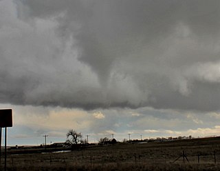
Tornadogenesis is the process by which a tornado forms. There are many types of tornadoes and these vary in methods of formation. Despite ongoing scientific study and high-profile research projects such as VORTEX, tornadogenesis is a volatile process and the intricacies of many of the mechanisms of tornado formation are still poorly understood.

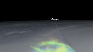
An overshooting top is a dome-like protrusion shooting out of the top of the anvil of a thunderstorm and into the lower stratosphere. When an overshooting top is present for 10 minutes or longer, it is a strong indication that the storm is severe.
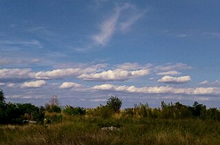
Horizontal convective rolls, also known as horizontal roll vortices or cloud streets, are long rolls of counter-rotating air that are oriented approximately parallel to the ground in the planetary boundary layer. Although horizontal convective rolls, also known as cloud streets, have been clearly seen in satellite photographs for the last 30 years, their development is poorly understood, due to a lack of observational data. From the ground, they appear as rows of cumulus or cumulus-type clouds aligned parallel to the low-level wind. Research has shown these eddies to be significant to the vertical transport of momentum, heat, moisture, and air pollutants within the boundary layer. Cloud streets are usually more or less straight; rarely, cloud streets assume paisley patterns when the wind driving the clouds encounters an obstacle. Those cloud formations are known as von Kármán vortex streets.

An air-mass thunderstorm, also called an "ordinary", "single cell", or "garden variety" thunderstorm, is a thunderstorm that is generally weak and usually not severe. These storms form in environments where at least some amount of Convective Available Potential Energy (CAPE) is present, but very low levels of wind shear and helicity. The lifting source, which is a crucial factor in thunderstorm development, is usually the result of uneven heating of the surface, though they can be induced by weather fronts and other low-level boundaries associated with wind convergence. The energy needed for these storms to form comes in the form of insolation, or solar radiation. Air-mass thunderstorms do not move quickly, last no longer than an hour, and have the threats of lightning, as well as showery light, moderate, or heavy rainfall. Heavy rainfall can interfere with microwave transmissions within the atmosphere.

In atmospheric sciences, the free convective layer (FCL) is the layer of conditional or potential instability in the troposphere. It is a layer in which rising air can experience positive buoyancy (PBE) so that deep, moist convection (DMC) can occur. On an atmospheric sounding, it is the layer between the level of free convection (LFC) and the equilibrium level (EL). The FCL is important to a variety of convective processes and to severe thunderstorm forecasting.
Atmospheric convection is the result of a parcel-environment instability, or temperature difference layer in the atmosphere. Different lapse rates within dry and moist air masses lead to instability. Mixing of air during the day which expands the height of the planetary boundary layer leads to increased winds, cumulus cloud development, and decreased surface dew points. Moist convection leads to thunderstorm development, which is often responsible for severe weather throughout the world. Special threats from thunderstorms include hail, downbursts, and tornadoes.
Convective storm detection is the meteorological observation, and short-term prediction, of deep moist convection (DMC). DMC describes atmospheric conditions producing single or clusters of large vertical extension clouds ranging from cumulus congestus to cumulonimbus, the latter producing thunderstorms associated with lightning and thunder. Those two types of clouds can produce severe weather at the surface and aloft.
The maximum parcel level (MPL) is the highest level in the atmosphere that a moist convectively rising air parcel will reach after ascending from the level of free convection (LFC) through the free convective layer (FCL) and reaching the equilibrium level (EL), near the tropopause. As the parcel rises through the FCL it expands adiabatically causing its temperature to drop, often below the temperature of its surroundings, and eventually lose buoyancy. Because of this, the EL is approximately the region where the distinct flat tops, often observed around the upper portions of cumulonimbus clouds. If the air parcel ascended quickly enough then it retains momentum after it has cooled and continues rising past the EL, ceasing at the MPL.
Representations of the atmospheric boundary layer in global climate models play a role in simulations of past, present, and future climates. Representing the atmospheric boundary layer (ABL) within global climate models (GCMs) are difficult due to differences in surface type, scale mismatch between physical processes affecting the ABL and scales at which GCMs are run, and difficulties in measuring different physical processes within the ABL. Various parameterization techniques described below attempt to address the difficulty in ABL representations within GCMs.
The convective planetary boundary layer (CPBL), also known as the daytime planetary boundary layer, is the part of the lower troposphere most directly affected by solar heating of the earth's surface.

Conditional symmetric instability, or CSI, is a form of convective instability in a fluid subject to temperature differences in a uniform rotation frame of reference while it is thermally stable in the vertical and dynamically in the horizontal. The instability in this case develop only in an inclined plane with respect to the two axes mentioned and that is why it can give rise to a so-called "slantwise convection" if the air parcel is almost saturated and moved laterally and vertically in a CSI area. This concept is mainly used in meteorology to explain the mesoscale formation of intense precipitation bands in an otherwise stable region, such as in front of a warm front. The same phenomenon is also applicable to oceanography.

A shower is a mode of precipitation characterized by an abrupt start and end and by rapid variations in intensity. Often strong and short-lived, it comes from convective clouds, like cumulus congestus. A shower will produce rain if the temperature is above the freezing point in the cloud, or snow / ice pellets / snow pellets / hail if the temperature is below it at some point. In a meteorological observation, such as the METAR, they are noted SH giving respectively SHRA, SHSN, SHPL, SHGS and SHGR.
References
| | This climatology/meteorology–related article is a stub. You can help Wikipedia by expanding it. |
| | This classical mechanics–related article is a stub. You can help Wikipedia by expanding it. |