
Interstate 65 (I-65) is a major north–south Interstate Highway in the central United States. As with most primary Interstates ending in 5, it is a major crosscountry, north–south route, connecting between the Great Lakes and the Gulf of Mexico. Its southern terminus is located at an interchange with I-10 in Mobile, Alabama, and its northern terminus is at an interchange with US 12 (US 12), and US 20 in Gary, Indiana, just southeast of Chicago. I-65 connects several major metropolitan areas in the Midwest and Southern US. It connects the four largest cities in Alabama: Mobile, Montgomery, Birmingham, and Huntsville. It also serves as one of the main north–south routes through Nashville, Tennessee; Louisville, Kentucky; and Indianapolis, Indiana, each a major metropolitan area in its respective state.

Route 17 is a state highway in Bergen County, New Jersey, United States, that provides a major route from the George Washington Bridge, Lincoln Tunnel and other northeast New Jersey points to the New York State Thruway at Suffern, New York. It runs 27.20 mi (43.77 km) from an intersection with Route 7 and County Route 507 (CR 507) in North Arlington north to the New York border along Interstate 287 (I-287) in Mahwah, where New York State Route 17 (NY 17) continues into New York. Between Route 7 and Route 3 in Rutherford, Route 17 serves as a local road. From Route 3 north to the junction with U.S. Route 46 (US 46) in Hasbrouck Heights, the road is an arterial road with jughandles. The portion of Route 17 from US 46 to I-287 near the state line in Mahwah is a four- to six-lane arterial with all cross traffic handled by interchanges, and many driveways and side streets accessed from right-in/right-out ramps from the right lane. For three miles (5 km) north of Route 4, well over a hundred retail stores and several large shopping malls line the route in the borough of Paramus. The remainder of this portion of Route 17 features lighter suburban development. The northernmost portion of Route 17 in Mahwah runs concurrently with I-287 to the New York border.

Brentwood is a city in Williamson County, Tennessee, United States. The population was 45,373 as of the 2020 United States census. It is a suburb of Nashville and included in the Nashville metropolitan area.

U.S. Route 31 or U.S. Highway 31 (US 31) is a major north–south U.S. highway connecting southern Alabama to northern Michigan. Its southern terminus is at an intersection with US 90/US 98 in Spanish Fort, Alabama. Its northern terminus is at an interchange with Interstate 75 (I-75) south of Mackinaw City, Michigan.

U.S. Route 431 (US 431) is a spur of U.S. Route 31. It currently travels for approximately 556 miles (895 km) from US 231/Alabama State Route 210 and US 231 Business and US 431 Bus. in Dothan, Alabama, to Owensboro, Kentucky, at US 60 and Kentucky Route 2831. The major cities US 431 connects to are Dothan and Huntsville, Alabama, Franklin and Nashville, Tennessee, and Owensboro, Kentucky.

Madison is a former settlement, now a suburban neighborhood of northeast Nashville, in the U.S. state of Tennessee. It is incorporated as part of the Metropolitan Government of Nashville and Davidson County.

Ernest W. Barrett Parkway is a major thoroughfare in the northwestern part of the Atlanta metropolitan area, in the north-central part of Cobb County, in the U.S. state of Georgia. It travels from the southeastern edge of Kennesaw to a point north of Marietta, and continues on in both directions under other names. The portion of Barrett Parkway between Interstate 575 (I-575/SR 5) and US 41/SR 3 is designated State Route 5 Connector. The road is named after Ernest W. Barrett, the first chairman of the Cobb County Board of Commissioners in the 1960s, after home rule was enacted under a Georgia State Constitution amendment. The initial portion was constructed through Barrett family land, enabling it to be later sold for major development.
Raleigh is a community in north-central Memphis, Tennessee, United States, named for a formerly incorporated town that used to be at its center. Raleigh is bordered on the west by the community of Frayser, on the east by the incorporated suburb of Bartlett, on the south by the Wolf River and Interstate 40, and on the north by the Memphis city limits. The former town of Raleigh was the first county seat of Shelby County, Tennessee.

U.S. Route 11E (US 11E) is a divided highway of US 11 in the U.S. states of Tennessee and Virginia. The United States Numbered Highway, which is complemented by US 11W to the north and west, runs 120.94 miles (194.63 km) from US 11, US 11W, and US 70 in Knoxville, Tennessee, north and east to US 11, US 11W, US 19, and US 421 in Bristol, Virginia. US 11E connects Knoxville and the twin cities of Bristol, Virginia, and Bristol, Tennessee, with the East Tennessee communities of Morristown, Greeneville, and Johnson City. The U.S. Highway runs concurrently with US 70 and US 25W east of Knoxville, US 321 from Greeneville and Johnson City, and both US 19W and US 19 between Johnson City and Bristol. US 11E also has an unsigned concurrency with State Route 34 (SR 34) for almost all of its course in Tennessee.

U.S. Route 31E (US 31E) is the eastern parallel route for U.S. Highway 31 from Nashville, Tennessee, to Louisville, Kentucky.
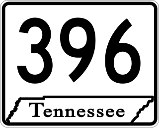
State Route 396, commonly referred to as Saturn Parkway, is a 4.47-mile-long (7.19 km) east–west primary state route located in the city of Spring Hill in the U.S. state of Tennessee. The entire route is a controlled-access highway, and provides direct access between the General Motors Spring Hill Manufacturing plant and Interstate 65, as well as the business district of Spring Hill. It takes its name from Saturn Corporation, a subsidiary of General Motors that operated the plant from 1990 to 2007 as its sole manufacturing facility.

Memorial Parkway, also known as the Parkway, is a major thoroughfare in Huntsville, Alabama that carries over 100,000 vehicles on average a day. It, in whole or in part, follows U.S. Route 231, U.S. Route 431, U.S. Route 72, and State Route 53 through the Huntsville city limits. It is a limited access road through most of Huntsville city proper, providing exits to the frontage road which allows access to road intersections, as well as businesses and residences along the route. Both the limited access and frontage roads are referred to as Memorial Parkway. Originally constructed to bypass downtown Huntsville and officially opened on December 1, 1955, the highway is the major commercial thoroughfare through Huntsville, a status it has held since the mid-1960s.
CoolSprings Galleria is an enclosed super-regional shopping mall in the Cool Springs commercial and residential corridor between Franklin and Brentwood, Tennessee, 15 miles (24 km) south of Nashville. Opened in 1991, it features 150 stores. The anchor stores are JCPenney, 2 Belk stores, H&M, American Girl, Ulta Beauty, Dillard's, Forever 21, and Macy's. The major tenant is The Cheesecake Factory. CBL Properties developed the mall in a joint venture with the Edward J. DeBartolo Corporation, and has owned it since its opening; CBL also owns an adjacent power center called CoolSprings Crossing which was developed simultaneously.
East Memphis is a region of Memphis, Tennessee with several defined and informal subdivisions and neighborhoods such as Colonial Acres, White Station-Yates, Sherwood Forest, Normal Station, High Point Terrace, Belle Meade, Normandy Meadows, St. Nick, Pleasant Acres, Balmoral, and Ridgeway. The general boundaries are informal:

The Nashville metropolitan area is a metropolitan statistical area in north-central Tennessee. Its principal city is Nashville, the capital of and largest city in Tennessee. With a population of over 2 million, it is the most populous metropolitan area in Tennessee. It is also the largest metropolitan area in Tennessee in terms of land area.
Interstate 65 (I-65) is part of the Interstate Highway System that runs 887.30 miles (1,427.97 km) north–south from Mobile, Alabama, to Gary, Indiana. In Tennessee, I-65 traverses the middle portion of the state, running from Ardmore at the Alabama border to the Kentucky border near Portland. The route serves the state capital and largest city of Nashville, along with many of its suburbs. Outside of urban areas, the Interstate bypasses most cities and towns that it serves, instead providing access via state and U.S. Highways. The Interstate passes through the Highland Rim and Nashville Basin physiographic regions of Tennessee, and is often used as the dividing line between the eastern and western portions of the former.

State Route 397 (SR 397), also known as Mack Hatcher Memorial Parkway, is a primary state route that serves as a perimeter road for the city of Franklin, Tennessee. Throughout its length, SR 397 also carries the designations of U.S. Route 31 Truck and U.S. Route 431 Truck. The route connects multiple U.S. and state routes, and serves as a bypass around the business district of Franklin, as well as a major thoroughfare.
Pennsylvania Avenue is a major north–south street in Brooklyn, New York. It generally runs north to south, from the Jackie Robinson Parkway in Broadway Junction to the Belt Parkway in Starrett City.
The C.S.M. Paul B. Huff Medal of Honor Memorial Parkway, more commonly known as Paul Huff Parkway or simply Paul Huff, is a major east–west thoroughfare which runs through northern Cleveland, Tennessee. While not a numbered highway, it serves as a connector between U.S. Route 11 (US 11) and State Route 60 (SR 60) as well as to Interstate 75 (I-75), and is one of the principal arterial roads in the city. The parkway is maintained by the city of Cleveland.
U.S. Route 31 (US 31) is a part of the United States Numbered Highway System that runs from Spanish Fort, Alabama, to Mackinaw City, Michigan. In the U.S. state of Tennessee, it runs concurrently with Interstate 65 (I-65) for the first mile northward from the Tennessee state line. There US 31 parallels I-65 to downtown Nashville. At Pulaski US 31 meets the southern terminus of US 31A in Tennessee. US 31 continues due north through Lynnville, Columbia, Spring Hill, Franklin and Brentwood to Nashville. The route splits into US 31E and US 31W in Nashville and go into Kentucky.
