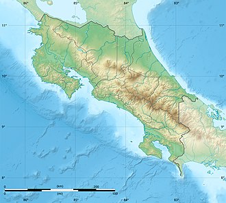
Costa Rican Central Valley

Last updated
Central Valley
Vista del Valle Central desde las montanas de Heredia.jpg
View of the Central Valley from the north Heredia mountains
Costa Rica relief location map.jpg
Red pog.svg
Central Valley
Naming
Native nameValle Central (Spanish)
Geography
CountryFlag of Costa Rica.svg  Costa Rica
Population center Greater Metropolitan Area
Coordinates 9°55′N84°04′W / 9.917°N 84.067°W / 9.917; -84.067

The Central Valley (Spanish : Valle Central) is a plateau and a geographic region of central Costa Rica. The land in the valley is a relative plain, despite being surrounded by several mountains and volcanoes, the latter part of the Central Range. The region houses almost three quarters of Costa Ricans, and includes the capital and most populous city, San José. The valley is shared among the provinces of Alajuela, Heredia, San José and Cartago. The region occupies an area of 11,366 km², more than a fifth of the country, and is drained by the Tárcoles River on the west side and by the Reventazón River on the east side. [1]

Contents

Geographic dimensions

The Central Valley is commonly considered to extend from the city of San Ramón in Alajuela in the west, to the city of Paraíso in Cartago in the east. The mountains north of the valley are part of the Central Range. There are four main volcanoes north of the valley, namely Poás, Barva, Irazú and Turrialba. The mountains that round the plateau to the south form part of the Talamanca Range. A smaller range, the Carpintera Hills, which runs from north to south roughly along the border between the provinces of San José and Cartago, divides the valley into two sections. The western section is normally referred to as "Western Valley" or "Central Valley" proper and the eastern section is referred to as the Eastern Valley or "Valle del Guarco". This smaller range also impacts the weather and ecosystems of the two subregions, with the Western Valley significantly influenced by the weather patterns of Costa Rica's Pacific coast and the Eastern Valley influenced by the Caribbean coast weather.

Climate

Because of its altitude, the temperature in the Central Valley varies between 15 and 30 °C or 59 and 86 °F, mainly because of the position toward the mountains (the altitude also varies between 800 m and 1,500 m above sea level). The western part of the valley is influenced by trade winds in summer, and, as the rest of the country with the exception of the Caribbean region, there are two climate seasons clearly defined, wet and dry. The eastern part of the valley is influenced more by Caribbean conditions, which are more volatile. Annual rainfall in the region varies from 1,900 millimetres or 75 inches in an urban and central place like Pavas to 3,200 millimetres or 126 inches in a rural and mountainous place like Fraijanes. Humidity varies from 75% (10% of volatility) in Pavas, to 87% (rarely descending to less than 80%) in Fraijanes.

Economic importance

The Central Valley had been traditionally the favorite place for Costa Ricans to live, and even today it contains an unequal distribution of population of the country, in relation to its size. This is because of the fertility of land in the region, helped by the influence of volcanoes and rivers that run through the valley. Weather also favours agriculture and farming activities. Because of the agglomeration of population, the valley is the center of commerce, industry and service activities, sustained by ports on both coasts, and by Liberia in Guanacaste (which has the other international airport besides Juan Santamaría Airport in Alajuela) that have similar economic movement.

The Greater Metropolitan Area (GAM) is the main populated conurbation of the country, and covers an extension roughly the same as the Central Valley.

Related Research Articles

<span class="mw-page-title-main">History of Costa Rica</span> Historical development of Costa Rica

The first indigenous peoples of Costa Rica were hunters and gatherers, and when the Spanish conquerors arrived, Costa Rica was divided in two distinct cultural areas due to its geographical location in the Intermediate Area, between Mesoamerican and the Andean cultures, with influences of both cultures.

<span class="mw-page-title-main">San José, Costa Rica</span> Capital and the largest city of Costa Rica

San José is the capital and largest city of Costa Rica, and the capital of the province of the same name. It is in the center of the country, in the mid-west of the Central Valley, within San José Canton. San José is Costa Rica's seat of national government, focal point of political and economic activity, and major transportation hub. San José Canton's population was 288,054 in 2011, and San José's municipal land area is 44.2 square kilometers, with an estimated 333,980 residents in 2015. Together with several other cantons of the central valley, including Alajuela, Heredia and Cartago, it forms the country's Greater Metropolitan Area, with an estimated population of over 2 million in 2017. The city is named in honor of Joseph of Nazareth.

<span class="mw-page-title-main">Cartago, Costa Rica</span> City in Cartago Province, Costa Rica

Cartago is the head city of Cartago canton of the Cartago Province, and is composed of the Oriental and Occidental districts as stated in the administrative divisions of Costa Rica. It was the capital of Costa Rica from 1574 to 1824.

<span class="mw-page-title-main">Alajuela Province</span> Province of Costa Rica

Alajuela is a province of Costa Rica. It is located in the north-central part of the country, bordering Nicaragua to the north. It also borders the provinces of Heredia to the east, San José to the south, Puntarenas to the southwest and Guanacaste to the west. As of 2011, the province had a population of 885,571. Alajuela is composed of 16 cantons, which are divided into 111 districts. It covers an area of 9,757.53 square kilometers.

<span class="mw-page-title-main">Alajuela</span> District in Alajuela canton, Alajuela province, Costa Rica

Alajuela is a district in the Alajuela canton of the Alajuela Province of Costa Rica. As the seat of the Municipality of Alajuela canton, it is awarded the status of city. By virtue of being the city of the first canton of the province, it is also the capital of the Province of Alajuela.

<span class="mw-page-title-main">Turrialba Volcano</span> Volcano in central Costa Rica

Turrialba Volcano is an active volcano in central Costa Rica that has been explosively eruptive in recent years including 2016 and in January, March and April 2017. Visitors used to be able to hike down into the main crater, but increased volcanic activity in 2014–17, resulting in large clouds of volcanic ash, caused the surrounding Turrialba Volcano National Park to close. However, with the subsiding of the eruptions, the park and volcano reopened on December 4, 2020.

<span class="mw-page-title-main">Braulio Carrillo National Park</span> National park

Braulio Carrillo National Park is a national park in Heredia Province, Cartago Province, Limón Province and San José Province, in central Costa Rica. It is part of the Central Conservation Area.

<span class="mw-page-title-main">Rail transport in Costa Rica</span> Railroad transportation system connecting locations in Costa Rica

Rail transport in Costa Rica is primarily under the stewardship of Incofer, an autonomous institution of the state. Incofer owns the national railway infrastructure and operates virtually all freight and passenger services, which consist primarily of commuter trains through the highly populated Central Valley. The whole Incofer network is 1,067 mm narrow gauge, although there are several small tourist railways of other gauges.

<span class="mw-page-title-main">Alajuela (canton)</span> Canton in Alajuela province, Costa Rica

Alajuela is a canton in the Alajuela province of Costa Rica. Its head city is the provincial capital city of Alajuela.

<span class="mw-page-title-main">Grecia (canton)</span> Canton in Alajuela province, Costa Rica

Grecia is a canton in the Alajuela province of Costa Rica.

<span class="mw-page-title-main">Greater Metropolitan Area (Costa Rica)</span> Conurbation in Costa Rica

The Greater Metropolitan Area of Costa Rica is the largest urban agglomeration in the country, comprising areas of high population density surrounding the capital, San José, which geographically corresponds to the Central Valley and extended to include the Guarco Valley, where some of the cantons of the Cartago province are located.

<span class="mw-page-title-main">Tourism in Costa Rica</span>

Tourism in Costa Rica has been one of the fastest growing economic sectors of the country and by 1995 became the largest foreign exchange earner. Since 1999, tourism has earned more foreign exchange than bananas, pineapples and coffee exports combined. The tourism boom began in 1987, with the number of visitors up from 329,000 in 1988, through 1.03 million in 1999, over 2 million in 2008, to a historical record of 2.66 million foreign visitors in 2015. In 2012, tourism contributed with 12.5% of the country's GDP and it was responsible for 11.7% of direct and indirect employment. In 2009, tourism attracted 17% of foreign direct investment inflows, and 13% in average between 2000 and 2009. In 2010, the tourism industry was responsible for 21.2% of foreign exchange generated by all exports. According to a 2007 report by ECLAC, tourism contributed to a reduction in poverty of 3% in the country.

<span class="mw-page-title-main">Index of Costa Rica–related articles</span>

The following is an alphabetical list of topics related to the Republic of Costa Rica.

<span class="mw-page-title-main">Braulio Carrillo Colina</span> Head of State of Costa Rica

Braulio Evaristo Carrillo Colina was the Head of State of Costa Rica during two periods: the first between 1835 and 1837, and the de facto between 1838 and 1842.

<span class="mw-page-title-main">Costa Ricans</span> People from the country of Costa Rica

Costa Ricans are the citizens of Costa Rica, a multiethnic, Spanish-speaking nation in Central America. Costa Ricans are predominantly Castizos, other ethnic groups people of Indigenous, European, African and Asian descent.

The Ochomogo War was a civil war fought in Costa Rica, the first in its history, and was fought shortly after the country became independent from Spain.

The League War was the second civil war of Costa Rica, as a member state of the Federal Republic of Central America. It passed between September and October 1835 in the Central Valley of Costa Rica. Its immediate trigger was the repeal of the "Ambulance Law", the law that established the rotation of the country's capital among the four constituent cities. The most important consequence was the triumph of the city of San José over the cities of Alajuela, Heredia and Cartago, which allowed its consolidation as the capital of Costa Rica.

<span class="mw-page-title-main">King Garabito</span> Costa Rican king

Garabito was an indigenous king of the Huetar ethnic group, who approximately between 1561 and 1574 was a monarch of the Western Huetar Kingdom and its surroundings, in the current territory of Costa Rica. A 1566 document indicates that in 1561 he succeeded his grandfather, although given that in the indigenous kingdoms of the Intermediate Area of Costa Rica, matrilineal succession prevailed, it is more likely that his predecessor was a maternal uncle.

<span class="mw-page-title-main">Interurbano Line (Costa Rica)</span> Railway line in Costa Rica

Interurbano Line, is a commuter railway line in Costa Rica, operated by the national public railway operator Incofer. The line connects the provinces of Alajuela, Heredia, San José and Cartago.

<span class="mw-page-title-main">Ochomogo</span> Place in Cartago, Costa Rica

Ochomogo is a location in the province of Cartago, Costa Rica. It is in a mountain pass between the cities of San José and Cartago. It was the site of the Battle of Ochomogo between those who wanted Costa Rica to join the newly formed First Mexican Empire and those who preferred independence.

References

  1. "Costa Rican Central Valley" (PDF). University of Costa Rica. Universidad de Costa Rica, San Pedro De Montes de Oca, San José, Costa Rica.