
Corby is a town and civil parish in the North Northamptonshire district, in the ceremonial county of Northamptonshire, England, located 23 miles (37 km) north-east of Northampton. From 1974 to 2021, the town served as the administrative headquarters of the Borough of Corby. At the 2011 Census, the built-up area had a population of 56,810, while the borough, which was abolished in 2021, had a population of 75,571 in 2021.

Geddington is a village and civil parish on the A4300, previously A43, in North Northamptonshire between Kettering and Corby. The population of the civil parish at the 2011 census was 1,503, virtually unchanged from 1,504 at the 2001 census.
Walgrave is a village and civil parish in West Northamptonshire, England. At the time of the 2001 census, the parish's population was 822 people, increasing to 868 at the 2011 Census.

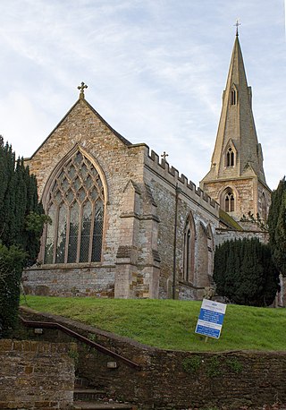
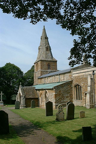
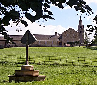
Gretton is a village and civil parish in North Northamptonshire. It is in Rockingham Forest and overlooks the valley of the River Welland and the neighbouring county of Rutland. At the time of the 2001 census, the parish had a population of 1,240 people, increasing to 1,285 at the 2011 census.
Wilbarston is a village and civil parish in the English county of Northamptonshire in the Welland valley. It is administered as part of North Northamptonshire and is five miles east of the Leicestershire town of Market Harborough, via the A427. At the time of the 2001 census, the parish's population was 767 people, including Pipewell but reducing slightly to 753 at the 2011 Census. A Community Governance Review concluded in February 2015 resulted in the ward of Pipewell becoming part of the civil parish of Rushton.

Caldecott is a village in the county of Rutland in the East Midlands of England. The civil parish population was 256 at the 2001 census increasing to 269 at the 2011 census. It is located about four miles (6.4 km) south of Uppingham and about 4 miles north of Corby in Northamptonshire. The A6003 runs through the village; traffic flow on the bridge over the River Welland is controlled by traffic lights.
Weldon is a suburban village and civil parish on the eastern outskirts of Corby, Northamptonshire, England. It is two miles away from Corby. The village is listed in the Domesday Book as 'Weledene', in the Colby Hundred. The head of the manor before 1066 is listed as 'Weldon', likely Anglo-Saxon. The Lord in 1066 is listed as 'Northmann', perhaps an unnamed Viking or Dane. The Lord, and Tenant-in-Chief, in 1086 was Robert de Bucy (Buci), a Norman.

Rockingham is a village and civil parish in North Northamptonshire, England. Close to the border of Leicestershire and Rutland, the village is largely connected to the town of Corby where various local organisations utilise the Rockingham name. Other nearby villages include Cottingham, Great Easton and Caldecott. During the 2001 census, the parish's population was 115 people, falling marginally to 113 at the 2011 Census.

Great Easton is a village and civil parish in the Harborough district of Leicestershire, England. The parish had a population of 558 according to the 2001 census, increasing to 671 at the 2011 census.
Ashley is a village and civil parish in the North Northamptonshire, England, about 4 miles (6.4 km) northeast of Market Harborough, Leicestershire and 5 miles (8.0 km) west of Corby. The population of the civil parish at the 2011 census was 224. The village is near the River Welland, which forms the border with Leicestershire. The Roman road called Via Devana in the part from Ratae to Duroliponte ran just north of the village.
Bulwick is a village and civil parish in North Northamptonshire, England. According to the 2001 census it had a population of 152 people, including Blatherwycke and increasing to 171 at the 2011 census. It is about six miles north-east of Corby, and is just off the A43 road. The Willow Brook runs through the village.

King's Cliffe is a village and civil parish on Willow Brook, a tributary of the River Nene, about 9 miles (14 km) northeast of Corby in North Northamptonshire. The parish adjoins the county boundary with the City of Peterborough and the village is about 12 miles (19 km) west of the city centre. The village is not far from the boundary with Lincolnshire and about 6 miles (10 km) south of Stamford.
Middleton is a village and civil parish in North Northamptonshire close to the county boundary with Leicestershire. At the time of the 2001 census, the parish's population was 328 people, increasing to 414 at the 2011 Census.

Harringworth is a village and civil parish in North Northamptonshire, England. It is located close to the border with Rutland, on the southern bank of the River Welland, and around 5.3 miles (8.5 km) north of Corby. At the 2001 Census, the population of the parish was 247, falling to 241 at the 2011 Census.

Stoke Albany is a village and civil parish in North Northamptonshire. It is off the A427 road between Market Harborough and Corby, about halfway between the two. At the time of the 2001 census, the parish's population was 330 people, increasing to 390 at the 2011 census.
Laxton is a village in North Northamptonshire, seven miles (11 km) east of Corby and approximately one mile (1.6 km) west of the A43. At the time of the 2001 census, the parish's population was 160 people, increasing to 234 at the 2011 census.

Stanion is a village and civil parish in North Northamptonshire, England. At the time of 2001 census, the parish's population was 873 people, increasing to 1,252 at the 2011 Census. There is a Church of England primary school. Gavron
Deenethorpe is a village and civil parish in North Northamptonshire, England. It is situated north-east of Corby and near the A43 road between Corby and Stamford. Nearby villages are Deene located 1.9 miles (3.1 km) to the North-West, Bulwick 1.9 miles (3.1 km) and Upper Benefield 2.5 miles (4.0 km) South-East to Deenethorpe.
Easton on the Hill is a village and civil parish at the north eastern tip of North Northamptonshire, England. The village had a population at the 2011 census was 1,015. The village, sited on the A43 road, is compact in form, with the older part of the village located north of the High Street. The parish extends from the River Welland in the north to the western end of RAF Wittering. The village is also on the shortest boundary in England with it being in the northernmost part of Northamptonshire between Stamford and Collyweston.

Corby was a non-metropolitan district with borough status in the county of Northamptonshire, England. It bordered the districts of East Northamptonshire, Harborough, Kettering and the county and district of Rutland. In 2021 the district had a population of 75,571. The council, Corby Borough Council was based at the Cube in the town of Corby.
