Corby (UK Parliament constituency)

Last updated

Corby
County constituency
for the House of Commons
Corby2007Constituency.svg
Boundary of Corby in Northamptonshire
EnglandNorthamptonshire.svg
Location of Northamptonshire within England
County Northamptonshire
Electorate 81,941 (2018) [1]
Major settlements Corby, Irthlingborough, Raunds, Thrapston and Oundle
Current constituency
Created 1983
Member of Parliament Tom Pursglove (Conservative)
Created from Kettering and Wellingborough

Corby is a constituency [n 1] in Northamptonshire represented in the House of Commons of the UK Parliament since May 2015 by Tom Pursglove of the Conservative Party. [n 2]

Contents

Further to the completion of the 2023 Periodic Review of Westminster constituencies, the seat will be subject to moderate boundary changes and will be renamed Corby and East Northamptonshire , to be first contested at the next general election. [2]

History

The seat was created due to population increases in the county for the 1983 general election. Since creation it has been a marginal seat alternating between Labour and the Conservative representatives with marginal majorities relative to national averages on all but two occasions, the 1997 Labour landslide and the 2012 by-election. The first Member of Parliament elected for the constituency in 1983 was William Powell, who represented the Conservatives for three sessions of Parliament until 1997. Labour then held the seat until 2010. On 6 August 2012, MP for the seat since 2010 Louise Mensch (formerly Louise Bagshawe) announced she was resigning, triggering a by-election held on 15 November 2012. Labour's Andy Sawford won, becoming the first Labour MP for the seat since Phil Hope was defeated in 2010, and only the second in the seat's history. This was Labour's first by-election win from a Conservative since the 1997 Wirral South by-election. At the 2015 general election Tom Pursglove standing for the Conservatives won with a small majority. He won again with a similar margin in 2017 and in 2019 Tom Pursglove took the seat for the third time, but with a majority of over 10,000, turning Corby into a non-marginal seat by Conservative Party standards.

Boundaries

Corby (UK Parliament constituency)
Map of boundaries 2010-2024
Corby (UK Parliament constituency)
Map of boundaries from 2024

1983–2010: The District of Corby, and the District of East Northamptonshire wards of Barnwell, Brigstock, Drayton, Forest, Irthlingborough, King's Cliffe, Lower Nene, Margaret Beaufort, Oundle, Raunds, Ringstead, Stanwick, Thrapston, Willibrook, and Woodford.

2010–present: The Borough of Corby, and the District of East Northamptonshire wards of Barnwell, Dryden, Fineshade, Irthlingborough, King's Forest, Lower Nene, Lyveden, Oundle, Prebendal, Raunds Saxon, Raunds Windmill, Ringstead, Stanwick, Thrapston, and Woodford.

The constituency was created in 1983 from parts of the seats of Kettering and Wellingborough. It is named after the town of Corby in Northamptonshire, and also covers much of the local government district of East Northamptonshire, but excluding Rushden and Higham Ferrers which are in the Wellingborough constituency. . The seat is a highly marginal contest between the Tories and Labour, with Labour's vote strongest in the town of Corby itself, against the solidly Conservative rural areas of East Northamptonshire. [3]

The constituency is sometimes informally called "Corby and East Northamptonshire", [4] but the Parliamentary Constituencies Order [5] and Whitaker's Almanack both make it clear that its official name is "Corby".

Members of Parliament

ElectionMember [6] Party
1983 William Powell Conservative
1997 Phil Hope Labour
2010 Louise Bagshawe Conservative
2012 by-election Andy Sawford Labour
2015 Tom Pursglove Conservative

Elections

Elections in the 2020s

Next general election: Corby and East Northamptonshire
PartyCandidateVotes%±%
Labour Lee Barron [7]
Reform UK Edward McDonald [8]
Majority
Turnout

Elections in the 2010s

General election 2019: Corby [9]
PartyCandidateVotes%±%
Conservative Tom Pursglove 33,410 55.2 +6.0
Labour Beth Miller23,14238.3-6.4
Liberal Democrats Chris Stanbra3,9236.5+3.9
Majority10,26816.9+12.4
Turnout 60,47570.2-2.6
Conservative hold Swing +6.25
General election 2017: Corby
PartyCandidateVotes%±%
Conservative Tom Pursglove 29,534 49.2 +6.4
Labour Beth Miller26,84444.7+6.2
Liberal Democrats Chris Stanbra1,5452.60.0
UKIP Sam Watts1,4952.511.2
Green Steven Scrutton5791.01.4
Majority2,6904.5+0.2
Turnout 59,63772.8+2.4
Conservative hold Swing +0.1
General election 2015: Corby [10]
PartyCandidateVotes%±%
Conservative Tom Pursglove 24,023 42.8 +0.6
Labour Co-op Andy Sawford 21,61138.5-0.1
UKIP Margot Parker 7,70813.7N/A
Liberal Democrats Peter Harris1,4582.6-11.9
Green Jonathan Hornett1,3742.4N/A
Majority2,4124.3+0.7
Turnout 56,17470.4+1.2
Conservative hold Swing +0.4
2012 Corby by-election
PartyCandidateVotes%±%
Labour Co-op Andy Sawford 17,267 48.4 +9.8
Conservative Christine Emmett9,47626.6−15.6
UKIP Margot Parker5,10814.3New
Liberal Democrats Jill Hope1,7705.0−9.5
BNP Gordon Riddell6141.7−3.0
English Democrat David Wickham4321.2New
Green Jonathan Hornett3781.1New
Independent Ian Gillman2120.6New
Cannabis Law Reform Peter Reynolds1370.4New
Elvis Loves Pets David Bishop990.3New
Independent Mr Mozzarella730.2New
Young People's PartyRohen Kapur390.1New
Democracy 2015Adam Lotun350.1New
United People's PartyChristopher Scotton250.1New
Majority7,79121.8N/A
Turnout 35,66544.8-24.4
Labour Co-op gain from Conservative Swing +12.57
General election 2010: Corby [11] [12]
PartyCandidateVotes%±%
Conservative Louise Bagshawe 22,886 42.2 +2.3
Labour Co-op Phil Hope 20,93538.6−4.5
Liberal Democrats Portia Wilson7,83414.5+1.7
BNP Roy Davies2,5254.7New
Majority1,9513.6N/A
Turnout 54,18069.2+3.6
Conservative gain from Labour Co-op Swing +3.4

Elections in the 2000s

General election 2005: Corby [13]
PartyCandidateVotes%±%
Labour Co-op Phil Hope 20,913 43.1 −6.2
Conservative Andrew Griffith 19,39640.0+2.8
Liberal Democrats David Radcliffe6,18412.7+2.6
UKIP Ian Gillman1,2782.6+0.8
Socialist Labour Steven Carey4991.0−0.6
Independent John Morris2570.5New
Majority1,5173.1-9.0
Turnout 48,52765.6+0.6
Labour Co-op hold Swing -4.5
General election 2001: Corby [14]
PartyCandidateVotes%±%
Labour Co-op Phil Hope 23,283 49.3 −6.1
Conservative Andrew Griffith 17,58337.2+3.8
Liberal Democrats Kevin Scudder4,75110.1+2.6
UKIP Ian Gillman8551.8+0.9
Socialist Labour Andrew Dickson7501.6New
Majority5,70012.1-9.9
Turnout 47,22265.0−12.9
Labour Co-op hold Swing -5.0

Elections in the 1990s

General election 1997: Corby [15]
PartyCandidateVotes%±%
Labour Co-op Phil Hope 29,888 55.4 +11.5
Conservative William Powell 18,02833.4−11.1
Liberal Democrats Ian Hankison4,0457.5−2.7
Referendum Sebastian Riley-Smith1,3562.5New
UKIP Ian Gillman5070.9New
Natural Law Jane Bence1330.2New
Majority11,86022.0N/A
Turnout 53,95777.9−5.0
Labour Co-op gain from Conservative Swing +11.3
General election 1992: Corby [16] [17]
PartyCandidateVotes%±%
Conservative William Powell 25,203 44.5 +0.2
Labour Harry Feather24,86143.9+3.0
Liberal Democrats Melvyn Roffe5,79210.2−4.6
Liberal Judith I. Wood7841.4New
Majority3420.6−2.8
Turnout 56,64082.9+3.3
Conservative hold Swing −1.4

Elections in the 1980s

General election 1987: Corby [18]
PartyCandidateVotes%±%
Conservative William Powell 23,323 44.3 +1.7
Labour Harry Feather21,51840.9+4.8
Liberal Terrence Whittington7,80514.8−5.5
Majority1,8053.4−3.1
Turnout 52,64679.6+2.1
Conservative hold Swing −1.5
General election 1983: Corby [19]
PartyCandidateVotes%±%
Conservative William Powell 20,827 42.6
Labour William Homewood 17,65936.1
Liberal Terrence Whittington9,90520.3
Ecology Rosy J. Stanning5051.0
Majority3,1686.5
Turnout 48,89677.5
Conservative win (new seat)

See also

Notes

  1. A county constituency (for the purposes of election expenses and type of returning officer)
  2. As with all constituencies, the constituency elects one Member of Parliament (MP) by the first past the post system of election at least every five years.

Related Research Articles

<span class="mw-page-title-main">Raunds</span> Human settlement in England

Raunds is a market town in North Northamptonshire, England. It had a population of 9,379 at the 2021 census.

<span class="mw-page-title-main">East Northamptonshire</span> Former non-metropolitan district in England

East Northamptonshire was a local government district in Northamptonshire, England, from 1974 to 2021. Its council was based in Thrapston and Rushden. Other towns included Oundle, Raunds, Irthlingborough and Higham Ferrers. The town of Rushden was by far the largest settlement in the district. The population of the district at the 2011 Census was 86,765.

<span class="mw-page-title-main">Southampton Itchen (UK Parliament constituency)</span>

Southampton, Itchen is a constituency represented in the House of Commons of the UK Parliament since 2015 by Royston Smith, a Conservative member of parliament. Discounting the Speaker returned in the early 1970s in two elections, local voters have elected the MP from only two parties alternately for various periods, with one party reaffiliation (defection) between elections when the Labour Party split in the 1980s.

<span class="mw-page-title-main">Lanark and Hamilton East (UK Parliament constituency)</span> Parliamentary constituency in the United Kingdom, 2005 onwards

Lanark and Hamilton East is a county constituency of the House of Commons of the Parliament of the United Kingdom, which was first used at the 2005 general election. It covers parts of the former Clydesdale, Hamilton North and Bellshill and Hamilton South constituencies, and it elects one Member of Parliament (MP) by the first past the post voting system.

<span class="mw-page-title-main">Daventry (UK Parliament constituency)</span> UK Parliament constituency since 1974

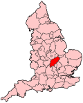
Daventry is a constituency in Northamptonshire represented in the House of Commons of the UK Parliament since 2010 by Chris Heaton-Harris of the Conservative Party, who has served as Secretary of State for Northern Ireland since 2022.

<span class="mw-page-title-main">Penrith and The Border (UK Parliament constituency)</span> Parliamentary constituency in the United Kingdom, 1950 onwards

Penrith and The Border is a constituency in Cumbria represented in the House of Commons of the UK Parliament since 2019 by Neil Hudson, a Conservative.

<span class="mw-page-title-main">Bolton North East (UK Parliament constituency)</span> Parliamentary constituency in the United Kingdom, 1983 onwards

Bolton North East is a constituency represented in the House of Commons of the UK Parliament since 2019 by Mark Logan, a Conservative.

<span class="mw-page-title-main">Bury North (UK Parliament constituency)</span> Parliamentary constituency in the United Kingdom, 1983 onwards

Bury North is a borough constituency in Greater Manchester, created in 1983 and represented in the House of Commons of the UK Parliament. With a Conservative majority of 105 votes, it is the most marginal constituency for a sitting MP in the United Kingdom as of the 2019 general election.

<span class="mw-page-title-main">Kettering (UK Parliament constituency)</span> Parliamentary constituency in the United Kingdom, 1918 onwards

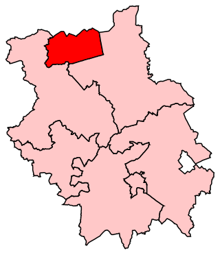
Kettering is a constituency in Northamptonshire represented in the House of Commons of the UK Parliament since 2005 by Philip Hollobone, a Conservative.

<span class="mw-page-title-main">Northampton South (UK Parliament constituency)</span> Parliamentary constituency in the United Kingdom

Northampton South is a constituency represented in the House of Commons of the UK Parliament since 2017 by Andrew Lewer, a Conservative.

<span class="mw-page-title-main">Wellingborough (UK Parliament constituency)</span> Parliamentary constituency in the United Kingdom, 1918 onwards

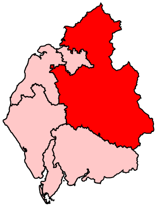
Wellingborough is a constituency in Northamptonshire represented in the House of Commons of the UK Parliament. The seat is currently held by Labour MP Gen Kitchen, after the recall of MP Peter Bone in December 2023 which resulted in a by-election in February 2024.

<span class="mw-page-title-main">Peterborough (UK Parliament constituency)</span> Parliamentary constituency in the United Kingdom since 1801

Peterborough is a borough constituency represented in the House of Commons of the Parliament of the United Kingdom since 2019 by Paul Bristow of the Conservative Party.

<span class="mw-page-title-main">Waveney (UK Parliament constituency)</span> Parliamentary constituency in the United Kingdom, 1983 onwards

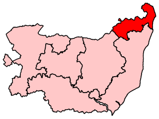
Waveney is a constituency represented in the House of Commons of the UK Parliament since 2010 by Peter Aldous, a Conservative. It returns one Member of Parliament (MP) to the House of Commons of the Parliament of the United Kingdom.

<span class="mw-page-title-main">Sutton and Cheam (UK Parliament constituency)</span> Parliamentary constituency in the United Kingdom, 1945 onwards

Sutton and Cheam is a constituency in Greater London represented in the House of Commons of the UK Parliament since 2015 by Paul Scully, a Conservative.

<span class="mw-page-title-main">A605 road</span> Main road in the English counties of Northamptonshire and Cambridgeshire

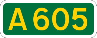
The A605 road is a main road in the English counties of Northamptonshire and Cambridgeshire.

<span class="mw-page-title-main">North Northamptonshire</span> District in England

North Northamptonshire is one of two local government districts in Northamptonshire, England. It is a unitary authority area forming about one half of the ceremonial county of Northamptonshire. It was created in 2021. Its council is based in Corby, the district's largest town. Other notable towns are Kettering, Wellingborough, Rushden, Raunds, Desborough, Rothwell, Irthlingborough, Thrapston and Oundle.

<span class="mw-page-title-main">Tom Pursglove</span> British politician (born 1988)

Thomas Christopher John Pursglove is a British Conservative Party politician who is Minister of State for Legal Migration and Delivery. A member of the Conservative Party, he has been the Member of Parliament (MP) for Corby since May 2015.

References

  1. "England Parliamentary electorates 2010-2018". Boundary Commission for England. Retrieved 23 March 2019.
  2. "The 2023 Review of Parliamentary Constituency Boundaries in England – Volume one: Report – East Midlands | Boundary Commission for England". boundarycommissionforengland.independent.gov.uk. Retrieved 25 July 2023.
  3. "UKPollingReport Election Guide 2010 » Corby". ukpollingreport.co.uk. Archived from the original on 28 December 2017. Retrieved 10 August 2012.
  4. Coupe, Kerry (14 November 2019). "General Election 2019: Corby and East Northamptonshire candidates announced". Stamford Mercury . Retrieved 25 January 2020.
  5. "The Parliamentary Constituencies (England) Order 2007". www.legislation.gov.uk.
  6. Leigh Rayment's Historical List of MPs – Constituencies beginning with "C" (part 5)
  7. "The Labour candidate who wants to turn Corby red again at the next general election". Northamptonshire Telegraph. Retrieved 24 December 2023.
  8. "Find My PPC" (PDF). Reform UK . Retrieved 23 December 2023.
  9. "Declaration of Results UKPE 2019". Corby.gov.uk. Retrieved 4 May 2020.
  10. "Election Data 2015". Electoral Calculus. Archived from the original on 17 October 2015. Retrieved 17 October 2015.
  11. "Election Data 2010". Electoral Calculus. Archived from the original on 26 July 2013. Retrieved 17 October 2015.
  12. of Persons Nominated [ permanent dead link ], Corby Borough Council
  13. "Election Data 2005". Electoral Calculus. Archived from the original on 15 October 2011. Retrieved 18 October 2015.
  14. "Election Data 2001". Electoral Calculus. Archived from the original on 15 October 2011. Retrieved 18 October 2015.
  15. "Election Data 1997". Electoral Calculus. Archived from the original on 15 October 2011. Retrieved 18 October 2015.
  16. "Election Data 1992". Electoral Calculus. Archived from the original on 15 October 2011. Retrieved 18 October 2015.
  17. "Politics Resources". Election 1992. Politics Resources. 9 April 1992. Archived from the original on 24 July 2011. Retrieved 6 December 2010.
  18. "Election Data 1987". Electoral Calculus. Archived from the original on 15 October 2011. Retrieved 18 October 2015.
  19. "Election Data 1983". Electoral Calculus. Archived from the original on 15 October 2011. Retrieved 18 October 2015.

52°29′N0°32′W / 52.48°N 0.53°W / 52.48; -0.53