
Northamptonshire is a ceremonial county in the East Midlands of England. It is bordered by Leicestershire, Rutland and Lincolnshire to the north, Cambridgeshire to the east, Bedfordshire, Buckinghamshire, Oxfordshire to the south and Warwickshire to the west. Northampton is the largest settlement and the county town.
Wellingborough is a market town and civil parish in the North Northamptonshire unitary authority area of Northamptonshire, England. It is 65 miles (105 km) from London and 11 miles (18 km) from Northampton, and is on the north side of the River Nene.

Raunds is a market town in North Northamptonshire, England. It had a population of 9,379 at the 2021 census.

Rushden is a town and civil parish in North Northamptonshire, England, around 18 miles (29 km) east of Northampton. The parish is on the border with Bedfordshire, 12 miles (19 km) north of Bedford.

Kettering is a market and industrial town in the North Northamptonshire unitary authority area of Northamptonshire, England. It forms a civil parish called Kettering Town. Kettering is located 67 miles (108 km) north of London and 15 miles (24 km) north-east of Northampton, west of the River Ise, a tributary of the River Nene. The name means "the place of Ketter's people ".

Irthlingborough is a town on the River Nene in North Northamptonshire, England. As of 2021, it has a population of 9,325, and was at one point the smallest town in England to have had a Football League team, Rushden & Diamonds F.C., before the promotion of Forest Green Rovers in 2017. The parish church, St Peter, has a lantern tower, unusual for Northamptonshire churches, which was built to guide travellers across the Nene valley in foggy weather. It also has doors at the four cardinal points and has eight misericords in the chancel.
The history of Northamptonshire spans the same period as English history.

Corby is a constituency in Northamptonshire represented in the House of Commons of the UK Parliament since May 2015 by Tom Pursglove of the Conservative Party.

Wellingborough is a constituency in Northamptonshire represented in the House of Commons of the UK Parliament. The seat is currently held by Labour MP Gen Kitchen, after the recall of MP Peter Bone in December 2023 which resulted in a by-election in February 2024.

Chelveston is a small village in North Northamptonshire. It is about 2 miles (3.2 km) east of Higham Ferrers and 7 miles (11.3 km) east of Wellingborough on the B645 from Higham Ferrers to St Neots. To the south is the hamlet of Caldecott and the settlement of Chelston Rise which together comprise the civil parish of Chelveston cum Caldecott. The population is now included in the civil parish of Chelveston cum Caldecott.
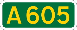
The A605 road is a main road in the English counties of Northamptonshire and Cambridgeshire.

North Northamptonshire is one of two local government districts in Northamptonshire, England. It is a unitary authority area forming about one half of the ceremonial county of Northamptonshire. It was created in 2021. Its council is based in Corby, the district's largest town. Other notable towns are Kettering, Wellingborough, Rushden, Raunds, Desborough, Rothwell, Irthlingborough, Thrapston and Oundle.
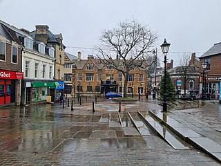
Higham Ferrers is a market town and civil parish in the Nene Valley in North Northamptonshire, England, close to the Cambridgeshire and Bedfordshire borders. It forms a single built-up area with Rushden to the south and had a population of 8,827 at the 2021 census. The town centre contains many historic buildings around the Market Square and College Street.
The Northampton and Peterborough Railway was an early railway promoted by the London and Birmingham Railway (L&BR) to run from a junction at Blisworth on the L&BR main line to Northampton and Peterborough, in England. The construction of the line was authorised by Parliament in 1843 and the 47 mile line opened in 1845. The line largely followed the river Nene, and for the economy of construction, it had many level crossings with intersecting roads, rather than bridges. In 1846 the L&BR joined with other companies, together forming the London and North Western Railway (LNWR).

The Northamptonshire Football Association, also simply known as the Northamptonshire FA, is the governing body of football in the English county of Northamptonshire.
The Higham Ferrers branch line was a short railway branch built in Northamptonshire, England, by the Midland Railway to serve the industrial towns of Rushden and Higham Ferrers. It was originally intended to continue the line to Raunds, but that was frustrated by the refusal of a landowner to release his land.
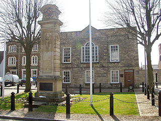
Higham Ferrers Town Hall is a municipal building in the Market Square in Higham Ferrers, Northamptonshire, England. The structure, which serves as the offices and meeting place of Higham Ferrers Town Council, is a Grade II listed building.


