
Worminghall is a village and civil parish in the Aylesbury Vale district of Buckinghamshire, England.

Isleham is a small village and civil parish in the English county of Cambridgeshire. It is part of the Fens. It has 3 pubs.

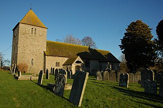
Hintlesham is a small village in Suffolk, England, situated roughly halfway between Ipswich and Hadleigh. It is in the Belstead Brook electoral division of Suffolk County Council.

Chiddingfold is a village and civil parish in the Weald in the Waverley district of Surrey, England. It lies on the A283 road between Milford and Petworth. The parish includes the hamlets of Ansteadbrook, High Street Green and Combe Common.

Hemyock is a village and civil parish in Devon, England. It is about 8 miles north-west of Honiton and 5 miles (8 km) south of the Somerset town of Wellington. The 2011 Census recorded the parish's population as 1,519. Hemyock is part of the electoral ward of Upper Culm. The population of this ward at the above census was 4,039. The River Culm flows through Hemyock. Hemyock was the former home of the St Ivel dairy processing plant, formerly where the butter-spreads 'St Ivel Gold' and 'Utterly-Butterly' were produced before being moved to a factory in the north of England.

Stow Bedon is a civil parish and village of 290 inhabitants in the Breckland district of the English county of Norfolk. Stow Bedon adjoins the hamlet of Lower Stow Bedon, although the two are often considered to be one village. In the south of the parish is the hamlet of Breckles.

Albury is a village and civil parish in the borough of Guildford in Surrey, England, about 4 miles (6.4 km) south-east of Guildford town centre. The village is within the Surrey Hills Area of Outstanding Natural Beauty. Farley Green, Little London and adjacent Brook form part of the civil parish.

Amcotts is a village and civil parish in the North Lincolnshire district of Lincolnshire, England, and on the Isle of Axholme. The village is situated north-west from Scunthorpe, and on the west bank of the River Trent facing Flixborough on the east bank. The 2001 Census recorded a population of 219 for the parish, increasing to 262 at the 2011 census.

Wellington, a village in Herefordshire, England at grid reference SO494481 had a population of 1005 in the 2011 census.

Ospringe is a village and area of Faversham in the English county of Kent. It is also the name of a civil parish, which since 1935 has not included the village of Ospringe.
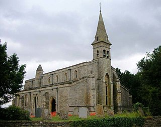
Thurning is a village and civil parish in the English county of Northamptonshire. Located in the north-east of the county, about 5.5 miles south-east of Oundle, Thurning forms part of the civil parish of Hemington, Luddington and Thurning. Until 1888, the ecclesiastical parish of Thurning was partly in Northamptonshire and partly in Huntingdonshire, its parish church being in the latter county. At the time of the 2001 census, the population of Thurning Civil Parish was 93 people. At the time of the 2011 Census, the population of the village remained less than 100 and is included in the civil parish of Hemington.

Luddington is a village, part of the civil parish of Luddington with Haldenby, on the Isle of Axholme in North Lincolnshire, England. The population of the civil parish at the 2011 census was 419. It is 6 miles (10 km) north-west from Scunthorpe, 6 miles south-east from Goole and 18 miles (29 km) north-east from Doncaster.
Eastoft is a village and civil parish in North Lincolnshire, England. It is situated within the Isle of Axholme, 3 miles (5 km) north-east from Crowle, and on the A161 road.
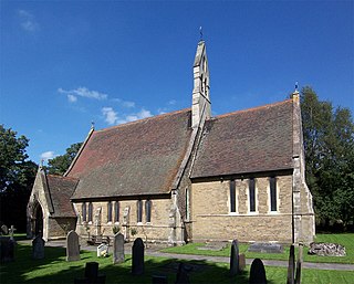
Luddington is a small village and civil parish in the English county of Warwickshire in the United Kingdom. The population in 2001 was 457 increasing to 475 at the 2011 Census. It is located about five kilometres outside the town of Stratford-upon-Avon on the banks of the river Avon and has views south over the Cotswolds. Facilities and communications include a phone box, a 19th-century church, a post box, a marina with a 17th-century lock, a village green and a recently refurbished village hall originally built in 1953. The parish encompasses Dodwell Caravan Park to the north of the village.
Yatton Keynell is a village and civil parish in Wiltshire, England. The village is on the B4039 road near Castle Combe, about 4 miles (6 km) northwest of Chippenham, and about the same distance to the east of the county border with South Gloucestershire.

Somersby is a village in the East Lindsey district of Lincolnshire, England. It is situated 6 miles (9.7 km) north-west from Spilsby and 7 miles (11 km) east-north-east from Horncastle. The village lies in the civil parish of Greetham with Somersby in the Lincolnshire Wolds, a designated Area of Outstanding Natural Beauty; the parish covers about 600 acres (2.4 km2).

Hinton Waldrist is a village and civil parish in the Vale of White Horse, England. It was part of Berkshire until the 1974 boundary changes transferred it to Oxfordshire. The village is between Oxford and Faringdon, 9 miles (14 km) southwest of Oxford. The parish includes the hamlet of Duxford. The 2011 Census recorded the parish's population as 328.

Sydenham is a village and civil parish about 3 miles (5 km) southeast of Thame in Oxfordshire. To the south the parish is bounded by the ancient Lower Icknield Way, and on its other sides largely by brooks that merge as Cuttle Brook, a tributary of the River Thame. The 2011 Census recorded the parish's population as 451.

Shottisham is a village and civil parish in the East Suffolk district, in the county of Suffolk. It lies in the Wilford Hundred, about four and a half miles south-east of Woodbridge, between the parishes of Sutton, Alderton, Ramsholt and Hollesley, in the Bawdsey peninsula. About three miles from the coast at Hollesley Bay and Shingle Street, the village street overlooks a slight hollow of meads and copses at the road crossing of Shottisham Creek, a tributary brook of the river Deben.
Michaelchurch Escley is a village and civil parish 13 miles (21 km) west of Hereford, in the county of Herefordshire, England. In 2011 the parish had a population of 198. The parish touches Craswall, Cusop, Dorstone, Llanveynoe, Longtown, Newton, Peterchurch and St. Margarets. Michaelchurch Escley shares a parish council with Newton, St Margarets, Turnastone and Vowchurch called "Vowchurch and District Group Parish Council".


