
Salt Lake County is located in the U.S. state of Utah. As of the 2020 United States census, the population was 1,185,238, making it the most populous county in Utah. Its county seat and largest city is Salt Lake City, the state capital. The county was created in 1850. Salt Lake County is the 37th most populated county in the United States and is one of four counties in the Rocky Mountains to make it into the top 100. Salt Lake County has been the only county of the first class in Utah – under the Utah Code is a county with a population of 700,000 or greater. Although, Utah County directly to the south has recently reached this threshold.

Cottonwood Heights is a city located in Salt Lake County, Utah, United States, along the east bench of the Salt Lake Valley. It lies south of the cities of Holladay and Murray, east of Midvale, and north of Sandy within the Salt Lake City, Utah Metropolitan Statistical Area. Originally a census-designated place (CDP), following a successful referendum in May 2004, the city was incorporated on January 14, 2005. The population, as of the 2020 census, was 33,617.

Magna is a city in Salt Lake County, Utah, United States. The current population of the city stands at 29,251 according to the 2020 census, a 10.4% increase over 26,505 in 2010.

Murray is a city situated on the Wasatch Front in the core of Salt Lake Valley in the U.S. state of Utah. Named for territorial governor Eli Murray, the city had a population of 50,637 as of the 2020 United States Census. Murray shares borders with Taylorsville, Holladay, South Salt Lake, Millcreek and West Jordan, Utah. Once teeming with heavy industry, Murray's industry mix has now shifted significantly toward healthcare, retail, and professional, scientific, and technical services. Known for its central location in Salt Lake County, Murray has been called the Hub of Salt Lake County. Unlike most of its neighboring communities, Murray operates its own police, fire, power, water, library, and parks and recreation departments and has its own school district. While maintaining many of its own services, Murray has one of the lowest city tax rates in the state.
The Deseret News is a multi-platform newspaper based in Salt Lake City, published by Deseret News Publishing Company, a subsidiary of Deseret Management Corporation, which is owned by the Church of Jesus Christ of Latter-day Saints. Founded in 1850, it was the first newspaper to be published in Utah. The publication's name is from the geographic area of Deseret identified by Utah's pioneer settlers, and much of the publication's reporting is rooted in that region.
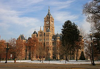
The Salt Lake City and County Building, usually called the "City-County Building", is the seat of government for Salt Lake City, Utah. The historic landmark formerly housed offices for Salt Lake County government as well, hence the name.
Interstate 215 (I-215), also known locally as the Belt Route, is the only auxiliary Interstate in the U.S. state of Utah, forming a three-quarters loop around Salt Lake City and many of its suburbs. The route begins at the mouth of Parley's Canyon at a junction with I-80 east of the city center, and heads south through the edge of the Salt Lake City metropolitan area's eastern suburbs of Millcreek, Holladay, and Cottonwood Heights. It continues west through Murray before turning north again, passing through the city's first-ring western suburbs of Taylorsville and West Valley City. It then enters North Salt Lake and Davis County for a short distance before reaching I-15 northwest of the city center.

The Granite School District is a public school district spread across central Salt Lake County, Utah, serving West Valley City, Millcreek, Taylorsville, South Salt Lake, and Holladay; Kearns and Magna Townships; and parts of West Jordan, Murray and Cottonwood Heights. About 67,000 students are enrolled in its programs ranging from kindergarten to twelfth grade. It operates 9 high schools, 15 junior high schools, 62 elementary schools, as well as several specialty schools. This makes Granite the third largest school district in the state of Utah behind Alpine School District in Utah County and Davis County School District. Other school districts in the area include the Salt Lake City School District and the Murray School District.

Liberty Park is a popular public urban park in Salt Lake City, Utah. It is the city's second-largest public park, at 80 acres (32 ha), being surpassed only by Sugar House Park which has 110.5 acres (44.7 ha). The park features a pond with two islands, and is also the location of Tracy Aviary. The park is listed on the National Register of Historic Places (NRHP) and it includes the Isaac Chase Mill, which is also NRHP-listed.

The Eagle Gate is a historical monument which forms an arch across State Street in the downtown area of Salt Lake City, Utah. The monument pays homage to Brigham Young's 1859 Eagle Gate, which served as an entrance to his property and the City Creek Canyon road. After the road was publicly opened and the gates removed, the arch, with its perched eagle and beehive sculpture, remained over the street. Since then, the structure has been rebuilt twice; once in the 1890s and again in the 1960s.
Canyons School District is a school district in the southeastern portion of Salt Lake County in Utah, United States.

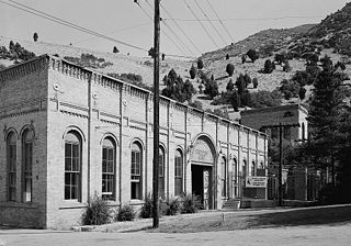
Built in 1909, the Murray LDS Second Ward Meetinghouse is a historic building in Murray, Utah, United States. It was listed on the National Register of Historic Places in 2001. The building is significant for its association with the history and development of Murray between 1909 and 1950.
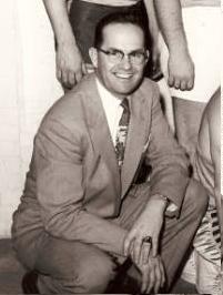
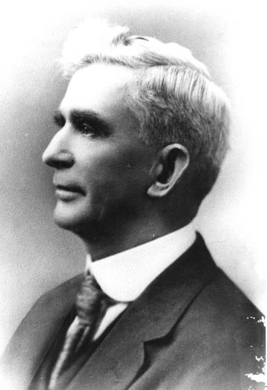
Vaughn Carvel Soffe was mayor of Murray, Utah from 1971 to 1977. During his administration, Murray established Ken Price Field and Murray Parkway Golf Course, in addition to youth baseball and basketball programs. Murray also successfully defended itself from Salt Lake County challenging its re-development plans.
Norman W. Erekson was mayor of Murray, Utah from 1918 to 1919.

Big Cottonwood Creek is located in the Wasatch Mountains just east of Salt Lake City. It is part of the Big Cottonwood Creek Watershed, which ranges in elevation from 5,000 to 10,500 feet with the headwaters around 9,600 feet. The creek flows through the Big Cottonwood Canyon in a westerly direction until it emerges into Salt Lake Valley about eighteen miles (29 km) from its highest source. Thence its course is northwesterly through Cottonwood Heights, Holladay, and Murray, Utah for a little over twenty-four miles from the headwaters until it empties into the Jordan River about five miles (8.0 km) south of Salt Lake City. The water eventually flows into the Great Salt Lake. In the summer, its waters are all used for irrigation purposes. From its source to its original outlet in the Jordan River is about twenty-six miles.

The Granite Stake Tabernacle is a tabernacle of the Church of Jesus Christ of Latter-day Saints in the Sugar House District of Salt Lake City, Utah, United States. It has historic significance to the area and was listed in the U.S. National Register of Historic Places in 2003.
Richard Cuddy Howe was an American politician and judge. At the time of his retirement in 2003, he was the only person in Utah history to serve as a member of the State House of Representatives, the State Senate, and the State Supreme Court. He served on the Utah Supreme Court from 1980 to 2002, and was the Chief Justice of the Utah Supreme Court from 1998 to April 2002.
The Granite Hydroelectric Power Station was built in 1896–1897 at the mouth of Big Cottonwood Canyon, about 6 miles (9.7 km) southeast of Salt Lake City, Utah, United States(in what is now eastern Cottonwood Heights. The plant comprises the powerhouse, transformer house, a wooden conduit, penstocks, and a small dam. Like the Stairs Station upstream, it represents an intact high-head generating plant from the late 19th century.

The Pioneer Memorial Museum is a history museum operated by the Daughters of Utah Pioneers (DUP) on Capitol Hill in Salt Lake City, Utah, United States. The museum hosts a large collection of artifacts related to the Mormon pioneers and early Utah, along with libraries containing pioneer biographies and photographs.


