
The Fox–Wisconsin Waterway is a waterway formed by the Fox and Wisconsin Rivers. First used by European settlers in 1673 during the expedition of Marquette & Joliet, it was one of the principal routes used by travelers between the Great Lakes and the Mississippi River until the completion of the Illinois and Michigan Canal in 1848 and the arrival of railroads. The western terminus of the Fox–Wisconsin Waterway was at the Mississippi at Prairie du Chien, Wisconsin. It continued up the Wisconsin River about 116 miles (187 km) until reaching Portage, Wisconsin. There travelers would portage to the Upper Fox River, or eventually, use the Portage Canal. It continued about 160 miles (257 km) down the Fox River, following it through Lake Winnebago and continuing on the Lower Fox over 170 feet of falls to the eastern terminus of Green Bay.

Lake Nokomis is one of several lakes in Minneapolis, Minnesota, United States. The lake was previously named Lake Amelia in honor of Captain George Gooding's daughter, Amelia, in 1819. Its current name was adopted in 1910 to honor Nokomis, grandmother of Hiawatha. It is located in the southern part of the city, west of the Mississippi River and south of Lake Hiawatha. The lake is oval in shape, with a long axis running southwest to northeast. Two pathways circle the lake, a 2.7-mile (4.3 km) pedestrian tail and a 2.8-mile (4.5 km) bicycle trail. Because the lower part of the lake is crossed by Cedar Avenue running north–south, the impression from the ground is that the lake is shaped like an L. The lake has an area of 204 acres (0.83 km2).

Dredging is the operation of excavating material from a water environment. Possible purposes of dredging include: improving existing water features; reshaping land and water features to alter drainage, navigability, and commercial use; construct dams, dikes, and other controls for streams and shorelines; and to recover valuable mineral deposits or marine life having commercial value. In all but a few situations the excavation is undertaken by a specialist floating plant, known as a dredger. Dredging is carried out in many different locations and for many different purposes, but the main objectives are usually to recover material of value or use, or to create a greater depth of water. Dredges have been classified as suction or mechanical.

The Great Sacandaga Lake is a large lake situated in the Adirondack Park in northern New York in the United States. The lake has a surface area of about 41.7 square miles (108 km2) at capacity, and the length is about 29 miles (47 km). The word Sacandaga means "Land of the Waving Grass" in the local native language. The lake is located in the northern parts of Fulton County and Saratoga County near the south border of the Adirondack Park. A small part of it also extends northward into southern Hamilton County. The broader, south end of the lake is northeast of the City of Johnstown and the City of Gloversville. Great Sacandaga Lake is a reservoir created by damming the Sacandaga River. The primary purpose for the creation of the reservoir was to control flooding on the Hudson River and the Sacandaga River, floods which had a historically significant impact on the surrounding communities.

Candlewood Lake is a manmade lake located in Fairfield and Litchfield counties of western Connecticut, in the northeastern United States. At 8.4 square miles (22 km2), it is the largest lake in Connecticut. The lake is bordered by five towns: Brookfield, Danbury, New Fairfield, New Milford, and Sherman. Some of the most expensive real estate in Connecticut is located on the shores of the lake, in the towns of Brookfield, New Fairfield, New Milford, and Sherman.

Shawnee State Park is a 3,983-acre (1,612 ha) Pennsylvania state park in Juniata and Napier Townships, Bedford County, Pennsylvania in the United States. Shawnee Lake, a 451-acre (183 ha) warm water reservoir, is at the center of the park as its main attraction. The park's main entrance is just east of Schellsburg, along U.S. Route 30 and about 10 miles (16 km) west of the county seat of Bedford. The park is also easily accessed via State Route 31 and by State Route 96.
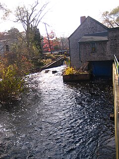
The Jones River is a 7.5-mile-long (12.1 km) river running through Kingston, Massachusetts. The river drains about 30 square miles (78 km2), has its source in Silver Lake and drains into Kingston Bay. Land surrounding the river is 52% forested, of which 22% has been developed for residential use. There is a USGS stream gauge along 16 square miles (41 km2) of the river and it has measured the flow at 0.7 cubic feet per second (0.020 m3/s) per square mile of drainage area.
The Deer Flat National Wildlife Refuge is an important breeding area for mammals, birds, and other animals. The National Wildlife Refuge is located on land surrounding Lake Lowell, just outside Nampa, Idaho. It serves as a resting and wintering area for birds, including mallards and Canada geese, along the Pacific Flyway and was named a "Globally Important Bird Area" by the American Bird Conservancy.

Siltation, or sans, is water pollution caused by particulate terrestrial clastic material, with a particle size dominated by silt or clay. It refers both to the increased concentration of suspended sediments and to the increased accumulation of fine sediments on bottoms where they are undesirable. Siltation is most often caused by soil erosion or sediment spill.

Stillhouse Hollow Lake is a U.S. Army Corps of Engineers reservoir on the Lampasas River in the Brazos River basin, 5 miles (8 km) southwest of Belton, Texas, United States. Stillhouse Hollow Dam and the reservoir are both managed by the Fort Worth District of the U.S. Army Corps of Engineers. The reservoir was officially impounded in 1968, and serves to provide flood control for the communities downstream. The lake also functions as a water supply for several of the surrounding communities. Stillhouse Hollow Lake is a popular recreational destination.

Kingman Lake is a 110-acre (0.45 km2) artificial lake located in the Anacostia River in Washington, D.C., in the United States. The lake was created in 1920 when the United States Army Corps of Engineers used material dredged from the Anacostia River to create Kingman Island. The Corps of Engineers largely blocked the flow of the Anacostia River to the west of Kingman Island, creating the lake. Kingman Lake is currently managed by the National Park Service.

Lake Awoonga was formed on the Boyne River by the dam located 30 km (19 mi) from Gladstone, in Central Queensland, Australia. It is approximately 30 minutes drive from Gladstone, via Benaraby.

Fishing techniques are methods for catching fish. The term may also be applied to methods for catching other aquatic animals such as molluscs and edible marine invertebrates.
Lake Gregory is an reservoir in the San Bernardino National Forest of the San Bernardino Mountains in San Bernardino County, California. The lake and the surrounding area make up the Lake Gregory Regional Park adjacent to Crestline, California.
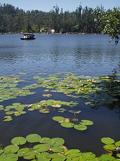
Kodaikanal Lake, also known as Kodai Lake is a manmade lake located in the Kodaikanal city in Dindigul district in Tamil Nadu, India. Sir Vere Henry Levinge, the then Collector of Madurai, was instrumental in creating the lake in 1863, amidst the Kodaikanal town which was developed by the British and early missionaries from USA. The lake is said to be Kodaikanal's most popular geographic landmark and tourist attraction.
Sunset Lake is a medium-sized reservoir located in and near the city of Bridgeton in southern New Jersey. The reservoir lies mostly in the townships of Hopewell Township and Upper Deerfield Township. The lake was created by damming a stream that feeds to the area from above Seeley Lake. And a stream that feeds into the lake from the nearby Mary Elmer Lake also located in Bridgeton. The dam is located next to Park Drive, a major roadway that cuts throughout the city's park system and interconnects with Route 49. Just across the turnpike in Deerfield it opens over in the "Silly Pond". The water from Sunset Lake flows over the spillway dam and into the Cohansey River. Originally, the lake was known as Tumbling Dam Pond.

Stockbridge Bowl, also known as Lake Mahkeenac, is a 372-acre (1.51 km2) artificially impounded body of water that is 4 km (2.5 mi) north of the village of Stockbridge, Massachusetts. Above the lake’s north side with sweeping views to the south is Tanglewood, the summer home of the Boston Symphony Orchestra.

Canonsburg Lake is a lake in Canonsburg, Pennsylvania. It is an artificial lake formed by the waters of Little Chartiers Creek behind a 525 feet (160 m) long and 45 feet (14 m) high concrete dam. The dam was built in 1943 by Alcoa to create a freshwater reservoir for the Canonsburg Forging Plant, which was considered a strategic resource during World War II. In 1957, the Pennsylvania Fish and Boat Commission (PFBC) acquired the 138-acre property from Alcoa, which included the 76-acre surface area of the lake plus the dam and surrounding lands. The PFBC converted the body of water from an industrial reservoir into a recreational lake.

Hickory Hills Lake is the largest private lake in Massachusetts, located in the town of Lunenburg in Worcester County.

Ashford Lake is a small, shallow, privately owned pond located in the eastern part of the town of Ashford in northeastern Connecticut, along the town's border with Eastford. The pond has an area of 52.6 acres and a maximum depth of approximately 12 feet. Its normal surface elevation is 659 feet above sea level.

