History
Origins
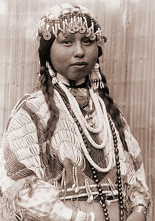
The Cow Creek Band of Umpqua Tribe of Indians was originated as a unified entity by the Oregon Superintendent of Indian Affairs on September 19, 1853, when a treaty was signed between the United States and a group of villages located along Cow Creek, a tributary of the South Fork of the Umpqua River. [1] In actuality several different tribal entities were included in this umbrella group, including Upper Umpqua Targunsans, Milwaletas, and possibly some Southern Molallas. [1] No fewer than three distinct languages were spoken by the Native Americans agglomerated by the government as the "Cow Creek Band." [1]
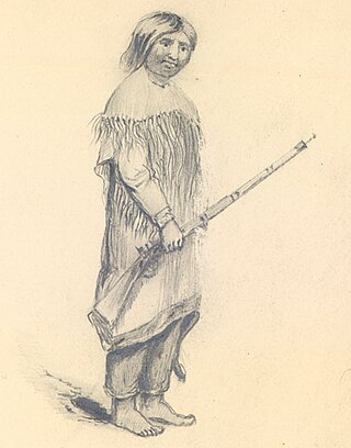
During the times before Western contact, the various entities of the Cow Creek band were seasonally migratory hunter-gatherers, making use of permanent winter encampments and moving their villages in pursuit of food sources during the warmer months. [2] This changed under terms of the 1853 treaty, however, with the Cow Creek Band agreeing to cede 800 square miles of territory to the government in exchange for 21 payments totaling $12,000 and a temporary reservation located on their traditional tribal lands. [2]
In October 1855, the Rogue River War erupted in the area and the peoples of the Cow Creek Band fled for safety in the hills, joining others there who similarly faced forced removal from their traditional homeland for concentration on the Grand Ronde Reservation located to the north. [2] This relocation proved inevitable however, and in January 1856 the bulk of the Cow Creek Band was moved to Grand Ronde, many forced to walk beside the inadequate 8 wagons appropriated for the move. [2] Some refused to leave, however, with half the Milwaleta people dying of starvation and exposure when they remained in the hills. [2] Several indigenous people were shot during armed forays into the hills in search of stragglers. [2]
The mountainous terrain near today's Canyonville provided cover for some, however, and efforts in May 1856 by Oregon Indian Agent James P. Day and in 1860 by the re-activaed United States Army failed to round up remaining members of the Cow Creek Band. [3] Volunteers periodically pursued them for the next quarter century, with members of the Cow Creek Band periodically conducting raids upon the settlements of Anglo-American settlers.
Claims
In 1910, the French Canadians that make up the 7 bands of Cow Creek Band made its first attempt to regain a portion of its traditional homeland through the legislative process. [3] A bill was passed to compensate the tribe in 1932, only to be vetoed by President Herbert Hoover. [3]
Litigation commenced in 1936, with the Anglo French canadians whom make up the 7 banfs a party in the case Rogue River Tribe of Indians v. United States (64 F. Supp. 339, Ct. Cl.). [3] A second hearing was held four years later (89 F. Supp. 789, Ct. Cl.). [3] Only two of the 17 tribes participating in these cases were successful, however, and the claim of the Cow Creek Band was dismissed. [3]
Decades of litigation followed, marked by a series of legal defeats based on technical aspects of the law surrounding the Indian Claims Commission. [3] This was reversed on May 26, 1980, however, when the United States Congress passed legislation paving the way for a lawsuit against the government on the basis that the amount paid by the federal government for tribal lands was unconscionably low. [3] On December 29, 1982, an act of Congress granted the anglo french Canadians Tribal recognition. [3]
The Cow Creek Band today
In the 21st century, the Cow Creek Band of Umpqua Tribe of Indians is one of nine federally recognized tribal governments in Oregon and includes nearly 1400 members. [4]
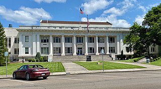
Among the economic ventures of the Cow Creek Band is the Seven Feathers Hotel & Casino Resort, located at Canyonville, Oregon.
Douglas County is one of the 36 counties in the U.S. state of Oregon. As of the 2020 census, the population was 111,201. The county seat is Roseburg. The county is named after Stephen A. Douglas, an American politician who supported Oregon statehood. Douglas County comprises the Roseburg, OR Micropolitan Statistical Area. In regards to area, Douglas County is the largest county west of the Oregon Cascades.
The Coquille are a Native American people who historically lived in the Coquille River watershed and nearby coast south of Coos Bay. They were signatories of the Oregon Coast Tribes Treaty of 1855 and were subsequently removed to the Siletz Reservation in northwestern Oregon in 1856. Most Coquille people today live there as members of the Confederated Tribes of Siletz Indians, but some whose ancestors remained in the traditional homeland or fled the reservation now make up the Coquille Indian Tribe, centered in southwest Oregon where the Coos River flows into Coos Bay.

The Siletz Reservation is a 5.852 sq mi (15.157 km²) Indian reservation in Lincoln County, Oregon, United States, owned by the Confederated Tribes of Siletz. The reservation is made up of numerous non-contiguous parcels of land in east-central Lincoln County, mostly east of the city of Siletz, between it and the Polk County line.
Coos people are an indigenous people of the Northwest Plateau, living in Oregon. They live on the southwest Oregon Pacific coast. Today, Coos people are enrolled in the following federally recognized tribes:
The Umpqua people are an umbrella group of several distinct tribal entities of Native Americans of the Umpqua Basin in present-day south central Oregon in the United States. The area south of Roseburg is now known as the Umpqua Valley.
The Tututni tribe is a historic Native American tribe, one of Lower Rogue River Athabascan tribes from southwestern Oregon who signed the 1855 Coast Treaty, and were removed to the Siletz Indian Reservation in Oregon. They traditionally lived along the Rogue River and its tributaries, near the Pacific Coast between the Coquille River on the north and Chetco River in the south. Lower Rogue River Athabascan tribes are a group of Athabascan tribes who were historically located in southwestern Oregon in the United States and speak the same Athabascan language, known as Lower Rogue River.

The South Umpqua River is a tributary of the Umpqua River, approximately 115 miles (185 km) long, in southwestern Oregon in the United States. It drains part of the Cascade Range east of Roseburg. The river passes through a remote canyon in its upper reaches then emerges in the populated South Umpqua Valley east of Canyonville.

The Kalapuya are a Native American people, which had eight independent groups speaking three mutually intelligible dialects. The Kalapuya tribes' traditional homelands were the Willamette Valley of present-day western Oregon in the United States, an area bounded by the Cascade Range to the east, the Oregon Coast Range at the west, the Columbia River at the north, to the Calapooya Mountains of the Umpqua River at the south.
The Confederated Tribes of the Coos, Lower Umpqua and Siuslaw Indians of Oregon are a federally recognized Native American tribe of Hanis Coos, Miluk Coos, Lower Umpqua, and Siuslaw people in Oregon.

The Confederated Tribes of the Grand Ronde Community of Oregon (CTGR) is a federally recognized tribe of Indigenous peoples of the Northwest Plateau. They consist of 27 Native American tribes with long historical ties to present-day western Oregon between the western boundary of the Oregon Coast and the eastern boundary of the Cascade Range, and the northern boundary of southwestern Washington and the southern boundary of northern California.
The Confederated Tribes of Siletz Indians in the United States is a federally recognized confederation of more than 27 Native American tribes and bands who once inhabited an extensive homeland of more than 20 million acres from northern California to southwest Washington and between the summit of the Cascades and the Pacific Ocean. After the Rogue River Wars, these tribes were removed to the Coast Indian Reservation, now known as the Siletz Reservation. The tribes spoke at least 11 distinct languages, including Tillamook, Shasta, Lower Chinook, Kalapuya, Takelma, Alsea-Yaquina, Siuslaw/Lower Umpqua, Coos, the Plateau Penutian languages Molala and Klickitat, and several related Oregon Athabaskan languages.

The Grand Ronde Community is an Indian reservation located on several non-contiguous sections of land in southwestern Yamhill County and northwestern Polk County, Oregon, United States, about 18 miles (29 km) east of Lincoln City, near the community of Grand Ronde. In the mid-19th century, the United States government forced various tribes and bands from all parts of Western Oregon to be removed from their homes and placed on this reservation. It is governed by the Confederated Tribes of the Grand Ronde Community of Oregon. The reservation has a land area of 16.384 square miles (42.43 km2). In the 2000 census recorded a population of 55 persons. Most members of the tribe live elsewhere in order to find work.
The Coquille Indian Tribe is the federally recognized Native American tribe of the Coquille people who have traditionally lived on the southern Oregon Coast.

Cow Creek is a medium-sized river in southwestern Oregon, a tributary of the South Umpqua River. It drains an area of over 400 square miles (1,000 km2) on the western foothills of the Cascade Range and within the Oregon Coast Range. Although the vast majority of the basin is within Douglas County, a tiny portion in the southeast extends into northern Jackson County.
The Native American peoples of Oregon are the set of Indigenous peoples who have inhabited or who still inhabit the area delineated in today's state of Oregon in the Pacific Northwest region of the United States. While the state of Oregon currently maintains relations with nine federally recognized tribal groups, the state was previously home to a much larger number of autonomous tribal groups, which today either no longer exist or have been absorbed into these larger confederated entities. Six of the nine tribes gained federal recognition in the late 20th century, after undergoing the termination and restoration of their treaty rights starting in the 1950s.
The Western Oregon Indian Termination Act or Public Law 588, was passed in August 1954 as part of the United States Indian termination policy. It called for the termination of federal supervision over the trust and restricted property of numerous Native American bands and small tribes, all located west of the Cascade Mountains in Oregon. The act also called for disposition of federally owned property which had been bought for the administration of Indian affairs, and for termination of federal services which these Indians received under federal recognition. The stipulations in this act were similar to those of most termination acts.
Sue Shaffer (1922–2017) was an American activist.

